
SLIDE 1
e
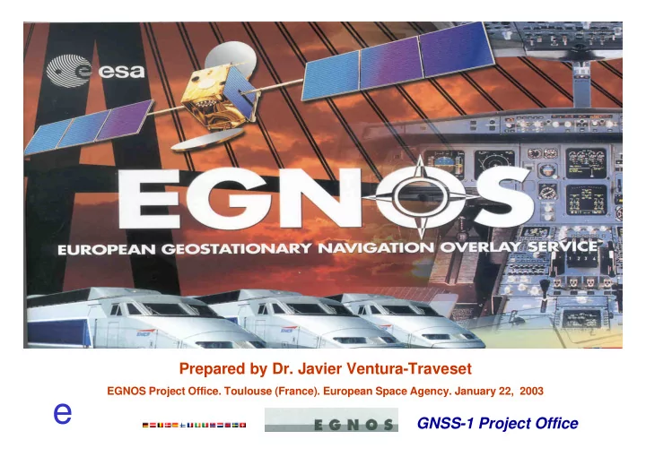
GNSS-1 Project Office Prepared by Dr. Javier Ventura-Traveset
EGNOS Project Office. Toulouse (France). European Space Agency. January 22, 2003
e GNSS-1 Project Office Presentation Outline The EGNOS Project: - - PowerPoint PPT Presentation
Prepared by Dr. Javier Ventura-Traveset EGNOS Project Office. Toulouse (France). European Space Agency. January 22, 2003 e GNSS-1 Project Office Presentation Outline The EGNOS Project: Fundamentals and Status EGNOS Pre-operational
GNSS-1 Project Office Prepared by Dr. Javier Ventura-Traveset
EGNOS Project Office. Toulouse (France). European Space Agency. January 22, 2003
GNSS-1 Project Office
The EGNOS Project: Fundamentals and Status EGNOS Pre-operational signal: The EGNOS Test Bed Merging EGNOS, WIRELESS and INTERNET
Potential EGNOS evolutions Summary
GNSS-1 Project Office
EGNOS
EGNOS is an initiative of the European Commission, Eurocontrol and the European Space Agency (ESA)
GALILEO is an initiative of the European Commission and ESA
GNSS-1 Project Office
Walker 27/3/1 + 3 in-orbit spares (1/plane)
inclination 56 deg altitude 23616 km
Period: 14 hr 22 min Ground track repeat about 10 days
GNSS-1 Project Office
Overall Spacecraft: 680 Kg / 1.6 kW class Launcher Options: Ariane, Proton, Soyuz, Zenit
Navigation payload: 115 Kg / 780 W SAR transponder: 20 kg / 100 W
Dimensions: 2.7 x 1.2 x 1.1 m3
13 m length with SAs
GNSS-1 Project Office
GEO
GNSS-1 Project Office
European Space Agency GNSS-1 Project Office
10 20 30 40 20 30 40 50 60 70 Longitude (°) Latitude (°)
AOR-E IOR Artemis
GNSS-1 Project Office
50 100 150
20 40 60 80
AOR -E (15.5°W) IOR (65.5°E) Artemis (15°E)
21.5 E
GNSS-1 Project Office
GPS GLONASS GEO NLES (x 7) RIMS EWAN
AOR-E IOR ARTEMIS
MCC 1 MCC 2 MCC 3 MCC 4 PACF ASQF
GNSS-1 Project Office
10 20 30 40 50 25 30 35 40 45 50 55 60 65 70 75 RKK FER ALB CNR1 CTN CRK CCV DJA GLG KON LSB LON MAD MAL MMT MMK PDM RST ROM SPT SDC SBT SOF STK TBL TAV TLS TRD TRO ACR ZRH FRK MAD
RIMS ASQF PACF NLES MCC
GNSS-1 Project Office
EGNOS WAAS MSAS
EGNOS is an integral part
GNSS-1 Project Office
Civil Aviation:
(APV-1 and APV-2) with a 99% availability for APV-2 (VAL=20m) over ECAC.
Maritime:
waters
Land Applications (Road community, agriculture, …) :
GNSS-1 Project Office
GNSS-1 Project Office
EGNOS System Level Activities
System Design Phase System Factory Integration & Tests On-Site Deployment & SIS Tests System Technical Qualification Phase
EGNOS Operations
Operational Framework Formalisation Operation Preparation Phase Initial Operations Phase
EGNOS HW/SW Production
Design & Production Sub-system Integration & Tests
2002 2003 2004
FQR ORR CDR
EGNOS Sites
Site Preparations Site Installations
IAR IAR SIS 0 FQR FQR CDR SIS1 SIS 2
GNSS-1 Project Office
GNSS-1 Project Office
Central Processing Facility CPF RIMS A, B and C Land Earth Station HW Central Control Facility (CCF)
GNSS-1 Project Office
All Sub-Systems delivered to Factory Integration (ID) First functional communications established
GNSS-1 Project Office
GNSS-1 Project Office
Deployed in 1999 Operated since early
2000
ESTB Reference station ESTB Processing Facility NLES
Hartebeeshoek (South Africa) Kourou (French Guyana)
AOR-E IOR
GNSS-1 Project Office
ESTB Operational Centre in Toulouse
GNSS-1 Project Office
GNSS-1 Project Office
GNSS-1 Project Office
(not complete list)
– EMS – Eurocopter – Delta - Hybridisation
– EGNOS through DAB – EGNOS through RDS – GALLANT – NAVOCAP SISNET – Intelligent Car Navigation (*)
– ESA SISNET Technology – ETRAN CCN SISNET – Special Applications (*)
INSTANT Nav-Com Maritime domain NAUPLIOS ETRAN-2 Waterways Applications(*)
GADEROS LOCOLOC/LOCOPROL INTEGRAIL ECORAIL RUNE
ETRAN-1 (*) to be launched
GNSS-1 Project Office
GNSS-1 Project Office
performance to 1-2 m
GNSS-1 Project Office
EGNOS GEO satellite
GNSS-1 Project Office
GNSS-1 Project Office
GNSS-1 Project Office
GNSS-1 Project Office
GPS antenna
GNSS-1 Project Office
EGNOS/SISNET for fleet management of
public bus transportation (NAVOCAP)
EGNOS dissemination through FM RDS
(TDF)
EGNOS dissemination through DAB
(BOSCH/BLAUPUNKT)
Full integration of EGNOS/SISNET
receiver in mobile phones
EGNOS/SISNET to support blind
pedestrian (GMV)
GNSS-1 Project Office
GNSS-1 Project Office
Context
definition in 2004.
constellation in 2006. First GPS IIF (L5) in 2005.
Possible EGNOS Evolution Objectives
towards sole mean
SISNET)
GNSS-1 Project Office
Incorporate additional
Provide SBAS service on L1
Include additional RIMS
Include additional GEOs
GNSS-1 Project Office
Adapt Ranging Stations to GPS
interference, iono scintillation and improved coverage
Provide additional EGNOS
means
Be implemented gradually
interruption.
GNSS-1 Project Office
Thanks to built-in
EU Accession AFI MEDA
GNSS-1 Project Office
INTERNET LAN DPC
INTERNET
Data Provider Center
EGNOS Msg
DPC
INTERNET
Global Load Balancer DPC
5 x 2 x
DPC
GNSS-1 Project Office
GNSS-1 Project Office
EGNOS AOC development progress is in line with the target of
delivering the first EGNOS signal in April 2003 and the final system (Operational Readiness Review) in April 2004.
With the broadcasting of the EGNOS test bed since Feb 2000,
SBAS has now become real in Europe for many users. This has allowed the development of a large number of GNSS multi- modal applications which may now use EGNOS
Interoperability with other SBAS (WAAS, MSAS) remains a key
Next important Program Challenges:
schedule (SIS0. SIS 1, SIS 2 and Final SIS)
framework (operations to start in Spring 2004)
GNSS-1 Project Office
GNSS-1 Project Office
Recent Galileo Studies further demonstrate
the huge Macro-economic benefit of Satellite Navigation Service development in Europe
Sector
EGNOS now recognised as first step to
Galileo and part of the European Satellite Navigation Strategy
EGNOS System sole European source of
GNSS Services in 2004-2008 timeframe
EGNOS/GALILEO combined services may
allow GNSS to become «sole means »