
SLIDE 1
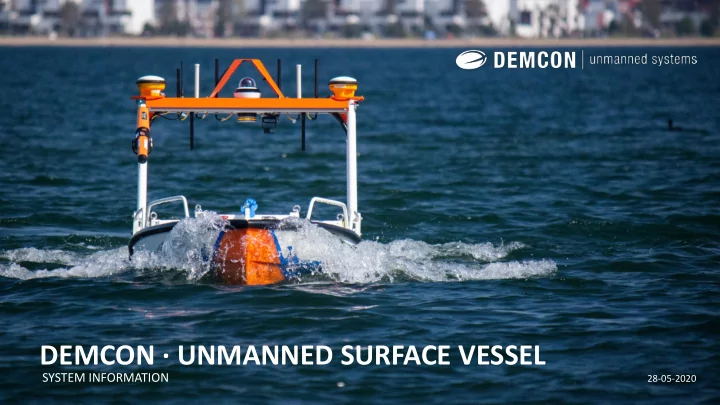
DEMCON · UNMANNED SURFACE VESSEL
SYSTEM INFORMATION
28-05-2020
DEMCON UNMANNED SURFACE VESSEL SYSTEM INFORMATION 28-05-2020 - - PowerPoint PPT Presentation
DEMCON UNMANNED SURFACE VESSEL SYSTEM INFORMATION 28-05-2020 INTRODUCTION This presentation contains information about the in-house developed Unmanned Surface Vessel (USV) by DEMCON Unmanned Systems for inland water (salt & sweet) survey
SYSTEM INFORMATION
28-05-2020
This presentation contains information about the in-house developed Unmanned Surface Vessel (USV) by DEMCON Unmanned Systems for inland water (salt & sweet) survey and measurement operations. Developed together with end-user and launching customer Van Oord Survey. The primary goal is to extend the survey capabilities by enabling operations in scenario’s where existing equipment would be inefficient, unsafe or not able to operate. Think amongst others in use cases with very low waters/near shores, nature/drinking water area’s and GNSS (GPS) degraded locations. Strict requirements for the solution were the ability to interface with different payloads, integrate in existing workflows, at least have the same functionalities as existing manned equipment, compliant with regulations and standards, and cope with the robustness needs of the user. Providing end users an innovative electric, small, autonomous and environmental friendly measurement platform.
An unmanned autonomous surface vessel offers the following advantages to your operation:
streams (vessel status, situational awareness & payload data) in off-site/ shore support centre for remote system operations. In short a versatile, customizable and future proof system that will operate in different environments from harbours, nature reserves and drinking water areas to challenging GNSS (GPS) degraded environments as construction pits, underneath bridges and besides steel structures.
: 2.5m x 1.1m x 1.0m (lxbxh, in transport), 0.8-1.5m (h-h, height in operation from water surface)
: Durable aluminum hull and hatches with watertight bulkhead separating compartments
: 0.39m incl. payload, able to operate in very shallow -0.5m waters (will turn over soil/ suck debris)
: Up to 9.5km/h, optimal cruise speed 8 km/h and mission speed 5 km/h
: Developed according to IP67, ISO9001, EMC and CE compliant
: up to 18m/s (average wind speed Bft 7 field tested)
: Removable bracket 63cm x 39cm x 44cm for under water sensors/equipment, up to 100 kg
: 16cm x 95cm for above water sensors/ equipment, up to 5 kg capacity
: Able to mount brackets on the 8 deck hatches, t.b.d. mounting capabilities
: Depend customer application needs,
: AIS, 360 IP cam, navigation-,warning-, signal lights, lidar
: 198 kg (excl. moonpool payload bracket & sensors), 300 kg max design weight (tested up to 370 kg)
: Full electric system with 2x stern and 1x bow rim driven thrusters
: High-performance lithium battery 5.000 Wh, UN38.3 lithium battery safety tested (DG shippable)
: Up to 5 hrs or 25 km sailing & (220V) 2 hours charge time (depending on charger)
: DUAL - RTK GPS, Position Accuracy (HRMS) depends on desired GPS system
: Real-time control system (Autopilot/DP) + separate industrial PC (NUC-Ibase, Nvidia or equivalent)
: 2.4/ 5.8 GHz, 4G-LTE Module (EU) & dedicated control & emergency stop link 433/868 MHz
Developed from the ground up based on specific technical and functional user requirements. The total system is designed, assembled and tested in-
segmented hull design in simulations and with a scale model tests. Which resulted in a novel Vessel Positioning System (patent pending). Design choices and sailing properties have been cross-checked with an independent navel architect and fluid dynamic consultants in order to validate the performance of the vessel. And more important analysing the flow near the underwater sensors to ensure optimal measurement performance. The aluminum hull is manufactured in cooperation with an independent shipyard. Electronics, assembly and integration of (maritime) components have been done in-house. By developing the system in-house DEMCON Unmanned Systems has control over the hardware and software. Thereby having the ability to fully customize the vessel, and gaining the knowledge and competences to design, build and test new vessels for different use case and scenario’s (other sizes, functionalities, payloads, etc.).
REDUNDANT PROPULSION 3 thruster configuration able to return to shore/ home when any of the thrusters fails. FULL ELECTRIC SYSTEM Silent, environmental friendly and powerful electric system, 100% liquid free system ADJUSTABLE BRIDGE In 3 different heights lockable positions in order to obtain best signal reception and for easier transport and accessibility underneath low hanging structures (bridges, pipes, etc.). BRIDGE SENSOR BRACKET Different mounting points for communication antenna’s (4G, 5,8/2,4 GHz, and sensors like GNSS (GPS) receivers, dedicated control link, IP cam, navigation lights, deck lights, orange signal light, LiDAR,
ALUMINUM HULL Industrial and watertight aluminium
bulkheads minimizing impact risks, shielding electrical components in different compartments and making the hull unsinkable. REDUNDANT SAFETY FEATURES Multiple hardware and software safety systems stops in/on the vessel and the control station.
ROBUST & NOVEL POSSITIONING SYSTEM Fixed electric thrusters in stern and bow. Minimal jamming chances due to no propeller axis. Minimal moving parts (no gears, no rudders, only water as lubricant/ cooling). Making it a sustainable and reliable system. PAYLOAD MOON-POOL Universal sensor bracket for different sensor mountings like multi-beam/ sonar, IMU, RC winch, SVS/P sensors. Water inlet/ outlets for water flow and level in the moon- pool (up to 100 kg). PROTECTIVE FINS Protective fins which are load bearing and used for placing the vessel on the ground. UNDERWATER WINCH 30m winch for depth measurements using sensors like a sound velocity (probe) sensor. CUSTOMIZABLE PAINT Exterior can be customized with customer colours and logo’s.
WATERTIGHT HATCHES Aluminum hatches for watertight closure of separated component and equipment compartments. BATTERY & CONTROL COMPUTER BAY Main watertight electronics compartment. 360 IP CAM Remote controllable 360 camera for first person view (FPV) and situational awareness for Beyond Visual Line of Sight (BVLOS)
HOISTING POINTS Three standard cleat-bollards with hoisting eyes 220V CHARGING SOCKET ON/OFF SWITCH DUAL RTK GPS ANTENNAS Precision positioning system with a dual antenna setup used to determine heading of the system, eliminating the need to rely on a magnetometer that can be heavily influenced by steel structures. 3 EMERGENCY STOPS 3rd generation emergency safety stops (highest level)
emergency safety stops
MISSION PLANNING The mission planner is used to plan the autonomous missions, set up geofences and auto-home locations. The software runs on Windows and Linux
control the USV via the onscreen arrows or connect an additional physical joystick (game) controller. New projects (mission plans) can be planned and uploaded in the office before going to the surveying site. On-site the missions can be loaded and activated on the vessel and operations will start. ADVANCED PATHPLANNING The mission planner is able to automatically generate grid waypoint paths in straight lines as well as custom paths for specific applications / missions. Users can also upload KML (GPS based vectors) files created in their software of choice. MISSION AREA SAFETY BOUNDERIES Below you can see an example of geo-fencing. Setting an outer fence to ensure the UAV can not leave the area (triggers system stop) and internal geo- fences to block off areas where you don’t want the USV to sail. You can set an offset from the geo-fences to define a safety margin. This allows you to take the edges of a structure and adapt the safe margin as stopping distance USV.
SOFTWARE CONTROL The mission planner has a redundant communication link with 2.4/ 5.8 GHz and 4G-LTE EU (switching automatically). This link provides the operator with a live 360 controllable video, USV status and location. These functionalities are needed in BVLOS operations. REMOTE CONTROL Industrial remote controller (CE, EMC, LVD / E4, RED) with a dedicated control link (433/868 MHz) for manual control and emergency stop trigger. REMOTE ACCESSIBILITY The system is accessible via mobile applications (windows/android) and remote access (desktop). This functionality allows the surveyor/ operator to log into the vessel from anywhere in the world and operate the total system (payload and mission planner software) via a secure data link. The systems data stream (system status, payload sensor data, 360 cam, etc.) can be shared with different (remote) office locations, a shore support centre and the supplier. This also allows live remote system diagnostics (analyses tools) and (firmware) updates enabling in the field operational support, service and maintenance capabilities.
The Vessel Positioning System (patent pending) enables full control over its movements allowing the vessel to move in any direction independent of its
FUNCTIONALITIES
the USV holds its current position and heading;
VERSATILE & MULTI PURPOSE Due to the universal payload bracket on the bridge for above water measurements AND the moonpool bracket for underwater measurements the system is sensor agnostic and can be equipped with different (user specific) sensors/equipment. Increasing the deploy ability for different applications and environments. LAUNCH, RECOVERY & TRANSPORT Equipped with an automatic RC hooking launch and recovery system for safe out of reach operations from any kind and height of quay wall, boat ramp or softer waterfront surface. A custom road legal trailer with hydraulically stabilized crane to launch and recover the USV in all different scenarios. The crane has a reach of 4m and a 20m winch able to hoist from every side of the trailer. The trailer includes vessel support/securing brackets and lockable equipment boxes. The trailer/crane/vessel combination to fits in a standard 20ft container for project shipment, transport or storage purposes. The USV alone can also be shipped by air cargo for rapid deployment purposes in a standard air cargo crate (including Dangerous Goods documentation).
SUSTAINABILITY
ENVIRONMENT
The system is designed from a multi-purpose and adjustable hardware and software architecture perspective. Providing the user with a future proof platform that can evolve by adding new technology, software (algorithms) and hardware (sensors) functionalities. Enabling new applications, use cases and operating environments. Extensions include adding different situational awareness, GPS-degraded navigation, collision avoidance, advanced path planning algorithms and communication solutions depending on specific user and scenario requirements. This flexibility ensures that the system is able to develop over time and cope with changing regulations and safety standards. Enabling further (future) integrations in traffic/ harbour management systems, remote control (shore) support centres, and user workflows.
DEMCON USV 3D LIDAR DATASET DEMCON PATHPLANNER GENERATOR
DEMCON Unmanned Systems BV Delftechpark 23 2628 XJ Delft unmanned@demcon.com +31 (0)88 1152000 +31 (0)6 23251403
DISCLAIMER