
SLIDE 1
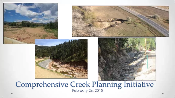
Comprehensive Creek Planning Initiative
February 26, 2015
Comprehensive Creek Planning Initiative February 26, 2015 Watershed - - PowerPoint PPT Presentation
Comprehensive Creek Planning Initiative February 26, 2015 Watershed Recovery Future Creek Long-Term Immediate Emergency Projects Vision Threat Response Assessment and Mitigation Funding and Watershed Implementation Master Plans
February 26, 2015
Future Creek Projects Funding and Implementation Emergency Response Immediate Threat Assessment and Mitigation Long-Term Vision Watershed Master Plans
recovery and restoration
mitigation projects
master planning process
Emergency Response
Long-Term Vision Watershed Master Plans
(POSAC), January 21
risk evaluations of watershed conditions
Emergency Response
Lon-Term Vision Watershed Master Plans
Long-Term Recovery
support
design
Emergency Response
Lon-Term Vision Watershed Master Plans
Long-Term Recovery
Emergency Response
Lon-Term Vision Watershed Master Plans
Long-Term Recovery
Emergency Response
Long-Term Recovery
Little Thompson
Council, Board consists of Advisory Council members
Left Hand
serve as watershed coalition, with board expansion
Fourmile
coalition
Upper Coal Creek
Environmental Group as fiscal agent
feedback
commitment
Emergency Response
Long-Term Vision Watershed Master Plans
Long-Term Recovery
Emergency Response
Long-Term Recovery
priority projects throughout unincorporated Boulder County
property and infrastructure due to post- flood conditions
County POS lands or associated with county transportation infrastructure is approximately $40 million
Emergency Response
Long-Term Recovery
currently
Boulder County, cities and towns, and Coalitions
coordinators
30% project design) from local communities
Emergency Response
Long-Term Recovery
Boulder County, cities and towns, and Coalitions
demonstration projects to allow coalitions to show citizens that work was moving forward.”
Julie McKay Phone: 720-564-2662 Email: jmckay@bouldercounty.org Website: www.BoulderCountyCreekPlan.org