
SLIDE 1
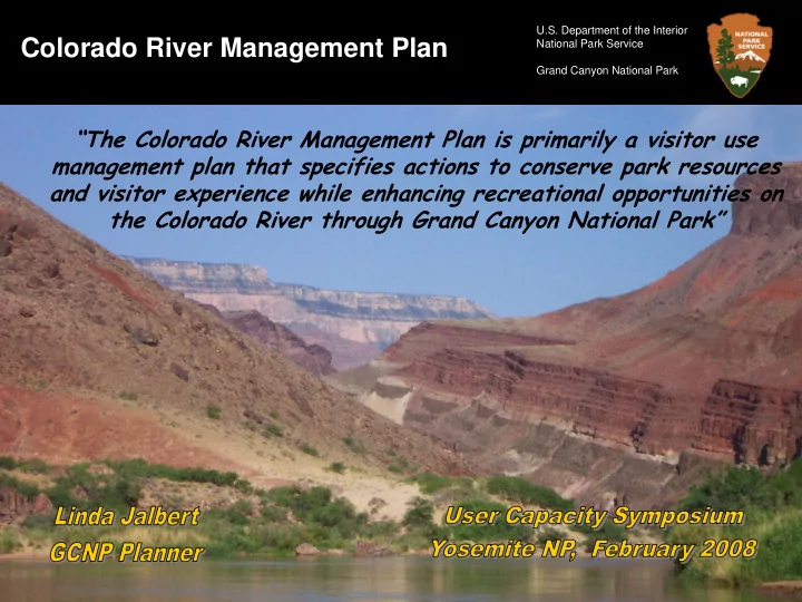
Colorado River Management Plan
U.S. Department of the Interior National Park Service Grand Canyon National Park
Colorado River Management Plan National Park Service Grand Canyon - - PowerPoint PPT Presentation
U.S. Department of the Interior Colorado River Management Plan National Park Service Grand Canyon National Park The Colorado River Management Plan is primarily a visitor use management plan that specifies actions to conserve park resources
U.S. Department of the Interior National Park Service Grand Canyon National Park
U.S. Department of the Interior National Park Service Grand Canyon National Park
U.S. Department of the Interior National Park Service Grand Canyon National Park
U.S. Department of the Interior National Park Service Grand Canyon National Park
U.S. Department of the Interior National Park Service Grand Canyon National Park
U.S. Department of the Interior National Park Service Grand Canyon National Park
U.S. Department of the Interior National Park Service Grand Canyon National Park
U.S. Department of the Interior National Park Service Grand Canyon National Park
U.S. Department of the Interior National Park Service Grand Canyon National Park
U.S. Department of the Interior National Park Service Grand Canyon National Park
1952 1995
U.S. Department of the Interior National Park Service Grand Canyon National Park
1952 1995
U.S. Department of the Interior National Park Service Grand Canyon National Park
58 97 176 333 114 324 438 45 93 88 226
Small camps <12 people Medium camps 13-24 people Large camps >24 people Total 50 100 150 200 250 300 350 400 450 500 Number of camps (Lees Ferry to Diamond Creek) 1973 1983 1991
No data
U.S. Department of the Interior National Park Service Grand Canyon National Park
10 20 30 40 50 60 70 80 90 100 110 120 130 140 150 160 170 180 190 200 210 220 230
0.5 1 1.5 2 Camps per mile
All primary + secondary camps Large & medium primary camps L i t t l e C
a d
1 D i a m
d C r e e k 2 2 6 E l v e s C h a s m 1 1 6 P h a n t
8 8 D e e r C r e e k 1 3 6 H a v a s u 1 5 6 L a v a F a l l s 1 7 9 W h i t m
e 1 8 7 C r y s t a l 9 8 R e d w a l l 3 3 H
s e R
k 1 7 H a n c e 7 7 F
s i l 1 2 5
U.S. Department of the Interior National Park Service Grand Canyon National Park
U.S. Department of the Interior National Park Service Grand Canyon National Park
U.S. Department of the Interior National Park Service Grand Canyon National Park
U.S. Department of the Interior National Park Service Grand Canyon National Park
Old Plan (1989) New Plan (2006)
(4-9 trips/day)
U.S. Department of the Interior National Park Service Grand Canyon National Park
0.0 1.0 2.0 3.0 4.0 5.0 6.0 7.0 8.0 9.0 Jan Feb Mar Apr 1-15 Apr 16- 30 May Jun Jul Aug Sep 1-15 Sep 16- 30 Oct Nov Dec Month Launches Non-commercial (small) Non-commercial (std) Commercial oar Commercial motor 0.0 1.0 2.0 3.0 4.0 5.0 6.0 7.0 8.0 9.0 Jan Feb Mar Apr 1-15 Apr 16- 30 May Jun Jul Aug Sep 1-15 Sep 16- 30 Oct Nov Dec Month Launches Non-commercial (small) Non-commercial (std) Commercial Oar Commercial motor
Max # trips/day
U.S. Department of the Interior National Park Service Grand Canyon National Park
U.S. Department of the Interior National Park Service Grand Canyon National Park
U.S. Department of the Interior National Park Service Grand Canyon National Park
U.S. Department of the Interior National Park Service Grand Canyon National Park
U.S. Department of the Interior National Park Service Grand Canyon National Park
Enough scouting boys, let’s run the gut. Any Questions? Yeah, where’d you get that hat Georgie? I’m Scared