
SLIDE 1
Co-operative Systems for Road Safety Smart Vehicles on Smart Roads - - PowerPoint PPT Presentation
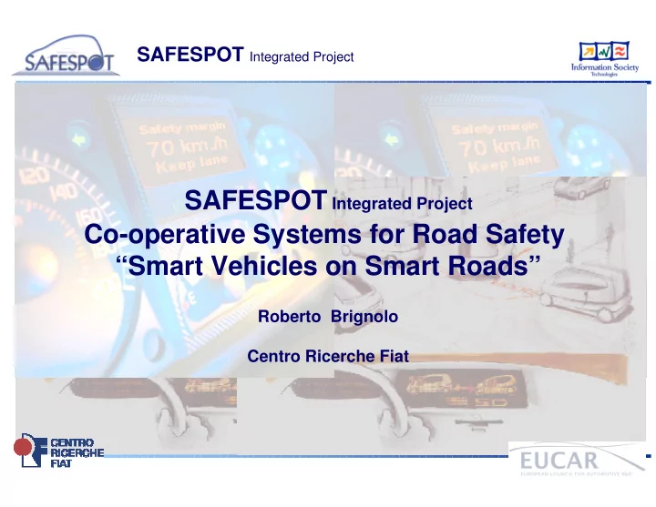
SAFESPOT Integrated Project SAFESPOT Integrated Project Co-operative Systems for Road Safety Smart Vehicles on Smart Roads Roberto Brignolo Centro Ricerche Fiat SAFESPOT Integrated Project Project type : Integrated Project (IP) 4th IST To
Project type: Integrated Project (IP) 4th IST call of the 6th European Framework Program (*) Consortium : 51 partners (from 12 European countries) OEM ( trucks, cars, motorcycles) ROAD OPERATORS SUPPLIERS RESEARCH INSTITUTES UNIVERSITIES Promoted by: EUCAR Timeframe: 1/2006 – 12/2009 Overall Cost Budget : 38 M (European Commission funding 20.5M) IP coordinator : Roberto Brignolo C.R.F. (FIAT RESEARCH CENTER – Italy) To prevent road accidents developing a “Safety Margin Assistant” that :
situations,
awareness of the surrounding environment, The Safety Margin Assistant will be an Intelligent Cooperative System based on Vehicle to Vehicle (V2V) and Vehicle to Infrastructure (V2I) communication
(*) Contract not yet signed
Participant # Company Short Name Nationality 1 Centro Ricerche Fiat ScpA CRF IT 2 DaimlerChrysler AG DC DE 3 Renault FRANCE, REGIENOV REGIENOV FR 4 Volvo Technology Corporation VOLVO SE 5 Robert BOSCH GmbH BOSCH DE 6 SIEMENS AG SIE DE 7 ANAS SpA ANAS IT 8 Compagnie Financière et Industrielle des Autoroutes COFIROUTE FR 9 NETHERLANDS ORGANISATION for APPLIED SCIENTIFIC RESEARCH TNO NL 10 MIZAR Automazione S.p.A. MIZAR IT 11 Piaggio & C. SPA PIAGGIO IT 12 Continental Teves AG & Co oHG CAS DE 13 IBEO Automobile Sensor GmbH IBEO DE 14 Kapsch TrafficCom AB KAPSCH SE 15 LACROIX TRAFIC LAC FR 16 NAVTEQ Europe B.V. NAVTEQ NL 17 Planung Transport Verkehr AG PTV AG DE 18 Q-Free ASA QFREE NW 19 Siemens VDO Automotive AG SVDO DE 20 Tele Atlas NV TA NL 21 VTT TECHNICAL RESEARCH CENTRE OF FINLAND VTT SF 22 Autostrada Brescia Verona Vicenza Padova S.p.A. BSPD IT 23 CG Côtes d'Armor CG22 FR 24 Swedish Road Administration SRA SE 25 CIDAUT: Fundación para la Investigación y Desarrollo en Automoción CIDAUT ES
Participant # Company Short Name Nationality 26 CENTRO STUDI SUI SISTEMI DI TRASPORTO CSST IT 27 Dipartimento di Ingegneria Biofisica ed Elettronica - Università degli Studi di Genova DIBE IT 28 CENTRE FOR RESEARCH AND TECHNOLOGY - HELLAS CERTH EL 29 Institute of Communication and Computer Systems ICCS EL 30 Laboratoire Central des Ponts et Chaussées LCPC FR 31 Istituto Superiore Mario Boella ISMB IT 32 MIRA Limited MIRA UK 33 Société pour le Développement de l'Innovation dans les Transports SODIT FR 34 Rijkswaterstaat RWS NL 35 Technische Universität Chemnitz TUC DE 36 Technische Universitaet Muenchen TUM DE 37 University of Stuttgart USTUTT DE 38 German aerospace center DLR DE 39 European Road Transport Telematics Implementation coordination Organization Scrl ERTICO BE 40 Center for Research And Telecommunication Experimentation for NETworked Communities CREATE-NET IT 41 Politechnika Warszawska IRE PW PL 42 Budapest University of Technology and Economics BME HU 43 CENTRE NATIONAL DE LA RECHERCHE SCIENTIFIQUE CNRS FR 44 Bundesanstalt fuer Strassenwesen BASt DE 45 THOMAS MILLER & CO. LTD MILLER UK 46 Provincie Noord-Brabant PNB NL 47 RENAULT SPAIN RNS ES 48 Universidad Politécnica de Madrid UPM ES 49 Telefónica Investigación y Desarrollo Sociedad Anónima Unipersonal TEL ES 50 CETECOM CETECOM ES 51 Magneti Marelli Electronic Systems MMSE IT
Side Side Crash Crash Lane Change Lane Change Assistance Assistance Safe Speed Safe Speed & Safe Distance & Safe Distance (RADAR based) (RADAR based) Lane Lane Support Support Rear Rear Detection Detection Blind Spot Blind Spot Collision Collision Mitigation Mitigation
Rear Rear Detection Detection Blind Spot Blind Spot Side Side Crash Crash Lane Change Lane Change Assistance Assistance Lane Lane Support Support Collision Collision Mitigation Mitigation
Extended Rear Extended Rear Detection & Detection & Blind Spot Blind Spot
Cooperative Cooperative Warning Warning
Infrastructure Based Infrastructure Based Warning Warning
Road Side Equipment (local or remote) Road Side Equipment (local or remote)
Extended Safe Distance and Speed
Extended Safe Distance and Speed
Information Sources Innovative Technologies HORIZONTAL ACTIVITIES SAFESPOT CORE ARCHITECTURE (Link with CVIS) BUSINESS MODELS, LEGAL ASPECT & DEPLOYMENT
IN VEHICLE SENSING & PLATFORM INFRASTRUCTURE SENSING & PLATFORM ACCURATE COOPERATIVE LOCALISATION DYNAMIC LOCAL MAPS AD HOC COMMUNICATION NETWORKING
Vehicle Platform Infrastructure Platform
Test beds Applications/ Scenarios Test sites Validation/ Evaluation ITALY GERMANY FRANCE
COOPERATIVE SYSTEMS APPL. VEHICLE BASED COOPERATIVE SAFETY SYSTEMS INFRASTRUCTURE BASED
Freeflow Black Spot Tunnels, bridges
SWEDEN
NETHERLANDS
COORDINATION LAYERS TECHNOLOGIES ORIENTED SUB-PROJECTS APPLICATIONS ORIENTED SUB-PROJECTS
COOPERATIVE SYSTEMS APPL. VEHICLE BASED COOPERATIVE SAFETY SYSTEMS INFRASTRUCTURE BASED
Specification Implementation & Prototypes Test and Validation Evaluation. Test Trials Needs Requirements SP 1 - IN VEHICLE SENSING & PLATFORM SP 2 - INFRASTRUCTURE SENSING & PLATFORM SP 4 - COOPERATIVE SYSTEMS VEHICLES BASED APPLICATION SP 3 - INNOVATIVE TECHNOLOGIES SP 5 – COOPERATIVE SYSTEMS INFRASTRUCTURE BASED APPLICATION SP 6 - DEPLOYMENT & LEGAL ASPECT & BUSINESS MODEL SP 7 - CORE ARCHITECTURE (link with CVIS) SP8 - IP MANAGEMENT
COORDINATION LAYERS TECHNOLOGIES ORIENTED SUB-PROJECTS APPLICATIONS ORIENTED SUB-PROJECTS
Reliable, fast, secure, potentially low cost protocols for local V2V and V2I
$% & '" $% (" (" &"# )) &"# ))
Car2Car Communication
SAFESPOT
CALM
V2V and V2I communication, based on geo-aware multi-hop routing CVIS V2V and V2I communication for safety and traffic efficiency applications using car2car and CALM technologies Support of ITS and Internet Services based on continuous communication over 802.11, GSM, UMTS, IR, IPv6, etc. V2V and V2I communication when no routing is needed
ROAD SENSORS
DGPS Vehicle sensors’ data Landmarks Other vehicles’ positions DATA FUSION ALGORITHMS
Safespot SafeSpot EV EV EV EV EV EV
ADVANTAGES INTELLIGENT ROAD ADVANTAGES INTEGRATED WITH REDUCTION OF INFRASTRUCTURE COST AND COMPLEXITY
REDUCTION OF VEHICLE SYSTEM COST AND COMPLEXITY
COOPERATIVE SYSTEMS FOR ROAD SAFETY: “SMART VEHICLES” ON “SMART ROADS”