
SLIDE 1
Click to edit Master title style Comprehensive Plan Update - - PowerPoint PPT Presentation
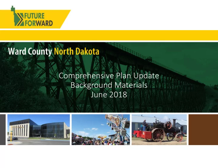
Click to edit Master title style Comprehensive Plan Update Background Materials June 2018 Comprehensive Planning ND Century Code zoning...[is required to be] in accordance with a comprehensive plan... Big Picture, Long Range
Ward County is in the process of developing a Comprehensive Plan to help prepare the County for the future. The Plan is a tool to maintain and improve quality of life for the County’s residents and to build a more resilient County. Understanding what matters to County residents is key to developing the Plan. The Comprehensive Plan is an official document adopted by the Ward County Board of County Commissioners as a policy guide, vision, and roadmap for the future. It will identify critical topics and develop strategies to address these topics. The planning process is expected to be completed by March 2019, and will be followed by updates to the County’s zoning and subdivision regulations.
approximately 40 years
floodplain mapping in Ward County in currently underway
Ward County that have flood insurance
areas with a 1% annual chance of flooding
with 1% annual chance of flooding must carry flood insurance
and water table conditions impact rural septic system design
systems by Minot & one by Rice Lake
system designs are common
1. Standard Absorption Trenches 2. Pressurized Seepage Beds 3. Above Grade Mound Systems
availability all influence what is considered prime farmland
production and processing of agricultural commodities
used for agriculture
zoning
townships is administered by Ward County
extraterritorial zoning that regulates land use for a limited distance outside their municipal boundaries
Renville, Mountrail, Burke, and Ward County in 1910.
boomer, the development of the Minot Air Force Base, and the recent Bakken Oil Boom.
20,000 30,000 40,000 50,000 60,000 70,000 1890 1900 1910 1920 1930 1940 1950 1960 1970 1980 1990 2000 2010
Ward Outside of Minot Minot Share
1957 1946-1964 2009-2014
1890 1900 1910 1920 1930 1940 1950 1960 1970 1980 1990 2000 2010 2016 Burlington 300 270 200 200 262 247 762 995 1,096 1,060 1,191 Minot 575 1,277 6,188 10,476 16,099 16,577 22,032 30,604 32,290 32,843 34,544 36,567 40,888 48,743 Sawyer 327 241 206 271 264 390 373 417 319 377 357 338 Surrey 309 361 999 856 917 934 1,365 Berthold 454 498 511 428 459 431 398 485 409 466 454 495 Des Lacs 188 205 197 180 185 197 212 216 209 204 199 Carpio 257 244 344 322 194 199 215 244 178 148 157 148 Douglas 171 284 288 313 236 210 144 112 93 64 64 61 Ryder 338 483 457 467 330 264 211 158 121 92 85 80 Makoti 283 276 212 219 214 159 199 145 145 154 148 Donnybrook 297 267 259 215 207 196 163 139 106 90 59 54 Kenmare 1,437 1,446 1,494 1,528 1,712 1,696 1,515 1,456 1,214 1,081 1,096 1,059 Minot AFB 12,077 9,880 9,095 7,599 5,521 5,964 % of County 34% 16% 38% 51% 61% 65% 75% 74% 83% 82% 83% 83% 83% 85.2%
60,000 70,000 80,000 90,000 100,000 110,000 2010 2014 2015 2019 2020 2024 2025 2029 2030 2035 2040
Ward County Future Population by Year from Three 2016 Studies
CO Expected Migr CO Low Migr CO High Migr HFA Projection VW High High VW Low Low VW Mid Mid
Ward County’s population will grow from 61,675 in 2010 to 84,924 in 2040
Forecast best matching current trends
+ Net Migration
reflects influence of Air Force Base personnel
illustrates recent growth in family formation
%6 %4 %2 % %2 %4 %6 Under 5 years 5 to 9 years 10 to 14 years 15 to 17 years 18 and 19 years 20 years 21 years 22 to 24 years 25 to 29 years 30 to 34 years 35 to 39 years 40 to 44 years 45 to 49 years 50 to 54 years 55 to 59 years 60 and 61 years 62 to 64 years 65 and 66 years 67 to 69 years 70 to 74 years 75 to 79 years 80 to 84 years 85 years and over Female: Male:
5,000 10,000 15,000 20,000 25,000 30,000 1990 2000 2010 2016 Total households
are 30% or less of household income. More than 16% of Ward County owner households are paying more than 30% of household income for housing. More than 38% of Ward County renter households are paying more than 30% of household income for housing.
categories will see significant increases:
Ward County owner
units were valued at $125,000 or more
Ward County owner
units were valued at $200,000 or more
Families with Specific Income Levels in Ward County & ND, 2014
Year Labor Force Employed Unemployed (%) Unemployed 2010 31526 30436 1090 3.5 2011 32491 31454 1037 3.2 2012 33955 33055 900 2.7 2013 34493 33558 935 2.7 2014 34553 33647 906 2.6 2015 34299 33205 1094 3.2 2016 33679 32301 1378 4.1 2017 32971 31909 1062 3.2
County’s economy are the Minot Air Force Base, the Oil and Gas Industry, and Agriculture
has 6,611 direct employees, and an additional 5,584 dependents
industry represented 15% of the total employment in Ward County
248
110
62
164
377
Industry 2017 Employees 2017 Establishments 2010 Employees 2010 Establishments % Change 2010 to 2017 Retail Trade 5227 296 5058 275 3.3% Health Care and Social Assistance 4937 196 5006 165
Accommodation and Food Services 3650 189 3698 171
Educational Services 3039 36 2821 31 7.7% Construction 1877 307 1791 251 4.8% Wholesale Trade 1788 159 1447 132 23.6% Public Administration 1649 45 1494 48 10.4% Mining, Quarrying, and Oil and Gas Extraction 1421 63 732 33 94.1% Transportation and Warehousing 1411 162 1055 115 33.7% Finance and Industry 1333 155 1732 130
Other Services (except Public Administration) 1209 178 1172 158 3.2% Administrative and Waste Services 1174 156 1184 121
Professional and Technical Services 916 223 722 167 26.9% Manufacturing 469 50 696 57
Information 455 21 543 30
Real Estate and Rental and Leasing 442 98 393 73 12.5% Arts, Entertainment, and Recreation 438 56 381 42 15.0% Utilities 130 8 118 8 10.2% Management of Companies and Enterprises 71 11 13 4 446.2% Agriculture, Forestry, Fishing and Hunting 47 19 38 11 23.7% All Industries 31683 2428 30278 2022 4.6%
4th Quarter 2010 & 2017 Industry Employment and Establishments*
*excludes certain classes of workers
detailed transportation element with the following key features:
Trends
The Comprehensive Plan will develop a transportation system strategy in cooperation with and consistent with key partners:
Areas of consideration will include at least the following key factors:
Minot 2035 Plan: Urbanizing Study Area Ward County Plan: Consistency with urbanizing areas around Minot
will evaluate existing functional class to match existing and projected trends in the County.
determining a roadways relative priority in the following areas:
and roadway surface type recommendations will be developed as part of the plan update.
be based on the following factors:
be used to determine pavement needs along the County Highway System.
data on pavement conditions from 2015.
recent projects completed on CR 10 and CR 23.
has a significant investment in bridge infrastructure.
bridge condition in Ward County is in good condition.
the bridge inventory has sufficiency rating of 80 or above.
inclusive of 12 county bridges defined as a major structures.
range of structure types which make up its current bridge inventory.
shows more information about the type of bridge structures maintain by Ward County.
inclusive of 12 county bridges defined as a major structures.
significant input into the transportation planning process.
will evaluate existing traffic trends on the County Roadway System.
and future projections, improvements may be recommended along various corridors or at specific intersections based on traffic conditions.
input into the transportation planning process.
will evaluate existing crash trends on the County Roadway System.
and future projections, improvements may be recommended along various corridors or at specific intersections based on crash data.
consideration in roadway design.
Plan will evaluate factors which may lead to changes in investment to improve certain corridors to carry 105,500 loads.
agricultural and industrial needs in the County is important to making these decisions.
will evaluate issues which impact the County Roadway System. Gravel pits are a factor in roadway considerations.
shows gravel pit activity in Ward County:
between 2014 and 2018.
between 2000 and 2013.
have been reclaimed based off of imagery.
been reclaimed and not active since 2000.
Plan will look at corridor preservation issues.
to corridor preservation is right of way (ROW).
planning level illustration of existing ROW along Ward County corridors.
Plan considers rail systems in Ward County.
rail lines running through Ward County.
likely include at-grade rail crossings on the County Highway system.
Plan considers active aviation systems in Ward County.
low volume airstrips in Ward County.
aviation infrastructure relates to transportation, land use and zoning issues.