
SLIDE 1
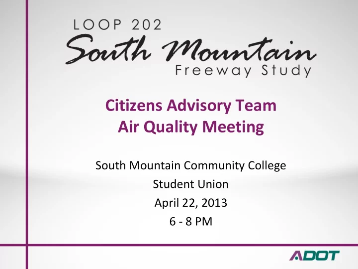
Citizens Advisory Team Air Quality Meeting
South Mountain Community College Student Union April 22, 2013 6 ‐ 8 PM
Citizens Advisory Team Air Quality Meeting South Mountain Community - - PowerPoint PPT Presentation
Citizens Advisory Team Air Quality Meeting South Mountain Community College Student Union April 22, 2013 6 8 PM Agenda Welcome and introductions SMCAT Operating Agreement review Air quality panel presentations and discussion Questions Update
South Mountain Community College Student Union April 22, 2013 6 ‐ 8 PM
4
Organization Name Representative Name Ahwatukee Foothills Chamber of Commerce Karen Starbowski Ahwatukee Village Planning Committee Melanie Beauchamp Arlington Estates HOA Camilo Acosta AZ Forward Diane Brossart / TBD AZ Public Health Association Al Brown Calabrea HOA Mike Buzinski City of Avondale Bryan Kilgore Cottonfields / Bougainvillea Community HOA Timmothy Stone Estrella Village Planning Committee Peggy Eastburn Foothills Club West HOA Michael Hinz Foothills Reserve HOA Derrick Denis Gila River Indian Community ‐ District 4 LaQuinta Allison Kyrene Elementary District Jeremy Calles Lakewood HOA Chris Boettcher Laveen Citizens for Responsible Development Laurie Prendergast Laveen Village Planning Committee Wes Lines Maricopa County Farm Bureau Clayton Danzeisen Mountain Park Ranch HOA Jim Welch Pecos Road/I‐10 Landowners Association Nathaniel Percharo Phoenix Mountains Preservation Council Michael Goodman Sierra Club Sandy Bahr Silverado Ranch Eric Baim South Mountain Village Planning Committee Tamala Daniels Southwest Valley Chamber of Commerce Woody Thomas The Foothills HOA Chad Blostone
5
The South Mountain Citizens Advisory Team (SMCAT) will provide a forum for communication between the Arizona Department of Transportation (ADOT), Federal Highway Administration (FHWA) and the local community regarding the proposed South Mountain Freeway. The SMCAT is a voluntary advisory team, not a decision‐ making body, and it will not be responsible for decisions made by the State of Arizona or the FHWA. The SMCAT will meet regularly to review project status and provide input on issues that are relevant to the project. The single purpose of the SMCAT is to provide a Build or No‐ Build recommendation for the South Mountain Freeway.
6
7
SMCAT members are expected to treat each other with mutual courtesy, respect and dignity. Since the SMCAT is a voluntary advisory team, it is important that individual SMCAT members abide by accepted standards
Unacceptable or disruptive behavior will not be tolerated and will be grounds for exclusion from further participation in SMCAT activities. Any SMCAT member who acts disrespectfully toward other members, disrupts the SMCAT process or is unable to attend meetings on a consistent basis may be required by the third party facilitator, the ADOT public involvement team or a majority of the other SMCAT members, to leave or resign from the SMCAT.
9
Overview of NEPA Air Quality Analysis for Highway Projects
Jeff Houk
FHWA Resource Center
April 22, 2013
10
NEPA Air Guidance
The National Environmental Policy Act is a procedural law and doesn’t include specific requirements for AQ analysis FHWA’s 1987 NEPA Technical Advisory includes requirement for carbon monoxide analysis of EIS projects FHWA issued Interim Mobile Source Air Toxics Guidance in 2006, updated in 2009 and 2012
11
NEPA Air Quality Analysis
Possible components (not all are completed for every project):
alternatives (qualitative, or quantitative “burden” analysis)
qualitative or quantitative)
12
Project-Level Transportation Conformity Requirements
13
Project Level Conformity
approving or funding any activity (including transportation projects) which does not conform to an implementation plan.
areas for criteria (NAAQS) pollutants: CO, PM, ozone, NO2
14
When Are Project-Level Conformity Determinations Required?
Prior to the first time a Federal project is adopted, accepted, approved, or funded
– NEPA Decision Document (CE, FONSI, ROD) – Right-of-Way Acquisition – Construction Authorization
Typically, project-level conformity is completed as part of the NEPA process (prior to adoption of CE, FONSI, ROD)
15
General Requirements for Project-level Conformity Determinations
PM)
implementation plan
16
Hot-Spot Analysis for Conformity
Required for all Federal nonexempt projects in CO, PM2.5 and PM10 nonattainment and maintenance areas Can be qualitative or quantitative (modeling) depending on type and timing of project In quantitative analysis, MOBILE6 or MOVES emissions models used to estimate roadway emissions, and CAL3QHCR or AERMOD dispersion modeling used to estimate concentrations Newest EPA/DOT guidance issued December 2010; defined grace period for use of MOVES
17 What projects are subject to CO hotspot analysis?
Modeling required for: Projects that impact a location identified in the SIP as a site of actual or possible violations Projects that affect intersections that are or will be LOS D or worse Projects affecting one of the 3 worst intersections in the area in terms of traffic volume or LOS Qualitative analysis required for all other projects
18
Projects of Air Quality Concern are… (i) New highway projects that have a significant number of diesel vehicles, or expanded highways with a significant increase in diesel vehicles; (ii) Projects affecting intersections at LOS D, E, or F with a significant number of diesel vehicles, or those that will change to LOS D, E, or F because of increased traffic volume from a significant number of diesel vehicles related to the project; (iii) New bus and rail terminals and transfer points that have a significant number of diesel vehicles congregating at a single location; (iv) Expanded bus and rail terminals and transfer points that significantly increase the number of diesel vehicles congregating at a single location; and (v) Projects in or affecting locations, areas, or categories of sites which are identified in the PM10 or PM2.5 applicable implementation plan or implementation plan submission as appropriate, as sites of violation or possible violation
What projects are subject to PM hotspot analysis?
40 CFR 93.123(b)(1)
19
Mobile Source Air Toxics (MSATs)
20
FHWA MSAT Guidance Approach
FHWA has developed a tiered approach for analyzing MSATs in NEPA documents:
meaningful MSAT effects;
MSAT effects; or
projects with higher potential MSAT effects.
21
Screening Thresholds for Higher Impact Projects
Quantitative emissions analysis is required for projects that 1) Involve new or additional capacity on roadways where the traffic volume will be 140,000-150,000 AADT (or higher) in the design year, or 2) Create or significantly alter an intermodal freight facility that generates high levels of diesel particulate emissions in a single location AND are in proximity to populated areas, or, in rural areas, in proximity to vulnerable populations (near schools, nursing homes, hospitals)
22
Climate Change/Greenhouse Gas Emissions
23
GHG Emissions Analysis in NEPA
Increasing level of interest/NEPA comments from public and EPA CEQ issued draft guidance for federal agencies; final guidance still in progress FHWA does not have formal guidance; some states have state- level guidance Emissions can be estimated, but climate impacts are global, not measurable; FHWA’s preference is to address at a regional or statewide level
24 Some FHWA NEPA documents include comparative information
Table showing statewide and project emissions potential compared to global totals
Global CO2 emissions, MMT Nevada motor vehicle CO2 emissions, MMT Nevada motor vehicle emissions, %
Project study area VMT, % of statewide VMT Percent change in statewide VMT due to project Current Conditions (2010) 29,670 10.3 0.0348% (None) Future Projection (2040) 45,500 11.9 0.0261%
Regional Air Quality Planning and Transportation Conform ity
South Mountain Citizens Advisory Team April 2 2 , 2 0 1 3
Role of MAG in Air Quality
Area ( Clean Air Act Section 1 7 4 , Arizona Law )
m onoxide, ozone, and PM-1 0 particulate pollution in a cooperative effort am ong:
Transportation I m provem ent Program and Regional Transportation Plan
Carbon Monoxide
8 -hour standard since 1 9 9 6
County Nonattainm ent Area to attainm ent status since the standards have been m et
dem onstrates that the standards w ill continue to be m et through 2 0 2 5
Carbon Monoxide Monitoring Data
Num ber of Eight-Hour Carbon Monoxide Exceedance Days in the Maricopa County Maintenance Area
48 86 67 29 25 19 22 4 3 1 3 3 2 1
1983 1984 1985 1986 1987 1988 1989 1990 1991 1992 1993 1994 1995 1996 1997 1998 1999 2000 2001 2002 2003 2004 2005 2006 2007 2008 2009 2010 2011 2012
20 40 60 80 100
Sources: 1983-1998: Revised MAG 1999 Serious Area Carbon Monoxide Plan for the Maricopa County Nonattainment Area, March 2001; 1999-2012: EPA Air Quality System.
Num ber of Exceedance Days
Carbon Monoxide Monitoring Data
2 nd Highest Eight-Hour Carbon Monoxide Concentrations in the Maricopa County Maintenance Area
Notes:
CO ( 8 -hour average, ppm )
Ozone
Nonattainm ent Area to attainm ent status for the 1 - hour standard
m illion ( ppm ) since 2 0 0 4
dem onstrates that the standard of 0 .0 8 ppm w ill continue to be m et through 2 0 2 5
has not been m et. The region has a Decem ber 3 1 , 2 0 1 5 attainm ent date.
Eight-Hour Ozone Monitoring Data
Num ber of Monitors Violating the Eight-Hour Ozone Standards in the Maricopa County Nonattainm ent Area
Sources: Maricopa County Air Quality Monitoring Data; EPA Air Quality System.
Num ber of Violating Monitors
7 6 3 2 1 11 1 1 1 9 2 4 6 8 10 12 2000 2001 2002 2003 2004 2005 2006 2007 2008 2009 2010 2011 2012 1997 8‐hour standard=0.08 ppm 2008 8‐hour standard=0.075 ppm
Eight-Hour Ozone Monitoring Data
Highest 3 -Year Average of the 4 th Highest 8 -Hour Ozone Concentration in the Maricopa County Nonattainm ent Area
Notes:
the standard.
2009-2012: EPA Air Quality System.
Ozone Concentrations ( ppm )
0.07 0.072 0.074 0.076 0.078 0.08 0.082 0.084 0.086 0.088 0.09 2000 2001 2002 2003 2004 2005 2006 2007 2008 2009 2010 2011 2012
‐‐‐‐‐‐‐‐‐‐‐‐‐‐‐‐‐‐‐‐‐‐‐‐‐‐‐‐‐‐‐‐‐‐‐‐‐‐‐‐‐‐‐‐‐‐‐‐‐‐‐‐‐‐‐‐‐‐‐‐‐‐‐‐‐‐‐‐‐‐‐‐‐‐‐‐‐‐‐‐‐‐‐‐‐‐‐‐‐‐‐‐‐‐‐‐‐‐‐‐‐‐‐‐‐‐‐‐‐‐‐‐‐‐
1997 8‐hour standard = .084 ppm
‐‐‐‐‐‐‐‐‐‐‐‐‐‐‐‐‐‐‐‐‐‐‐‐‐‐‐‐‐‐‐‐‐‐‐‐‐‐‐‐‐‐‐‐‐‐‐‐‐‐‐‐‐‐‐‐‐‐‐‐‐‐‐‐‐‐‐‐‐‐‐‐‐‐‐‐‐‐‐‐‐‐‐‐‐‐‐‐‐‐‐‐‐‐‐‐‐‐‐‐‐‐‐‐‐‐‐‐‐‐‐‐‐‐
2008 8‐hour standard = .075 ppm
PM-1 0 Particulate Matter
stagnant conditions since 2 0 0 7
pending EPA concurrence w ith the exceptional events docum entation subm itted by the Arizona Departm ent
that the standard of 1 5 0 m icrogram s per cubic m eter w ill be m et by Decem ber 3 1 , 2 0 1 2 during high w ind conditions
PM-1 0 Monitoring Data
Num ber of 2 4 -Hour PM-1 0 Exceedance Days in Maricopa County and the PM-1 0 Nonattainm ent Area
Notes:
1998-2012: EPA Air Quality System.
Num ber of Exceedance Days
3 2 10 18 11 13 4 8 7 6 2 4 19 27 11 1 22 5 10 15 20 25 30
1988 1989 1990 1991 1992 1993 1994 1995 1996 1997 1998 1999 2000 2001 2002 2003 2004 2005 2006 2007 2008 2009 2010 2011 2012
Exceedance Days Exceptional Events‐EPA Concurred Exceptional Events‐EPA Took No Action Exceptional Events‐EPA Nonconcurrence Exceptional Events‐Flagged by ADEQ Exceptional Events‐EPA Concurrence Pending 13 3 11 7
Motor Vehicle Em issions
I nventory indicates that m otor vehicle exhaust contributes the follow ing shares of total em issions:
Key Transportation Control Measures in MAG Air Quality Plans
Passenger Cars and Trucks and Gasoline Sulfur Control Requirem ents ( 2 0 0 4 )
Highw ay Diesel Sulfur Control Requirem ents ( 2 0 0 6 , 2 0 0 7 )
Key Transportation Control Measures in MAG Air Quality Plans ( continued)
Transportation Conform ity
program s and projects to conform to the purpose
cause violations of the air quality standards
budgets
Conform ity Requirem ents
Regional Transportation Plan m ust pass the conform ity em issions tests
m odels
m easures
Carbon Monoxide Results for Conform ity Budget Test – August 2 0 1 2
699.7 554.1 662.9 509.1 508.8 520.5 100 200 300 400 500 600 700 800 2006 Budget 2010 2015 Budget 2015 2025 2031 Friday in Decem ber: Episode Day Conditions
CO Emissions (metric tons/ day)
August 2 0 1 2 Conform ity Determ ination on Am ended FY 2 0 1 1 -2 0 1 5 MAG Transportation I m provem ent Program and Regional Transportation Plan 2 0 1 0 Update
Eight-Hour Ozone: Volatile Organic Com pounds ( VOC) Results for Conform ity Budget Test – August 2 0 1 2
67.9 55.6 48.6 43.1 45.3 10 20 30 40 50 60 70 80 2008 Budget 2010 2015 2025 2031 Thursday in June: Episode Day Conditions
VOC Emissions (metric tons/ day)
August 2 0 1 2 Conform ity Determ ination on Am ended FY 2 0 1 1 -2 0 1 5 MAG Transportation I m provem ent Program and Regional Transportation Plan 2 0 1 0 Update
Eight-Hour Ozone: Nitrogen Oxides ( NOx) Results for Conform ity Budget Test – August 2 0 1 2
138.2 130.4 77.6 45.0 43.3 20 40 60 80 100 120 140 160 2008 Budget 2010 2015 2025 2031 Thursday in June: Episode Day Conditions
NOx Emissions (metric tons/ day)
August 2 0 1 2 Conform ity Determ ination on Am ended FY 2 0 1 1 -2 0 1 5 MAG Transportation I m provem ent Program and Regional Transportation Plan 2 0 1 0 Update
PM-1 0 Results for Conform ity Budget Test – August 2 0 1 2
59.7 44.6 42.6 48.3 50.9 10 20 30 40 50 60 70 2010 Budget 2010 2015 2025 2031 Annual Average Day Conditions
PM-10 Emissions (metric tons/ day)
August 2 0 1 2 Conform ity Determ ination on Am ended FY 2 0 1 1 -2 0 1 5 MAG Transportation I m provem ent Program and Regional Transportation Plan 2 0 1 0 Update
Trend in Motor Vehicle Exhaust Em ission Rates for Carbon Monoxide ( CO)
Trend in Motor Vehicle Exhaust Em ission Rates for Volatile Organic Com pounds ( VOC)
Trend in Motor Vehicle Exhaust Em ission Rates for Nitrogen Oxides ( NOx)
Trend in Motor Vehicle Exhaust, Tire W ear and Brake W ear Em ission Rates for Particulates ( PM-1 0 )
Reductions in Vehicle Em issions 1 9 9 0 -2 0 1 2
em ission rates declined by the follow ing percentages:
For m ore inform ation contact: Lindy Bauer ( 6 0 2 ) 2 5 4 -6 3 0 0
51
Mobile Source Air Toxics (MSATs)
The 1990 Clean Air Act Amendments mandate EPA to regulate 188 hazardous air pollutants (HAPs) In 2001 and 2007 rulemakings, EPA identified a subset of these that come from mobile sources (MSATs) 7 pollutants account for most of the adverse health effects: Benzene Naphthalene 1,3-Butadiene Formaldehyde Diesel Particulate Matter Acrolein Polycyclic Organic Matter
52 MSATs: MOVES2010 Trends
53
Why are emissions going down?
New car, truck and bus standards Tighter CO, HC, NOx and PM limits New cold-start standards for CO and HC Longer useful life requirements/warranties On-board diagnostic systems New technologies (e.g., PM filters/traps, on-board vapor recovery) New fuel requirements Sulfur and benzene limits Fuel volatility limits, reformulated fuels Ethanol blending requirements, biodiesel
54
Upcoming Tier 3 Standards
Pollutant % Reduction—2017 % Reduction--2030 NOx 8% 28% VOC 3% 23% CO 4% 30% Direct PM2.5 0.1% 10% SO2 51% 51% Benzene 4% 36% 1,3-Butadiene 5% 37% Formaldehyde 3% 12% Acetaldehyde 3% 26% Acrolein 1% 15%
55
Diesel Particulate Matter (DPM)
EPA has classified diesel exhaust as a probable human carcinogen, but has not adopted a risk estimate (California has); occupational studies show conflicting outcomes In addition to new emissions standards, EPA has promoted and funded retrofit programs to clean up older vehicles, non-road equipment (e.g., construction equipment) and locomotives DPM shows the largest decrease of all the MSATs; total emissions have dropped by half just since 2005
56
EPA’s Risk Management Framework
Risk Level 10-6 10-4 Negligible Acceptable – Provides Ample Margin of Safety Considering Other Factors Unacceptable – Regulatory Action Needed to Reduce Risk < 1 in 1 million risk > 100 in 1 million risk
Source: Part V of EPA’s Risk Assessment and Modeling - Air Toxics Risk Assessment Reference Library, Volume 1, www.epa.gov/ttn/fera/data/risk/vol_1/chapter_27.pdf
57
Risk Assessment: Transportation Examples
China Basin (US Army COE) estimated cancer risk at ~ 8.5 per million for highways near port Schuyler Heim Bridge (Alameda Corridor Transportation Authority) estimated cancer risk at ~ 10-20 per million (with 30-40,000 trucks per day) 92-97% of risk comes from DPM risk estimate adopted by CA OEHHA but not used by EPA: without DPM, overall risk would be near or below 1 per million
58
Guam Haul Road
DOD conducted MSAT risk assessment for Guam roadways as part of EIS to relocate 8000 Marines from Okinawa Analyzed cancer risk for MSATs at 8 locations with traffic volumes up to ~ 180,000 ADT; assumed fixed 2014 and fixed 2030 emissions
modeled
Actual receptors: All locations < 2/million cancer risk (<1/million with 2030 emissions) Sidewalks: All locations < 4/million cancer risk
58
www.guambuildupeis.us/documents/final/volume_9/Vol9_AppI_Air_Imp act_Study_for_Guam_and_CNMI_Military_Relocation_EIS.pdf
59
Even these low risks based on conservative assumptions:
Fixed near-term emissions rates: ignore recent and upcoming EPA regulations, fleet turnover (scrappage of old cars and purchase of new ones) Fixed long-term exposure: China Basin: 24 hours a day, 365 days a year, for 70 years Schuyler Heim: 24/350/70 (also assumed people would have their home windows open) Guam Haul Road: 24/365/30 (even on sidewalks)
60
Comparative Risk
Source Estimated risk (per million) Lifetime injury accident risk 707,500 Lifetime cancer risk (all causes) 336,000 Lifetime fatal accident risk 10,500 Radon 2,000 NATA 2009 (all HAPs, all sources) ~50 EPA 2007 MSAT rule residual risk 5 Guam Haul Road 1-2 Schuyler Heim, China Basin projects ~1
Presented by: Paul T. Roberts, Ph.D. Sonoma Technology, Inc. Petaluma, CA Presented to: South Mountain Citizens Advisory Team Phoenix, AZ April 22, 2013
4215
Examples of Impacts and Mitigation
Improve understanding of
activity and emissions, especially for PM
concentrations resulting from various construction phases
cost-effective mitigation strategies
Selected construction project
– Located in a rural part of southern Arizona – Involves widening of State Road 92 from two to five lanes – Spans a 4-mile stretch of SR 92
related fugitive dust
categories
emissions were associated with the roadway excavation phase
entrained road dust did not correlate with real-world air quality data 2009 PM10 Emissions 7,488 kg (8.3 tons)
(exhaust emissions)
No PM10 impacts on Labor Day, when construction was halted (but on-road traffic only 23% lower than an average weekday).
(29 µg/m3 max during case study); construction impacts
hours, but max NO2 concentrations < 10 ppb
School-specific ambient air sampling, distance from freeway sound wall:
Adcock: 17 m Fyfe: 18 m Western: 136 m Hancock: 2400 m
Source: Roberts et al., 2010. “Near-Roadway Mobile-Source Air Toxics (MSATs) Exposures Along U.S. 95 in Las Vegas, Nevada.”
65
Before widening After widening Fyfe Elementary School next to US 95 in Las Vegas. Settlement agreement resulted in near-road monitoring and in-school mitigation.
66
Concentration gradient in near-roadway concentrations
Upwind Downwind
Daytime (9am-5pm) Mean BC Concentrations (µg/m3)
0.2 0.4 0.6 0.8 1 1.2 1.4 1.6 1.8 2
Hancock Western Adcock Fyfe Fyfe Adcock Western Hancock
Increasing Distance from US 95
0-1 m/s 1-2 m/s 2-3 m/s >=3 m/s
Distance from wall: Adcock: 17 m Fyfe: 18 m Western: 136 m Hancock: 2400 m Note upwind vs. downwind impacts
Source: Roberts et al., 2009
67
Median concentrations by hour of BC (µg/m3), CO (ppm), NO (ppb), and NO2 (ppb) at Fyfe Elementary School (Las Vegas, NV) on weekdays in winter (December 2007 to February 2008).
68
Effective filter efficiency: original system about 66%; improved system about 97%. Effective filter efficiency: original system about 50%; improved system about 72%.
Teacher often left door open to outside.
69
Peter Hyde, Arizona State University for South Mountain Citizens Advisory Team Air Quality Panel Discussion 22 April 2013
41% 33% 3% 2% 1% 1% 14% 4% 1%
diesel exhaust, vehicular construction exhaust industrial locomotives agricultural airport ground support gasoline exhaust, vehicular lawn & garden recreational
Considering gas and diesel combustion together, diesel combustion ‐‐‐‐‐ 81% of EC emissions gasoline combustion ‐‐ 19%
Air toxics monitoring sites: Joint Air Toxics Assessment Project
(CC = central city)
# Name Major Cross Streets Remarks 1 Greenwood I-10/27th Ave CC, freeway corridor 2
Thomas Rd./39th Ave. CC, neighborhood 3 VEI McDowell Rd./40th Street CC, near 202 freeway 4 Supersite Camelback Rd./15th Ave. CC, neighborhood 5
Broadway Rd./Central Ave. CC, neighborhood 6 Salt River Osborne Rd./Alma School Rd. Urban perimeter (east) 7 Gila River Pecos Rd. alignment/51st Ave. Urban perimeter (south-central) 8 Queen Valley 30 mi E of Apache Jct. Background, 57 mi ESE of CC 9 Tonto Nat. Mon. SR 88/turn-off to monument Background, 57 mi ENE of CC
100 200 300 400 500 600 700 800 Gaseous PM
500 1000 1500 2000 2500 Houston, TX LA, CA Seattle, WA Detroit, MI Phoenix, AZ Louisville, KT lifetime excess cancer cases per 1,000,000 low high average