
SLIDE 1
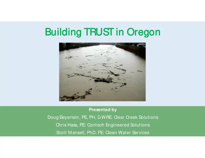
Buil Buildin ding g TR TRUST UST in in Or Oreg egon
- n
Presented by Doug Beyerlein, PE, PH, D.WRE: Clear Creek Solutions Chris Hass, PE: Contech Engineered Solutions Scott Mansell, PhD, PE: Clean Water Services
Buil Buildin ding g TR TRUST UST in in Or Oreg egon on - - PowerPoint PPT Presentation
Buil Buildin ding g TR TRUST UST in in Or Oreg egon on Presented by Doug Beyerlein, PE, PH, D.WRE: Clear Creek Solutions Chris Hass, PE: Contech Engineered Solutions Scott Mansell, PhD, PE: Clean Water Services Intr In trodu oducti
Presented by Doug Beyerlein, PE, PH, D.WRE: Clear Creek Solutions Chris Hass, PE: Contech Engineered Solutions Scott Mansell, PhD, PE: Clean Water Services
Ch Chris is Has ass, s, PE Stormwater Consultant – OR 503-807-2322 CHass@ContechES.com Sc Scott t Man ansell, sell, PhD, , PE Senior Engineer 503-681-4466 MansellS@CleanWaterServices.org Do Doug g Bey eyerlei erlein, n, PE PE, PH, D.WR WRE Principal Engineer 425-225-5997 beyerlein@clearcreeksolutions.com
Intr oduction to TRUST and Continuous Simulation Modeling
Continuous Modeling Example
Applications of TRUST by Clean Water Ser vices
Developed for Clean Water Ser vices.
Includes the entir e Tualatin River Basin.
Tualatin River Urban Stormwater Tool
Long-ter m r ain gauges
1 948-present
TRUST is built on the WWHM HSPF softwar e platfor m. CCS has developed similar stor mwater softwar e for
9 counties in western Washington
1 . Easy to use. 2. Wide range of BMPs 3. Both water quality and flow control BMPs 4. Fast set up and execution. 5. Has been customized with local data. 6. Continuous simulation hydr ology.
Single Event Methods:
Rational Method: Q = CIA (1 880s)
SBUH SCS Curve Number s (1 930s) Cr eated pr e-computer . Simplified for calculation by slide r ule. REQUIRES MULTIPLE MAJOR ASSUMPT IONS.
Runoff frequency is the same as r ainfall fr equency (the 1 00-year stor m causes the 1 00-year flood). FALSE
Antecedent soil moistur e conditions ar e always the same. FALSE
Rainfall events ar e never back to back (one stor m immediately after another ). FALSE
Stor m shape and r ainfall distr ibution ar e always the same. FALSE POOR ASSUMPTIONS!!!
Still the cur r ent standard most places in Or egon, but…
Pr oduces stor mwater control facilities that do not pr event incr eased str eam channel
er osion.
Pr oduces stor mwater control facilities that do not pr event flooding downstr eam when combined with flows fr om other developed subbasins.
Stormwater contr ols sized using single events have
Increased erosion
Matched predevelopment peak only
Large incr ease in dur ation of flows in the erosive r ange.
Caused flooding
Extended per iod of peak flow from
from multiple subbasins causes mor e peak over lap downstream
Inaccur ate pr ediction of antecedent
antecedent moistur e conditions, precipitation, and back-to-back events
https:/ / www.researchgate.net/ figure/ Hydrograph-Analysis-for-Conventional-Detention-of-the-Two-Year-2-h-Event-in-Fort_fig1_318613692
Runoff frequency is statistically calculated from the long-term hourly simulated r unoff data.
Antecedent soil moistur e conditions ar e calculated (and change) ever y time step.
Rainfall & evaporation are from the measur ed histor ical r ecor d.
Stor m shape and r ainfall distr ibution ar e fr om the measur ed histor ical r ecor d.
Calibr ation to r eal stor ms and r eal str eamflow data Bad assumptions fr om single event methods ar e gone!
1 966: Stanfor d Water shed Model
1 979: EPA HSPF
2001 : Western Washington Hydr ology Model (WWHM)
201 5: T RUST
201 9: TRUST 201 9 (update of or iginal T RUST)
Continuous simulation hydrology computes the entir e hydr ologic cycle for multiple year s.
Multiple-year hour ly histor ic rainfall used to gener ate gener ate multiple-year hour ly hour ly r unoff data.
Stormwater runoff = surface runoff + inter flow.
Continuous simulation computations from HSPF (included in T RUST softwar e).
HSPF r uns in the backgr ound with local calibr ated par ameter values and meteor ological data.
HSPF sponsor ed and funded by EPA and USGS.
Continuous simulation hydrology to compute stormwater r unoff for both conditions.
Models & sizes BMPs to mitigate development effects
Pr edevelopment Post-development
T he entire water cycle is computed on an hourly time step for multiple year s.
T RUST computes changes in soil moistur e, evapotranspir ation, and r unoff ever y time step.
T hr ee types of r unoff:
Sur face r unoff
Interflow (shallow subsurface r unoff)
Gr oundwater / base flow
Can automatically size and compute r outing thr ough a number of types of BMPs.
Flow contr ol standard based on er osive flow range.
Flow contr ol standard is typically ½ of 2- year to 1 0-year flow.
Adjustable within TRUST for differ ent jur isdictions / differ ent applicable range.
Flow Dur ation Analysis: Per cent of time the flow exceeds a specific value
Requir es continuous simulation hydr ology.
Pr oduces stor mwater control facilities that ar e cor r ectly sized because:
Pr edevelopment par ameter values are calibr ated to local hydr ologic conditions and land uses.
Runoff calculations ar e mor e accur ate due to better antecedent moistur e conditions and r eal, measur ed stor m events.
Pr edevelopment flood fr equency values ar e accur ate because based on flow, not pr ecipitation and based on r eal storms.
Stor age volumes to r educe flows to pr edevelopment conditions ar e mor e accur ate because they have been ‘tested’ over many year s in the model.
Pr oduce stor mwater contr ol facilities that do not incr ease stream channel er osion because:
Match pr edevelopment flow durations in the er osive flow range in the str eam instead of peak flows.
T he number of hours of high (erosive) flows in the stream do not incr ease above pr edevelopment conditions.
Dr ainage ar eas ar e divided into per vious land segments
§
Soil
§
Vegetation
§
Slope
§
Imper viousness
Per vious and imper vious segments ar e linked to r outing and LIDA, e.g.
§
Extended dr y basins
§
Constr ucted water quality wetlands
§
Rain gar dens
§
Por ous pavement
User locates pr oject on Tualatin Basin map, inputs pr e- and post-development land use and pr oposed mitigation measures.
Pr edevelopment and mitigated flows ar e compar ed at Point of Compliance (POC).
Mitigation measur es designed to meet flow contr ol standar d and/ or water quality tr eatment standard.
1 . Extended Dr y Basin 2. Constr ucted WQ Wetland 3. Natur al Channel 4. Gr avel Tr ench/ Bed 5. Flow Splitter 6. SSD Table 7. Stor age Tank 8. Stor age Vault
1 . Rain Gar den 2. LIDA Swale 3. Infiltr ation Planter 4. Flow-T hr ough Planter 5. Por ous Pavement 6. Gr een Roof
Intr oduction to TRUST and Continuous Simulation Modeling
Continuous Modeling Example
Applications of TRUST by Clean Water Ser vices
§ Select location § Use NRCS for soil type § Set up basin ar ea
§ Alter imper vious/ per vious ar eas to r eflect development § Run fir st iter ation of pond § Optimize pond sizing § Autopond sizing
§ Develop apar tments on tax lot 9000, 91
00 and 9200
§ Pr e-developed Condition
§ Pasture 3.92 acr es
§ Post-developed Condition
§ 74,300 sqft (1
.70 acr es) r oof
§ 45,1
00 sqft (1 .04 acr es) parking
§ 51
,400 sqft (1 .1 8 acres) landscape
§ Development tr igger s Categor y 3 or NMFS
r equir ements for flow-dur ation cur ve matching BMP
City of Beaverton GIS S ystem
All vegetation assumed to be pasture.
Use NRCS to classify soil types.
Type C/ D
US DA National Resource Conservation S ervice Websoil S urvey
50% 2yr Pre
50% 2yr Pre
50% 2yr Pre
50% 2yr Pre
Key Design Par ameters §
Max ponding depth
§
Water way side slopes (e.g. 3:1 , 4:1 )
§
Or ifice size(s)
§
Weir elevation, width
§
Weir notch depth/ width
Focus on 50% of the 2yr event fir st
Use AutoPond as a star ting point and adjust or ifice and weir to optimize the BMP sizing. §
With AutoPond Footpr int – 1 30’ x 1 30’
§
Without AutoPond Footpr int 1 20’ x 1 20’
Intr oduction to TRUST and Continuous Simulation Modeling
Continuous Modeling Example
Applications of TRUST by Clean Water Ser vices
0.5 1 1.5 2 2.5 3 3.5 11/ 29/ 1994 11/ 30/ 1994 12/ 1/ 1994 12/ 2/ 1994 Flow (cfs)
Moved BMP locations Evaluate a range of in- stream strategies and combinations Rapidly developing Interim BMPs/ Retrofits
Distributed Regional Stream Enhancement
In-line detention (in series) Riparian wood/ vegation In-stream wood/ vegation Real-time Control S wales / detention basins
Chris Hass, PE Stormwater Consultant – OR 503-807-2322 CHass@ContechES.com Scott Mansell, PhD, PE Senior Engineer 503-681-4466 MansellS@CleanWaterServices.org Doug Beyerlein, PE, PH, D.WRE Principal Engineer 425-225-5997 beyerlein@clearcreeksolutions.com