
SLIDE 1
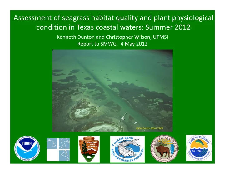
Assessment of seagrass habitat quality and plant physiological condition in Texas coastal waters: Summer 2012
Kenneth Dunton and Christopher Wilson, UTMSI Report to SMWG, 4 May 2012
Assessment of seagrass habitat quality and plant physiological - - PowerPoint PPT Presentation
Assessment of seagrass habitat quality and plant physiological condition in Texas coastal waters: Summer 2012 Kenneth Dunton and Christopher Wilson, UTMSI Report to SMWG, 4 May 2012 Our Goal: To provide a State- wide assessment of Texas TEXAS
Kenneth Dunton and Christopher Wilson, UTMSI Report to SMWG, 4 May 2012
Lower Laguna Upper Laguna Corpus Christi Bay Mission-Aransas (MA-NERR)
Texas
Gulf of Mexico TEXAS
Neckles, HA, BS Kopp, BJ Peterson and PS Pooler. 2012. Integrating Scales of Seagrass Monitoring to Meet Conservation Needs. Estuaries and Coasts. Vol. 35: pp 23‐46.
www.TexasSeagrass.org
All of the protocols used in this sampling effort will be posted for general use and reference on www.TexasSeagrass.org In the very near future, website visitors will be able to query individual methods and locate literature references describing, testing, and implementing these procedures. Such a resource is easily available to resource managers and ensures measurement consistency amongst different groups and agencies.
1. Previously delineated seagrass meadows were used to identify specific regions of interest (NOAA Benthic Habitat Mapping, Texas 2004/2007 Benthic Data Set)* 2. Polygons were used to create a tessellated map overlying these regions of interest 3. Random site locations (567 total) were then identified within each polygon 4. For mapping purposes, the data was interpolated using an inverse distance weighting squared method
Mission-Aransas (MA-NERR) Corpus Christi Bay Upper Laguna Lower Laguna
*TPWD Seagrass Viewer: http://www.tpwd.state.tx.us/gis/seagrass/
‐ Percent Coverage ‐ Species Composition ‐ Canopy Height ‐ Tissue C:N:P, δ N15 and δ C13
‐ Light Attenuation ‐ Total Suspended Solids ‐ Depth and Secchi Depth ‐ Temperature, Salinity, pH, DO and Water Column Chlorophyll* *Measured with YSI Datasonde
coverage
Field measurements of bathymetry provide a valuable metric for tracking changes in available seagrass habitat over time resulting from dredging and/or natural erosion.
The Tier 2 sampling program also implements a series of plant condition indicators. We focused on Halodule wrightii since it was the most widespread of the five seagrass species in Texas waters.
Annual measurements of canopy height provide a useful metric for assessing plant condition and habitat availability for resident fauna. Increasing the sampling frequency for this metric could also yield seasonal or annual estimates of plant growth.
Extremely high C:P and C:N ratios of plant tissue suggests that portions of the ULM are nutrient limited. This is likely attributed to the lack of a significant freshwater (nutrient) source to the estuary.
Halodule Halodule
The N and P content of seagrass tissues integrate the nutrient conditions in overlying waters and sediments. They are excellent condition indicators and are sensitive to N‐loading events.
Stable carbon and nitrogen isotopic ratios of plant tissue are useful for identifying changes in nutrient sources over time (i.e. from wastewater effluent).
Halodule Halodule
MANAGEMENT CONCERN ‐ Rapid assessment of seagrass coverage revealed a noticeable absence of vegetation at a suitable depth. ‐ The last remote sensing effort (2007) showed seagrass cover at this location. ‐ The location of this bare area is coincident with low salinities in fall/winter 2010 associated with the Arroyo Colorado watershed. QUESTION ‐ Do the environmental parameters measured during the Tier 2 assessment sufficiently identify conditions inhibiting seagrass proliferation?
The absence of seagrass coverage corresponds to an area of high light attenuation resulting from high concentrations of chlorophyll and TSS. High spatial coverage and resolution in field data allows resource managers to focus conservation efforts on specific areas of concern.
MANAGEMENT CONCERN ‐ A mitigation agreement from a proposed construction project requires the successful restoration of T. testudinum and
QUESTION ‐ Are the natural distributions of
controlled by specific environmental conditions? If so, how can managers successfully identify species‐specific restoration locations?
Syringodium and Thalassia both reside in deeper waters with similar optical properties…
Syringodium is generally restricted to the ULM, which has a high residence time and salinity. Thalassia is restricted to areas near large inlets with lower residence times and salinities. Since Syringodium is known to thrive in locations with lower salinities than the ULM (i.e. Florida), Thalassia is likely excluding Syringodium in CCB and LLM
MANAGEMENT CONCERN ‐ A rare seagrass species has recently become listed as a “species of concern” and requires legislative protection QUESTION ‐ Where is this species distributed along the coastline of Texas? Which areas require protection, and under what conditions does this species flourish?
http://flora.nhm‐wien.ac.at/
In the LLM, Ruppia is patchily distributed and restricted to extremely shallow habitat (< 10 cm). This habitat exhibits a higher salinity due to evaporation, which suggests that Ruppia has a high tolerance to salinity. Because of its distribution in shallow waters, Ruppia is at a high risk from prop scars and trampling.
http://ian.umces.edu
Apply information on seagrass growth requirements with yearly
develop annual Report Cards. Such a categorical classification of water quality is:
multiple variables
multiple surveys/years
general public
The Tier 2 sampling effort provides a quantitative description of both plant condition indicators and habitat quality parameters. This information will be utilized to develop a species‐specific habitat suitability index (HSI) for Texas seagrasses. The HSI will be refined with the addition of each annual survey and will serve as a valuable tool for:
efforts
change, sea level rise and coastal development
Vims.edu Wired.com
Tier 3 implements an intensive monitoring program intended to address specific ecophysiological questions. This Tier is the most geographically limited, but also provides the most detailed information. Such information is often required to develop innovative and effective management solutions to unique problems.
Water Quality ‐ Chlorophyll a, TSS, Nutrients and Sonde ‐ Discrete light measurements (Kd and %SI) ‐ Continuous light measurements Benthic Habitat ‐ Seagrass tissue: nutrient/isotopic analysis ‐ Above‐ and below‐ground seagrass biomass ‐ % Cover, canopy height and shoot density ‐ Epiphyte and macroalgal cover ‐ Sediment characteristics (TOC and grain size) *Measurement parameters and sampling frequency
are flexible to meet project objectives
Transect Orientation Permanent transects (50 m) are positioned perpendicular to the shoreline to incorporate the deep edge of the seagrass meadow and provide a depth gradient
http://floridakeys.noaa.gov
Permanent Transects (North : South)
‐ Trayler Island1 ‐ Hog Island1 ‐ Mud Island1 ‐ East Flats1 ‐ Padre Island National Seashore1 ‐ LM 1511,2
1 Transect locations are visited annually to
document: % cover, seagrass biomass, light availability, water quality, sediment characteristics and epiphyte/macroalgal cover
2 LM151 is a long‐term monitoring site utilized
for continuous measurements of underwater irradiance, monthly water quality surveys and quarterly assessments of plant condition
Based on a light requirement of 20 %SI and a measured KD of 1.02, Thalassia should extend into deeper waters up to 1.57m. However, Tier 3 sampling revealed the prevalence
range and a negative correlation between Thalassia coverage and sediment ammonium.
Seagrass distributions and plant physiological characteristics are often influenced by complex biogeochemical processes. The Tier 3 sampling program affords scientists with the ability to research and identify complex linkages between seagrass plants and their environment.
Program Status: Tier 2
‐ A total of 567 individual monitoring sites were identified within the NERR, CCB, ULM and LLM ‐ These sites were all sampled between August and September 2011 ‐ The georeferenced data has been checked for Q/A and mapped for all regions ‐ Preparations are currently underway for the 2012 sampling season
Program Status: Tier 3
‐ A total of 6 permanent transects were identified within the NERR, CCB and ULM ‐ These transects were all surveyed between August and September 2011 ‐ The data is currently under review for Q/A
Overall State of the Texas Seagrass Monitoring Program
‐ Funding is currently in place for continued monitoring through FY 2012 ‐ All of the raw data currently resides within a professionally developed central database ‐ A central website has been created to house all of the protocols, sample data and GIS information ‐ We are currently developing an annual report on the overall condition of Texas seagrass meadows
Long‐term monitoring data must be easily accessible to resource managers and the general public. This website is up and running and will serve as the primary source for sampling protocols, observational data, maps and monitoring reports. All of the Tier 2 and Tier 3 data presented here will soon be available for use!
30
http://www.tdl.org/
‐ Sally Morehead and Ed Buskey, Mission‐Aransas NERR ‐ Martha Segura and Joe Meiman, National Park Service ‐ Ray Allen and Jace Tunnell, Coastal Bend Bays and Estuaries Program ‐ Melissa Porter, Texas General Land Office
‐ UT‐Austin Center for Water Resources (David Maidment) ‐ Eric Hersh and Tim Whiteaker
‐ Kim Jackson ‐ Travis Bartholomew ‐ Kelly Darnell ‐ Nathan McTigue ‐ Geoff Hensgen ‐ Joe Stachelek ‐ Beau Hardegree ‐ Karen Bishop ‐ Dana Sjostrom ‐ Jace Tunnell ‐ Joe Meiman
‐ Hilary Neckles ‐ Bill Dennison ‐ Jim Fourqurean