
SLIDE 1
Black = existing Trail Red = Proposed Transportation Project #1 - - PowerPoint PPT Presentation
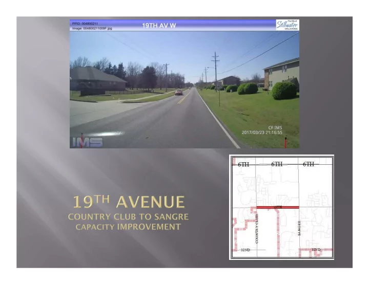
Black = existing Trail Red = Proposed Transportation Project #1 19th AVENUE COUNTRY CLUB TO SANGRE CAPACITY IMPROVEMENT This project was evaluated and recommended as part of the update of the Stillwater Transportation Enhancement Plan (STEP)
Black = existing Trail Red = Proposed
This project was evaluated and recommended as part of the update of the Stillwater Transportation Enhancement Plan (STEP) 2040 update. It is for a 3 lane facility with adjacent alternative transporta- tion paths similar to the section of 19th from Sangre to Western. The project includes widening one box bridge structure.
Included in the construction of 19th Avenue from Sangre to Western Roads was a 10’ wide multi-use path along the north side. Significant development has occurred along the south side of 19th Avenue and a path along the south side will provide better connectivity of those neighborhoods to Babcock Park and other points in the City.
Name (Optional): COMMENTS:
This project accomplishes the goals of the City Council by bringing substandard streets into compliance with City Standards and provide for means of alternate transportation. 3rd Avenue is a collector which helps to move traffic from the residential areas east of Perkins Road into the downtown and OSU cam- pus areas. Reconstruction of this section will bring the street up to City Standards and will add active transportation elements. This reconstruction coupled with reconstruction of the bridge over East Boomer Creek, scheduled to begin this fall and which includes elements for active transportation provides means for active transpor- tation for the residents of this area to the downtown and OSU campus areas.
Name (Optional): COMMENTS:
The Oklahoma Department of Transportation has scheduled upgrading SH 51 (6th Ave.) from west of Western Road to west of Perkins Road. 6th Avenue is a major corridor through the community and de- sign of the improvements will impact the community for several decades. Among the many things to be considered, such as north-south connectivity across the corridor as well as connectivity from OSU campus to the downtown area, is how to accommodate alternative modes of transportation. This item will allow for retaining a consultant to identify and investigate various locations for the alternative trans- portation modes
Name (Optional): COMMENTS:
This is the last phase of a ODOT/City multi-phase project to widen and extend Western from Hall of Fame to Airport Road, and widening of Airport Road to Washington. Phase IIIA is under design and will terminate at the south terminal access road. Phase IIIB will continue the road northeasterly to Airport Road and then to Washington Street. The project provides for 4 lanes and alternative trans- portation paths along the entire route. It also includes widening and new signals at Washington. Completion of the project provides for a continuous alternative transportation path from 6th and West- ern to the Kameoka Trail as well as Sanborn Lake area. Making it possible to access 6th Avenue and Western Road from the Parkview Estates residential area.
Name (Optional): COMMENTS:
The updated STEP plan analysis showed this section of Country Club is approaching capacity. The project would extend the short section of 5 lanes through the existing development and then transition to 4 lanes at 9th Ave.
Name (Optional): COMMENTS:
The referenced area of Duck Street is part of the City’s Form Based Code area which has among the goals to provide transportation modes for all forms of transportation in an efficient and esthetically pleas- ing manner to help encourage mixed used development. The pavement rating for this section of Duck Street suggests it needs rehabilitation with a mill and overlay.
Name (Optional): COMMENTS:
This project provides $2.3 million in funding for completion of the Kameoka Trail between 9th Avenue and Perkins Road to Strickland Park.
Name (Optional): COMMENTS: Black = Existing Trail Red = Proposed Trail
This section of Lakeview is subject to frequent flooding. The proposed project would raise the eleva- tion of the road to eliminate flood water from running over the top of the road and add alternate trans- portation paths along the section.
Name (Optional): COMMENTS:
This project reconstructs Monroe Street from 6th Avenue to University and provides for alternate means
transportation mode study as part of the connectivity issues across the 6th Avenue corridor.
Name (Optional): COMMENTS:
Professional services for this project was started several years ago but canceled due to a shortage of
analysis considered the effect of a 3 lane, 4 lane and 5 lane facility and determined a 4 lane facility was the appropriate typical section. The project requires the widening of two box bridge structures and in- cludes wide paths for pedestrians and other alternative transportation uses as well as new signals at 19th Avenue and Sangre Road and improved east bound to south bound right turn at 6th Avenue as well as elevating the road above the 100 year flood plain. Elevation of the road will help to provide access to the southwest portion, including emergency access, during flooding events when Western Road is closed.
Name (Optional): COMMENTS:
This project provides for the design and construction of sidewalk improvements along 19th Avenue west of Sangre Road and in the residential neighborhoods north of 19th Avenue and east of Country Club Road. Included is construction of a pedestrian signal across 19th Avenue at Westbrook Drive. The improvements would allow greater bicycle and pedestrian access to the Sangre Ridge middle and elementary schools south of 19th Avenue. This project might also be eligible for ODOT participation.
Name (Optional): COMMENTS:
The pavement management rating index for University Avenue indicates it should be replaced. One of the challenges with replacement is the age of the 24” water main along University. Given the age of the line it is prudent to reconstruct the line as part of the project with an associated increase in cost. Additionally with planned improvements at OSU the opportunity may exist to change the designation of a portion of the street from Collector to Local.
Name (Optional): COMMENTS:
The STEP 2040 update study shows the portion of Western Road between 12th and 6th Avenues is at capacity and the section from 26th to 19th Avenues will reach capacity within the study time. This project is shown as two phases. A significant portion of the projects costs is for the purchase of ROW between 12th and 6th Avenues. The study suggests a 5 lane typical section will be needed by the end of the study
tending to the Perkins and Coyle communities.
Name (Optional): COMMENTS:
This is the second phase of the proposed improvements to Western Road described on Project #14
Name (Optional): COMMENTS:
Project # Project Conceptual Cost 1 19th Avenue: Country Club to Sangre ‐ Design, Utility, ROW/Legal & Construction $5,750,000 2 19th Avenue: Sidewalk from Sangre to Western, Design & Construction $400,000 3 3rd Avenue: Perkins Rd to Berry St $1,750,000 4 6th Avenue/Hwy 51: Alternate Transportation Study $100,000 5 Airport Arterial Road: Phase III(B) ‐ Design, Utility $3,000,000 6 Country Club Road: 9th to 6th ‐ Design, Utility & Construction $650,000 7 Duck Street: 6th to Hall of Fame $11,200,000 8 Kameoka Trail Connections: Design, Utility, ROW/Legal & Construction $2,300,000 9 Lakview Avenue: Railroad to Perkins Rd $750,000 10 Monroe Street: 6th to University Avenue $2,000,000 11 Sangre Road: Design, Utility, ROW/Legal and Construction $6,800,000 12 Southwest Schools: Improved Routes ‐ Design & Construction $125,000 13 University Avenue: Western to Monroe $7,600,000 14 Western Road: 12th to 6th ‐ Design, Utility, ROW/Legal & Construction $7,000,000 15 Western Road: 26th to 19th ‐ Design, Utility, ROW/Legal & Construction $3,100,000 $52,525,000 Question/Comment (Print): M O N D A Y, J U N E 1 0 , 2 0 1 9
Name (Optional): Phone or Email (Optional) for possible follow‐up information:
Transportation Project List
Your Priority Ranking