Beaver Creek Trail Feasibility Study Community Workshop May 28, - - PowerPoint PPT Presentation

beaver creek trail feasibility study
SMART_READER_LITE
LIVE PREVIEW

Beaver Creek Trail Feasibility Study Community Workshop May 28, - - PowerPoint PPT Presentation

Beaver Creek Trail Feasibility Study Community Workshop May 28, 2019 Study Advisory Committee Members John Caporale , Caln Planning JoEllen McBride , Caln Parks and Commission Recreation George Chambers , Caln Board of Karen


slide-1
SLIDE 1

Community Workshop May 28, 2019

Beaver Creek Trail Feasibility Study

slide-2
SLIDE 2

Study Advisory Committee Members

  • John Caporale, Caln Planning

Commission

  • George Chambers, Caln Board of

Commissioners

  • Allan Cohen, William Cohen & Sons
  • Jamie DiDomenico, Chester County

Sports Arena

  • Al Dimateo, Lincoln Highway

Committee

  • Scot Gill, Caln Township

Wastewater Director

  • Chuck Kramer, Former Caln

Township Commissioner

  • Brett Klukan, Caln Parks and

Recreation

  • George March, Caln Township Civil

Service Commission

  • JoEllen McBride, Caln Parks and

Recreation

  • Karen Sefton, Wedgwood HOA
  • Abbey Swan, Caln Township Staff

Consultant Team

  • Rob Daniels, Brandywine

Conservancy

  • Sheila Fleming, Brandywine

Conservancy

  • Rachael Griffith, Chester County

Planning Commission

  • Meredith Mayer, Brandywine

Conservancy

  • Brian Styche, Chester County

Planning Commission

slide-3
SLIDE 3

Background

2004 2019 2018 2017 2015

Beaver Creek Trail Feasibility Study Chester Valley Trail West Feasibility Study/Master Plan Caln Township Comprehensive Plan Caln Township Beaver Creek Staff Report Brandywine Creek Greenway Strategic Action Plan

2014 2010

Caln Township Mobility and Connectivity Study Lloyd Park Master Plan

slide-4
SLIDE 4
slide-5
SLIDE 5

What constitutes the Greenway?

  • 40 mile long corridor of
  • pen space and trails
  • Width to be determined
  • Urban, suburban, rural
  • Diverse natural, cultural,

and scenic features

  • Land- and water-based
  • Public and private

property

  • Functions vary
slide-6
SLIDE 6

Partner Priorities

6

slide-7
SLIDE 7
slide-8
SLIDE 8

Beaver Creek Trail Staff Report, 2015

  • Proposed a 1.5-mile recreation

trail along G.O. Carlson at Park Drive, continuing through the woods to Lloyd Avenue Dog Park

  • Would connect to 1.8 miles of

existing walking trail along G.O. Carlson Boulevard

  • Public meeting on June 18, 2015
  • Prepared in support of

Township applications for grant funding to move forward with the project that were not successful

slide-9
SLIDE 9

Chester Valley Trail West

Feasibility Study and Master Plan

slide-10
SLIDE 10

Project Context

slide-11
SLIDE 11

Project Context

Harrisburg Philadelphia

Lancaster

CHESTER VALLEY TRAIL WEST

Northwest Lancaster Co. River Trail Enola Low Grade Trail Chester Valley Trail Schuylkill River Trail

slide-12
SLIDE 12

Recommended Alignment

slide-13
SLIDE 13

Recommended Alignment

Segment Total Mileage Multiuse Miles Beaver Creek 2.2 1.8 Caln Twp. 5.0 3.3

slide-14
SLIDE 14

CVT West Recommended Alignment

Beaver Creek Segment Caln Township Segment Beaver Creek Trail Feasibility Study

slide-15
SLIDE 15

Beaver Creek Trail Feasibility Study Project Overview

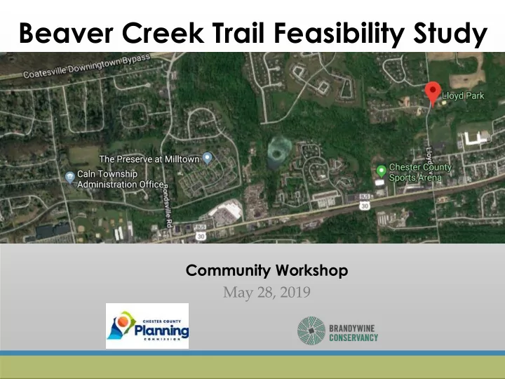
Project goal is to connect the Caln Municipal Building to Lloyd Park for non-vehicular travel

slide-16
SLIDE 16

Scope of Work

§ Bicycle & Pedestrian Conceptual Plans

Permitting & Construction

§ Shared Roadway Design Guidelines § Draft & Final Report § Alignment Evaluation & Property Owner Engagement

Guided by Stakeholder and Community Input

Conceptual Engineering & Feasibility Detailed Design & Engineering Planning Funding

§ Implementation Plan & Funding Strategy

slide-17
SLIDE 17

Project process

  • A trail feasibility study helps determine a possible trail

alignment by:

  • Considering environmental, cultural, historical, and

geologic constraints

  • Building upon previous studies and other local, regional,

and state-wide planning efforts

  • Involving the community and other stakeholders to share

their input

  • A trail feasibility study prepares a project for the design and

engineering phase of trail planning which prepares a project for construction

  • All together, taking a trail from concept to construction can take

ten to twenty years!

slide-18
SLIDE 18

Schedule

Meeting Purpose

  • 1. Give project background
  • 2. Present project overview,

scope, timeline, and budget

  • 3. Gather feedback regarding non-

vehicular travel in Caln Township

slide-19
SLIDE 19

Inventory Mapping

slide-20
SLIDE 20
slide-21
SLIDE 21
slide-22
SLIDE 22
slide-23
SLIDE 23

Public input

slide-24
SLIDE 24
slide-25
SLIDE 25
slide-26
SLIDE 26

We want to hear from you!

  • Sign-in: Project Email List
  • Review/Comment on Boards and

Participate in Mapping Activity

  • Project W

ebsite

https://www.brandywine.org/co nservancy/projects/beaver- creek-trail

  • Comment Forms
  • Take a project description sheet

home with you or share with a neighbor

slide-27
SLIDE 27

Next Steps

Receive and review community input Property owner coordination Work with study advisory committee to develop draft trail alignment

Community Workshop for public input on draft alignment

(date to be determined and publicized, fall 2019)

Thank you!