
SLIDE 1
1
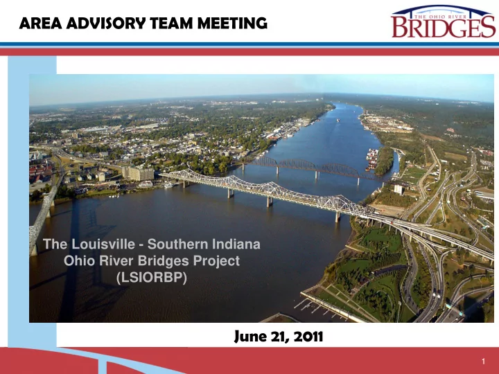
The Louisville - Southern Indiana Ohio River Bridges Project (LSIORBP)
AREA ADVISORY TEAM MEETING June 21, 2011
AREA ADVISORY TEAM MEETING The Louisville - Southern Indiana Ohio - - PowerPoint PPT Presentation
AREA ADVISORY TEAM MEETING The Louisville - Southern Indiana Ohio River Bridges Project (LSIORBP) June 21, 2011 1 1. Welcome / Introductions 2. Project History 3. Why We Are Here 4. Proposed Alternatives 5. Next Steps 2 The Bridges
1
The Louisville - Southern Indiana Ohio River Bridges Project (LSIORBP)
AREA ADVISORY TEAM MEETING June 21, 2011
2
3
4
in 1 or 2 bridge combinations
process
Draft EIS
5
Selected Alternative: Construct New Downtown Bridge Construct New East End Bridge Reconstruct Kennedy Interchange
6
Bridges Authority (LASIBA) – 2010
7
8
9
Transportation Plan amended to add tolling
developing financial plan
10
Governors, Mayor identified potential project savings
Interchange in place
roadway and tunnel from six lanes to four lanes
Bridge pedestrian / bike path under a separate project
11
Project Segment 2003 Selected Alternative 2011 Modified Alternative Section 1 - Kennedy Interchange $1,530.0 $728.2 Section 2 - Downtown River Bridge $569.7 $532.6 Section 3 - Downtown IN Approach $392.7 $177.8 Section 4 - KY East End Approach $885.2 $794.8 Section 5 - East End River Bridge $406.2 $326.2 Section 6 - IN East End Approach $234.8 $231.7 Other Costs(2) $124.2 $125.0 TOTAL(1) $4,142.8 $2,916.2
(Costs in $, million) (1) Totals may not sum due to rounding (2) Includes costs that are not section specific, including Project Oversight, Environmental Mitigation of Hazardous Materials, Wetland Remediation and Historic Preservation
12
changes
– Tolling – Implementation of cost saving ideas
13
Traffic Diversion Effects
Vehicle Types Tolling Range Traffic Patterns
Travel Model
model traffic
Cars, trucks, SUVs - $1 to $2 Box / panel trucks - $2 to $4 Tractor trailers - $4 to $8
through separate analysis by Bridges Authority
14
linkage
15
16
17
18
Section 2 – Downtown Bridge
19
750’ 500’ MIN
Section 2 – Downtown Bridge
20
View Looking Toward Indiana
Bridge Cross Section Including Pedestrian Walkway/Bikeway
21
View Looking Toward Indiana
Bridge Cross Section Without Pedestrian Walkway/Bikeway
22
View From Pedestrian Walkway/Bikeway
23
Section 2 – Downtown Bridge
24
Section 2 – Downtown Bridge
3 TOWER CABLE-STAYED
25
3 TOWER CABLE-STAYED
Section 2 – Downtown Bridge
26
With sidewalk
27
With out sidewalk
28
Modified – w/out sidewalk
29
Section 2 – Downtown Bridge
Structure
Existing Traffic Pattern Proposed Traffic Pattern
30
31
Downtown Bridge
32
Downtown Bridge
33
EIS Selected Alternative Modified Alternative
Complex bridge network for Southbound access ramps Replace bridge network with collector-distributor roadway system 4 lane US 31 over Court Ave. from I-65 to Clark Memorial Bridge 2 lane US 31 over Court Ave. from I-65 to Clark Memorial Bridge Reconstruct I-65 Bridge over 7th St. Eliminate I-65 bridge over 7th St. provide full access on 6th St. Complex flyover bridge for I-65 NB exit to 10th Street Eliminate flyover and revise NB exit to 10th Street similar to existing alignment Relocate 10th St. under I-65 to the south adjacent to RR spur and 9th St. Reconstruct 10th St. similar to existing alignment Total bridge construction 674,500 sft. Total bridge construction 205,500 sft.
SECTION 3
34
COURT AVE. ACCESS
35
COURT AVE. ACCESS
36
6TH & 7TH STREET ACCESS
37
6TH & 7TH STREET ACCESS
38
10TH STREET ACCESS
Clark Memorial Hospital
39
Clark Memorial Hospital
10TH STREET ACCESS
40
SB FRONTAGE & STANSIFER ACCESS
41
SB FRONTAGE & STANSIFER ACCESS
42
43
44
The Louisville - Southern Indiana Ohio River Bridges Project (LSIORBP)
AREA ADVISORY TEAM MEETING June 21, 2011