SLIDE 6 26.05.2019 6
(including general chacteristics and particular features of the region -ocean, enclosed, semi enclosed sea etc.)
- Configuration of the Coasts
(including adjacency and oppositness, direction, comparative lenghts, concave or convex shape)
(including presence of ports, roadsteads, bays, river mouths, low-tide elevations, reefs)
boundaries)
- The presence of islands and rocks
(including their size and position in the context of general geographic configuration)
- Geological and geomorphological factors
- Economic factors
(Hydrocarbon resources, fisheries)
- Navigation
- Socio-economic and demographic factors
- Defence and security
- Environment
- Historical rights
- Presence of Third States
SPECIA IAL/RELE L/RELEV ANT ANT CIRCUMS UMS T ANCE NCES
✔ ✔ ✔ ✔ ✔ ✔
? x ? ? ?
✔ ✔
?
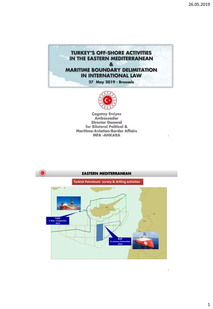
EASTERN MEDITERRANEAN
11
The Role of Islands in Maritime Boundary Delimitation
EASTERN MEDITERRANEAN
12