
SLIDE 1
Geomatic Surveyors Ltd
Why Laser Scanning?
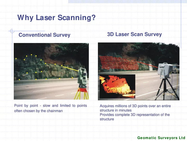
Conventional Survey
Point by point Point by point -
- slow and limited to points
slow and limited to points
- ften chosen by the chainman
- ften chosen by the chainman
Acquires millions of 3D points over an entire Acquires millions of 3D points over an entire structure in minutes structure in minutes Provides complete 3D representation of the Provides complete 3D representation of the structure structure