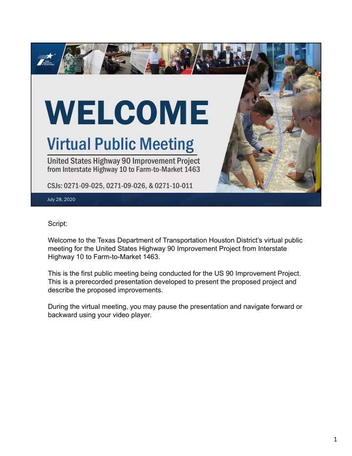
WELCOME Virtual Public Meeting United States Highway 90 Improvement - - PDF document

welcome
SMART_READER_LITE
LIVE PREVIEW

WELCOME Virtual Public Meeting United States Highway 90 Improvement - - PDF document

WELCOME Virtual Public Meeting United States Highway 90 Improvement Project from Interstate Highway 10 to Farm-to-Market 1463 CSJs: 0271-09-025, 0271-09-026, & 0271-10-011 July 28, 2020 July 28, 2020 US 90 Improvement Project Script:


slide-1
SLIDE 1

July 28, 2020 US 90 Improvement Project

Virtual Public Meeting

United States Highway 90 Improvement Project

from Interstate Highway 10 to Farm-to-Market 1463

CSJs: 0271-09-025, 0271-09-026, & 0271-10-011

WELCOME

July 28, 2020

Script: Welcome to the Texas Department of Transportation Houston District’s virtual public meeting for the United States Highway 90 Improvement Project from Interstate Highway 10 to Farm-to-Market 1463. This is the first public meeting being conducted for the US 90 Improvement Project. This is a prerecorded presentation developed to present the proposed project and describe the proposed improvements. During the virtual meeting, you may pause the presentation and navigate forward or backward using your video player. 1

slide-2
SLIDE 2

July 28, 2020 US 90 Improvement Project

Memorandum of Understanding

National En National Envir vironme nmental P tal Policy A licy Act (NEP t (NEPA) Assign A) Assignmen ment t to the the Texas Depar xas Department of ment of Transpor ansportation tation

The environmental review, consultation, and other actions required by applicable Federal environmental laws for this project are being, or have been, carried-out by TxDOT pursuant to 23 U.S.C. 327 and a Memorandum of Understanding dated December 9, 2019, and executed by the Federal Highway Administration (FHWA) and TxDOT.

2

Script: The US 90 improvement project is anticipated to be federally funded and construction is tentatively scheduled to begin in 2025. Due to the project receiving federal funds, TxDOT is required to assess the potential environmental effects of the proposed project. The process that is followed is called the National Environmental Policy Act process, otherwise known as NEPA. The NEPA process provides analyses of the potential impacts to the natural and manmade environment, and helps the decision maker to make an informed decision on whether or not to proceed with the project. On December 9, 2019, TxDOT received a signed Memorandum of Understanding from the Federal Highway Administration that permits TxDOT to assume responsibility from the Federal Highway Administration for reviewing and approving certain assigned NEPA projects. This review and approval process applies to this project. 2

slide-3
SLIDE 3

July 28, 2020 US 90 Improvement Project

Virtual Public Meeting in Response to Public Health TxDOT changed the traditional in-person public meeting to an

  • nline format in response to the COVID-19 outbreak.

The virtual public meeting and TxDOT website provide the same information as an in-person meeting: – Study information – Estimated study timeframe – Process for submitting comments – Key contacts

3

Script: Given the unique circumstances of the COVID-19 pandemic, along with the department’s commitment to protecting public health during this national emergency, TxDOT is conducting this virtual public meeting to avoid in-person

  • contact. At this time, the online public meeting is being conducted in-lieu of an in-

person public meeting. This presentation covers the same information that the Houston District would have presented at an in-person public meeting. The comment process for the virtual public meeting will be described near the end of this presentation. All meeting materials can be found on the TxDOT website on the US 90 meeting notice page. The website for the project is www.txdot.gov; key word search “US 90 from I-10.” 3

slide-4
SLIDE 4

July 28, 2020 US 90 Improvement Project

US 90 Public Meeting

4

Script: This virtual public meeting is being held to introduce the proposed project, present the alternatives being considered and gather public input. You are encouraged to submit comments on the proposed project after reviewing the meeting materials and listening to this presentation. 4

slide-5
SLIDE 5

July 28, 2020 US 90 Improvement Project

US 90 Study Process

5

2019 2020 2021

Collect Data Identify Existing Conditions Map Constraints Develop Need & Purpose Develop Alternatives Develop Evaluation Criteria Recommend an Alternative Initiate Project Develop Schematic & Environmental Documentation Evaluate Alternatives

Virtual Public Meeting Public Involvement Opportunity

Yo You are u are here! here!

PUBLIC INVOLVEMENT

Script: As a quick review, TxDOT began the project development process in 2019 by collecting data and reviewing current conditions and constraints that exist in the project corridor. From reviewing the data collected, the project team developed two build alternatives and then began evaluating both options. Existing conditions, the project's purpose and need and the preliminary build alternatives are being presented at this virtual public meeting. 5

slide-6
SLIDE 6

July 28, 2020 US 90 Improvement Project

US 90 Project Overview

6

Script: The project's study limits extend from I-10 to FM 1463 for a length of approximately 10 miles. The project is located in Waller, Fort Bend and Harris counties. 6

slide-7
SLIDE 7

July 28, 2020 US 90 Improvement Project

US 90 Existing Typical Section

7

Script: US 90 from I-10 to Bains Street in the City of Brookshire and from Kenney Street to FM 1463 currently has one travel lane in each direction, 8-foot shoulders on the

  • utside of the travel lanes and open ditches for drainage. Through the City of

Brookshire, US 90 widens to four travel lanes with parallel parking and sidewalks on the south side. A Union Pacific railway is north of and adjacent to the roadway right-

  • f-way. The average roadway right-of-way width throughout the project area is 100

feet. 7

slide-8
SLIDE 8

July 28, 2020 US 90 Improvement Project

Study Purpose and Need

8

Script: The purpose of the proposed project is to improve mobility and safety within the project corridor. The proposed project is being developed to address these two major needs. Throughout the past few years, the project area has experienced growth in commercial development, including warehousing and distribution centers, which is projected to continue. The increased development has created congestion and delays along US 90 and at intersections. The existing 2-lane undivided roadway and 4-lane undivided roadway through Brookshire do not provide adequate mobility to accommodate traffic volumes projected for the next 25 years. Second, crash rates on this segment of US 90 are higher than average crash rates

  • n similar roadways in Texas, which results in potentially unsafe travel conditions

and reduced mobility. The existing US 90 lacks dedicated median space to allow for vehicle turns and it does not have appropriate accommodations for pedestrians or bicyclists, which is also a safety concern. 8

slide-9
SLIDE 9

July 28, 2020 US 90 Improvement Project

US 90 Daily Traffic Volumes and Level of Service

9

Script: Now let’s talk about daily traffic volumes and level of service along US 90, what it is today and what is projected for the future. Level of service is illustrated in the graphic on the right. Level of service ranges from A, free flowing traffic as shown in light green, to F which is heavily congested as shown in red. In terms of delays experienced by the traveling public, a level of service A through D is considered acceptable, and a level of service E or F is considered unacceptable. By the year 2045, traffic volumes on US 90 are projected to grow by 40% from I-10 to Koomey Road, and by almost 50% from Koomey Road through the City of Brookshire to FM 1463 in the City of Katy. With no improvements, the current capacity of US 90 from Koomey Road to FM 1463 would not be adequate to accommodate traffic volumes in 2045 and therefore, will have significant traffic congestion. At this level of congestion the roadway is projected to operate at level of service E. The intersections at Koomey Road, Bains Street, Waller Avenue, Woods Road, Igloo Road, FM 2855, Pederson Road and Cane Island Parkway are projected to operate at a level of service F, or what we refer to as a failing level of service with significant to considerable traffic delays. For study purposes, making no improvements to the roadway other than routine maintenance is known as the no build alternative. The goal of the proposed project is to improve mobility to an acceptable level of service. 9

slide-10
SLIDE 10

July 28, 2020 US 90 Improvement Project

US 90 Safety and Crash Analysis (Years 2016 – 2018)

10

Script: Regarding safety, the project team analyzed crash data for the US 90 project corridor for the years 2016 through 2018. Locations of crashes were placed on a map, and circles were placed and color coded where multiple crashes occurred in the same general location; these are called ‘hot spots.’ Blue dots indicate a low crash density, pink a moderate crash density, and yellow a high crash density. The top 5 crash locations, or ‘hot spots’, are at Waller Avenue, Baines Street, FM 1463, Cooper Street and FM 2855. For example, between 2016 and 2018 there were 154 crashes in the project corridor with 83 crashes, or 54 percent, occurring at these 5 hot spot locations. In addition, two of the crashes involved pedestrians and two involved bicyclists. The chart at the bottom presents the crash rate along the project corridor. The state average crash rate for a similar roadway is 199 crashes per 100 million vehicle miles for an urban segment, as shown by the blue line on the chart, and 72 crashes per 100 million vehicle miles for a rural segment, as shown by the purple line. Crashes on both urban and rural segments of US 90 from I-10 to FM 1463 between 2016 and 2018 were above the state average, as shown by the orange and green bars. Proposed improvements to the project corridor are explained in the next few slides. 10

slide-11
SLIDE 11

July 28, 2020 US 90 Improvement Project

US 90 Alternatives Typical Sections

11

Script: As we noted earlier, two build alternatives were developed for the project. In both alternatives improvements include four travel lanes, two in each direction, an 18-foot raised median with openings for turning movements and a closed drainage system. The difference between the two alternatives is with the sidewalks and bikeway. For Alternative 1 there would be a 12-foot bikeway on the north side of the project corridor and a 6-foot sidewalk on the south side. The proposed right-of-way width would be 120 feet, which is an increase of 20 feet from the existing right-of-way width. For Alternative 2 there would be a 10-foot shared use path on both sides of the roadway for pedestrians and cyclists. The proposed right-of-way width for this alternative would be 135 feet, which is an increase of 35 feet from the existing right-of-way width. Improvements from I-10 to Donigan Road for both alternatives only include pavement upgrades and striping. During the study process, TxDOT also evaluates drainage needs for proposed projects. For this project, TxDOT determined that it would need approximately 15.8 acres of additional right-of-way to accommodate the stormwater detention needs for either of the proposed build alternatives. Four potential detention areas are shown on the schematic layouts either in green or blue depending on the build alternative.

11

slide-12
SLIDE 12

July 28, 2020 US 90 Improvement Project

US 90 Proposed Typical Section within the City of Brookshire

12

Script: The proposed improvements in Brookshire from Koomey Road to Kenney Street would include an urban roadway section with four travel lanes, two in each direction, and a closed drainage system. The roadway would include a 14-foot center left turn lane, a 12-foot bikeway on the north side and an 8-foot parallel parking lane. The 13-foot existing sidewalk on the south side would remain in place. From Koomey Road to Bains Street there would be 10-foot shared-use paths for cyclists and pedestrians in both directions. No additional right-of-way would be required for improvements in this section due to constraints on both sides of the roadway, the Union Pacific railway on the north side and buildings on the south side. 12

slide-13
SLIDE 13

July 28, 2020 US 90 Improvement Project

How to Read a Schematic

13

Script: Here is a screenshot of the legend for the schematics that you can find on the

  • website. The legend is included on each page of the schematic so you can

reference it during your review. The screenshot on the left shows the various types of lines that you will see. Of particular note are the red dashed lines that show the proposed alignments and the black dashed lines that identify existing and proposed right-of-way. The screenshot on the right shows the colors that fill the proposed design. These colors identify the limits and major aspects of the project. Let’s walk through them. The proposed right-of-way for Build Alternatives 1 and 2 are shown in blue and light green, respectively. The yellow color identifies the proposed main travel lanes on US 90. The proposed raised median is shown in gray and the existing and proposed bridge widenings in maroon. The proposed cross streets and major driveways are shown in orange and the proposed sidewalks and shared use paths in purple. The proposed bikeway is identified in dark green. Any pavement to be removed is noted with the large crosshatching and new pavement overlays are shown in purple diagonal lines. Areas in red indicate potential displacements. 13

slide-14
SLIDE 14

July 28, 2020 US 90 Improvement Project

US 90 Bicycle and Pedestrian Accommodations

14

Script: TxDOT considered a number of factors when developing alternatives to provide equitable access for all roadway users including bicyclists and pedestrians. These factors include:

  • The roadway’s proximity to a school on the east end of the project corridor;
  • Commercial development within the City of Brookshire with multiple

driveways for businesses on the south side of US 90;

  • The adjacent railway along US 90 with limited road crossings on the north

side; and

  • Input from the City of Katy, City of Brookshire, Katy ISD and Waller County

14

slide-15
SLIDE 15

July 28, 2020 US 90 Improvement Project

US 90 Evaluation of Build Alternatives

15

Script: The table shown here summarizes how the two build alternatives will be evaluated to determine each alternative’s potential impacts on the natural and built

  • environment. Evaluation criteria include the following:
  • Right-of-way;
  • Utility impacts;
  • Constructability;
  • Drainage;
  • Waters of the United States, including Wetlands;
  • Floodplains and floodways;
  • Hazardous materials;
  • Residential, commercial and other displacements;
  • Cultural resources; and
  • Environmental justice communities.

These subject matters are currently being evaluated and technical reports summarizing the anticipated impacts are being prepared. Alternative 2 potentially has three displacements as shown in red on the schematic layout sheets 4 and 5 15

slide-16
SLIDE 16

July 28, 2020 US 90 Improvement Project

US 90 Improvements Next Steps

16

Script: This virtual public meeting is being held to present preliminary alternatives for the proposed project and gather public and stakeholder input. After the comment period closes TxDOT will review the comments received and prepare a virtual public meeting summary report. The summary report will be posted to the project website approximately three months after the close of the comment period. The next steps include refining the schematic for the recommended alternative; further evaluating environmental impacts and presenting the recommended alternative at a future public involvement opportunity. Provided the environmental documents and process are approved, the project would then move into detailed design and right-of-way acquisition could begin. Although the proposed project is not currently funded, it is anticipated that state and federal funding will be secured. The project is estimated to cost 113 million dollars. 16

slide-17
SLIDE 17

July 28, 2020 US 90 Improvement Project

Public Meeting Materials Public meeting materials are provided on the TxDOT website: – Public meeting exhibit boards – Comment card – Fact sheet – Proposed alternatives schematic – Environmental constraints map

17

Proposed Alternatives Schematic Comment Card Fact Sheet Environmental Constraints Map

Script: The project website contains all materials presented in this virtual public meeting including this presentation in both English and Spanish, exhibit boards, a comment card, a project fact sheet, schematic layouts for the two proposed build alternatives and the environmental constraints map. The schematic layouts provide a more in- depth look at details such as intersection improvements, sidewalks, shared use paths, center left-turn lanes, and the existing and proposed right-of-way. These files are large and may require more time to download than the other project materials. 17

slide-18
SLIDE 18

July 28, 2020 US 90 Improvement Project

How to Submit Your Written Comments

18

Script: TxDOT encourages you to review the materials posted on the project web site and to provide written comments. The comment form is located on the project's website. Comments must be received via email or mailed and postmarked by Wednesday, August 12, 2020, to be included in the official virtual public meeting summary report. But you may submit comments

  • r questions at anytime during project development by contacting Zain Walkabout,

TxDOT project manager, at (713) 569-3540 or zaineb.walkabout@txdot.gov. You can submit written comments in the following ways:

  • Via email to hou-piowebmail@txdot.gov
  • Via mail to the TxDOT Houston District, Attention: Advanced Project

Development Director, P.O. Box 1386, Houston, Texas, 77251-1386

  • Online by visiting www.TxDOT.gov and searching in the upper right-hand search

box for “US 90 from I-10.” Click on the email link at the bottom of the project page to open the comment form. Again, responses to comments received during the comment period will be included in the Virtual Public Meeting Summary report that will be posted on the project website in approximately three months. The project website is www.txdot.gov; key word search “US 90 from I-10.” 18

slide-19
SLIDE 19

July 28, 2020 US 90 Improvement Project

19

Thank you!

Please remember to submit comments by Wednesday, August 12, 2020.

Script: Thank you for participating in this virtual public meeting. 19