
SLIDE 1
We are Fugro 60 years Mapping the World We are an all-terrain - - PowerPoint PPT Presentation
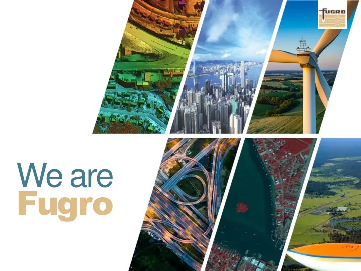
We are Fugro 60 years Mapping the World We are an all-terrain mapping provider. 2 www.fugro.com Global network of offices and 10,500 employees facilities 175 offices 60+ countries to offer unified support for 5 regions projects on
www.fugro.com 2
years
We are an all-terrain mapping provider.
www.fugro.com 3
10,500 employees 175 offices 60+ countries 5 regions 15 R&D centres
to offer unified support for projects on any scale.
www.fugro.com 4 Houston, TX Fugro USA, Inc. (US Corporate HQ) Gorrondona & Associates, Inc. Seattle, WA Fugro Pelagos, Inc. San Louis Obispo, CA Fugro Consultants, Inc. San Diego, CA Fugro Pelagos, Inc. Westlake, LA Fugro Consultants, Inc. Fort Worth, TX Fugro Consultants, Inc. Gorrondona & Associates, Inc. Dallas, TX Fugro Consultants, Inc. Dallas Aerial Surveys, Inc. Gorrondona & Associates, Inc. San Antonio, TX Fugro Consultants, Inc. Fugro JCLS, Inc. Gorrondona & Associates, Inc. Beaumont, TX Fugro Consultants, Inc. Austin, TX Fugro Consultants, Inc. Fugro Roadware, Inc. Gorrondona & Associates, Inc. Oakland & Walnut Creek, CA Fugro Consultants, Inc. Waco, TX Fugro Consultants, Inc. Pasadena, TX Fugro Consultants, Inc. Richmond, VA Fugro Roadware, Inc. Columbia, MD Fugro Consultants, Inc. Frederick & Hagarstown, MD Fugro Geospatial, Inc. Richard Crouse & Associates, Inc. Los Angeles La Mirada Ventura Tustin, CA Fugro Consultants, Inc. Sacramento, CA Fugro Consultants, Inc. Denver, CO Northwest Geomatics, Inc. Louisville, CO Fugro Consultants, Inc. Valencia, CA Fugro Consultants, Inc. Rapid City, SD Fugro Geospatial, Inc. Jacksonville, FL Fugro Consultants, Inc. Augusta, GA Fugro Consultants, Inc. Norfolk, VA Fugro Consultants, Inc. Bethel Park, PA TerraSurv, Inc. Chantilly, VA Airbus Defense & Space Geo-Intellegence, Inc. The Woodlands, TX GeoSolutions, Inc. Lubbock, TX Gorrondona & Associates, Inc. High-Tech Land & GPS Surveyors, Inc. Kenner, LA Fugro Consultants, Inc. Baton Rouge, LA Fugro Consultants, Inc. Lafayette, LA Fugro JCLS, Inc. Fugro GeoServices, Inc. Natchitoches, LA Fugro JCLS, Inc. Bay St. Louis MO , Fugro Pelagos, Inc. Spartanburg, SC Richard Crouse & Associates, Inc. Kansas City, KS Richard Crouse & Associates, Inc. Old Town, ME Richard Crouse & Associates, Inc. Ro , TX tan Patriot Surveying, Inc. El Paso, TX Land-Mark- Professional Surveying, Inc. Calgary, AB Northwest Geomatics, Inc. Gainsville, FL Fugro Consultants, Inc.
TXDIR Team Locations
www.fugro.com 5
Oblique Imagery 3D Modeling Orthoimagery Lidar Topographic & Planimetric Mapping Analytics & Change Detection
www.fugro.com 6
We’ve made more than 24 trips around the earth in the last five years!
LIDAR ORTHOS OBLIQUES
211,102
miles
164,477
miles
237,250
miles
www.fugro.com 7
Over 31 projects in 7 years
www.fugro.com 9
With a suite of sensors covering all terrain types and multiple solutions for advanced analysis, we ensure you receive all usable information from your elevation data.
www.fugro.com 10
Fugro provides lidar services for all topographic applications. Capabilities include: Topo/Bathy, Wide Area, Corridor, Urban Areas and Environmental. Additionally, Fugro provides mobile and terrestrial lidar for transportation and infrastructure projects.
Wide Area/High Altitude Topo Lidar Topo Bathy Lidar Wide Area Ultra High Density Topo Lidar Corridor Mapping High Density Topo Lidar Lidar for Urban Applications Lidar for Environmental Applications
www.fugro.com 11
2ppsm – 100ppsm Full Waveform 5-20cm Vertical Accuracy RMSE
QL RMSEz (non-vegetated) (cm) NVA at 95-percent confidence level (cm) QL0 < 5 < 9.8 QL1 < 10 < 19.6 QL2 < 10 < 19.6 QL3 < 20 < 39.2
www.fugro.com 12
DEM Point cloud Classification Intensity images Contours Hydro-flattening Hydro-enforced Land use/ land cover
www.fugro.com 13
Point Classification Cleaning Vegetation Height and Density Raster Slope Raster Building Polygons HAG and LAG Change Detection
www.fugro.com 14
3D Modeling Veg Management Veg Proximity Risk Clearance Trends Solar Potential Condition Assessment Damage Assessment Flood Modeling
www.fugro.com 16
Traditional photogrammetry has expanded from compiling planimetrics, mass points and breakline data to autocorrelated digital elevation models and complex fully textured 3D models.
www.fugro.com 17
Planimetrics Mass Points Spot Elevations Breaklines Contours
www.fugro.com 18
Created to generate
accuracy standards at pixel resolutions ranging from 3in to 12in (most common aerial imagery resolutions)
(PanoramiX)
www.fugro.com 20
Measure
Report, Snapshot, KML and PDF Overlay Existing GIS Mobile Compatibility
www.fugro.com 21
www.fugro.com 22
Draw and measure vertical and horizontal lines, area polygons and points. All exported as a shapefile or KML.
www.fugro.com 23
www.fugro.com 24
www.fugro.com 25
Created from 3in Oblique Imagery Using GPS, IMU and AT solution Maintain positional accuracies Recognizable to non GIS users Expands GIS environment
www.fugro.com 26
Build 3D Edit 3D Navigate 3D Query 3D Analyze 3D Communicate and Distribute
www.fugro.com 27
Skyline TerraExplorer Link Oblique Imagery to 3D Models View simultaneously Measure Simultaneously Analyze Structures Additional Integrations: PX + Esri PX + CAMA (ex. S&S)
Software and Solutions CAMA Talks Underway
TEP + GeoServices REST TEP + PDF TEP + GeoPackage TEP + GeoJSON TEP + WFS, Excel, S-57
www.fugro.com 28
Analysis
Display
Spatial Queries
components
3D Viewshed Analysis Video Display from Security Camera
www.fugro.com 29
Sharing and Presenting
Optimization
formats to a stream-optimized Skyline proprietary format
remote terrain database for easy distribution Product Highlights
databases
True Ortho Created from 3D Model Best Path Route Calculated from 3D Model
www.fugro.com 30
Product Highlights (cont.)
external users
Ribbon (i.e. PXMapper)
map as ActiveX controls
3D Model Cross Section 3D Presentation Mode with Selected Routes and Locations
www.fugro.com 31
Data Source
3D Model Dynamic Object of Oil Rig and Helicopter Route Video on Terrain from Web/Security CAM
www.fugro.com 32
Software Access and Navigation
Measurement and Analysis Terrain Analysis Slope Map Tools Flood Tool Volume Analysis Tool Terrain Profile Tool Best Path Tool
Fire simulation in TerraExplorer 3D Model Shadow and Solar Potential Analysis
www.fugro.com 33
Line of Sight Tools
Shadow Tools
Comparison Tools
True Ortho with Moving Vehicles Removed
www.fugro.com 34
Keith Owens k.owens@fugro.com (775) 287-2661 m (301) 948-8550 o x119 Visit: www.fugrogeospatial.com
Proud to provide geo-intelligence and asset integrity solutions to contribute to a liveable world.