Wast stewater r Treatm tment P t Project Colquitz Coalition - - PowerPoint PPT Presentation

wast stewater r treatm tment p t project
SMART_READER_LITE
LIVE PREVIEW

Wast stewater r Treatm tment P t Project Colquitz Coalition - - PowerPoint PPT Presentation

Wast stewater r Treatm tment P t Project Colquitz Coalition Annual General Meeting February 13, 2019 1 Pr Project ct Comp ompone onent nts Mc McLoughl ghlin Po Point W Wastew ewater Trea reatment P Plant: provides


slide-1
SLIDE 1

Wast stewater r Treatm tment P t Project

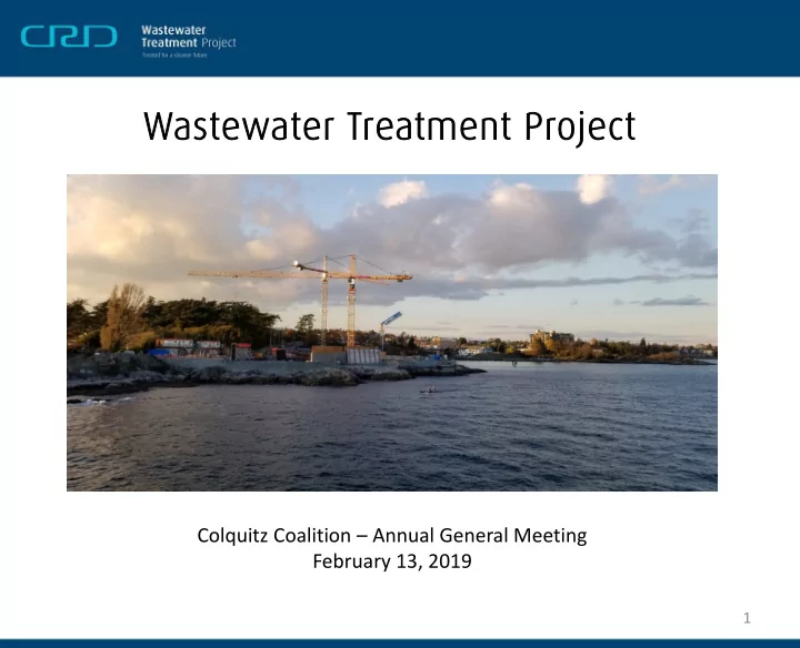
Colquitz Coalition – Annual General Meeting February 13, 2019

1

slide-2
SLIDE 2

Pr Project ct Comp

  • mpone
  • nent

nts

  • Mc

McLoughl ghlin Po Point W Wastew ewater Trea reatment P Plant: provides tertiary treatment to the core area’s wastewater.

  • Residuals T

Treatm tment t Faci cility ty: treats residual solids from the McLoughlin Point Wastewater Treatment Plant to produce “Class A” biosolids.

  • Conveyance S

e Sys ystem em: carries wastewater from across the core area to the McLoughlin Point Wastewater Treatment Plant, and residual solids to the Residuals Treatment Facility at Hartland Landfill.

2

slide-3
SLIDE 3

Pr Project ct Ov Overvi rview M Map

3

slide-4
SLIDE 4

Resi sidual ual Sol

  • lids C

s Con

  • nveyan

ance Line

4

slide-5
SLIDE 5
  • 19.3 km forcemain
  • 12.4 km return
  • Pipes will be built within previously-disturbed

existing road or path rights-of-way:

  • At Colquitz River crossing: deviation of 4m from

roadway for 40m.

  • At Ward Creek crossing: deviation of 30m from

roadway for 100m.

  • Estimated footprint of project is 3.8 ha,

approximately 95% of which will be within previously-disturbed areas

Pi Pipe pe C Context xt

5

slide-6
SLIDE 6

Regu gula latory

  • Core Area Liquid Waste Management Plan
  • Amendment 11
  • Municipal Wastewater Regulation
  • Section 40 Notice from a Director
  • Water Sustainability Act
  • Section 11 Notifications
  • Fisheries Act
  • Request for Review
  • Navigation Protection Act
  • Navigation Protection Program
  • District of Saanich

6

slide-7
SLIDE 7
  • Pipes will pass through the Tod Creek and Colquitz River

watersheds, and the Portage Inlet drainage

  • 23 Watercourse Crossings
  • 12 fish-bearing and 11 non-fish bearing
  • 6 wetlands in proximity to the alignment
  • Majority of watercourse crossings will not involve instream

work.

  • Only instream works will be crossings of Ward Creek,

Goward Springs A, Peers Creek, and Colquitz River.

Watercour

  • urse C

Cros

  • ssing

ngs

7

slide-8
SLIDE 8

Potenti tial l Con

  • nstr

tructi tion

  • n E

Eff ffects ts

  • Harm to fish and fish

habitat.

  • Harm to terrestrial

mammals, amphibians, and reptiles.

  • Harm to migratory birds or

their nests due to vegetation clearing and/or hazard tree removal.

Mi Miti tigati tion

  • n Me

Measures

  • Comply with Water Sustainability Act

permit conditions.

  • Submit Request for Review to Fisheries

and Oceans Canada.

  • Implement an Envi

vironm

  • nment

ntal al Manag anagement nt P Plan lan during construction:

  • Fish and amphibian salvage;
  • Pre-clearing nest surveys; and
  • Environmental monitoring.
  • Time construction to minimize effects:
  • Clearing outside of the breeding

bird window; and

  • In-stream works completed

within the reduced risk window.

Fish and W d Wild ldli life

8

slide-9
SLIDE 9

Potenti tial C l Con

  • nstr

tructi tion

  • n

Eff ffects ts

  • Erosion of exposed soil and

deposition of sediment into the watercourses, leading to effects on aquatic species and habitats.

  • Release of particulate waste to

aquatic habitat.

  • Spills of hazardous materials

into aquatic habitat.

  • Blasting related changes to

groundwater hydrology leading to effects on nearby wells.

Mi Miti tigati tion

  • n Me

Measures

  • Maintain compliance with all federal and

provincial requirements for water quality

  • Eros
  • sion
  • n and

and Sediment nt Cont

  • ntrol P
  • l Plan

lan to prevent erosion and protect watercourses from sediment.

  • Pr

Protect ection o

  • f Water

ercourses during construction.

  • Was

astewater Manag anagement nt P Plan lan to properly dispose of water used during construction and commissioning.

  • Spill

l Respons

  • nse P

Plan lan to reduce risk and impact of spills during construction.

  • Blas

lasting ng M Manag anagement nt Plan lan to protect fish bearing watercourses, structures, groundwater wells and human health.

Water Qu r Quali lity ty

9

slide-10
SLIDE 10

Ward Creek crossing location Existing Peers Creek culverts

Pr Propo posed C d Crossing g Loca cati tions

10

slide-11
SLIDE 11

View of Colquitz crossing location Downstream of Ward Creek crossing location

Prop

  • pos
  • sed C

Cros

  • ssing

ng Loc

  • cations
  • ns

11

slide-12
SLIDE 12
  • Majority of watercourse crossings will not involve instream

work.

  • For bridge crossings at Admirals Bridge and Tillicum Bridge, pipe

will be suspended from existing bridge

  • For culvert crossings the pipe will be installed over the culvert

where possible

  • Where the pipe must be installed underneath, a ‘punch and

bore’ method will be used

  • Trenches excavated on both sides of the existing

culvert

  • Borehole drilled underneath culvert to connect

trenches

  • Pipe will be installed through borehole
  • Only instream works will be at Ward Creek, Goward Springs A,

Peers Creek, and Colquitz River.

Watercour

  • urse C

Cros

  • ssing

ng Method hods

12

slide-13
SLIDE 13

Plan v n view o

  • f

f a typi pical pu punc nch h & bo bore i ins nstallation Profi file v view o

  • f

f a typi pical pu punc nch h & bo bore i ins nstallation

Watercour

  • urse C

Cros

  • ssing

ng Method hods

13

slide-14
SLIDE 14
  • Only instream works will be crossings of Ward Creek, Goward

Springs A, Peers Creek, and Colquitz River.

  • Goward Springs A and Peers Creek works will involve culvert

replacements

  • Ward Creek and Colquitz River works will be “open cut”

installations

  • All instream works will be completed during the Reduced Risk

Timing Window (June 15 – September 15)

  • For work on the Colquitz, a restoration plan will be implemented

upon completion of works to minimize erosion and restore disturbed vegetation

Ins nstream W am Wor

  • rks

14

slide-15
SLIDE 15

Ins nstream W am Wor

  • rks Loc
  • cations
  • ns

15

slide-16
SLIDE 16

Typi pical fi fish h isolation s n setup p using ng 5 mm m mesh ne h nets Typi pical flow i isolation n setup p using m ng meter ba bags gs

Ins nstream W am Wor

  • rks Loc
  • cations
  • ns
slide-17
SLIDE 17

Exampl ple o

  • f s

f site isolation n using ng meter ba bags gs a and nd machi hine nery ope perating o ng outside de o

  • f

f active cha hanne nnel.

Ins nstream W am Wor

  • rks Loc
  • cations
  • ns
slide-18
SLIDE 18
  • A detailed restoration plan has

been prepared for the Colquitz crossing at Marigold Road

  • Elements include:
  • 1. Channel Bed Restoration
  • 2. Bank Stabilization
  • 3. Riparian Vegetation

Restoration

Sit ite R Res estoratio ion

18

slide-19
SLIDE 19

Questions?

19