
SLIDE 1
THE Louis Berger Group, INC
WAQUOIT BAY STREAM RESTORATION MASTER PLAN Falmouth and Mashpee, - - PowerPoint PPT Presentation
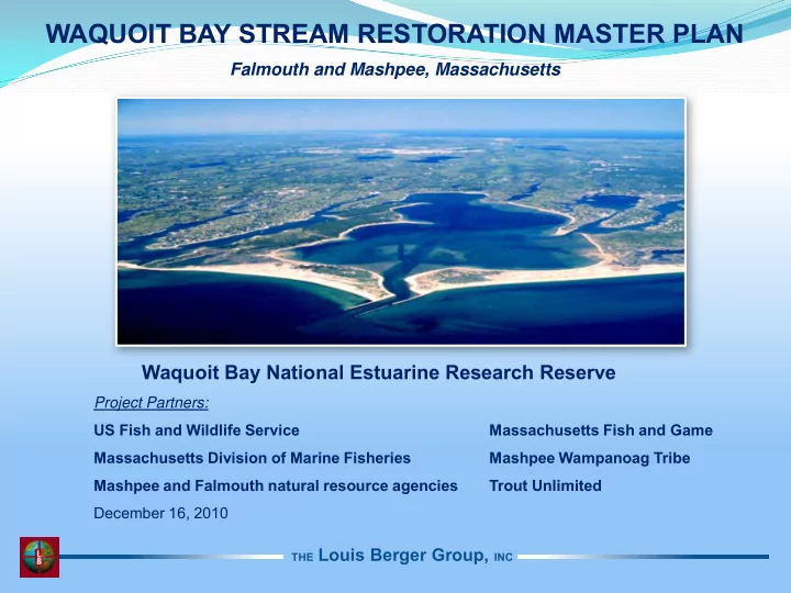
WAQUOIT BAY STREAM RESTORATION MASTER PLAN Falmouth and Mashpee, Massachusetts Waquoit Bay National Estuarine Research Reserve Project Partners: US Fish and Wildlife Service Massachusetts Fish and Game Massachusetts Division of Marine
THE Louis Berger Group, INC
THE Louis Berger Group, INC
Hingham Bay
THE Louis Berger Group, INC
THE Louis Berger Group, INC
(from: Schwarzman 2002 and Finch-Cape Cod)
THE Louis Berger Group, INC
THE Louis Berger Group, INC
Quashnet Bogs
THE Louis Berger Group, INC
THE Louis Berger Group, INC
Hingham Bay
THE Louis Berger Group, INC
THE Louis Berger Group, INC
THE Louis Berger Group, INC
THE Louis Berger Group, INC
THE Louis Berger Group, INC
THE Louis Berger Group, INC
POOL SECTION B-B’
THE Louis Berger Group, INC
Lower Quashnet River bogs abandoned and purchased by Division of Fisheries and Game – 1956 (picture of David Leonowicz near Martin Rd., 1953)
THE Louis Berger Group, INC
THE Louis Berger Group, INC
THE Louis Berger Group, INC
THE Louis Berger Group, INC
THE Louis Berger Group, INC
Quashnet Bogs
THE Louis Berger Group, INC
Atlantic White Cedar Swamp Red Maple Swamp
THE Louis Berger Group, INC
THE Louis Berger Group, INC
THE Louis Berger Group, INC
THE Louis Berger Group, INC
Photos Courtesy of Alex Hackman, MA DER
THE Louis Berger Group, INC
Photos Courtesy of Alex Hackman, MA DER
THE Louis Berger Group, INC
THE Louis Berger Group, INC
THE Louis Berger Group, INC