
SLIDE 1
W e l c o m e
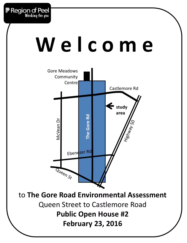
to The Gore Road Environmental Assessment Queen Street to Castlemore Road Public Open House #2 February 23, 2016
The Gore Rd McVean Dr Castlemore Rd study area Gore Meadows Community Centre
W e l c o m e Gore Meadows Community Centre Castlemore Rd study - - PDF document
W e l c o m e Gore Meadows Community Centre Castlemore Rd study area The Gore Rd McVean Dr to The Gore Road Environmental Assessment Queen Street to Castlemore Road Public Open House #2 February 23, 2016 Purpose and Content of Public Open House #
to The Gore Road Environmental Assessment Queen Street to Castlemore Road Public Open House #2 February 23, 2016
The Gore Rd McVean Dr Castlemore Rd study area Gore Meadows Community Centre
Purpose and Content of Public Open House # 2
The Open House will present information on:
property requirements
Streets” approach and new stormwater management practices
impacts of the preliminary recommended design, and
The purpose is to update you on the study progress and provide an opportunity for you to comment on the recommended preferred solution and design concept.
widening 2 to 4 lanes
the road centerline south
Drive to avoid cemetery and watercourses
and approvals
way
construction
need for improvements
evaluation of alternative solutions
Phases 1 and 2
Environmental Assessment Process
1 and 2 of the LRTP and Problem and Opportunity
existing and future conditions
concepts
House (POH) # 1
received during and following POH# 1
alternative design concepts
recommended design concept
measures
and consider input received during and following POH#2
Environmental Study Report
review and comment We Are Here
complete and the project moves to the detailed design stage before construction
Phase 1
Phase 2
Phase 3
Phase 4
Phase 5
Phases of the Municipal Class Environmental Assessment process
Study Schedule & Planning Process
2000‐2002 The Gore Rd EA Completed 2005‐2013 Design and Construction (2 Phases) 2011‐2012 Long Range Transportation Plan Update Winter/Spring 2014 Phase 3A Fall 2015 to Winter 2015 Phase 3B Winter/Spring 2016 Phase 4 Fall 2016+ Detailed Design Phase 5
widening
2016 and will span two seasons with an approximate completion date of summer 2018
What’s happening with other projects in the area?
project is underway and will widen The Gore Road from 2 to 4 lanes within the study limits.
completion is summer 2016.
Widening Project South of The Gore Road Study Area Widening Project North of The Gore Road Study Area
Access to adjacent community facilities should be considered, i.e. temples and shopping Minimize impacts from any widening The study area includes many seniors who have specific needs There is support for bicycle facilities Do not widen to 6 lanes or allow trucks on The Gore Rd
Public Feedback
What we heard from you…….
Improve traffic flow at the Queen St intersection
A Complete Street Approach
Source: Complete Streets by Design, Toronto Centre for Active Transportation
A Complete Street is designed for all ages, abilities, and modes of travel. On Complete Streets, safe and comfortable access for pedestrians, bicycles, transit users and people with disabilities is not an afterthought, but an integral planning feature. Source – Complete Streets Canada
The Improvements to The Gore Road finished in 2013 included:
Staff will consider the following design elements for re‐constructing The Gore Road as a complete street:
turning lanes
crossings
Moving People Options
at the Two Bridge Crossings
Recommended based
vegetation around watercourse
educational activities in relation to the watercourse
existing right/left turn lanes
LID stormwater management practices
Proposed alignment for the multi‐use trail
sidewalk
The complete corridor design is shown on the roll plan.
Multi‐use trail or cycle track + sidewalk on the west side of bridges
Confirmation of Phase 2 Preferred Solution
lanes throughout The Gore Road corridor Modify intersections for transit, active transportation and turning
Source: www.rutlandreder.com Source: City of Ottawa
healthy lifestyle through connected multi‐use trails (complete streets approach)
Queen Street intersection through signal timing improvements
infrastructure (biking and walking)
bike / pedestrian crossing (location(s) to be confirmed Examples of multi‐use trail and cycle track from other jurisdictions.
traffic moving at the posted speed
Active Transportation
Recommendations for the study area include:
east and west sides of The Gore Road or a raised uni‐ directional cycle track on each side (or a combination
to be confirmed in detailed design)
assist cycling movements at the intersections
at the school locations
Cycle‐Track Multi‐use Trail
To learn more about the Active Transportation Plan or to access information on biking and trails visit us online at: www.walkandrollpeel.ca
Illustrated Two Way Multi‐use Trail
Source: City of Ottawa
Managing Stormwater
Low Impact Development (LID) practices use simple, cost effective landscape features and other techniques to filter, store, infiltrate and use rain where it falls. LID facilities as shown below may include (examples only): Bioretention
runoff volume, lessens peak flow rates and removes stormwater pollutants Permeable Pavement
volume and removes stormwater pollutants
colors and patterns Low Impact Development practices are recommended to manage stormwater at various locations throughout the corridor. Facilities may be located adjacent to or under walkways, multi‐use trails and or lay‐by parking. Enhanced Grass Swales
volume and removes stormwater pollutants Further information can be found at www.peelregion.ca/planning/officialplan/focus‐climate.htm
Streetscape Design Considerations
▬ Benches ▬ Tree plantings ▬ Decorative flower pots ▬ Public art ▬ Transit shelters ▬ Wayfinding signage ▬ Pedestrian scale lighting ▬ Decorative treatments ▬ Crosswalk treatments ▬ Median plantings ▬ Garbage receptacles Staff may consider the following options for streetscaping improvements in detailed design:
Streetscaping Toolbox Report
Commitment Highlights
minimize disruption during construction
business, institutions and commercial areas are maintained during and after construction
infrastructure to support healthy lifestyle activities (walking, biking, etc.)
The vision for the corridor is a “community for life”. Working with you, to create a healthy, safe and connected community.
Natural Environment
The Construction Project team will ensure:
environment are followed
prepared
bird window
Social Environment
assessment in detailed design
Cultural Heritage and Archaeology Picture of Barnswallows Picture of man riding a bicycle on The Gore Rd Picture of Cemetery
17
What happens next?
along with the recommended design concept into an Environmental Study Report (ESR)
the corridor and members of the public who registered at the Public Open Houses
Please tell us what you think:
You can review the boards on our website and provide comment at: www.peelregion.ca/pw/transportation/environ‐assess/ea‐the‐gore‐road.htm
email/fax/letter to either project manager: Neal Smith, C.E.T. Region of Peel Transportation Division 10 Peel Centre Drive, Suite B, 4th Floor Brampton, ON L6T 4B9 Tel: 905‐791‐7800 ext. 7866 Toll Free: 1‐888‐919‐7800 Fax: 905‐791‐1442 Email: neal.smith@peelregion.ca Stephen Schijns, P.Eng Project Manager AECOM 5080 Commerce Boulevard Mississauga, Ontario L4W 4P2 Tel: 905‐238‐0007 Direct: 905‐206‐8136 Email: stephen.schijns@aecom.com
Youth Engagement
In the fall of 2014 the EA project team had the opportunity to engage the Grade 11 students of
Castlebrooke Secondary School Environmental Studies Class (assisted by their
teacher Beth Lisser, Science/Special Education) in the environmental study work that was being conducted within the study area and adjacent to the school. The students worked in the field with the project specialists for:
Some of their activities included taking measurements and recording details on:
and
Please come and visit the project website and see the PowerPoint presentation developed by the students on their environmental learning and the issues they identified within the corridor.
Picture of Students with Project Team
Youth Engagement
Mapping of Student Activities School Bridge Bridge
Location & Type
Terrestrial Ecology Fluvial Geo‐ morphology Aquatic Habitat Storm Water Management