SLIDE 1
USE DEPENDENT SOIL PROPERTIES: RESULTS FROM SOME STUDIES IN NJ & NYC
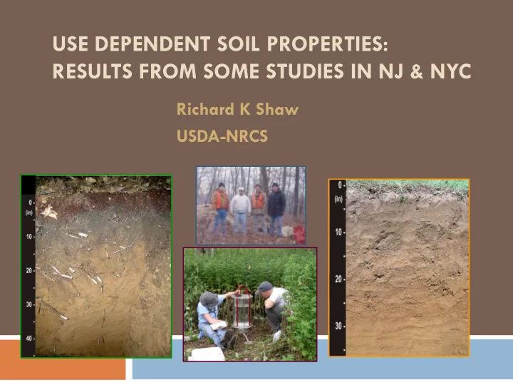
Richard K Shaw USDA-NRCS
SLIDE 2
SLIDE 3 Outline
Definitions NJ matched pair study NYC infiltration & land use study Other related NRCS Projects What’s Next?
SLIDE 4 Soil properties that show change and respond to use and management of the soil, such as soil organic matter levels and aggregate stability.
http://soils.usda.gov/sqi/concepts/glossary.html
Use-dependent
- r management-dependent properties
SLIDE 5
Soil properties that change over the human time scale in response to anthropogenic (management, land use) and non-anthropogenic (natural disturbances and cycles) factors. Many are important for characterizing soil functions and ecological processes and for predicting soil behavior on human time scales.
http://soils.usda.gov/sqi/concepts/glossary.html
Dynamic soil properties
SLIDE 6
Soil properties that show little change over time and are not affected by use and management of the soil, such as mineralogy * and particle size distribution.
http://soils.usda.gov/sqi/concepts/glossary.html
Use-independent properties
SLIDE 7 Use dependent properties
*Effects of Cultivation on Hydroxy-Interlayering
- f 2:1 Clay Minerals in Some New Jersey Soils
In some soils, vermiculite or smectite hydroxy-Al interlayered vermiculite or smectite
R.K. Shaw, 1994 Dissertation, Dept of Soils and Crops, Rutgers University
L.A. Douglas, Advisor H.L. Motto P.H. Hsu J.C.F. Tedrow J.R. Heckman
SLIDE 8 soil quality or soil health - the capacity of the soil to
function. Two aspects of soil quality include:
dynamic soil quality - That aspect of soil quality
relating to soil properties that change as a result of soil use and management or over the human time scale.
inherent soil quality - That aspect of soil quality
relating to a soil’s natural composition and properties as influenced by the factors and processes of soil formation, in the absence of human impacts.
Soil Quality
SLIDE 9 NJ Matched Pair Study
1991 NRCS-NJ: Ron Taylor, Daryl Lund, Maxine Levin, Dave
Kingsbury, Thornton Hole, Lenore Matula
Examine changes in soil properties upon cultivation. Full characterization at NSS Lab. Matched pairs Same series (prime farmland soils) under 2 land uses:
a)
Woodland - not cropped >50 yrs
b)
Cultivation - continually cropped > 30 yrs
SLIDE 10 NJ Matched Pair Study
Bob Grossman, Research Soil Scientist NSSC, Lincoln, NE
Fragipan properties Desert soil project Soil Survey Manual Assessment methods soil physical properties
SLIDE 11 NJ Matched Pairs: 1991-present
32 pairs: same soil series in woodland & cultivation
144A & 140 148 149A & 153D
Hazen* Washington (2 pairs)* Freehold* Delaware Gladstone* Collington* Lordstown* Berks* Holmdel* Bath (Wurtsboro)* Penn* Sassafras* Galway* Ryder (Berks)* Keyport* Wassaic Quakertown* Chillum* Chatfield Mattapex Wurtsboro Westphalia* Albia (Venango) Aura* Lakewood Lakehurst
*included in statistical analyses
Evesboro Klej
SLIDE 12 Comparing the Matched Pairs
Downer matched pair, Buena, Atlantic County
SLIDE 13 Comparing the Matched Pairs
- 1. Compare Soil Organic Carbon Density or
Areal organic carbon to 1 meter depth
Sum (all horizons to 1 m):
% SOC x thickness x Db = kg C / m2
SLIDE 14 Comparing the Matched Pairs
- 2. Compare properties of selected horizons (3)
Wooded Cultivated O 0 to 5 cm
A
5 to 13 cm Ap 0 to 27 cm AB, BA, 13 to 23 cm E or BE
Bt
23 to 45 cm Bt or Bw 27 to 45 cm
100 cm depth
100 cm depth
SLIDE 15 Comparing the Matched Pairs
Soil Organic Carbon Density to 1 meter depth
average values kg C / m2
n Wooded Cultivated t-value 18 14.53 6.98 9.82*** Average loss upon cultivation = 52%
*** significant at .001 level
SLIDE 16 Areal Org. Carbon: Linear Regression
regression equation 18 pairs r value
Simple linear regression cult AOC = 0.348 wood AOC + 1.924 .6176 Stepwise multiple regression cult AOC = 0.319 wood AOC + 0.023 %silt + 1.410 .6391 Simple linear regression AOC loss = 0.652 wood AOC - 1.924 .8272 Stepwise multiple regression AOC loss = .6807 wood AOC - 0.023%silt - 1.410 .8355
SLIDE 17 Wooded vs Cultivated; A horizons
Variable n Means t-value wood cult % sand 19 45.91 47.33
% silt 19 41.63 39.62 1.33 % clay 19 11.69 12.10
% OC 19 4.72 1.18 4.31 *** Db 17 0.90 1.52
*** significant at the .001 level
SLIDE 18 Wooded vs Cultivated; A horizons
Variable n Means t-value wood cult 1/3 Bar H2O 9 29.36 19.67 3.44 ** 15 Bar H2O 19 11.17 6.02 3.37 ** % AWC 9 19.99 12.31 3.02 * % TPS 9 56.40 45.49 4.74 ** % AFP 9 25.40 17.84 2.91 *
** significant at the .01 level *significant at the .05 level
SLIDE 19 Wooded vs Cultivated; A horizons
Variable n Means t-value wood cult CEC 19 17.44 7.61 4.54 *** pH (H2O) 19 4.49 5.92
% Base Sat. 19 36.37 80.22
Kf 17 0.26 0.35
*** significant at the .001 level
SLIDE 20 Correlation Coefficients; A Horizons
1/3 Bar 15 Bar %C Db H2O H2O PAWC TPS AFP Db
- .747** -----
- .691** -.651** -.647** -.994** -.737**
%C
- .747** .528** .880** .440* .706** .518**
* significant at the .05 level ** significant at the .01 level
SLIDE 21 Cult vs wooded; B horizons
Variable n Means t-value
wood cult % sand 19 45.25 46.05
% silt 19 38.83 36.39 1.29 % clay 19 16.25 17.61
% OC 19 0.47 0.29 3.89 ** Db 17 1.44 1.76
** significant at the .01 level
SLIDE 22 Cult vs wooded; B horizons
Variable n Means t-value wood cult
1/3 Bar H2O 17 19.00 17.98 0.85
15 Bar H2O
19 7.36 7.53
% PAWC 17 11.44 10.28 0.97 % TPS 17 45.69 41.23 3.68 ** % AFP 17 18.91 13.99 3.56 **
**significant at the .01 level
SLIDE 23 Cult vs wooded; B horizons
Variable n Means t-value wood cult CEC 19 7.21 6.46 0.99 pH (H2O) 19 4.85 5.97
% Base Sat. 19 26.58 72.21
*** significant at the .001 level
SLIDE 24 Cult vs wooded; 100 cm depth
Variable n Means t-value
wood cult % sand 15 53.36 60.44
% silt 15 28.77 21.65 1.67 % clay 15 20.03 17.91 1.01 % OC 14 0.13 0.08 3.29 ** Db 11 1.59
** significant at the .01 level
SLIDE 25 Cult vs wooded; 100 cm depth
Variable n Means t-value wood cult
1/3 Bar H2O 11
17.90 16.80
0.64
15 Bar H2O
15 9.05
8.07
1.08
% PAWC 11 7.17 7.64
% TPS 11 40.25 39.24 0.44 % AFP 11 13.43 12.74 0.35
SLIDE 26 Cult vs wooded; 100 cm depth
Variable n Means t-value wood cult CEC 15 7.59
5.99
1.53 pH (H2O) 15 4.84 5.41
% Base Sat. 14 23.29 51.43
** significant at the .01 level *** significant at the .001 level
SLIDE 27 Effects on Soil Classification
n = 19 pairs 2 from ultisol to alfisol
2 from dystrudept to eutrudept great group 2 from ultic hapludalf to typic subgroup All from changes in base saturation
SLIDE 28 Implications
Most soil survey map units cover different land use types,
but list only one set of soil properties per component Gladstone series- residuum & colluvium from granitic gneiss 21% agriculture 47% woodland 31% urban Freehold series- low greensand inner coastal plain 23% agriculture 13% woodland 58% urban
SLIDE 29 NYC Infiltration & Land Use Study
Hydrologic Soil Group = most requested soil
interpretation in NYC
Based on soil properties:
- Ksat
- Depth to restrictive layer (20 to 40”)
- r water table (24 to 40”)
Traditionally assigned to a soil series
SLIDE 30 Bronx River Watershed Soil Survey
1:6000 scale, high intensity survey, ~7000 acres Minimum size delineation = 0.5 acre Land use diversity
- Undisturbed woodlands
- Low Use parkland (mugwort, very stony)
- High use parkland (lawn, non-stony)
- Woodlawn Cemetery
- Residential areas
SLIDE 31 BRW Infiltration & Land Use Study
Cornell Sprinkle Infiltrometer Soundview Park - Low use area
Soils:
Fill (HTM) Natural Materials
Coarse-silty Coarse-loamy Loamy-skeletal Sandy Land uses:
Low-use High-use
SLIDE 32 USDA-NRCS Infiltration and Land Use Study Bronx River Watershed, New York City
Soil Series Particle-Size Class Landuse in/hr
Chatfield coarse-loamy woodland 6.14 Charlton coarse-loamy woodland 6.61 Olinville* coarse-loamy woodland 7.32 Chatfield coarse-loamy woodland 7.56 Suncook sandy woodland 7.80 Deerfield sandy woodland 10.39
* formed in HTM (fill)
SLIDE 33 USDA-NRCS Infiltration and Land Use Study Bronx River Watershed, New York City
Soil Series Particle-Size Class Landuse in/hr
Tonawanda coarse-silty city park (high use) 0.12 Laguardia* loamy-skeletal city park (high use) 0.24 Centralpark* loamy-skeletal city park (high use) 0.24 Centralpark* loamy-skeletal city park (high use) 0.47 Greenbelt* coarse-loamy city park (high use) 0.71
*formed in HTM (fill)
SLIDE 34 USDA-NRCS Infiltration and Land Use Study Bronx River Watershed, New York City
Soil Series Particle-Size Class Landuse in/hr
Greenbelt* coarse-loamy low use parkland 3.78 Hollis coarse-loamy low use parkland 4.49 Laguardia* loamy-skeletal low use parkland 4.70 Suncook* sandy low use parkland 7.80 Laguardia* loamy-skeletal low use parkland 9.45
*formed in HTM (fill)
SLIDE 35 USDA-NRCS Infiltration and Land Use Study Bronx River Watershed, New York City
Soil Series Particle-Size Class Landuse in/hr
Centralpark loamy-skeletal residential (back yard) 0.00 Greenbelt coarse-loamy residential (tree pit) 0.00 Bigapple sandy residential (vacant lot) 1.38 Greenbelt coarse-loamy residential (landscaped) 2.36 Greenbelt coarse-loamy residential (landscaped) 2.60 Greenbelt coarse-loamy residential (rain garden) 6.38
All soils formed in HTM (fill)
SLIDE 36 USDA-NRCS Infiltration and Land Use Study Bronx River Watershed, New York City
Soil Series Particle-Size Class Landuse in/hr
Greenbelt coarse-loamy residential (tree pit) 0.00 Greenbelt coarse-loamy city park - high use 0.71 Greenbelt coarse-loamy residential (landscaping) 2.36 Greenbelt coarse-loamy residential (landscaping) 2.60 Greenbelt coarse-loamy city park – low use 3.78 Greenbelt coarse-loamy residential (rain garden) 6.38
Greenbelt soils are formed in HTM (fill)
SLIDE 37 USDA-NRCS Infiltration and Land Use Study Bronx River Watershed, New York City
Soil Series Particle-Size Class Landuse in/hr
Laguardia loamy-skeletal industrial 0.00 Laguardia loamy-skeletal city park (high use) 0.24 Laguardia loamy-skeletal city park (high use) 0.71 Laguardia loamy-skeletal city park (low use) 4.70 Laguardia loamy-skeletal city park (low use) 9.45
Laguardia soils are formed in HTM (fill)
SLIDE 38 Laguardia series fill with construction debris loamy-skeletal industrial land use 0.00 in/hr infiltration Sims Hugo Neu Metal Recycling Hunts Point, Bronx
SLIDE 39
Bronx River Watershed Soil Survey 1:6000 scale, high intensity survey
Our model: Undisturbed woodlands Low Use Parkland Cemeteries High use parkland & Industrial More foot traffic Increase in Db Decrease in Ksat Decrease in infiltration rate
SLIDE 40 BRW use dependent map units, soil properties
Surface Db
Ksat HSG
g/cm3 in/hr
Woodlands 0.9 - 1.47 0.6 to 7.14 B
Charlton
Low use parkland 0.9 - 1.65 0.6 to 6 B
Laguardia
Cemetery 0.9 – 1.65 0.6 to 3.6 B
Greenbelt
High use parkland 1.2 - 1.8 0.14 to <1.42 C
Laguardia
SLIDE 41 Other related NRCS projects
Soil Change Working Group ( now Soil & Ecosystem Dynamics) NRCS & other members Mission areas
Soil Quality Dynamic Soil Properties Ecological Site Index
SLIDE 42
Soil Change Guide
This Guide is designed for soil survey, vegetation, and ecological site or unit inventory work in order to help soil scientists and other inventory specialists collect interpretable data about soil change within the human time scale. This Guide describes a sampling system to measure dynamic soil properties for all major land uses (except urban lands where the land and soil have been significantly reshaped).
SLIDE 43 Rapid Carbon Assessment
A comprehensive inventory of soil
carbon stocks for soils of the U.S. as affected by soil properties, agricultural management, ecosystems, and land uses.
Enhanced carbon data are
needed for evaluating the effects
- f conservation practices on soil
carbon and for global carbon accounting.
SLIDE 44
Soil Survey Division Program Plan 2011-2015
#4 of 17 items. Collect dynamic soil properties and other pertinent features focusing on benchmark soils, landscapes and ecological sites.
SLIDE 45 What’s missing?
Use dependent data base would:
Allow users to select more applicable data Increase accuracy of interpretations Enable an evaluation of soil quality Provide more accurate information about the state
from Aspects of a Use- Dependent Data Base By Robert B. Grossman and Jim R. Fortner, NSSC, Lincoln, NE. NCSS Newsletter, October1999
SLIDE 46 Summary
Differences in soil properties from land use can be
significant
In some cases may affect interpretations Use dependent map units may be an option, depending
- n mapping scale, and extent of land use changes
A database that can accommodate use dependent
properties would be more flexible