UAS for pipeline inspection and exploration Dr Joseph Barnard - - PowerPoint PPT Presentation
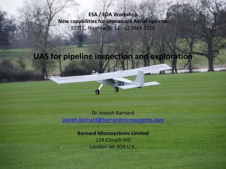
ESA / EDA Workshop New capabilities for Unmanned Aerial Systems ESTEC, Noordwijk, 11 12 MAY 2010 UAS for pipeline inspection and exploration Dr Joseph Barnard joseph.barnard@barnardmicrosystems.com Barnard Microsystems Limited 134 Crouch Hill
ESA / EDA Workshop: New capabilities for UAS 2
The Unmanned Aircraft System
The UA flying beyond line‐of‐sight has an always‐on satellite (Intelsat or Iridium) link to a ground station for telemetry and VHF radio relay. The ground staff must reply to any Air Traffic Control voice communications with the UA so the UA appears to an Air Traffic Controller to be a conventional manned aircraft.
ESA / EDA Workshop: New capabilities for UAS 3
Unmanned Aircraft
Dyke Weatherington, author of the DoD “Unmanned Systems Roadmap 2007 – 2032” summed up the role of military Unmanned Systems as being missions that were “dull, dirty or dangerous”. In oil, gas and mineral exploration and production activities, there are additional potential roles for UA: ‐ where they can generate better quality data than manned systems; ‐ where the operational cost (including insurance) is sufficiently low as to allow flights to gather data on a routine basis.
ESA / EDA Workshop: New capabilities for UAS 4
Unmanned Aircraft have already been used in Exploration & Production activities
Oil pipeline monitoring Aeronautics Defence Systems provide pipeline monitoring services in Angola to ChevronTexaco under a $ 4 million contract. More recently, Aeronautics Defence Systems have provided a similar service in Nigeria. Problems with use of satellite imagery are: ‐“It can take up to 14 days for the LEO satellite to be over the area of interest.” ‐“Bandwidth is limited and expensive.”
from UAV SystemsThe Global Perspective 2005 by Blyenburgh & Co
ESA / EDA Workshop: New capabilities for UAS 5
Aerial photography: the most popular civilian application of Unmanned Aircraft
Aerial photography using CropCam
Image of 160 acres of land in British Columbia, derived from stitching together 12 separate images using the CropCam: from www.cropcam.com
ESA / EDA Workshop: New capabilities for UAS 6
Magnetic field surveys: the next most popular application of Unmanned Aircraft
A survey in which the Earth’s magnetic field is measured using high resolution , lightweight, Caesium beam magnetometers, as shown below.
MagSurvey Prion by Magsurvey Limited, from http://www.magsurvey.co.uk/
ESA / EDA Workshop: New capabilities for UAS 7
Universal Wing surveys completed in 2007 from Princeton, British Columbia
26 MAR 2007 – 10 APR 2007 1,600 line km (Alberta, Canada) 16 APR 2007 – 30 AUG 2007 >20,000 line km (Nunavut, Canada) 20 OCT 2007 – 23 NOV 2007 >6,500 line km (Northwest Territories, Canada) Quality magnetic field data Unmanned Aircraft can fly at lower elevations and at slower speeds than manned fixed wing aircraft and can deliver helicopter‐like data quality at a fraction of the cost. We have integrated a lightweight high performance Cesium magnetometer (model G‐823A), combined with an ultra‐small size CM‐201 Larmor counter to provide high sensitivity (0.004nT/%Hz RMS) and low heading error @ ±0.15nT over 360º equatorial and polar spins. This facilitates high quality data acquisition. Superior resolution is provided by the Cesium Larmor signal with the Earth’s field tracking rates exceeding thousands of nT
- ver 0.1 second periods.
ESA / EDA Workshop: New capabilities for UAS 8
ESA / EDA Workshop: New capabilities for UAS 9
From Christer Broman at ConocoPhillips
ESA / EDA Workshop: New capabilities for UAS 10
From Christer Broman at ConocoPhillips
ESA / EDA Workshop: New capabilities for UAS 11
What are the compelling capabilities of Unmanned Aircraft? Zephyr
ESA / EDA Workshop: New capabilities for UAS 12
Unmanned Aircraft can fly all night, night after night, at low levels (such as 50 feet AGL)... From a presentation by James Macnae at SEG 2006
Unmanned Aircraft can fly when the electrical and magnetic noise levels are low
ESA / EDA Workshop: New capabilities for UAS 13
Unmanned Aircraft can fly where pilots prefer not to go
As exploration activities move to the more hostile regions of the Earth, such as the Arctic Ocean, and to more politically unstable areas, expect to see a growing use of Unmanned Aircraft operating in areas where it would be irresponsible to expect pilots to fly: low level, night flights over the Arctic Ocean; flights over regions in which there is low level strife, where the larger manned survey aircraft provide target practice and some excitement for the locals.
ESA / EDA Workshop: New capabilities for UAS 14
Unmanned Aircraft collect higher resolution data
Being smaller and always flying using precision navigation, the Unmanned Aircraft can fly closer to the ground (“tight drape”) and collect higher resolution data.
ESA / EDA Workshop: New capabilities for UAS 15
The advantages of using Unmanned Aircraft in E & P activities
Unmanned Aircraft create less of a disturbance to the parameters being measured such as the magnetic, or, gravitational field, since they are physically smaller than their manned
- counterparts. However, the instruments are closer to sources of electrical noise on the
aircraft. Unmanned Aircraft cost less to operate per line km, since:
- an Unmanned Aircraft operator can manage several UA at the same
time;
- the Unmanned Aircraft uses less than 20% of the fuel used by a manned aircraft
Small Unmanned Aircraft are more environmentally friendly since they:
- require less materials to build and is easier to dispose of at the end of its life;
- use less fuel and creates less pollution per km travelled;
- make less noise in flight;
Unmanned Aircraft can routinely fly missions covering the same area, day after day, night after night, to perform measurements for use in change detection and data averaging:
- detecting a leak in an oil pipeline using differential thermal and / or interferometric
SAR imaging.
ESA / EDA Workshop: New capabilities for UAS 16
However, Unmanned Aircraft (“UA”) have not yet seen widespread deployment...
Unmanned Aircraft are not permitted to fly in commercial (“un‐segregated”) air space. UA do not have a protected aeronautical frequency band. UA are not sufficiently reliable. Almost all present day Unmanned Aircraft are single engine experimental aircraft which do not have air worthiness certificates UA have not yet clocked up sufficient flight hours to provide data for a convincing safety case, without which the National Aviation Authorities, such as the FAA, the CAA, and the like will not issue of Certificate of Authorization (“COA”) to fly even in restricted air space. In the absence of sufficient flight hours, and a legally sound safety case, the insurance costs are astronomical, and blow any business case out of the water. Insurance costs are inversely related to flight hours: $10 million insurance cover cost = $k / n*100K_flight_hours. UA do not yet have a sense and avoid system to enable them to detect and avoid other airborne objects, such as the farmer flying a Cessna in the Canadian outback... Government security services need to be sure the Unmanned Aircraft cannot fall into the hands of, or be used by, or be taken over in flight by, criminals or terrorists.
ESA / EDA Workshop: New capabilities for UAS 17
It will take a few years before we see UA in widespread commercial applications...
UA systems developers are getting their flight hours and experience in the military sector.
ESA / EDA Workshop: New capabilities for UAS 18
ESA / EDA Workshop: New capabilities for UAS 19
sniper Militia with RPG children Militia with AK47 IED
ESA / EDA Workshop: New capabilities for UAS 20
But, it will happen.
Work on the development of sense and avoid systems is underway in the USA, Europe and in the Far East. The view is that once proven on Unmanned Aircraft, these systems will become mandatory on manned aircraft. The World Radio Conference will next meet in 2011, where it is hoped there will be progress on an assignment of a protected aeronautical frequency band for UA use. Many of the National Aviation Authorities have assigned staff to develop the regulations for Unmanned Aircraft flight in non‐segregated air space:
- US FAA and RTCA SC‐203
- EUROCONTROL and EuroCAE
Working Group 73 on UAVs
- Australian, Belgian, Canadian, Dutch, Austrian, South African, Swedish and U.K. CAA
Both the FAA and EUROCONTROL are investigating solutions to the UA security aspects. The early uses of Unmanned Aircraft will be in hostile areas where it would be irresponsible to send pilots. Interestingly, this is one of the new frontiers for oil, gas and mineral exploration. If experiences in the military area are anything to go by, Unmanned Aircraft will provide copious amounts of high quality data. Developing software to interpret high resolution data will become a high priority and a new market area for scientific and AI software developers.
ESA / EDA Workshop: New capabilities for UAS 21
Exploration and Production activities take place throughout the world...
From a climate point of view, the Arctic region has some of the most severe weather conditions one could encounter: Total darkness (in winter time) Temperatures: drop to ‐40C Spray icing Snow and ice Part of the Trans Alaska Pipeline, from http://www.usgs.gov
ESA / EDA Workshop: New capabilities for UAS 22
Exploration and Production activities take place throughout the world...
In North Africa and in the Middle East, a survey plane could encounter: temperatures that reach +50C during the day; abrasive sand storms.
Satellite photograph of a dust storm showing fine sand from Morocco and Western Sahara (below Morocco) being blown over to Lanzarote and Fuertaventura.
ESA / EDA Workshop: New capabilities for UAS 23
The instruments used in a geophysical survey can be divided into two groups:
Those weighing less than 10 kg Those weighing more than 100 kg (best suited to manned aircraft at present)
Gravity gradiometer: 350 kg+ http://www.ga.gov.au/image_cache/GA4750.pdf
Geometrics G822 airborne Cesium magnetometer
ESA / EDA Workshop: New capabilities for UAS 24
Geophysical survey instruments weighing less than 10 kg
High resolution (24.6 MPixel) digital camera 1.55 um InGaAs based near infrared and thermal imaging cameras Polarimetric (dual polarization) hyper‐spectral imaging system Scanning LIDAR or mm RADAR unit for digital elevation mapping (DEM) Caesium or Potassium magnetometer for use in magnetic mapping Quantum cascade laser for ethane detection miniature SAR (such as the ImSAR NanoSAR)
Ideal Payload = 4 Kg
Above: the 1 kg NanoSAR from ImSAR, http://www.imsar.net/ has flown on a Scan Eagle
ESA / EDA Workshop: New capabilities for UAS 25
The Canon EOS 5D Mk II camera body
- 5,616 x 3,744 Pixels = 21 MPixels
- computer interface and control via fast USB 2
- weight = 810 g
The Canon EF 100mm f/2.0 USM lens
- angle = 20°
x 14°
- autofocus
using silent motor
- weight = 425 g
High performance sensors combined with on‐board, real‐time, sensor data processing
- Camera 1 points to the left, camera 2 downwards and camera 3 to
the right.
- Synchronous photographs are taken each second to provide an angular coverage that
is 60° (16,848 pixels) wide and 14° (3,744 pixels) in the direction of travel.
- Each camera is connected to a separate computer, for parallel image processing.
ESA / EDA Workshop: New capabilities for UAS 26
Synthetic Aperture RADAR (SAR) need not be hugely expensive... BYU = Brigham Young University ACR = Advanced Ceramics Research
ESA / EDA Workshop: New capabilities for UAS 27
Geophysical survey instruments weighing more than 100 kg
Gravity meter (absolute or gradient): 450 kg + (could be made lighter) Gamma ray sensor: ~250 kg (very difficult to make lighter) Airborne ElectroMagnetic (AEM) probing: 1,000 amp pulses, 4 mSec long into a 24 m diameter, 6 turn, coil. Difficult to make smaller, or, lighter. Fugro Airborne Services AEM aircraft fitted out with a large electromagnetic coil.
ESA / EDA Workshop: New capabilities for UAS 28 Use of Unmanned Systems… 28
A 2 amp current is passed through the coil wrapped around the relatively small Silver Fox Unmanned Aircraft shown above. The current in the coil is modulated at around 88 kHz. A sensing coil is towed behind the Unmanned Aircraft and the signals detected by the towed sensor, shown below, enable the Unmanned Aircraft to detect underground tunnels and buried wires.
However, low level flying enables the use of Unmanned Aircraft
ESA / EDA Workshop: New capabilities for UAS 29 Use of Unmanned Systems… 29
With reference to the above diagram, the magnetic field strength B at a distance Z from an n turn coil is given by the following expression: One observation is that the field strength decreases with the third power of distance between the coil on the aircraft and the region where the eddy current is induced.
Airborne Electromagnetic survey might suggest the use of a large aircraft...
ESA / EDA Workshop: New capabilities for UAS 30
The ideal range for an Unmanned Aircraft engaged in geophysical survey work
A development survey typically covers an area of 20 x 20 = 400 square kilometers: 4 flights x 785 line km each. For a typical exploration survey covering a 100 x 100 = 10,000 square km region: 48 flights x 780 line km each One of the longest oil pipelines in the world is the 1,768 Km long Baku‐Tbilisi‐Ceyhan (BTC): locate UA base in each of three countries: max range required = 770 km A UA with a range of 800 km would be suitable for both geophysical survey and pipeline monitoring work. From a logistics point of view, having a UA flying at 100 kph for 8 hours per flight, gives sufficient time for a regular aircraft servicing period and take‐off time each day.
Ideal Range = 800 km
ESA / EDA Workshop: New capabilities for UAS 31
BLOS in‐flight communications requirements if things are going well…
ESA / EDA Workshop: New capabilities for UAS 32
BLOS in‐flight requirements if an emergency is encountered…
If a problem (sensor or systems failure, collision detected) is encountered en route, we very quickly require live video feed from cameras on the Unmanned Aircraft with a sudden and urgent need for a low latency, high bandwidth, high reliability satellite communications link.
ESA / EDA Workshop: New capabilities for UAS 33
Always remember the legal and insurance issues
Someone is always responsible for the Unmanned Aircraft. (IAI / Belgian Hunter in the Congo). One might think that the bandwidth requirements can be eased through the use of autonomy. However, if the “autonomous” Unmanned Aircraft crashes and injures or kills someone, or causes damage to property, somebody will be held responsible and could face criminal prosecution. Typically, the person or organization assuming responsibility for the Unmanned Aircraft need to take out $ 10 million of liability insurance. The need for a human‐in‐the‐loop is something robotics technologists are trying to eliminate, but it will take a huge amount of hard evidence, experience and time to convince insurance companies and commercial users of Unmanned Aircraft to offer reasonable insurance fees. Oil, gas and mineral exploration companies are concerned about the “Reputational Damage “ that is likely to occur should an Unmanned Aircraft cause the death of innocent people. The consequences of Reputational Damage can be severe: ‐ loss of an exploration licence ‐ rejection of a bid to explore a region ‐ closure of an ongoing, profitable, activity
ESA / EDA Workshop: New capabilities for UAS 34
Some considerations of a satellite communications link
Legal: Who assumes responsibility to assure the UA user of the availability of the link? If a satellite communications link malfunction is established as the cause of an accident, who will assume legal responsibility for the consequences of the accident? How will usage of the available, protected, bandwidth be policed? Technical: A low latency (< 1 second) is required for Air Traffic Control voice relay. Streaming video signals may be required, for example, in the monitoring of activities
- f pirates at sea. Each video channel could require a bandwidth
- f around 4 MHz.
Global coverage is essential for developers to design in usage of a satellite system link. Commercial: This solution will, in certain cases, compete with other solutions.
ESA / EDA Workshop: New capabilities for UAS 35
Estimated price for the ideal GeoSurvey UA System = < $120,000 FY [02]
4 kg x 800 km range = 3,200 kg.km and price = 0.921 * 16,200^0.6 = $ 117,000.
ESA / EDA Workshop: New capabilities for UAS 36
Caution over Unmanned Aircraft System prices... (UA Systems can be expensive)
The price of an Unmanned Aircraft System that would be needed to transport a payload in excess
- f 10 kg over a distance of 1,800 km would exceed the cost of a light aircraft.
Reason: ‐ UA have a high Non Recurring Engineering (“NRE”) expenses. ‐ The NRE costs of the Cessna are in the past. ‐ The Cessna is produced in larger quantities on equipment that has been written off. Navigation instrument equipped Cessna Skylane 182‐T Max payload = 517 kg Max range = 1,722 km Price = $349,500 ‐ from www.cessna.com
ESA / EDA Workshop: New capabilities for UAS 37
The military requires Unmanned Aircraft:
with long endurance times, to enable them to loiter over an area of interest and watch what is going on below; that have stealth characteristics, so that they are not easily seen as they loiter over an area
- f interest;
that are agile, so they can escape any attack that might be mounted against them; now, with the expectation that reliability will improve with time, usage and production.
AAI Shadow 200 Unmanned Aircraft with US Forces in Iraq (photo supplied by AAI Corp).
ESA / EDA Workshop: New capabilities for UAS 38
For geophysical survey + pipeline monitoring, one requires an Unmanned Aircraft:
with a long range, to enable the Unmanned Aircraft to cover a large survey area, cost effectively, between refueling; with low vibration engines that also have a low magnetic “signature,” so as not to perturb the sensitive measurements being made and to increase the reliability of the Unmanned Aircraft; that flies on a smooth and well controlled flight path, to minimize the overlap required between scan lines and maximise measurement accuracy; with a high reliability from the outset.
InSitu Scan Eagle Unmanned Aircraft on launcher, from uav_roadmap2005.pdf.
ESA / EDA Workshop: New capabilities for UAS 39
The InView Twin Engine UAS
ESA / EDA Workshop: New capabilities for UAS 40
A modular design with an open architecture
- the reliable InView
TWIN can fly on one engine;
- the safety provided by two engines is a requirement of the oil,
gas and mineral exploration companies, for Unmanned Aircraft operation Beyond Line of Sight;
- by mounting the engines on the wings, the aircraft can fly very
slowly and the engine induced vibration level is reduced, resulting in superior photographs. The InView has a huge 21” x 10” x 12” payload section under the wing
ESA / EDA Workshop: New capabilities for UAS 41
The InView Twin Engine aircraft takes about one hour to build and test.
ESA / EDA Workshop: New capabilities for UAS 42
- for military, state and civilian missions
Wingspan 4 m
- safer than most other Unmanned Aircraft
Payload 4 kg
- modular and easily transportable
MTOW 20 kg (with payload, no fuel)
- can take‐off from an unprepared strip
Endurance 7+ hours
- capable of very slow flight
Loiter speed 25 kph (to be confirmed)
- a rich mix of high performance sensors
Max speed 100 kph (to be confirmed)
- manual and autopilot flight modes
Fuel AVGAS 100LL
- superb on‐board computer power for use in
real‐time sensor data processing Propulsion 2x SAITO FG‐30 engines Total Power = 3.6 kW
The InView TWIN has impressive safety features, together with a 800 km range. It is large enough to carry professional sensors in a massive payload bay under the wing, with powerful
- n‐board sensor data processing, but small enough to be easily transported in a small van.
Short take‐off can be from an unprepared strip, with a landing also at an unprepared strip. Like the twin engine Mosquito aircraft, the InView TWIN is constructed using plywood, which will disintegrate on impact with a structure, to minimise damage to the structure.
The InView twin engine Unmanned Aircraft at a glance.
ESA / EDA Workshop: New capabilities for UAS 43
Visual comparison between the InView and the larger Elbit Systems Hermes 1500.
Our tail is proportionately heavier than that of the Hermes 1500, but we have more elevator and rudder authority enabling our aircraft to better manage flights in gusts. Both aircraft have a sloping front
- section. We will soon be changing
the front section to hold a flight camera.
ESA / EDA Workshop: New capabilities for UAS 44
We are using the Swedish SkyView GCS software for mission management.
ESA / EDA Workshop: New capabilities for UAS 45
Automated pre‐flight testing is a must for routine flight safety.
ESA / EDA Workshop: New capabilities for UAS 46
Much of the preparation time is taken up with pre‐flight aircraft and payload tests.
ESA / EDA Workshop: New capabilities for UAS 47
More pre‐flight aircraft tests, including communications link tests.
ESA / EDA Workshop: New capabilities for UAS 48
In conclusion
The Unmanned Aircraft has much to offer in the areas of oil, gas and mineral exploration and pipeline and facility monitoring. This is realized by staff in oil, gas and mineral exploration
- companies. However, the reliability of the Unmanned Aircraft simply has to be improved.
Unmanned Aircraft need to fly in un‐segregated air space before large scale use can be made
- f this technology. Work is underway at EuroCAE
WG‐73, the US RTCA SC‐203, ASTRAEA and the European Defence Agency and European Space Agency, to name a few organisations, to develop recommendations to enable Unmanned Aircraft to fly in un‐segregated air space. Increasingly, oil, gas and mineral exploration companies are considering the potential roles
- f Unmanned Aircraft in Exploration and Production activities.
A huge amount of experience is being gained in military operations. In my view, satellite communication is an essential component of Unmanned Aircraft
- peration Beyond‐Line‐of‐Sight. In this respect, it is important at an early stage to consider: