
SLIDE 1
GeoViz Hamburg 2011
Lucia Tyrallová, Stephan van Gasselt and Hartmut Asche - University of Potsdam and Free University of Berlin
1
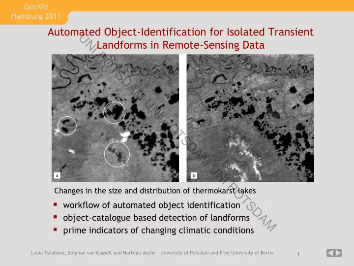
Automated Object-Identification for Isolated Transient Landforms in Remote-Sensing Data
- workflow of automated object identification
- object-catalogue based detection of landforms
- prime indicators of changing climatic conditions