Thurston County Focus Group Conversation Habitat Conservation Plan - - PowerPoint PPT Presentation

thurston county focus group conversation habitat
SMART_READER_LITE
LIVE PREVIEW

Thurston County Focus Group Conversation Habitat Conservation Plan - - PowerPoint PPT Presentation

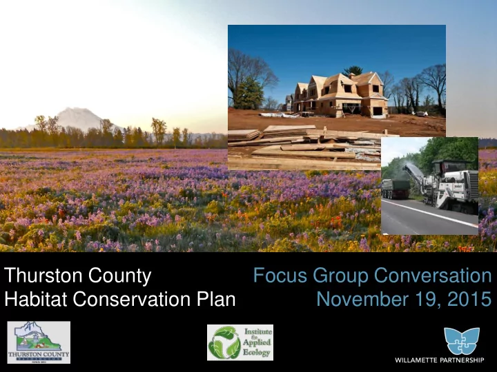
Thurston County Focus Group Conversation Habitat Conservation Plan November 19, 2015 Meeting Objectives Update on HCP process and how we got here Talk about what needs to be in the HCP Get feedback Is the approach clear?


slide-1
SLIDE 1

Thurston County Habitat Conservation Plan Focus Group Conversation November 19, 2015

slide-2
SLIDE 2
  • Update on HCP process and how we got here
  • Talk about what needs to be in the HCP
  • Get feedback

– Is the approach clear? Anything missing? Are there alternatives? – Is the logic behind the plan elements sound? Are there creative ideas to improve the plan?

Meeting Objectives

slide-3
SLIDE 3
  • Recent listings of 4 species
  • Provides predictability and

local control

  • Limits liability for County and

private land owners

  • More common sense

conservation

Why an HCP for Thurston County?

slide-4
SLIDE 4
  • Petitions to list 12

species from conservation groups

  • Lawsuit to force a

decision in 2011

  • Listings of 4 species in

2013-2014

  • Impacts can occur, but

with a HCP and permit from USFWS

Endangered Species Act

slide-5
SLIDE 5

ESA Species in Thurston County

2001 2011 2013 2014

TCB, MPG, SHL, OSF: Candidates TCB, MPG, SHL Proposed for Listing TCB, SHL Listed MPG, OSF Listed OSF Proposed

2006

TCB, MPG, SHL State Listed

1997

OSF State Listed

slide-6
SLIDE 6
  • Habitat loss
  • Habitat

Fragmentation

  • Decreases in

habitat quality

Reasons for Listing

Subdivisions in Tumwater UGA US Census Bureau, Washington Office of Financial Management, Thurston Regional Planning Council

slide-7
SLIDE 7

Public Lands Without a County HCP:

– Impacts to listed species require USFWS Permit, HCP, and NEPA process.

Private Lands Without a County HCP:

– Impacts to listed species still require USFWS Permit. – Individual HCPs = additional delay and cost, plus mitigation.

Without an HCP…

Streaked Horned Lark: Rod Gilbert Photo

slide-8
SLIDE 8

With an HCP…

Private & Public Lands With a County HCP:

– Faster permit times and lower total costs – Very limited site surveys – Limited involvement of USFWS – Conservation occurs in advance and at a scale that can lower cost

Taylor’s checkerspot: Oregon Zoo Photo

slide-9
SLIDE 9

What an HCP is:

A tool to forecast, manage, and permit defined impacts to endangered species

Regulatory assurances for 30 years For identified and quantified impacts

slide-10
SLIDE 10

County Building Permit Applicants – Prairie Areas

Complete project site survey in correct season Pay for Mitigation* Required by USFWS Complete Individual HCP & NEPA, Get Individual Incidental Take Permit

Timelines with and without a County HCP

6 mo 12 mo 18 mo 24 mo 36 mo

Complete HCP Permit Application, Pay Mitigation Fee, Receive HCP Permit (4-6 weeks)

* Mitigation Bank may not be available.

slide-11
SLIDE 11

HCP Project Timeline

2013 2014 2015 2016 Field Surveys Technical Working Group Meetings County Outreach Take Permit Issued HCP Development EIS/SEPA Development 2017 PHAM Development Draft HCP/EIS Public Review and Comment Public Meetings

slide-12
SLIDE 12
  • Background
  • Covered Species, Lands, and Activities
  • Impacts
  • Conservation Strategy
  • Implementation

What will the HCP Include?

slide-13
SLIDE 13 To help protect your privacy, PowerPoint has blocked automatic download of this picture.

HCP Covered Species

Streaked horned lark Oregon spotted frog Taylor’s checkerspot Mazama pocket gopher

Puget blue Oregon branded skipper Mardon skipper Vesper sparrow Hoary elfin

Valley silverspot

SBWB Nuthatch

  • W. Gray Squirrel
slide-14
SLIDE 14

Covered Lands: HCP Habitat Areas

slide-15
SLIDE 15

Covered Activities

(linked to County decisions)

  • Private lands

– Residential and Commercial Development

  • Public Services

– School & fire station construction

  • County Actions

– Development and utility permit issuance – Transportation activities – Water and wastewater management – Land management & habitat restoration

slide-16
SLIDE 16

In 30 years, Thurston County will grow

slide-17
SLIDE 17

Project Impacts by 2045 (Draft)

<1%

slide-18
SLIDE 18

30-yr Projected Residential Construction

Estimates based on population projections and Thurston Regional Planning Council Buildable Lands Analysis

Residential Capacity

slide-19
SLIDE 19

Where impacts come from: Residential Construction

5 acre parcel New home & driveway 60ft envelope 19

  • New homes &

driveways

  • Impact in 60 ft.

development envelope

  • House + Driveway

=~ 1 ac area.

  • Potential added

accessory buildings

slide-20
SLIDE 20

Where impacts come from: Commercial/Industrial

5 acre parcel Commercial development Typically site loses all habitat value 20

  • New commercial

development

  • Impacts extend to

property line

  • For the projections,

assume full loss of habitat for the property

slide-21
SLIDE 21

Where impacts come from: County Transportation

21

  • New Road

Construction

  • Impacts for added

impervious area and partial impact in right

  • f way
  • Best management

practices (BMPs) to minimize impacts

slide-22
SLIDE 22

As Thurston grows, managing for high quality habitat is also important

slide-23
SLIDE 23

Current thinking on elements of a program:

Conservation Program

– Avoid/minimize impacts – Work with willing landowners who want to manage for habitat on their working lands – Protect land to support prairie - oak and riparian/wetland habitat – Manage and enhance the habitat on those lands – Track progress and adapt to make sure we’re practicing common sense conservation

slide-24
SLIDE 24

What Conservation Can Look Like

100 acre parcel Enhance habitat Secure the land Manage & Monitor – in perpetuity

24

slide-25
SLIDE 25
  • Unavoidable impacts need mitigation

How much conservation will be needed?

25

Quality & Quantity of Habitat Impacted Quality & Quantity of Habitat Mitigated

slide-26
SLIDE 26

A plan can be implemented and financed in a lot of ways

slide-27
SLIDE 27
  • Roles, responsibilities,

tasks

– Process for issuing coverage – Costs and funding – Logistics – Enforcement – Reporting

Implementation and Funding

Early blue violet at Glacial Heritage– IAE Photo

slide-28
SLIDE 28

County Building Permit Applicants – Prairie Areas

Complete project site survey in correct season Pay for Mitigation* Required by USFWS Complete Individual HCP & NEPA, Get Individual Incidental Take Permit

Timelines with and without a County HCP

6 mo 12 mo 18 mo 24 mo 36 mo

Complete HCP Permit Application, Pay Mitigation Fee, Receive HCP Permit (4-6 weeks)

* Mitigation Bank may not be available.

slide-29
SLIDE 29

What needs to get financed? 1. The conservation strategies in the HCP 2. HCP management and administration When do these get financed? 1. Early: Getting conservation “in the bank” before permitted impacts occur 2. Ongoing over HCP

Costs and funding

slide-30
SLIDE 30

QUESTIONS

  • What’s missing?
  • Ideas?
slide-31
SLIDE 31

Habitat Conservation Plan Impacts Analysis

Photo credit: Rod Gilbert

31

slide-32
SLIDE 32

Projecting Development Out to 30 Years

  • 1. Assuming 88% build-out to zoned capacity
  • Population projections
  • Buildable lands analysis (Thurston Regional Planning Council)
  • 2. Estimate affected area per development unit
  • Full lot use in Urban Growth Boundary
  • Full lot use for commercial/industrial

32

slide-33
SLIDE 33

30-YEAR DEVELOPMENT PROJECTIONS

slide-34
SLIDE 34

5 acre parcel New home, Structures & driveway 60ft envelope

Estimates per Development Unit

34

  • Homes and permitted
  • utbuildings
  • Impact in 60 ft

development envelope

  • n each structure

(minus overlap)

  • Estimated average 2.33

acre total impact area/development unit

*Based on looking at forty lots with varying sizes

slide-35
SLIDE 35

Projecting Development Out to 30 Years

  • 1. Assuming 88% build-out to zoned capacity
  • Population projections
  • Buildable lands analysis (Thurston Regional Planning Council)
  • 2. Estimate affected area per development unit
  • Full lot use in Urban Growth Boundary
  • Full lot use for commercial/industrial
  • 2.33 ac/unit for residential
  • 3. Overlay projected development with habitat
  • Using maps of soils, suitable habitat, species locations

35

slide-36
SLIDE 36

Overlay of Habitat

36

  • Screen identifies

parcel as having habitat.

  • Zoned 1 unit/5

acres

  • Only 1-2 units

potentially affected

slide-37
SLIDE 37

Overlay of Habitat

37

Projected 18,632 units added

  • n lots with habitat

Fewer units actually affected 7,000-9,000

slide-38
SLIDE 38

38

* As of August 13, 2015. Final analysis pending second half of 2015 gopher survey results.

Projected New Development Units: Unincorporated Thurston County Soil Preference Low Medium High > 650 feet from known gophers 50% 29% 8% ≤ 650 feet from known gophers 1% 4% 6% Gophers detected * 0.04% 1.2% 0.5% TOTAL PROJECTED UNITS by 2045

  • n gopher habitat

20,768

30-Year Projected New Development by Habitat Category

slide-39
SLIDE 39

Projecting Public Works Projects

39

slide-40
SLIDE 40

QUESTIONS

  • Is the logic sound?
  • Alternatives?
slide-41
SLIDE 41

Habitat Conservation Plan Conservation Strategy

Photo credit: Rod Gilbert

41

slide-42
SLIDE 42

Conservation Strategies

  • 1. Avoid impacts
  • Include minimization

practices (BMPs) for many covered activities

  • Use the existing Critical

Areas Ordinance guidelines

42

Roadside maintenance

slide-43
SLIDE 43

Conservation Strategies

  • 2. Conserve land in

the most important places

  • Look at securing

land in Reserve Priority Areas as a diverse network

  • Secure lands with

multiple habitat benefits for multiple species

43

slide-44
SLIDE 44

Conservation Strategies

  • 3. Enhance and steward

natural areas

  • Provide funds to enhance

natural areas

  • Establish funding base for

long-term stewardship

  • Assume HCP conservation

lands will be enhanced to high quality native habitat and maintained at that level

44

Photos: South Sound Prairies

slide-45
SLIDE 45

Preliminary Draft 30-year Residential Development Impacts/Mitigation

(County Jurisdiction)

1283 Functional Acres 491 Functional Acres 429 Functional Acres 1294 Functional Acres 816 Functional Acres 403 Functional Acres Prairie Species, East of Black River

slide-46
SLIDE 46

Conservation Strategies

  • 4. Support working lands conservation—especially next

to and between reserves

  • Provide information and incentives for landowners to

steward the habitat on their land

  • Create regulatory assurances for stewardship
  • Coordinate with USDA, DoD, and other landowner

programs, especially near and between conservation lands

46

slide-47
SLIDE 47

Common Sense Conservation

HCP Mitigation Conservation

  • n Public

Lands JBLM & ACUB Funds Section 6 Land Acquisition Land Trusts & Working Lands

slide-48
SLIDE 48

QUESTIONS

  • Is the logic sound?
  • Alternatives?
slide-49
SLIDE 49

Habitat Conservation Plan Mitigation

Photo credit: Rod Gilbert

49

slide-50
SLIDE 50

Complete project site survey in correct season Pay for Mitigation* Required by USFWS Complete Individual HCP & NEPA, Get Individual Incidental Take Permit

Timelines with and without a County HCP

6 mo 12 mo 18 mo 24 mo 36 mo

Complete HCP Permit Application, Pay Mitigation Fee, Receive HCP Permit (4-6 weeks)

* Mitigation Bank may not be available.

Mitigation: From a Permit Applicant View

slide-51
SLIDE 51

Mitigation: From a Credit Developer’s View

Wait for a call from a Permit Applicant Pay for Mitigation* Required by USFWS Work with Permit Applicant and USFWS to select site and develop mitigation plan

6 mo 12 mo 18 mo 24 mo 36 mo

* Mitigation Bank may not be available.

Propose site, and have early meeting with County & USFWS County selects projects & issues credit contract USFWS signs bank instrument, work begins, credits released

51

slide-52
SLIDE 52

Compensating for a new Single Family Residence

5 acre parcel New home & driveway 60ft envelope 52

  • New home & driveway
  • Impact in 60ft

development envelope

  • ~ 1 acre of impact area
  • Habitat value less for

lower preference soils and further from known gopher locations

slide-53
SLIDE 53

Ways to Reduce Impacts within a Lot

High

5 acre parcel

Med

New home & driveway 60 ft envelope

  • Avoid high preference

soils

Low

53

slide-54
SLIDE 54

Ways to Reduce Impacts within a Lot

High

5 acre parcel

Med

New home & driveway 60 ft envelope

  • Avoid high preference

soils

  • Cluster development

Low

54

slide-55
SLIDE 55

Ways to Reduce Impacts within a Lot

High

5 acre parcel

Med

New home & driveway 60ft envelope

  • Avoid high preference

soils

  • Cluster development
  • Decrease

development footprint

Low

55

slide-56
SLIDE 56

The full cost of habitat conservation

Variables Range Acquisition Cost per Acre $4,000 to $50,000 Initial Stewardship/Maintenance per acre $300 to $750 On-going Stewardship/Maintenance per acre $200 to $500 Project Management per acre $200 to $600

*based on sample of 5 prairie projects in Thurston County

Average cost for a functional acre of conservation: $

56

slide-57
SLIDE 57

The full cost of habitat conservation

Variables Range Acquisition Cost per Acre $4,000 to $50,000 Initial Stewardship/Maintenance per acre $300 to $750 On-going Stewardship/Maintenance per acre $200 to $500 Project Management per acre $200 to $600

Average cost for a functional acre of conservation: $15,876 to $86,854

57

59% 10% 31%

Elements of the Cost of Conservation

Acquisition Enhancement Maintenance

slide-58
SLIDE 58

58

* As of August 13, 2015. Final analysis pending second half of 2015 gopher survey results.

Projected New Development Units: Unincorporated Thurston County Soil Preference Low Medium High > 650 feet from known gophers 50% 29% 8% ≤ 650 feet from known gophers 1% 4% 6% Gophers detected * 0.04% 1.2% 0.5% TOTAL PROJECTED UNITS by 2045

  • n gopher habitat

20,768

30-Year Projected New Development by Habitat Category

slide-59
SLIDE 59

Compensating for a new Single Family Residence

* Based on 3050 sq ft house + driveway, actual costs based on actual footprint and impact of development.

Estimated cost* per Single Family Residence on open lot Soil Preference Low Medium High > 650 feet from known gophers $6,303 $12,600 $37,800 ≤ 650 feet from known gophers $31,500 $37,800 $42,000 Gophers detected * $42,000 $42,000 $42,000 TOTAL PROJECTED UNITS by 2045

  • n gopher habitat (in part)

18,632

59

59% 10% 31%

Elements of the Cost of Conservation

Acquisition Enhancement Maintenance

$2,381-$13,028 $15,876-$86,854

slide-60
SLIDE 60

QUESTIONS

  • Is the logic sound?
  • Alternatives?
slide-61
SLIDE 61

HCP Project Timeline

2013 2014 2015 2016 Field Surveys Technical Working Group Meetings County Outreach Take Permit Issued HCP Development EIS/SEPA Development 2017 PHAM Development Draft HCP/EIS Public Review and Comment Public Meetings