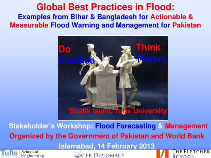
SLIDE 1 Think Theory Do Practice
Shafik Islam, Tufts University
Stakeholder’s Workshop: Flood Forecasting & Management
Organized by the Government of Pakistan and World Bank Islamabad, 14 February 2013
Global Best Practices in Flood:
Examples from Bihar & Bangladesh for Actionable & Measurable Flood Warning and Management for Pakistan
SLIDE 2 102 Years Ago…
“Hitherto the long range forecaster has been denied a seat in the banquet hall of science; …the general scientist has denounced him; the professional weather man has treated him with supercilious scorn” (Ricard 1911).
100 years later…
2010 Pakistan Flood: >20M people; >$40B Economic Impact 2011 Thailand Flood: >13M people; >$46B Economic Impact Floods in Asia: Lessons to be Learned “…as Thailand begins its rehabilitation effort, it should not
- nly include reconstruction of infrastructure but also
restoration of the trust and confidence of the people. We need to continuously learn from mistakes and prepare for a better future.” Irandoust and Biswas (2012)
SLIDE 3 BIG Gulliver LITTLE Gulliver Issues of SCALES; LEVELS; DOMAINS : Watershed; Problemshed; Policyshed BIG Gulliver
SLIDE 4 Coupled Natural, Societal and Political Domain (NSPD)
Ecosystem Values & Norms
Political Domain
Governance
Societal Domain
Water Quantity Water Quality
Natural Domain
Assets
Q
E
P C
G
V
Issues of SCALES and DOMAINS : Watershed; Problemshed; Policyshed
SLIDE 5
Indus River System
A Boundary Crossing Coupled Natural and Human System
Domains Scales Levels Watershed Problem-shed Policy-shed
SLIDE 6
Indus River System A Boundary Crossing Coupled Natural and Human System
SLIDE 7 Domains, Scales and Levels
Scale Challenges: Combination of cross-scale and cross-level Interactions
SLIDE 8 Ecological Economics Economic Utility Culture & Values Governance & Institutions Climate Weather Water Quality Macro Micro Large Small
Water Management Flood Forecasting
Water Quantity
SLIDE 9 Flood Forecasting is like a
B.P.
Flood Forecasting is like a
B.P.
Flood Forecasting is like a B.P Flood Forecasting is like a
B.P
Pakistan
Connect THEORY and PRACTICE: Create Actionable Knowledge in WATER
I hope you will REMEMBER and RECALL FOUR Points & ANSWER one question
What is Actionable Knowledge for Pakistan?
SLIDE 10
Boston to Pakistan
Flood Forecasting
SLIDE 11 Topography Precipitation Soil Moisture Surface Runoff Climate Weather Vegetation Macro Micro Large Small
Water Management Flood Forecasting
Evaporation
SLIDE 12 Connect THEORY and PRACTICE: Create Actionable Knowledge in WATER
SLIDE 13 Perception of water resources systems
“Practitioners” “People” Scientists Engineers
?
?
?
?
?
? ? ?
Politicians Justice
SLIDE 14 Connect THEORY and PRACTICE: Create Actionable Knowledge in WATER
SLIDE 15
Indus River System
An Example from AquaPedia: What Can We Learn Together?
SLIDE 16 Boston to Pakistan
Flood Forecasting
Best Practices
- Numerical Weather Prediction Model
- Rainfall-Runoff Model
- Flood Innundation Models
SLIDE 17
Before 1970s 2000s
Transformative changes in measurement technologies. Transformative developments for hydrometeorologocical science and understanding of hydrologic and climatic processes?
SLIDE 18 What They Made Possible. SRTM USGS Quad
Digital Elevation
- Enabled Spatial Hydrologic Modeling
- Linked Continental Hydrology and Oceans
- First Tool in Characterizing a Problem
SLIDE 19 Regional to Global Linkages Precipitation Gauges
Precipitation
- See Rainfall as Structured Fields That Move and Transform
- Catalyst in Understanding Macro-Scale Processes
SLIDE 20
- Data Collection
- Preparation
- Output
- Dissemination
DISSEMINATION OUTPUT PREPARATION DATA COLLECTION
Flood Forecasting: What do we need?
SLIDE 21
Flood Forecasting in Europe: Current State of the Art
SLIDE 22
SLIDE 23 Operational Flood Forecasting in Bangladesh
Flood Forecast and Warning Center (FFWC), Bangladesh
Basis: - One dimensional fully hydrodynamic model (MIKE 11 HD) incorporating all major rivers and
- floodplains. This is linked to a lumped conceptual rainfall-runoff model (MIKE 11 RR) which generates
inflows from catchments within the country. Details:
- Catchment Area = 82,000 sq. km.
- Total length of modelled rivers = 7270 km.
- No. of catchments =216
- Total number of forecast stations = 30
- Flood maps generated from model results via GIS link to model (MIKE 11 GIS)
OUTPUT :
- Daily monsoon bulletin & river situation report
- River level forecasts for 24, 48 and 72 hours
- Current warning messages
- Special flood situation report
- Thana inundation status map
- Flood forecast maps
- Monthly flood report
- Dry season bulletin (weekly)
- Annual Flood Report
Source: FFWC, Bangladesh
SLIDE 24 Flood Forecasting: Issues of Scales and Domains
Source: FFWC, Bangladesh
SLIDE 25 Real Time Data Collection: Rainfall : 55 Water Level : 73 Flood Forecasting:38 Stations
Source: FFWC, Bangladesh
SLIDE 26 1972-90: 3-day Forecast by Gauge to Gauge Correlation 1990 up till now : 3-day Forecast: Deterministic Modeling (Operational) Future: 1~10 day Forecast by Probabilistic Modeling (Experimental)
Flood Forecasting in Bangladesh: 40 Years of Experience and Wisdom
Source: FFWC, Bangladesh
SLIDE 27 Special Outlook, FFWC, BWDB 25 April 2012
As per the Numerical Weather Prediction (NWP) of Bangladesh Meteorological Department (BMD), there is possibility of rainfall in the north east region of Bangladesh for next three days (from 26 to 28 April 2012). This may contribute to further rise of river water level in the Meghna Basin, in the north East region, specially in the Sylhet, Sunamgonj and Moulvibazar Districts.
How was this Qualitative Forecast Done?
- Bangladesh Meteorological Dept, 25 April 2012 Chart
- Indian Meteorological Department (IMD) forecast
- NOAA rainfall estimates from the web
- No Hydrological or Innundation model was used
- Dissemination to BWDB Field Offices
For further detail visit http://www.bmd.gov.bd/nwp.php
Source: FFWC, Bangladesh
FFWC Qualitative Forecasting: An Example of Actionable Knowledge
SLIDE 28
ECMWF: Verification of Precipitation Forecast Skills
SLIDE 29
Intercomparison of Global Model Precipitation Forecast Skills
SLIDE 30
Forecasting of Water Levels from Satellites: Example from Bangladesh
SLIDE 31
Flood Innundation Map: 48-hour Forecast
SLIDE 32
SLIDE 33
World Bank-Tufts Partnership in Bihar, India
SLIDE 34 Day 4: Review and HEC HMS for BA Basin
- Comparison of IMD Forecasted and Observed Rainall
- Available rainfall, water level and streamflow data
- ZERO order model for Forecasting Hyaghat Flow
- Review HEC-HMS implementaion
- Customize HEC-HMS for the BA Basin
- Calibration and Validation of HEC-HMS for the BA basin
World Bank-Tufts Partnership in Bihar, India
SLIDE 35 2009 and 2010 flood seasons: Comparison of IMD forecasted rainfall And raingage observations from Benibad and Kathmundu suggests
- Very Low Correlation
- Forecasted rainfall is OVERESTIMATED
- When observed rainfall is greater than a threshold (mean + ONE standard
deviation), forecasted rainfall is significantly UNDERESTIMATED.
World Bank-Tufts Partnership in Bihar, India
SLIDE 36
Available rainfall, water level and stream flow data Hourly Rainfall: Benibad, Kamtul, Hayaghat, Jhanjharpur: 2000-2005 selected storms
World Bank-Tufts Partnership in Bihar, India
SLIDE 37 Hayaghat Water Level and Discharge Forecasting: ZERO Order Model Flow/Water Level tomorrow = Flow/Water Level Today; This is 1-Day Forecast Flow/Water Level Day after tomorrow = Flow/Water Level Today; 2-Day Forecast
- Correlation between Forecasted and Observed Values are VERY HIGH
World Bank-Tufts Partnership in Bihar, India
SLIDE 38
Rainfall from Satellite: TRMM Daily Seasonal
World Bank-Tufts Partnership in Bihar, India
SLIDE 39 BA Model with Four B.P.
Three Years:
Forecasting Model
- Data Needs Identified?
- 72 Hours Lead Time
Modeling is a Synthesis of Science and Art
One Year:
- How to set up the Model?
- What Data do we Need?
- What Forecasting Lead Time?
Five Years:
- An Operational and Validated
Flood Forecasting Model
- Data integrated in modeling
- 3-6 Days Lead Time
World Bank-Tufts Partnership in Bihar, India
SLIDE 40 Boston to Pakistan
Flood Forecasting
Best Practices Best Partners
- Boston to Patna
- Best Technology and Know How
- Bank
- Be Adaptive to Patna
SLIDE 41 Flood Forecasting & Water Management: Actionable Knowledge for Pakistan “How to prevent Hazard to become Disaster”
- Improve RESILIENCE to water hazards in Pakistan
– Non-Structural (e.g. forecasting & warning systems)/ Structural (e.g. embankment, barrage, dams) – Local/Provincial/National/International – Short/Medium/Long-term
- Improve water PRODUCTIVITY in Pakistan
– Improved basin planning and investment prioritization – Improved irrigated agriculture – Improved agricultural services
SLIDE 42 Primary Challenges for Pakistan: I3
Problems and Conditions TO Solutions and Management
– Models (Flood Forecasting; Water Management…Numerical Weather Prediction Models, Rainfall Runoff Models, Flood Innundation Models) – Data (Topographic Data; Rating Curves; Weather and Climate Data) – Lack of real-time LOCAL and BOUNDARY data
– Build and Strengthen Institutions to address PROBLEMS and CONDITIONS – Integrate SHORT-term and LONG-term goals to CREATE ACTIONABLE KNOWLEDGE through strategic policy and MEASURABLE METRICS
– Physical infrastructure – Build Capacity (Brilliant Practitioners from Pakistan who understand the “context” and current “know-how”
SLIDE 43
From Data and Models to Action and Implementation
SLIDE 44 Hydrological model Decision support information Global probabilistic weather forecast
From Data and Models to Action and Implementation
What is Global Flood Awareness System (GloFAS)?
GIoFAS is a Joint collaboration between the EC Joint Research Centre and the European Centre for Medium-Range Weather Forecast
SLIDE 45 Boston to Pakistan
Flood Forecasting
Best Practices Best Partners Best Practitioners
- Best Technology
- Best Practices
- Best Partners
- Best Practitioners for Pakistan