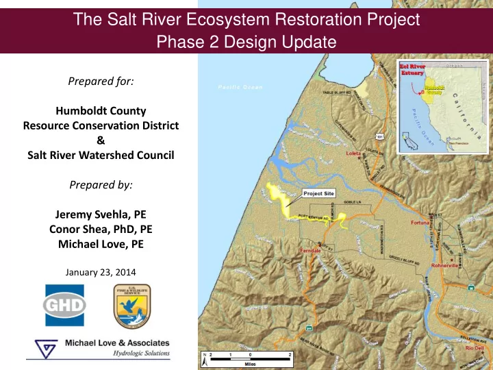

The Salt River Ecosystem Restoration Project Phase 2 Design Update Prepared for: Humboldt County Resource Conservation District & Salt River Watershed Council Prepared by: Jeremy Svehla, PE Conor Shea, PhD, PE Michael Love, PE January 23, 2014
Acknowledgments Salt River Watershed Council KAM AMMAN AN HYDRO DROLO LOGY GY & E ENGINEE GINEERING, ING, INC McBain & Trush
Presentation Overview 1. Project Overview 2. Phase 2 Design Goals/Objectives 3. Channel Design Development – Geomorphic Channel Grading – Instream Wood – Revegetation 4. Adaptive Management Plan (AMP) 5. Implementation Considerations 6. Q&A
Project Development Watershed-Based and Ecosystem-Scale Primary Project Components Salt River Channel and Riparian Corridor 1. Riverside Ranch Tidal Marsh Restoration Restoration (Phase 1) Riverside Ranch Tidal Marsh Restoration 2. Salt River Channel and Riparian Floodplain Corridor Restoration (Phase 2) Upslope Sediment 3. Upslope Sediment Reduction Reduction Program Program 4. Adaptive Management Plan – Riverside Ranch, Channel and Riparian Floodplain, Sediment Maintenance and Management
Overall Project Goals Overall Project Goals 1. Rehabilitate the Salt River channel and adjacent riparian floodplain by increasing hydraulic conveyance and constructing habitat features that re-establish ecological processes beneficial to fish and other native species; 2. Restore historic estuarine habitat and tidal connectivity within the lower Salt River; 3. Improve water quality and drainage efficiency across the floodplain and implement long-term upslope sediment reduction; 4. Manage excess sediment loads by maximizing fluvial and tidal channel sediment transport capacity and implementing sediment management areas; 5. Initiate a long-term corridor adaptive management process that maximizes ecological restoration success in a working landscape
Geomorphic Channel Design Rational
Geomorphic Channel Design Rational • Transport hyperloads of sediment through low- slope channel SOURCE AND TRANSPORT REACH DEPOSITIONAL REACH
Sediment Supply and Deposition Rates
Most Sediment Comes with High Discharge
High Flow Events Occur Only a Few Days a Year
Phase 2: Salt River Channel and Riparian Floodplain Corridor Geomorphic and 2-D Hydraulic Modeling Design Approach
Channel Cross-section Design Riparian Planting along Channel
Channel Cross-section Design Effective Discharge: 86 cfs Exceeded 27 days/year
Channel Cross-section Design Full Active Channel Discharge: 138 cfs Exceeded 13 days/year
Channel Cross-section Design Berm Overtopping Discharge: 400 cfs Exceeded 1 day/year
Large Wood Used to Create Geomorphic Features Large Wood Design Considerations 1. Supports Geomorphic Channel Functions 2. Provides Aquatic Habitat Diversity 3. Reuses Onsite Materials 4. Designed for Minimal Maintenance 5. Meets Permit Requirements Riparian Planting along Channel
Log Sill Structures (Side Channel Inlet)
Revegetation Design Approach Revegetation Considerations 1. Compatible with geomorphic design and adjoining land uses 2. Short Term Erosion Control/SWPPP Compliance 3. Long Term Succession to Suppress Invasive Species 4. Permit Requirements (Planting Area and Species) 5. Freshwater and Brackish Habitats
Revegetation Design Approach
Revegetation Design Approach
Adaptive Management Plan (AMP) Long-term Monitoring and Management Program One of the Four Project Components Monitoring and management structure Identify monitoring components, triggering mechanisms and potential actions Relates project performance to goals & objectives Includes Roles for all Stakeholders Watershed Council HCRCD Landowners Regulatory Group Funders Technical Advisory Included in 10-year Permits Basis to Pursue Long-term Funding Opportunities
Adaptive Management Plan (AMP) Long-term Monitoring and Management Program The Process The Structure
Recommend
More recommend