
SLIDE 1
Cumulative effects of rapid climate and land-use changes on the Yamal Peninsula, Russia
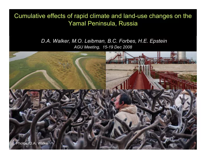
D.A. Walker, M.O. Leibman, B.C. Forbes, H.E. Epstein
AGU Meeting, 15-19 Dec 2008
Photos: D.A. Walker
The Greening of the Arctic Project: Two Arctic Transects North - - PowerPoint PPT Presentation
Cumulative effects of rapid climate and land-use changes on the Yamal Peninsula, Russia D.A. Walker, M.O. Leibman, B.C. Forbes, H.E. Epstein AGU Meeting, 15-19 Dec 2008 Photos: D.A. Walker The Greening of the Arctic Project: Two Arctic
Photos: D.A. Walker
Base map: Walker 2005, Journal of Vegetation Science, 16: 267-282. Photo: Subzone A, Isachsen, D.A. Walker. Isachsen Grid, Subzone A
Photo D.A. Walker
NASA: Land Cover Land-Use Change program
Uma Uma Bhatt, Gary Bhatt, Gary Kofinas Kofinas, , Jozsef Geml Jozsef Geml, Martha Raynolds, Vladimir Romanovsky, Lee Taylor, Skip Walker: , Martha Raynolds, Vladimir Romanovsky, Lee Taylor, Skip Walker: University of Alaska Fairbanks University of Alaska Fairbanks Marina Marina Liebman Liebman, , Nataliya Moskalenko Nataliya Moskalenko, , Pavel Orekov Pavel Orekov, , Artem Khomotov Artem Khomotov, Anatoly , Anatoly Gubarkov Gubarkov: : Earth Earth Cryosphere Cryosphere Laboratory, Moscow, Russia Laboratory, Moscow, Russia Bruce Forbes, Bruce Forbes, Florian Stammler Florian Stammler, , Timo Kumpula Timo Kumpula, , Elina Karleja Elina Karlejaärvi ärvi: : Arctic Centre, Arctic Centre, Rovaniemi Rovaniemi, Finland , Finland Howie Howie Epstein: Epstein: University of Virginia University of Virginia Jiong Jia Jiong Jia: : REC-TEA, Chinese Academy of Science REC-TEA, Chinese Academy of Science Joey Joey Comiso Comiso: : NASA Goddard NASA Goddard
Courtesy of A. Gubarkov
Yamal Peninsula Yamal Peninsula
Photos: D.A. Walker
28-30 Jan 2008. NRC, 2003. Cumulative Environmental Effects of the Oil and Gas Development on the Alaska North Slope.
Extent of the North Slope, AK development (2001)
Extent of Bovanenkovo Gas Field (2001)
2
2
2
2
2
2
Graphics: Florian Stammler: Yamal LCLUC Workshop, Moscow, 28-30 Jan 2008. Photos: D.A. Walker
Photos: D.A. Walker.
Photos: D.A. Walker
1. Complete and timely reclamation of lands used during the technical work that are not industrial and have no facilities on them. 2. Establishing and protecting corridors for movement between camps by people and reindeer herders. (Zen’ko 2004, Stammler 2005).
Photo: D.A. Walker Stammler, F. 2005. Reindeer Nomads Meet the Market: Culture, Property and Globalisation at the End of the Land. Litverlag-Halle Studies in the Antrhopology of Eurasia, Muenster. Zen'ko, M. A. 2004. Contemporary Yamal: ethnoecological and ethnosocial problems. Anthropology & Archeology of Eurasia 42:7-63.
Pavel Orekhov and Nenets herder.
Photo: D.A. Walker
Bruce Forbes. 2008. Equity, vulnerability and resilience in social-ecological systems: A contemporary example from the Russian
Public Policy, 15: 203-236.
None of the trends are significant at p = 0.05 because of high interannual variability. Bhatt et al.: NASA LCLUC Workshop, 2008.
Circumpolar Data Sets Primary controls at pan-Arctic scale:
AVHRR Land-surface Temp Permafrost Soils Glacial Geology Vegetation
Raynolds, M.K., D. A. Walker and H. A. Maier. 2006. NDVI patterns and phytomass distribution in the circumpolar Arctic. Remote Sensing of Environment 102:271-28 . Raynolds, M. K., J. C. Comiso, D. A. Walker, D. Verbyla. 2008. Relationship between satellite-derived land surface temperatures, arctic vegetation types, and
Raynolds, M. K. and Walker, D. A. 2008. Relationship of permafrost characteristics, NDVI, and arctic vegetation types. Proceedings of the Ninth International Conference on Permafrost: 1469-1474. Raynolds, M. K. and Walker, D. A. 2008 (submitted): The effects of deglaciation on circumpolar distribution of arctic vegetation. Canadian Journal of Remote Sensing. Raynolds, M.K. 2009 in prep. Synthesis of circumpolar controls on NDVI.
:Martha Raynolds Ph.D. thesis
y = 0.0036x + 0.356 R2 = 0.2158
Yamal y = 0.0036x + 0.358 R2 = 0.2158 Circumpolar Arctic y = 0.0137x – 0.0204 R2 = 0.5814
Martha Raynolds: Yamal LCLUC meeting, Moscow 28-31 Jan 2008.
Areas with less NDVI than expected are brown, areas with more NDVI than expected are green.
< - 0.3 > + 0.3
Martha Raynolds: Yamal LCLUC meeting, Moscow 28-31 Jan 2008.
NDVI & LAI Soils
Plant Biomass Ground temperatures
Active layer Plant Cover
Extensive nutrient-poor surface sands with lichens that are easily
Underlain by permafrost with massive pure ice. Extensive landslides are rapidly eroding the landscape.
Photos: D.A. Walker and M. Liebman (upper right)
Elina Karlejaärvi (Arctic Centre, graduate student, botanist), Nataliya Moskalenko (ECI, ecologist), Howie Epstein (U Va Co-PI, ecosystem ecologist), Marina Leibman (ECI, Permafrost, geomorphologist), Patrick Kuss (UAF, Post Doc, botanist), Anatoly Gubarkov (ECI, graduate student, permafrost, industrial impacts), Artem Khumotov (ECI, graduate student, GIS), George Mateyshak (MSU, Soil Scientist), D.A. Walker (Project PI, geobotanist)
Photo: D.A. Walker
Photo: D. A. Walker
Photo: Bruce Forbes
Bruce Forbes, Arctic Centre, Rovaniemi, PI of the ENSINOR Project.