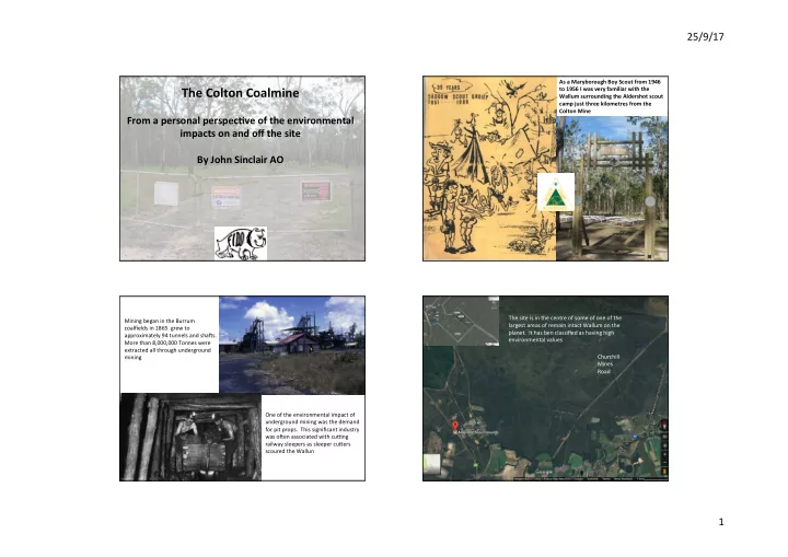
the colton coalmine
play

The Colton Coalmine to 1956 I was very familiar with the Wallum - PowerPoint PPT Presentation

25/9/17 As a Maryborough Boy Scout from 1946 The Colton Coalmine to 1956 I was very familiar with the Wallum surrounding the Aldershot scout camp just three kilometres from the Colton Mine From a personal perspec2ve of the environmental


  1. 25/9/17 As a Maryborough Boy Scout from 1946 The Colton Coalmine to 1956 I was very familiar with the Wallum surrounding the Aldershot scout camp just three kilometres from the Colton Mine From a personal perspec2ve of the environmental impacts on and off the site By John Sinclair AO The site is in the centre of some of one of the Mining began in the Burrum largest areas of remain intact Wallum on the coalfields in 1865 grew to planet. It has ben classified as having high approximately 94 tunnels and shaBs. environmental values More than 8,000,000 Tonnes were extracted all through underground mining Churchill Mines Road One of the environmental impact of underground mining was the demand for pit props. This significant industry was oBen associated with cuJng railway sleepers as sleeper cuKers scoured the Wallun 1

  2. 25/9/17 Because the mine will be open cut working in a deep pit cuNng through layers of groundwater aquifers the environmental impacts will be felt far beyond the mine Vegeta2on paLerns along Churchill Mines Road site. pH: Once the coal seam is exposed to air the sulphur in the The most obvious impact arises from the water that will seep con2nually into the deep open cut Pyrites begins an endless chain reac2on genera2ng sulphuric pit cuNng though various aquifers. acid. This poses a huge environmental threat to the natural integrity of Great Sandy Strait arises. Most aqua2c life is This will have two impacts: extremely sensi2ve to any changes in pH and water quality. 1. It will change the hydrology of land surrounding the mine making it more drought sensi2ve; and Heavy Metals: Exposure causes heavy metals 2. Water contaminated by acid (sulphur (Aluminium, Arsenic, Boron, Cadmium, Chromium, Cobalt, exposure) and heavy metals will be discharged into the Mary River to allow mining to proceed Copper, Lead, Manganese, Nickel and Zinc) to be released as a without the pit flooding. result of the mining process. These will be in the cocktail being flushed into the Mary River. Heavy metals don’t breakdown Polluted ground water from Colton Mine is like other pollutants do and they will con2nue to accumulate proposed to will be pumped out of the pit and in the sediment and poten2ally in the water for year a_er year discharged into Mary River at the Devil’s Elbow, Dundathu just 8 kilometres up from the Great while the mine is in opera2on. While they may plateau when Sandy Strait Ramsar site. the mine ceases opera2on they will persist in the sediment and con2nue entering the food chain long a_er. 2

  3. 25/9/17 It is the environmental impacts on Great Sandy Strait that arise from that discharged water that most worries FIDO The proponents admit that • The mine will need to discharge 946 megalitres of there is the poten2al for the dams to overflow during flood untreated mine water annually. events discharging the toxic • Translated this means that 200 litres per second contents into the Susan River (equivalent of 10 x 20 litre containers) will be discharged directly into the Mary River every second (600 jerry cans per minute). Just imaging people flushing that volume of contaminated undrinkable water into the estuary and what it can do to life in the river. • Put another way that is 5.8% of the average daily Mary River flow But what happens when the Mary River flow over the 2dal barrage ceases? The natural flow of the Mary River discharge is through Great Sandy Strait. For most of its history the the geological syncline that is represented by Woody Island has blocked the Mary River from flowing into Hervey Bay. Un2l the sea levels rose sufficiently, the river was turned south and headed down Great Sandy Strait discharging into the Pacific somewhere east of Double Island Point. Even now most of the river’s flow is to the south The threats from water from the mine aren’t limited exclusively to the Mary River. The mine as evidenced by the 2dal is wholly within the catchment of the Susan River. Major flood events can carry the most delta south of River Heads toxic water from the mine site and disperse dangerous pollutants downstream. 3

  4. 25/9/17 The main freshwater wetland types are Melaleuca swamp forest and other palustrine wetlands. Great Sandy Strait is a Wetland of Interna2onal Significance. It was inscribed as Ramsar site 992 in 1999. Its 93,160 ha includes marine, estuarine and inter2dal wetlands and salt pans. The inter2dal wetland habitats consist of: • 15,500 ha of mangrove forests, • 12,300 ha of inter2dal and sub2dal seagrass beds, • 2,800 ha of saltmarshes, unvegetated mud, sand and salt flats, and estuarine and channel waters of varying depth and width. It is a very special place deserving the highest level of protec2on. Great Sandy Strait is a narrow shallow protected Heritage waterway separa2ng Fraser Island from the mainland has a Extracts from "Eye of the Storm" rich historical and cultural heritage Patrick White which has been under-recognized describing Great Sandy Strait and Fraser Island (K’gari) Beneath them the straits burnished silver by the heat; ahead of them the solid island trembling percep@bly with the mo@on of their flight. ... On one side was the strait flat and listless through the fringe of mean looking mangroves; on the other, beyond the pickets of eucalypts rose the dark mass of the more obscure esoteric rainforest which obscured, presumably the ocean. 4

  5. 25/9/17 Great Sandy Strait is a mecca for small boa2ng enthusiasts The nutrient rich double ended estuary of Great Sandy Strait supports an excep2onally rich array of fauna Waders use the expansive 2dal flats intensively, especially near the The 2dal delta makes a perfect habitat for trans-equatorial waders seagrass beds. • Eighteen of the 24 migratory shorebird species listed under JAMBA and CAMBA use these wetlands. • The area is recognized as among the most important roos2ng sites for migratory trans-equatorial shorebirds in Australia. • Counts of up to 40,000 shorebirds have been recorded. • It provides one of the most important roos2ng areas for migratory, trans-equatorial shorebirds in Australia. 5

  6. 25/9/17 Great Sandy Strait is the most important of thirteen areas for the Eastern Curlews, containing 14.3% of the known Australian popula2on. Only a handful of sites on the eastern seaboard hold a majority of the popula2on. All six species of marine turtles found in Queensland inhabit the strait. — green, hawksbill, flatback, Pacific Ridley, loggerhead and leatherback turtles. The Great Sandy Strait is an important feeding ground for juvenile turtles. This popula2on becomes even more endangered if we fail to protec t this Turtles are reliant on sea grass . very significant part of their Australian habitat from pollu2on What happens when the seagrass of Great Sandy Strait has an unnatural uptake of heavy metals — Cadmium, Cobalt and Manganese? Three species of dolphins, the common dolphin, boKle-nosed dolphin and the Indo- Pacific, humpback dolphin, are resident in the area. Great Sandy Strait is a recognized “hot spot” for the endangered dugong with high densi2es of these marine All of this rich biodiversity is at risk of being slowly poised by the mammals dependent on the sea grass there . heavy metals discharged into this special waterway or by the . changes in the pH 6

  7. 25/9/17 Mangroves: The mangrove So far there has been no Environmental Impact Statement for the Colton Coal communi\es represent a transi\on between temperate and tropical mine because the size of the deposit was understated and that enabled the whole regions. Ten species of mangrove enlarged scheme to slip through without scru\ny of the impact that it will have on have been iden\fied. Aegiali@s the Great Sandy Strait Ramsar site and he public need answers to some very annulata and Xylocarpus granatum cri\cal ques\ons. reach their southernmost limit • Why have the plans for the hazardous materials dams been scaled back to here. increase the poten\al for severe environmental impacts on the Susan River Seagrass: The seagrass beds contain Catchment? six species. These areas act as • What is the an\cipated pH of the water being discharged into the Mary River? nursery and feeding grounds for • What are the volumes and projected impacts of the heavy minerals in the prawns and fish, and the feeding sediments and how long will these persist? grounds for dugong and turtles. • What is going to be the impact on the fauna that has un\l now made Great Rare BuLerflies: Old stands of grey Sandy Strait its home? mangrove support popula\ons of the endangered Illidge's ant-blue Since there has not yet been an Environmental Impact Statement and because buKerfly. Ramsar and World Heritage sites are triggers for the EPBC Act Federal Fish and crabs: The area is Environment Minister Josh Frydenberg is determining whether it should have extremely important for the been considered a controlled ac2on and assessed under Federal environment protec\on of, and as a source of laws. The public certainly needs to get some clear answers to these cri2cal food for, juvenile and environmental issues. adult fish and crustaceans. 7

Download Presentation
Download Policy: The content available on the website is offered to you 'AS IS' for your personal information and use only. It cannot be commercialized, licensed, or distributed on other websites without prior consent from the author. To download a presentation, simply click this link. If you encounter any difficulties during the download process, it's possible that the publisher has removed the file from their server.

Recommend


More recommend