surdex web based client product inspection tool
play

Surdex web-based client product inspection tool Data resides at - PowerPoint PPT Presentation

2020 H-GAC A ERIAL O RTHOIMAGERY P ROJECT K ICK - OFF M EETING December 03, 2019 Ed Turner VP, Business Development John Boeding CP, PLS Senior VP, Sales & Marketing Chesterfield, Missouri Chesterfield, Missouri Cornell Rowan CP


  1. 2020 H-GAC A ERIAL O RTHOIMAGERY P ROJECT K ICK - OFF M EETING December 03, 2019 Ed Turner – VP, Business Development John Boeding CP, PLS – Senior VP, Sales & Marketing Chesterfield, Missouri Chesterfield, Missouri 
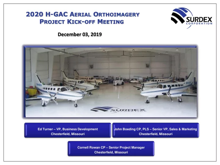
Cornell Rowan CP – Senior Project Manager Chesterfield, Missouri

  2. 2020 H-GAC A ERIAL O RTHOIMAGERY P ROJECT • Cornell Rowan CP • 11 years with Surdex Corporation • B.S. Degree in Engineering Technology • ASPRS Certified Photogrammetrist Since 1997 • More than 34 years in the industry P ROJECT • Former Photogrammetry Manager and Independent Contractor M ANAGER • Project Manager for numerous Private and Government projects in the State of Texas and many other States as well • H-GAC 2016 & 2018 Orthophoto projects and 2017 Hurricane Harvey Orthophoto project • Texas Statewide 2014 - 2016 Orthoimagery project C OMPETITION S ENSITIVE 2

  3. 2020 H-GAC A ERIAL O RTHOIMAGERY P ROJECT • Approximately 100 employees • Financially Sound • 65 years in the industry (Since 1954) • Aerial acquisition – Imagery (film & digital) and LiDAR A BOUT • Imagery and LiDAR Processing • Ground Surveying S URDEX • Aerotriangulation • Orthophotography Production • Planimetric & Topographic Mapping • GIS Services • All production operations based in Chesterfield, MO C OMPETITION S ENSITIVE 3

  4. 2020 H-GAC A ERIAL O RTHOIMAGERY P ROJECT • Clientele • Local government/COG’s • State government (DOT, DNR, statewide, etc.) • Federal government (USGS, USDA, USACE, NGA, A BOUT FEMA, etc.) • Oil & Gas S URDEX • Personnel • Extremely low turnover rate – long-term employees • Numerous with advanced degrees • 9 Certified Photogrammetrists • Registered Land Surveyors C OMPETITION S ENSITIVE 4

  5. 2020 H-GAC A ERIAL O RTHOIMAGERY P ROJECT • Dedicated R&D staff to improve performance, quality, and cost-effectiveness • Algorithm and process development • Hardware and software integration and development • Key resources A BOUT • 10 aircraft with hangar where in-house inspections, maintenance and repairs are performed S URDEX • 9 digital sensors (5-ADS100, 3-DMC, 1-RCD- 30/Oblique) • 4 film cameras • 3 Optech Galaxy LiDAR sensors • 30+ softcopy workstations, including stereoscopic • 2.5 PB of on-line storage C OMPETITION S ENSITIVE 5

  6. 2020 H-GAC A ERIAL O RTHOIMAGERY P ROJECT One of Surdex’s 10 Aircraft Pressurized Twin-Turbine with *RVSM Flight Range: 2,193nm Max Altitude: 1,200 – 35,000 agl Certified Altitude: 35,000msl Cruise Speed: 300+ knots Endurance: * RVSM stands for Reduced Vertical Separation Module – required by the FAA for operations above 28,000’ MSL >6 hours C OMPETITION S ENSITIVE 6

  7. 2020 H-GAC A ERIAL O RTHOIMAGERY P ROJECT Surdex Hangar and In-House Maintenance C OMPETITION S ENSITIVE 7

  8. 2020 H-GAC A ERIAL O RTHOIMAGERY P ROJECT The Leica ADS100 mounted in the Cessna 441 Conquest II – 10 C OMPETITION S ENSITIVE 8

  9. 2020 H-GAC A ERIAL O RTHOIMAGERY P ROJECT Review of Scope and Specifications Surdex Corporation has been contracted to acquire, process and deliver leaf-off true color 6-inch and 12-inch ground sample distance (gsd) orthophotos. • Camera Type: Leica ADS100 Pushbroom Sensor • Acquisition Widow: Late December (after first hard freeze) – Late February (when deciduous trees are bare) • Sun Angle: 30 degrees or greater above the horizon • Airspace: Surdex’s Responsibility • Conditions: Free from haze, fog, dust, smoke, snow or floodwaters (streams must be with normal banks) • Clouds: Less than 5% cloud cover on any single photograph/image or tile • Sidelap: 20 – 30% over entire AOI – Min 15% - Max 45% • Building Lean: Reduced by adding supplemental flightlines • Flight Altitude: 1:1 ration between pixel and ground resolution (6- inch at ~6,250’ agl & 12 - inch at ~12,500’ agl) • Airborne GPS & IMU: Data shall be recorded at all times • Geodetic Control: Existing Control will be utilized and additional points will be surveyed as needed • Image Tile Scheme: Lambert Grid • Image Tile Buffer: No Buffer • Spectral Resolution: 4-band • Projection: State Plane – TX South Central and Central Zones • Horizontal Datum: NAD 1983 (2011) • Horizontal Units: US Foot • Metadata: Conformed to the Federal Geographic Data Committee (FGDC) Content Standard for Digital Geospatial Metadata (FGDC-STD-001-1998) C OMPETITION S ENSITIVE 9

  10. 2020 H-GAC A ERIAL O RTHOIMAGERY P ROJECT Existing Ground Control Diagram – 6-inch and 12-inch GSD C OMPETITION S ENSITIVE 10

  11. 2020 H-GAC A ERIAL O RTHOIMAGERY P ROJECT Existing Ground Control Diagram – 6-inch and 12-inch GSD C OMPETITION S ENSITIVE 11

  12. 2020 H-GAC A ERIAL O RTHOIMAGERY P ROJECT 6-inch and 12-inch Flightlines C OMPETITION S ENSITIVE 12

  13. 2020 H-GAC A ERIAL O RTHOIMAGERY P ROJECT 6-inch and 12-inch Flightlines C OMPETITION S ENSITIVE 13

  14. 2020 H-GAC A ERIAL O RTHOIMAGERY P ROJECT Supplemental Flightlines to be Flown to Reduce Building Lean C OMPETITION S ENSITIVE 14

  15. 2020 H-GAC A ERIAL O RTHOIMAGERY P ROJECT 30 Degree or Greater Sun Angle Chart C OMPETITION S ENSITIVE 15

  16. 2020 H-GAC A ERIAL O RTHOIMAGERY P ROJECT Surdex Flight Tracker C OMPETITION S ENSITIVE 16

  17. 2020 H-GAC A ERIAL O RTHOIMAGERY P ROJECT 6-inch re-sampled to 12-inch C OMPETITION S ENSITIVE 17

  18. 2020 H-GAC A ERIAL O RTHOIMAGERY P ROJECT 6-inch re-sampled to 12-inch C OMPETITION S ENSITIVE 18

  19. 2020 H-GAC A ERIAL O RTHOIMAGERY P ROJECT 6-inch re-sampled to 12-inch C OMPETITION S ENSITIVE 19

  20. 2020 H-GAC A ERIAL O RTHOIMAGERY P ROJECT 6-inch and 12-inch Lambert Grids C OMPETITION S ENSITIVE 20

  21. 2020 H-GAC A ERIAL O RTHOIMAGERY P ROJECT 6-inch and 12-inch Lambert Grids C OMPETITION S ENSITIVE 21

  22. 2020 H-GAC A ERIAL O RTHOIMAGERY P ROJECT SurCheck ■ Surdex web-based client product inspection tool  Data resides at Surdex  Corrections made based on client inspection results  Delivery after validated corrections  ESRI ImageServer piped through a web browser  Seamless roam of product image data  Base Maps for product validation  Base Map swipe feature  Overlays (tile layout, seamlines, previous project imagery, etc.)  Client ability to overlay graphics  Tracking of shipping, acceptance, correction dates  Robust statistics C OMPETITION S ENSITIVE 22

  23. 2020 H-GAC A ERIAL O RTHOIMAGERY P ROJECT SurCheck – Client Review C OMPETITION S ENSITIVE 23

  24. 2020 H-GAC A ERIAL O RTHOIMAGERY P ROJECT Preliminary Project Production Schedule C OMPETITION S ENSITIVE 24

  25. 2020 H-GAC A ERIAL O RTHOIMAGERY P ROJECT Building Lean C OMPETITION S ENSITIVE 25

  26. 2020 H-GAC A ERIAL O RTHOIMAGERY P ROJECT Seamline C OMPETITION S ENSITIVE 26

  27. 2020 H-GAC A ERIAL O RTHOIMAGERY P ROJECT Seamline C OMPETITION S ENSITIVE 27

  28. 2020 H-GAC A ERIAL O RTHOIMAGERY P ROJECT Building Lean and Seamline C OMPETITION S ENSITIVE 28

  29. 2020 H-GAC A ERIAL O RTHOIMAGERY P ROJECT Surdex Web Hosting of 2020 Orthoimagery ■ Surdex will create separate web hosting services for each partner/area and provide a dedicated e-mail to a group of web administrators to setup user accounts for each partner as needed. ■ Surdex will provide sample connection strings for Web Mapping Services typically used in CAD and other GIS packages and how to add a connection in ESRI software. C OMPETITION S ENSITIVE 29

  30. 2020 H-GAC A ERIAL O RTHOIMAGERY P ROJECT Questions… Answers… C OMPETITION S ENSITIVE 30

Download Presentation
Download Policy: The content available on the website is offered to you 'AS IS' for your personal information and use only. It cannot be commercialized, licensed, or distributed on other websites without prior consent from the author. To download a presentation, simply click this link. If you encounter any difficulties during the download process, it's possible that the publisher has removed the file from their server.

Recommend


More recommend