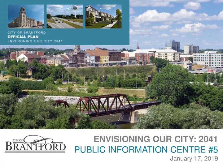
Study Process The City of Brantford is undertaking three studies to - - PowerPoint PPT Presentation

study process
SMART_READER_LITE
LIVE PREVIEW

Study Process The City of Brantford is undertaking three studies to - - PowerPoint PPT Presentation

ENVISIONING OUR CITY: 2041 PUBLIC INFORMATION CENTRE #5 January 17, 2019 Study Process The City of Brantford is undertaking three studies to guide future development to 2041 and to take into account the Boundary Expansion Lands transferred


slide-1
SLIDE 1

ENVISIONING OUR CITY: 2041 PUBLIC INFORMATION CENTRE #5

January 17, 2019

slide-2
SLIDE 2

2

Study Process

The City of Brantford is undertaking three studies to guide future development to 2041 and to take into account the Boundary Expansion Lands transferred from Brant County to the City in January 2017:

Official Plan Review Master Servicing Plan Update Transportation Master Plan Update

slide-3
SLIDE 3

3

Purpose of this PIC

1) Outline key outputs from Municipal Comprehensive Review:

  • Alternative Intensification Target
  • Alternative Designated Greenfield Density

Target

  • Amount of Employment Land Needs
  • Amount of Community Land Needs

2) Options on where new Growth Should be Located 3) Land Use Options 4) Workshop on Growth and Land Use Options

slide-4
SLIDE 4

4

SGL Planning & Design Inc.

Urban Boundary Expansion, Secondary Plan

The Planning Partnership

Official Plan, Consultation

Cushman & Wakefield

Real Estate

AgPlan

Agricultural Consultants

GM BluePlan Engineering Ltd.

Municipal Servicing

Plan B Natural Heritage

Landscape Ecology and Natural Heritage Planning

ASI

Heritage Culture, Archaeology, Indigenous Engagement

Ecosystem Recovery Inc.

Natural Resources Engineering, Stormwater Management

Dillon

Transportation

Consultants

slide-5
SLIDE 5

Opportunities to be Involved in the Process

5

Public Information Centre #1

Update on project and process

Public Information Centre #2

Municipal Comprehensive Review, Employment Conversions & Growth Options Kick off of Environmental Assessment for Boundary Expansion Lands

Public Information Centre #3

Municipal Comprehensive Review, Land Needs Assessment, Urban Boundary Expansion

Public Information Centre #4

Vision and Principles for Development in the Boundary Expansion Lands

v v v v v v v v

Public Information Centre #5

Options for Community Design in the Boundary Expansion Lands

Public Information Centre #6

Preferred Land Use Plan for the Boundary Expansion Lands

Statutory Public Open House

Draft Official Plan

Statutory Public Meeting and Council Presentation

Official Plan

2017

September 11 November 16

2018

May 17 June 21

2019

January 17 June

9

Fall Winter

slide-6
SLIDE 6

Presentation

6

Municipal Comprehensive Review

– Alternative Target – Alternative Greenfield Area Density Target – Employment Land Needs to Accommodate 2041 forecast – Community Land Needs to Accommodate 2041 forecast

slide-7
SLIDE 7

7

Targets for employment and population growth

2016 2041 Total 2016-2041 Growth Population 101,710 163,000 61,290 Employment 44,890 79,000 34,110

Municipal Comprehensive Review Land Needs

slide-8
SLIDE 8

8

Municipal Comprehensive Review Employment Land Needs

Employment density determined by reviewing current job density and nature of future employment.

slide-9
SLIDE 9
  • Substantial shift in the housing market required.
  • Recommend to continue shift towards medium and

higher density housing.

  • Slowly increase intensification target:

9

Municipal Comprehensive Review Alternative Intensification Target

40% to 2021 45% 2021 to 2031 50% 2031 to 2041 = 12,400 units

slide-10
SLIDE 10
  • A reasonable distribution of units by type to the various

geographical components of the Built-up Area would include:

  • 650 single and semi-detached units in the existing neighbourhoods;
  • 1,250 second units in the existing neighbourhoods;
  • 800 townhouses in the existing neighbourhoods;
  • 1,000 student housing units;
  • 3,400 townhouse in the Intensification Corridors and Major

commercial sites;

  • 1,300 apartments in the Intensification Corridors and Major

commercial sites; and

  • 3,900 apartments in the Downtown Urban Growth Centre.

10

Municipal Comprehensive Review Intensification Strategy

slide-11
SLIDE 11

11

Municipal Comprehensive Review Designated Greenfield Area Targets

slide-12
SLIDE 12
  • Alternative DGA Density target is 52 residents and jobs

combined per hectare.

  • This will be achieved by:

12

Municipal Comprehensive Review Alternative DGA Density Target

  • Existing DGA – 47 residents and jobs combined

per hectare;

  • Vacant lands in existing DGA – 55 residents and

jobs combined per hectare;

  • New DGA – 60 residents and jobs combined per

hectare.

  • New DGA to be planned to achieve mix of 55%

Singles and Semis / 40% Townhouses / 5% Apartments.

slide-13
SLIDE 13

13

Municipal Comprehensive Review Community Area Land Needs

2041 DGA RESIDENTS AND JOBS

Population 52,465 Employment 6,451 Total Residents and Jobs in DGA 58,916 Less Minimum Residents and Jobs to be accommodated in Existing DGA 31,344 Total Residents and Jobs in New DGA 27,572

slide-14
SLIDE 14

Presentation

14

Municipal Comprehensive Review – Where New Growth Should be Located

slide-15
SLIDE 15

15

Boundary Expansion Lands Boundary Expansion

Total Area = 2,700 ha

Natural Heritage System = 980 ha 2017 Urban Boundary Lands = 270 ha Trigger Lands = 360 ha

Total Developable Lands = 1,090 ha

slide-16
SLIDE 16
  • To accommodate 2041 population and

employment forecasts, need:

  • 336 hectares Employment lands
  • 460 hectares Community lands

16

Boundary Expansion Lands Boundary Expansion

slide-17
SLIDE 17

Divided into 18 Block Areas:

  • 11 Community Blocks
  • 7 Employment Blocks

17

Potential Expansion Lands Boundary Expansion Lands

slide-18
SLIDE 18
  • Study team developed a series of Principles and

criteria to evaluate the 18 Blocks.

  • Each Block was analyzed and ranked from Most

Preferred to Least Preferred for each principle.

  • Identified specific constraints and trade-offs for

each Block.

  • Identified potential for mitigation, management
  • r phasing measures to address constraints for

each Block.

18

Boundary Expansion Lands Boundary Expansion Lands

slide-19
SLIDE 19
  • Community Area Options:

19

Boundary Expansion Lands Preferred Expansion Lands

  • Blocks C1, C2, C4, C5, C7 and C11 are preferred.
  • Blocks C10, C8 and C6 each have constraints due

to isolation and servicing.

  • Two Community Area Options carried forward.
  • Employment Area Options:
  • Blocks E3, E4, E5, E6, E7 and south portion of E1

and E2 are preferred.

slide-20
SLIDE 20

Most preferred Community Options:

  • C1, C2, C4, C5, C7, C10, C11 and west portion of

C8.

  • Total of 460 hectares.

Most preferred Employment Options:

  • E3, E4, E5, E6, E7 and South portion of E1 and E2
  • Total of 336 hectares.

20

Boundary Expansion Lands Option 1

slide-21
SLIDE 21

21

Boundary Expansion Lands Option 2

Most preferred Community Options:

  • C1, C2, C3, C4, C5, C7 and South portion of C6.
  • Total of 460 hectares.

Most preferred Employment Options:

  • E3, E4, E5, E6, E7 and South portion of E1 and E2.
  • Total of 336 hectares.
slide-22
SLIDE 22

Presentation

22

Land Use Options – North Options – Tutela Heights Options

slide-23
SLIDE 23

Draft Planning Principles

Natural Heritage Preservation Cultural Heritage Protection and Integration Housing Choice Full Range of Community Amenities Mobility Choice Walkability Sustainability Sense of Place

slide-24
SLIDE 24

Land Use Options

24

Natural Heritage System

  • Natural Heritage System same in all options.
  • Includes significant natural heritage features and buffers.
  • Includes headwater drainage features that have to be protected and maintained.
slide-25
SLIDE 25

Land Use Options

25

Natural Heritage System

  • All headwater drainage features

evaluated.

  • Categorized into Protection, Conservation

and Mitigation.

  • Protection: feature to remain with buffer.
  • Conservation: feature to remain but can

be altered.

  • Mitigation: feature can be removed but

function must be maintained.

slide-26
SLIDE 26

Land Use Options

26

Natural Heritage System

  • Other Environmental Features also identified.
  • Features to be studied through an EIS at draft plan of subdivision stage.
slide-27
SLIDE 27

Road Options - Option 1A

27

  • Arterial Roads:
  • King George Rd. / Highway 24 - maintained as a Controlled Access Major Arterial.
  • Wayne Gretzky Pkwy. - Extended to Park Rd. as a Major Arterial.
  • Collector Roads:
  • East-west collector road north of Powerline Rd.
  • North-south collector roads connecting to roads south of Powerline Rd.
slide-28
SLIDE 28

Road Options - Option 2A

28

  • Arterial Roads:
  • Same as Option 1A
  • Collector Roads:
  • Additional east-west collector road north of Jones Creek
  • North-south collector road links area north and south of Jones Creek.
slide-29
SLIDE 29

Road Options - Option 1B

29

  • Arterial Roads:
  • King George Rd. is a Major Arterial;
  • Wayne Gretzky Pkwy. extended to Park Rd. as a Controlled Access Major Arterial;
  • Garden Ave. extended as a Major Arterial.
  • Collector Roads:
  • Same as 1A
slide-30
SLIDE 30

Road Options - Option 2B

30

  • Arterial Roads:
  • Same as 1B
  • Collector Roads:
  • Same as 2A
slide-31
SLIDE 31

Active Transportation Network

31

On and Off-road Active Transportation Network Identified

slide-32
SLIDE 32

Land Use Options

32

  • Two land use options created for each of Boundary Options 1 and 2.
  • Options 1A and 2A are similar except for the difference in Settlement Area Boundary.
slide-33
SLIDE 33

Land Use Options

33

Option 1B and 2B are similar except for the difference in Settlement Area Boundary.

slide-34
SLIDE 34

Land Use Options

34

Neighbourhood Corridor & Neighbourhood Centre

  • Comprised of low rise multi-unit housing - townhouses, low rise apartments.
  • Neighbourhood Centres also comprised of grocery stores and local retail,

services, library and community centre.

  • Option 1A focused along new east-west collector road.
slide-35
SLIDE 35

Land Use Options

35

Neighbourhood Corridor & Neighbourhood Centres

  • Option 2A also focused along east-west collector north of Jones Creek.
slide-36
SLIDE 36

Land Use Options

36

Neighbourhood Corridor & Neighbourhood Centres

  • Option 1B focused along Powerline Rd.
slide-37
SLIDE 37

Land Use Options

37

Neighbourhood Corridor & Neighbourhood Centres

  • Option 2B focused along Powerline Rd. and along King George Rd. and

Park Rd. north of Jones Creek.

slide-38
SLIDE 38

Land Use Options

38

Greenfield Intensification Corridor & Community Commercial Mixed Use

  • Greenfield Intensification Corridor comprised of multi-unit housing, retail and

mixed use.

  • Community Commercial Mixed Use comprised of grocery stores and other

major retail.

  • Options 1A and 2A:
  • Greenfield Intensification Corridor along Park Rd.
  • Community Commercial along King George Rd.
slide-39
SLIDE 39

Land Use Options

39

Greenfield Intensification Corridor & Community Commercial Mixed Use

  • Options 1B and 2B:
  • Greenfield Intensification Corridor along King George Rd.
  • Community Commercial along Park Rd.
slide-40
SLIDE 40

Land Use Options

40

Neighbourhood Residential

  • Comprised primarily of single detached and semi-detached

houses with some townhouses.

  • Represents remaining Community Areas.
slide-41
SLIDE 41

Land Use Options

41

Neighbourhood Residential

slide-42
SLIDE 42

Land Use Options

42

Neighbourhood Residential

slide-43
SLIDE 43

Land Use Options

43

Neighbourhood Residential

slide-44
SLIDE 44

Land Use Options

44

Employment

  • Prestige Employment comprised of offices & light

industrial.

  • General Industrial comprised of full range of

manufacturing and outdoor storage.

  • Employment Supportive comprised of retail and

service commercial serving the employment areas.

  • Options 1A and 2A are the same:
  • Prestige Employment located close to Hwy

403 & Powerline Rd.

  • Employment Supportive distributed along

Paris Rd., Powerline Rd. & Garden Ave.

slide-45
SLIDE 45

Land Use Options

45

Employment

  • Options 1B and 2B are the same.
  • More Prestige Employment along west boundary with Brant County.
  • Employment Supportive along Powerline Rd. at Paris Rd. and Golf Rd. and along Adams Rd.
slide-46
SLIDE 46

Land Use Options

46

Parks and Schools

  • Same number in each option.
  • Neighbourhood Parks distributed to achieve 5 minute

walking distance:

  • Approximately 1.5 ha.
  • Accommodate one sports field and play

structures.

  • One Community Park in each option:
  • 4 ha. to accommodate multiple sports fields
  • Elementary schools located adjacent to a

Neighbourhood Park.

  • One Secondary School in each option.
  • Options 1A and 2A:
  • Community Park Central.
  • Secondary School near Wayne Gretzky

Parkway extension.

slide-47
SLIDE 47

Land Use Options

47

Parks and Schools

  • Option 2A
slide-48
SLIDE 48

Land Use Options

48

Parks and Schools

  • Options 1B and 2B:
  • Community Park located further to the west.
  • Secondary School near King George Rd.
slide-49
SLIDE 49

Land Use Options

49

Parks and Schools

  • Option 2B
slide-50
SLIDE 50

Land Use Options

50

Natural Heritage System

  • Natural Heritage System same in all options.
  • Includes significant natural heritage features and buffers.
  • Includes headwater drainage features that have to be protected and maintained.
slide-51
SLIDE 51

Land Use Options

51

Natural Heritage System

  • All headwater drainage features

evaluated.

  • Categorized into Protection, Conservation

and Mitigation.

  • Protection to remain with buffer.
  • Conservation to remain but can be

moved.

  • Mitigation can be removed but function

must be maintained.

slide-52
SLIDE 52

Land Use Options

52

Natural Heritage System

  • Other Environmental Features also identified.
  • Features to be studied through an EIS at draft plan of subdivision stage.
slide-53
SLIDE 53

Tutela Heights Land Use Options

53

Option 1

  • Conklin Rd. extended to link to Phelps Rd.
  • Suburban Residential:
  • Existing Residential Area.
  • Large estate lots.
  • Transitional Residential:
  • Large urban lots act as a transition to estate

lots.

  • Abutting Suburban Residential lots.
  • Neighbourhood Residential:
  • Similar permitted uses as in North Options.
  • Neighbourhood Corridor:
  • Similar permitted uses as in North Options.
  • Located at Conklin Road and opposite

Tutela Heights Road at Mount Pleasant Road.

  • Parks: 3 new parks.
  • Road Closure.
slide-54
SLIDE 54

Tutela Heights Land Use Options

54

Option 2

  • Transitional Residential:
  • Larger area than in Option 1.
  • Neighbourhood Corridor:
  • Located on new collector road.
slide-55
SLIDE 55

Water Stormwater Wastewater – Land Use Option 2A/B Wastewater – Landuse Option 1A/B

North Lands– Water, Wastewater, and Stormwater Servicing

55

slide-56
SLIDE 56

Tutela Heights – Water, Wastewater, and Stormwater Servicing

Water Stormwater Wastewater Option 2 – Connect at Gilkison St Wastewater Option 1 – Connect at Mount Pleasant Rd

56

slide-57
SLIDE 57

57

slide-58
SLIDE 58

58

slide-59
SLIDE 59

59

slide-60
SLIDE 60

60