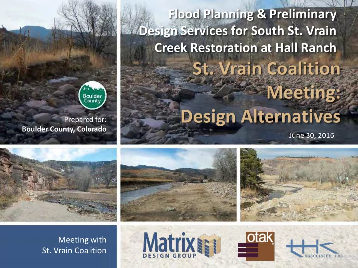
SLIDE 1 Flood Planning & Preliminary Design Services for South St. Vrain Creek Restoration at Hall Ranch
Meeting with
June 30, 2016 Prepared for: Boulder County, Colorado
Meeting: Design Alternatives
SLIDE 2
I ntroduction
Introduction
§ Purpose of meeting: Design Alternatives
Project website
§ www.BoulderCountyOpenSpace.org/ssv
SLIDE 3
Matrix Team
SLIDE 4
Project Area
SLIDE 5
Project Schedule
Design schedule
§ Notice to Proceed: May 2016 § Alternatives Compiled: June 2016 § Preferred Alternative: July 2016 § 30% Draft Design: August 2016 § Final Deliverable: September 2016
SLIDE 6
W ork to Date
Riparian and Wetland Assessment Aquatics and Terrestrial Concerns Sediment Sampling Homeowner Meetings Existing/Ongoing Project Coordination
SLIDE 7 Project Goals Statem ent
Provide a conceptual design for the entire South Saint Vrain Creek project area that restores and improves the channel and surrounding floodplain areas to a safe, natural, resilient, functioning, and ecologically rich habitat. This project will use qualitative research, quantitative data, and community input to inform resilient design that shall utilize natural system principles and onsite materials to expedite recovery from the 2013 floods and set up for better performance in future flood events. Components to meet goals include incorporating natural channel diversity and character, re-establishing floodplain benches for lateral connectivity, reducing longitudinal connectivity constraints, improving flow conveyance and sediment transport to maintain environmental values, promote naturally functioning stream processes, protect public and private infrastructure, improve public safety, repair unstable erosion scars in high-risk areas, and revegetate denuded areas.
SLIDE 8
Decision Making Process
SLIDE 9
Prioritization Criteria
SLIDE 10 Alternatives: I ssue & Reach Based
Alternatives and Strategies:
§ Floodplain Connectivity § Channel Complexity § Revegetation § Infrastructure Protection
Master Plan: The purpose of this alternative is to implement a
channel alignment that will optimize the interaction with completed,
- ngoing, and funded projects while being sensitive to the constraints
presented by the presence of numerous private residences throughout this river corridor. The implementation of this alternative will expedite the maturation of this reach by re-establishing a natural channel, repairing erosion scars, re-establishing floodplain benches, building point-bars and excavating pools, revegetating denuded areas, and stabilizing channel banks.
SLIDE 11
Alternative: Floodplain Connectivity
Floodplain connectivity involves activating the floodplain at frequent intervals to enable critical floodplain functions, including:
§ Sediment storage § Reduction of erosive forces in main channel § Nutrient transfer § Healthy riparian/wetland ecosystem
Strategies to establish floodplain connectivity include:
§ Activating overflow channels § Incorporating channel/floodplain benching (sediment removal)
SLIDE 12
Alternative: Floodplain Connectivity
SLIDE 13
Alternative: Channel Com plexity
Channel complexity refers to channel features that contribute to geomorphically effective bedforms, as well as habitat quality and diversity
§ Low Flow Channel § Pools, riffles, steps § Bars (point, lateral, mid-channel) § Large woody material (bank protection/habitat enhancement) § Roughened channels/boulder clusters
SLIDE 14
Alternative: Channel Com plexity
SLIDE 15
Alternative: Channel Com plexity
SLIDE 16 Alternative: Revegetation
Revegetation will provide the framework for increased ecosystem function and aesthetic appeal along the corridor. Our team will:
§ Protect and preserve existing stands of vegetation § Incorporate bioengineering measures to increase habitat maturation and resiliency § Plant a diverse palette of native plant species
§ Willow clusters § Cottonwood galleries § Wetlands (perennials) § Riparian benches (perennials and woody plants) § Upland meadows (grasses, wildflowers and trees)
SLIDE 17 Alternative: Revegetation
Riparian Woodlands/ Fringe Wetlands Open Water Channel Cottonwood Gallery Shrub/ Grassland Riparian/ Fringe Wetlands Cottonwood Gallery Shrub/ Grassland 100 Year Floodplain Residual Terrace Third Terrace Second Terrace Floodplain Bench Floodplain Bench First Terrace Second Terrace Third Terrace Cotton Wood Gallery Wetland/Riparian Bench Grassland Meadow
SLIDE 18
Alternative: I nfrastructure
Infrastructure: Roads, Bridges, Houses, Ditches Bank Stabilization
§ Bioengineering § Buried Rootwads
Offset Buried Natural/Structural Aspects
§ Buried Riprap Revetment § Buried Boulders § Structural Walls
Channel Alignment: In-depth Analysis Required
§ Slope, Sinuosity, Wavelength, Belt Width
Detention Cost
SLIDE 19 Alternative: I nfrastructure Protection
Root Wad Stabilization Boulder Toe Protection Utility Armoring Vegetated Geogrid
SLIDE 20 Em ergency W atershed Protection ( EW P)
Colorado Emergency Watershed Protection (EWP) Program, Phase II
SLIDE 21 21
Lefthand Watershed Oversight Group Public Meeting 4/11/2016
Purpose: Implement emergency recovery measures to protect life and property in watersheds impaired by a natural disaster Funding: $63.2 mil. total/ $47.4 mil. federal State Sponsor: Colorado Water Conservation Board Local Sponsors: Counties, cities/towns, watershed coalitions, others Timeline: April 1, 2018 technical assistance agreement ends
Em ergency W atershed Protection ( EW P)
SLIDE 22 22
Lefthand Watershed Oversight Group Public Meeting 4/11/2016
Safety - Purpose of projects: protect life safety and property from future flooding and erosion No Cost to Landowner- Projects funded through federal, state, and local sponsors without capital cost to landowners, can opt
- ut at any time before final design
Holistic Approach - Opportunity to:
§ Design projects as a system and minimize impacts to downstream properties § Address some reach-wide water and sediment management issues
Stream and Habitat Health - Improve overall ecological health and resiliency of your property Opportunities for Multiple Benefits:
§ Stabilize stream channels § Reconnect floodplains with streams § Manage sediment § Reduce hazards and improve flood conveyance § Improve habitat § Enhance recreational opportunities
EW P: Benefits Landow ners
SLIDE 23 23
Lefthand Watershed Oversight Group Public Meeting 4/11/2016
Key Topics for Collaboration and Agreement
EW P: Benefits Landow ners
Channel Location Landscape Features Vegetation Planting
SLIDE 24
Preferred Alternative
Combination of Alternatives Decision Matrix Engineering/Science Based Judgements Consensus and Buyoff from Stakeholders Understanding Construction Project Goals and Funding
SLIDE 25
Site Visit w ith Stakeholders
Opportunity to walk sites with team to understand alternatives and preferred alternative Week of July 18th
SLIDE 26
W hat’s Next?
Evaluate Alternatives with Decision Making Matrix Prioritize Alternatives Sediment Transport Analysis Geomorphic Site Survey Draft 30% Designs Final 30% Designs