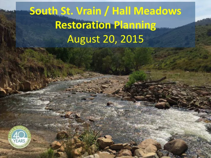
SLIDE 1
South St. Vrain / Hall Meadows Restoration Planning August 20, 2015
SLIDE 2 Agenda
- Introductions
- Purpose & Goals of Meeting
- Planning Area
- Master Plan
- Restoration Planning: Cost Estimates, Grants,
Scope, Timeline
SLIDE 3 Purpose & Goal
- Purpose: to discuss creek restoration along
South St. Vrain Creek with neighbors and
– to get up-to-speed on the planning area, grants, scope, timeline, and next steps – to listen to opportunities and constraints
SLIDE 4 Watershed Recovery
Future Creek Projects Funding and Implementation Emergency Response Immediate Threat Assessment and Mitigation Long-Term Vision Watershed Master Plans
SLIDE 5
South St. Vrain / Hall Meadows Planning Area
SLIDE 6
South St. Vrain / Hall Meadows Management Plans and Assessments
SLIDE 7 County Assessments & Plans
- Boulder County Comprehensive Plan – Environmental
Resource Element (2014)
- Hall Ranch Meadows Natural Resource Assessment (2005)
- St. Vrain Creek Open Space Management Plan (2004)
- Environmental Assessment – South St. Vrain Creek (2000)
- Resource Assessment Report – Custode Property (2000)
- North Foothills Management Plan (1996)
SLIDE 8 Management
- Boulder County Comprehensive Plan –
Environmental Resources Element (2014)
– Critical Wildlife Habitat #7, St. Vrain Corridor – Significant Natural Communities – Riparian and Wetland Areas – Riparian Habitat Connectors – Preble’s Meadow Jumping Mouse (PMJM) Habitat Conservation Area
SLIDE 9 Management
- St. Vrain Creek Corridor Open Space Management Plan
- Corridor designated as “Natural” and “Agriculture”
- The vision for the county open space properties along
- St. Vrain Creek is:
Boulder County Parks and Open Space (BCPOS) responsibly and innovatively manages the County's water resources for diverse
- purposes. These resources are managed in an effective, sustainable,
and efficient manner to support agriculture, provide quality visitor use opportunities, maintain viable riparian corridors, and for other environmental benefits. Stakeholders, government agencies, and BCPOS staff work together as stewards to ensure the protection and
- ptimum utilization of these resources. (BCPOS 2004, p. 9)
SLIDE 10 Management
North Foothills Management Plan
- Corridor designated as important bird habitat
- Some of the management goals include:
– Protect and properly manage Conservation Areas, Significant Plant Communities, and rare plants. – Manage vegetative communities by maintaining and encouraging desirable native species, restoring degraded areas, and eliminating or controlling undesirable exotic species. – Manage for ecosystem integrity by encouraging and planning for naturally occurring processes, or the simulation of those processes, so they will remain vital components of the ecosystem. – The management direction is toward protecting critical resources, encouraging native species over exotic, and maintaining natural
- processes. Where feasible, a passive approach of letting nature take
its course will be utilized (p. 19)
SLIDE 11
Post-Flood Work
SLIDE 12
SLIDE 13
Hall II – Lyons Quarry Post-Flood / Pre-Clean Up
SLIDE 14
Hall II – Lyons Quarry Post-Flood / Pre-Clean Up
SLIDE 15
Hall II – Lyons Quarry
SLIDE 16
Hall II – Lyons Quarry
SLIDE 17
Hall II – Lyons Quarry
SLIDE 18
Hall II – Lyons Quarry
SLIDE 19
Hall II – Access Road (FEMA)
SLIDE 20
Andesite Bridge (FEMA – BC Transportation)
SLIDE 21
Andesite Bridge (FEMA – BC Transportation)
SLIDE 22
SLIDE 23
Secondary Channel – Spring 2014
SLIDE 24
Secondary Channel – October 2014
SLIDE 25
Secondary Channel – August 2015
SLIDE 26
Secondary Channel – August 2015
SLIDE 27
South Ledge & Meadows Diversion
SLIDE 28
SLIDE 29
SLIDE 30
Watershed Master Plan
- Prepared through the St. Vrain Creek Coalition
- Adopted by Board of County Commissioners
- n February 26, 2015
- “Roadmap for long-term recovery”
– Geomorphic Assessments – Ecological Assessments – Conceptual-level Designs – Prioritization
SLIDE 31 Geomorphic Assessment
Due to the nature of the South St. Vrain Creek…(slope, channel characteristics, bed material, etc.) the channel will tend to migrate and avulse for a range of hydrologic conditions. Absent of large flow events, the channel plan form for these reaches will likely remain reasonably stable once stream bank vegetation has re-established. However, beyond some threshold discharge the channel plan form can be expected to change, and in some instances change significantly due to avulsion and migration. Consequently, it is recommended that in most instances along…South St. Vrain Creek that the channel be left in the current (post-flood) alignment…In areas where it may be necessary to reclaim limited amounts of private property or protect infrastructure (including bridges, roadways and utilities), minor realignment
- f the main channel may be necessary. In addition, the use of localized rock
riprap bank protection is recommended to stabilize local sections of the channel where necessary. However, it should be recognized that in these reaches it will not likely be possible to stabilize the channel plan form over long reaches, for a range of high flow conditions. (pp. 4-5)
- St. Vrain Creek Watershed Master Plan: Quantification of Geomorphic Parameters, Anderson Consulting, Inc., August 7, 2014
SLIDE 32 Geomorphic Assessment
At the mouth (near the gravel quarry upstream
- f Lyons) the valley slope significantly flattens,
the channel becomes unconfined and the South St Vrain becomes a highly depositional riffle- pool gravel dominated C-type channel with a propensity for braiding and meandering. (p. 6)
Geomorphic Assessment of St. Vrain Creek System, Walsh Environmental, July 28, 2014
SLIDE 33
SLIDE 34
SLIDE 35 Geomorphic Assessment
Channelization (straightening) and stream bank armoring occurs throughout the St. Vrain Creek system. The response of the stream system to these modifications typically occurs within and beyond the modified reach and frequently begins with a bed incision process. As channels incise or berms are constructed, channels are disconnected from their floodplains, and in turn, the excess energy in the system causes an increase in erosion laterally and/or vertically. The increased erosion leads to an increase in sediment load transferred downstream of the channelized reach, where the channel may not have the capacity to continue to move the sediment through, ultimately leading to bed aggradation. (p. 14)
Geomorphic Assessment of St. Vrain Creek System, Walsh Environmental, July 28, 2014
SLIDE 36 Geomorphic Assessment
When possible the St. Vrain Coalition should seek to maintain a naturally meandering stream with frequent opportunities for floodplain access. (p. 14) Floodplains play an important role in dissipating stream energy and provide low-risk locations for natural sediment deposition in addition to providing ecological complexity and good riparian
Geomorphic Assessment of St. Vrain Creek System, Walsh Environmental, July 28, 2014
SLIDE 37 Geomorphic Assessment
Overflow channels and flood chutes carved though the floodplains during the 2013 flood provide
- pportunities for seasonal floodplain access. It is
recommended that the St. Vrain Coalition prioritize protecting and restoring these locations as well as the wider channel corridor from the impacts of development, in order to reap the multiple benefits of increased flood protection and improved stream health provided by floodplain access and seasonal side channels. (p. 14)
Geomorphic Assessment of St. Vrain Creek System, Walsh Environmental, July 28, 2014
SLIDE 38 Ecological Assessment
SSV02 = Old St. Vrain Road bridge to quarry
– Channel Condition = 3 – Hydrologic Alteration = 7 – Bank Condition = 2 – Riparian Quantity = 3 – Riparian Quality = 1 – Canopy Cover = 1 – Nutrient Enrichment = 10 – Manure or Septic = 10 – Pools = 1 – Barriers to Movement = 10 – Fish Habitat Complexity = 4 – Aquatic Invertebrate Habitat = 5
Table 3, Page 8, Rapid Ecological Assessment of St. Vrain Creek Corridor, Walsh Environmental, July 15, 2014
SLIDE 39 Ecological Assessment
Recommendation SSV02: Develop sediment transport/channel alignment plan through this reach; regrade floodplain while keeping floodplain access; protect as depositional reach
Table 4, Page 9, Rapid Ecological Assessment of St. Vrain Creek Corridor, Walsh Environmental, July 15, 2014
SLIDE 40
- St. Vrain Creek Watershed
Master Plan
- Tier 1 - Projects reducing flood risk due to
post-flood conditions
– Natural channel design – Provide protection of infrastructure including ditches, homes, roads, and the town of Lyons – Ecological restoration
SLIDE 41
- St. Vrain Creek Watershed
Master Plan
The purpose of this alternative is to implement a channel alignment that will optimize the interaction with completed, ongoing, and funded projects while being sensitive to the constraints presented by the presence of numerous private residences throughout this river corridor. The implementation
- f this alternative will expedite the maturation of
this reach by re-establishing a natural channel, repairing erosion scars, re-establishing floodplain benches, building point-bars and excavating pools, re-vegetating denuded areas, and stabilizing channel banks. (p. 7-18).
SLIDE 42
SLIDE 43
SLIDE 44
SLIDE 45 Master Plan Cost Estimate
BCPOS Estimated Total Cost = $5.6 million
(removed fill, reduced revegetation, less bank protection)
SLIDE 46 Funding to Date
- Colorado Water Conservation Board - CWCB
Stream Restoration Grant = $110,000
– Planning, design, and demonstration project
- Community Development Block Grant – Disaster
Relief (CDBG-DR) – Colorado Watershed Resilience Planning Grant Program = $295,000
– Planning, engineering, surveys, and up to 30% design
SLIDE 47 CDBG-DR Project Scope
– 3.2 mile stretch of the South St. Vrain Creek – Custode to the end of the Hall Ranch property at Old
– Public and private lands
- The project will consist of:
– engineering analysis and surveys, including hydraulics, geomorphological and sediment transport studies – 30% design (preliminary)
SLIDE 48
South St. Vrain / Hall Meadows Planning Area
SLIDE 49 Technical
- Hydrology & Hydraulics
- Sediment Transport
- Environmental Resources
- Restoration Options & Prioritization
- Permitting (local, state, and federal)
- Implementation
- Grant Management
- Public Outreach
SLIDE 50 Harman, W., R. Starr, M. Carter, K. Tweedy, M. Clemmons, K. Suggs, C. Miller. 2012. A Function- Based Framework for Stream Assessment and Restoration Projects. US Environmental Protection Agency, Office of Wetlands, Oceans, and Watersheds, Washington, DC EPA 843-K-12-006.
SLIDE 51 CDBG-DR Grant Timeline
- Grant Contract (September-October ’15)
- Request for Proposal (90 days from contract)
- Engineering and Surveys (winter – summer ’16)
- Design - Alternatives & Priorities (summer-fall 2016)
- Implementation including Permitting and
Construction – TBD * Public, SVCC, and other stakeholder outreach and input at various points throughout project
SLIDE 52 Future Projects
- PROJECTS DEPENDANT ON FUTURE FUNDS
- Potentially prioritize projects:
– Protect infrastructure in the reach between the Andesite Quarry & Old St. Vrain Road bridges – Ecological values
SLIDE 53
Design Considerations
SLIDE 54 Design Considerations
- Maintain natural creek processes
- Resilience measures where appropriate:
– natural stream design to increase bank & channel stability – a reduction in maximum flow velocity through increased floodplain connectivity – other mitigation measures as appropriate
- Restore and protect habitat
– low flow channel with a lower width-to-depth ratio – increased in-stream habitat complexity – revegetation with native species
- Channel realignment at specific locations if necessary
SLIDE 55 Design Considerations
- Private Homes, Property, and Infrastructure
- Downstream Impacts
- Roadways
- Bridges
- Ditches
- Conveyance
- Debris/Hazards
- Other Studies
- $$$$
SLIDE 56 Design Considerations
- Questions, Ideas, Concerns
- What are your priority areas?
- What considerations are we missing?