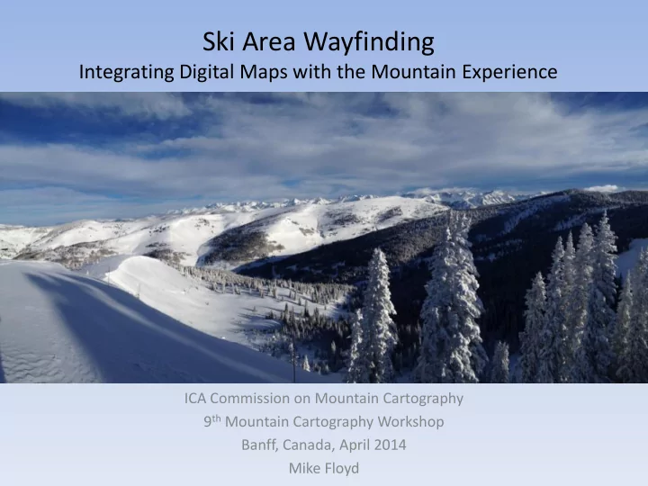
Ski Area Wayfinding Integrating Digital Maps with the Mountain - - PowerPoint PPT Presentation

ski area wayfinding
SMART_READER_LITE
LIVE PREVIEW

Ski Area Wayfinding Integrating Digital Maps with the Mountain - - PowerPoint PPT Presentation

Ski Area Wayfinding Integrating Digital Maps with the Mountain Experience ICA Commission on Mountain Cartography 9 th Mountain Cartography Workshop Banff, Canada, April 2014 Mike Floyd The Problem Skiing: the bigger the terrain, the better


slide-1
SLIDE 1

Ski Area Wayfinding

Integrating Digital Maps with the Mountain Experience

ICA Commission on Mountain Cartography 9th Mountain Cartography Workshop Banff, Canada, April 2014 Mike Floyd

slide-2
SLIDE 2
  • Skiing: the bigger the terrain, the better
  • But wait…..
  • Skier numbers are declining across the industry
  • Ski Patrol: people get hurt and lost; patrollers

respond, putting their lives on the line

  • Risk Management: protect employees and guests
  • Cartography as a wayfinding tool

The Problem

slide-3
SLIDE 3

How often do significant injuries

  • ccur?
  • Skier injury rate: 1 per 1000 skier days
  • Snowboarding injury rate: 1 per 600 days
  • On an average midwinter weekend day: 30-60

people are injured and receive treatment from ski patrol

  • Number of injuries is consistent, nature and

severity changes with snow conditions

  • Injury rates in Colorado decreased until 2006,

increasing since then

  • X-Games/Red Bull effect?
slide-4
SLIDE 4

Why do people get hurt?

  • Skiing/riding too fast for conditions
  • Distracted
  • Terrain was too difficult
  • Tried a shortcut and ended up confused then

lost then injured

slide-5
SLIDE 5

Who gets hurt?

  • Predominantly beginner and intermediate

skiers

– most injuries are minor extremity injuries – Less than 50% require surgery

  • Advanced skiers are injured less often but

more severely

  • 8% of patrol dispatches are for uninjured

guests who are “lost”

– 95% of these guests are from Latin America

slide-6
SLIDE 6

What if people had better information to make decisions?

  • Town of Vail wayfinding project started summer

2013

– People who feel at ease in their surroundings are more likely to spend $$$

  • Above average snowfall during the winter of

2013-2014

– More rescues occurred in remote areas within the ski area – More snow means additional work for patrollers (avalanche mitigation, digging out ski lift towers, etc.)

slide-7
SLIDE 7

Proposed Solutions

  • Maps by cartographers NOT graphic designers

– International guests in mind – Create a visual hierarchy

  • Quantify the dangerous places using GIS data

derived from accident reports

– Is this a dangerous place or just high volume of traffic?

slide-8
SLIDE 8

Proposed solutions (cont.)

  • QR codes at key locations

– Informal and formal surveys reveal a pattern of people getting lost in the same places

Scan for directions

slide-9
SLIDE 9

Proposed Outcomes (cont.)

  • Different map product for kiosks, folded maps,

and mobile devices

  • GIS data available for other mountain

departments

– Snowmaking lines, utilities, roads, avalanche mitigation

slide-10
SLIDE 10
slide-11
SLIDE 11
slide-12
SLIDE 12
slide-13
SLIDE 13
slide-14
SLIDE 14
slide-15
SLIDE 15

1975

slide-16
SLIDE 16

1980

slide-17
SLIDE 17

1987

slide-18
SLIDE 18

1999

slide-19
SLIDE 19

2014

slide-20
SLIDE 20

Desired Outcomes

  • Injury rates decrease
  • Number of patrol dispatches decreases
  • Guest experience improves
slide-21
SLIDE 21

Less Desired Outcomes

  • Relocate the problem

– People still get hurt, but they are finding new and equally treacherous places to do it

slide-22
SLIDE 22

Thanks for listening!

Mike Floyd cedarcanvas@gmail.com Cedar Canvas Cartography, Vail, CO, USA