
SLIDE 1
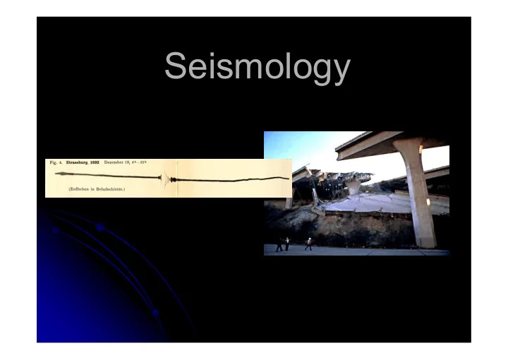
Seismology What is seismology? Seismology is science dealing with - - PowerPoint PPT Presentation
Seismology What is seismology? Seismology is science dealing with all aspects of earthquakes : OBSERVATIONAL SEISMOLOGY Recording earthquakes (microseismology) Cataloguing earthquakes Observing earthquake effects (macroseismology)
Seismology is science dealing with all aspects of earthquakes:
OBSERVATIONAL SEISMOLOGY
Recording earthquakes (microseismology) Cataloguing earthquakes Observing earthquake effects
(macroseismology)
ENGINEERING SEISMOLOGY Estimation of seismic hazard and risk
Aseismic structure (earthquake resistant structure)
‘PHYSICAL’ SEISMOLOGY Study of the properties of the Earth’s interior
Study of physical characteristics of seismic sources
EXPLORATIONAL SEISMOLOGY (Applied seismic methods)...
Earthquakes occur:
tired (Hindu)
(Mongolia)
sneezes or scratches (Africa)
the giant catfish Namazu that supports the Earth and prevents it to sink into the ocean) weakens and Namazu moves (Japan)
Peru his footsteps shake the Earth. Then natives run out of their huts and yell: “I’m here, I’m here!”
The Three Major Chemical Radial Divisions
Crust Mantle Core
To see how earthquakes really occur, we first need to learn about constitution of the Earth!
The boundary between the crust and the mantle is mostly
mantle have different compositions.
This boundary is referred to as the Mohorovičić discontinuity
It was discovered in 1910 by the Croatian seismologist Andrija Mohorovičić.
The crust is the most heterogeneous layer in the Earth
The crust is on average 33 km thick for continents and 10 km thick beneath oceans; however it varies from just a few km to
http://quake.wr.usgs.gov/research/structure/CrustalStructure/index.html
Earth’s mantle exists from the bottom of the crust to a depth of 2891 km (radius of 3480 km) – Gutenberg discontinuity
It is further subdivided into:
The uppermost mantle
(crust to 400 km depth)
The transition zone
(400 – 700 km depth)
The mid-mantle
(700 to ~2650 km depth)
The lowermost mantle
(~2650 – 2891 km depth)
The uppermost mantle is composed dominantly of olivine; lesser components include pyroxene, enstatite, and garnet Beno Gutenberg
inside the Earth the Earth’s core is actually freezing as the Earth gradually cools.
liquid outer core and the solid inner core occurs at a radius of about 1220 km – Lehman discontinuity, after Inge Lehman from Denmark.
mantle and outer core is sharp.
the core-mantle boundary is greater than that at the Earth’s surface!
is similar to that of water, it flows kilometers per year and creates the Earth’s magnetic field.
homogeneous part of the Earth
alloy of iron and nickel in liquid form.
is released; this heat causes the outer core to convect and so generates a magnetic field.
The interior of the Earth is dynamic –
Additional energy comes from
Convection in the astenosphere enables tectonic processes – PLATE TECTONICS
PLATE TECTONICS theory is very young (1960-ies) It provides answers to the most fundamental questions in seismology: Why earthquakes occur? Why are earthquake epicenters not uniformly distributed around the globe? At what depths are their foci?
Tectonic plates are large parts of litosphere ‘floating’ on the astenosphere
Convective currents move them around with velocities of
several cm/year.
The plates interact with one another in three basic ways:
Collision leads to
SUBDUCTION of one plate under another. Mountain ranges may also be formed (Himalayas, Alps...).
It produces strong
and sometimes very deep earthquakes (up to 700 km).
Volcanoes also occur
there.
EXAMPLES: Nazca – South America Eurasia – Pacific
Plates moving
away from each
RIDGES between them (spreading centres).
The earthquakes
are generally weaker than in the case of subduction.
EXAMPLES: Mid-Atlantic ridge (African – South American plates, Euroasian – North American plates)
Plates moving past each
TRANSFORM FAULTS.
The earthquakes may be
very strong.
EXAMPLES: San Andreas Fault (Pacific – North American plate)
in waves that radiate outward from the fault.
Longitudinal waves:
first.
the wave.
Transversal waves:
the spreading direction.
(e.g. through the outer core).
P-waves: S-waves:
Surface waves: Rayleigh and Love waves
Their amplitude diminishes with the depth. They have large amplitudes and are slower than
body waves.
These are dispersive waves (large periods are
faster).
P S surface waves
Up-Down N-S E-W
Earthquake in Japan Station in Germany Magnitude 6.5
Seismographs are devices that
record ground motion during earthquakes.
The first seismographs were
constructed at the very end of the 19th century in Italy and Germany.
Horizontal 1000 kg Wiechert seismograph in Zagreb (built in 1909)
Modern digital broadband
seismographs are capable of recording almost the whole seismological spectrum (50 Hz – 300 s).
Their resolution of 24 bits (high
dynamic range) allows for precise recording of small quakes, as well as unsaturated registration of the largest ones.
We are now equipped
to start recording and locating earthquakes. For that we need a seismic network of as many stations as possible.
Minimal number of
stations needed to locate the position of an earthquake epicentre is three.
Broad-band seismological stations in Europe
To locate an earthquake
we need precise readings
S-waves arrive at a number of seismic stations.
Accurate absolute timing
(with a precission of 0.01 s) is essential in seismology!
Knowing the difference in
arrival times of the two waves, and knowing their velocity, we may calculate the distance of the epicentre.
This is done using the
travel-time curves which show how long does it take for P- and S-waves to reach some epicentral distance.
Another example of picking arrival times
After we know the
distance of epicentre from at least three stations we may find the epicentre like this
There are more
sofisticated methods of locating positions of earthquake foci. This is a classic example of an inverse problem.
Besides the position of the epicentre and the depth of focus, the earthquake magnitude is another defining element of each earthquake.
Magnitude (defined by Charles Richter in 1935) is proportional to the amount of energy released from the focus.
Magnitude is calculated from the amplitudes of ground motion as measured from the
know the epicentral distance to take attenuation into account.
Formula: M = log(A) + c1 log (D) + c2 where A is amplitude of ground motion, D is epicentral distance, and c1, c2 are constants.
There are many types of magnitude in seismological practice,
depending which waves are used to measure the amplitude: ML, mb, Mc, Ms, Mw, ...
Increase of 1 magnitude unit means ~32 times more released
seismic energy!
Magnitude Effects Number per year
less than 2 Not felt by humans. Recorded by instruments
Numerous 2 Felt only by the most sensitive. Suspended objects swing >1 000 000 3 Felt by some people. Vibration like a passing heavy vehicle 100 000 4 Felt by most people. Hanging objects swing. Dishes and windows rattle and may break 12 000 5 Felt by all; people frightened. Chimneys topple; furniture moves 1 400 6
damage 160 7-8 Widespread panic. Few buildings remain
20 8-9 Complete devastation. Ground waves ~2
Equivalent Magnitude Event Energy (tons TNT)
––––––––––––––––––––––––––––––––––––––––––––––––––––––––––––––––––
2.0 Large quary blast 1 2.5 Moderate lightning bolt 5 3.5 Large ligtning bolt 75 4.5 Average tornado 5 100 6.0 Hiroshima atomic bomb 20 000 7.0 Largest nuclear test 32 000 000 7.7
100 000 000 8.5 Krakatoa eruption 1 000 000 000 9.5 Chilean earthquake 1960 32 000 000 000
Gutenberg-Richter
frequency-magnitude relation: log N = a – bM
b is approximately
constant, b = 1 world- wide there are ~10 more times M=5 than M=6 earthquakes
This shows selfsimilarity
and fractal nature of earthquakes.
humans, animals, objects and surroundings.
and/or by questionaires sent there.
at each of the studied places.
Mercalli-Cancani-Sieberg (MCS), Medvedev-Sponheuer- Karnik (MSK), Modified Mercalli (MM), European Macroseismic Scale (EMS).
European Macroseismic Scale (EMS 98)
EMS DEFINITION SHORT DESCRIPTION
––––––––––––––––––––––––––––––––––––––––––––––––––
I Not felt Not felt, even under the most favourable circumstances. II Scarcely felt Vibration is felt only by individual people at rest in houses, especially on upper floors of buildings. III Weak The vibration is weak and is felt indoors by a few people. People at rest feel a swaying or light trembling. IV Largely The earthquake is felt indoors by many people, outdoors by very
V Strong The earthquake is felt indoors by most, outdoors by few. Many sleeping people awake. A few run outdoors. Buildings tremble
clatter together. The vibration is strong. Top heavy objects topple
EMS DEFINITION SHORT DESCRIPTION
––––––––––––––––––––––––––––––––––––––––––––––––––
VI Slightly Felt by most indoors and by many outdoors. Many people in damaging buildings are frightened and run outdoors. Small objects fall. Slight damage to many ordinary buildings e.g. fine cracks in plaster and small pieces of plaster fall. VII Damaging Most people are frightened and run outdoors. Furniture is shifted and
suffer moderate damage: small cracks in walls; partial collapse of chimneys. VIII Heavily Furniture may be overturned. Many ordinary buildings suffer damaging damage: chimneys fall; large cracks appear in walls and a few buildings may partially collapse. IX Destructive Monuments and columns fall or are twisted. Many ordinary buildings partially collapse and a few collapse completely. X Very Many ordinary buildings collapse. destructive XI Devastating Most ordinary buildings collapse. XII Completely Practically all structures above and below ground are devastating heavily damaged or destroyed.
presented on isoseismal maps.
the places with same intensities.
MAGNITUDE!
intensity is: Io = M + 2
magnitude, but many intensities!
disasters that are mostly harmless to humans! The only danger comes from buildings designed not to withstand the largest possible earthquakes in the area.
civil engineers parameters they need in order to construct seismically safe and sound structures.
bridge between seismology and earthquake engineering.
Izmit, Turkey, 1999
Most common input parameters are:
acceleration (PGA)
velocity (PGV)
displacement (PGD)
records of ground acceleration obtained by strong-motion accelerographs.
Accelerogram of the Ston-Slano (Croatia, M = 6.0, 1996) event
In order to estimate the parameters, seismologists need:
well into the past,
at the construction site, as well as on the path between epicentre and the site,
from near-by epicentral regions,