SAN FERNANDO T.O.D. OV ERLAY ZONES
San n Fe Ferna rnando ndo CORR ORRIDO IDORS RS SPEC ECIFIC - - PowerPoint PPT Presentation
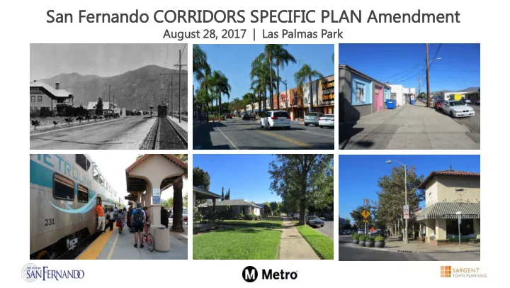
San n Fe Ferna rnando ndo CORR ORRIDO IDORS RS SPEC ECIFIC IFIC PLAN AN Am Amendment ndment August t 28, 2017 17 | Las Palmas Park SAN FERNANDO T.O.D. OV ERLAY ZONES PROCESS Adoption of Original Specific Plan: January 2005
SAN FERNANDO T.O.D. OV ERLAY ZONES
- Adoption of Original Specific Plan: January 2005
- Metro Awards City of San Fernando TOD Grant: February 2013
- Sargent Town Planning Hired: May 2014
- Analysis, Discovery, and Initial Public Outreach: August 2014 – January 2015
- Specific Plan Amendment Preparation: January 2015 – June 2015
- Additional Public Outreach: June 2015 – October 2015
- Specific Plan Preparation Continues: November 2015 – January 2016; August 2017
- Environmental Review: June 2017 – October 2017
- Public Hearings & Plan Adoption: November – December 2017
PROCESS
SAN FERNANDO T.O.D. OV ERLAY ZONES
Stakeholder Interviews
- September – October 2014
- September 2015
Development Advisory Committee Meetings
- September 30, 2014
- November 12, 2014
- January 14, 2015
- June 17, 2015
Community Workshops
- November 19, 2014
- January 21, 2015
(no sig ignific ificant ant changes ges from exis isting) ing) OUTREACH PROCESS TO DATE
Planning and Preservation Commission meetings
- August 4, 2015
- October 6, 2015
SAN FERNANDO T.O.D. OV ERLAY ZONES
2005 CORRIDORS SPECIFIC PLAN
- Area to be updated as part of T.O.D. Zoning grant
from Metro
SAN FERNANDO T.O.D. OV ERLAY ZONES
SPECIFIC PLAN BOUNDARY ADJUSTMENT
Existing Corridors Specific Plan Specific Plan Boundary City Center San Fernando Mall Mixed-Use Transition Workplace Commercial Support Commercial Maclay Auto Commercial Neighborhood Serving Overlay
- Expanded area as
part of 2013 T.O.D. Zoning RFP
- Further
expansion to better protect neighbourhood scale/character
SAN FERNANDO T.O.D. OV ERLAY ZONES
SPECIFIC PLAN BOUNDARY: 2017
Existing Zoning Multiple Family (R-3) Limited Commercial (C-1) Commercial (C-2) Limited Industrial (M-1) Light Industrial (M-2) Specific Plan 2 (SP2) Existing Corridors Specific Plan 2017 Specific Plan Boundary City Center San Fernando Mall Mixed-Use Transition Workplace Commercial Support Commercial Maclay Auto Commercial Neighborhood Serving Overlay
- Workplace and
Mixed-Use Zones
- n 1st
- Neighborhood
protection zone south of 2nd
SAN FERNANDO T.O.D. OV ERLAY ZONES
OVERVIEW OF CHANGES
REVISIONS AND REFINEMENTS BASED ON COMMUNITY INPUT
Strategy #1: Reduce the proposed scale and intensity of development to better reflect San Fernando’s historic small town character. Strategy #2: Employ place-making strategies on San Fernando, MacClay and Truman – along with updated zoning and design guidelines – to reinvigorate the existing retail core with more restaurant/entertainment type uses, and to better connect it to MacClay north of the tracks. Strategy #3: Use place-making strategies to improve the pedestrian safety, comfort and visual character of downtown’s streetscapes, to transform Truman from an old highway to a downtown Avenue, and thereby attracting the good quality infill development you want, rather than that strip commercial and affordable housing that are generally built along arterial thoroughfares. Strategy #4: Update zoning and guidelines to emphasize employment uses, small commercial, and market rate housing in the Mixed-Use Corridor/Workplace Neighborhood between the Downtown Core and Hubbard. Strategy #5: Attract tech companies and other job creators to the area nearer Metrolink and Hubbard by “sandwiching” the area between Metrolink and the revived Downtown Core with the new East SF Valley Transit coming soon to further invigorate both.
SAN FERNANDO T.O.D. OV ERLAY ZONES
LOCATION OF HOUSING: 2005 SPECIFIC PLAN
Existing Corridors Specific Plan 2017 Specific Plan Boundary City Center San Fernando Mall Mixed-Use Transition Workplace Commercial Support Commercial Maclay Auto Commercial Neighborhood Serving Overlay
2005 SP BOUNDARY 2017 SP BOUNDARY
Existing Zoning Multiple Family (R-3) Limited Commercial (C-1) Commercial (C-2) Limited Industrial (M-1) Light Industrial (M-2) Specific Plan 2 (SP2)
Within 2005 Specific Plan Area Within San Fernando Zoning Area
SAN FERNANDO T.O.D. OV ERLAY ZONES
LOCATION OF HOUSING: 2005 SPECIFIC PLAN
2005 SP BOUNDARY 2017 SP BOUNDARY
Existing Corridors Specific Plan 2017 Specific Plan Boundary City Center San Fernando Mall Mixed-Use Transition Workplace Commercial Support Commercial Maclay Auto Commercial Neighborhood Serving Overlay Existing Zoning Multiple Family (R-3) Limited Commercial (C-1) Commercial (C-2) Limited Industrial (M-1) Light Industrial (M-2) Specific Plan 2 (SP2)
Within 2005 Specific Plan Area Within San Fernando Zoning Area
SAN FERNANDO T.O.D. OV ERLAY ZONES
LOCATION HOUSING: 2017 SPECIFIC PLAN
2017 Specific Plan Boundary City Center Sub-District Mixed-Use Corridor Sub-District Workplace Flex Disrict General Neighborhood District Maclay District Auto Commercial Sub-District Shopfront Overlay Reduced Height Overlay Mixed-Use Overlay Proposed Corridors Specific Plan
2005 SP BOUNDARY 2017 SP BOUNDARY
Within 2005 Specific Plan Area Within San Fernando Zoning Area
SAN FERNANDO T.O.D. OV ERLAY ZONES
Within 2005 Specific Plan Area Within San Fernando Zoning Area
2017 Specific Plan Boundary City Center Sub-District Mixed-Use Corridor Sub-District Workplace Flex Disrict General Neighborhood District Maclay District Auto Commercial Sub-District Shopfront Overlay Reduced Height Overlay Mixed-Use Overlay Proposed Corridors Specific Plan
LOCATION OF HOUSING: 2017 SPECIFIC PLAN
2005 SP BOUNDARY 2017 SP BOUNDARY
SAN FERNANDO T.O.D. OV ERLAY ZONES
2017 Specific Plan Boundary City Center Sub-District Mixed-Use Corridor Sub-District Workplace Flex Disrict General Neighborhood District Maclay District Auto Commercial Sub-District Shopfront Overlay Reduced Height Overlay Mixed-Use Overlay Proposed Corridors Specific Plan
CUP REQUIRED FOR HOUSING
- Require CUP for all multi-family
residential buildings.
SAN FERNANDO T.O.D. OV ERLAY ZONES
ESSENTIAL CHARACTER: CITY CENTER SUB-DISTRICT
SAN FERNANDO T.O.D. OV ERLAY ZONES
DEVELOPMENT REGULATIONS: CITY CENTER SUB-DISTRICT
Existing Proposed Residential Land Use
- Permitted by right
- Only allowed on upper floors
- Permitted subject to CUP, and only within
Mixed-Use Overlay area
- Allowed only on upper floors
Height
- 4 floors / 50 ft.
- 3 floors / 40 ft.
- 4 floors / 50 ft. within Mixed-Use Overlay only
Floor Area Ratio
- 3.0 FAR max.
- 3.5 FAR max. for mixed-use development
- 3.0 FAR max.
- 3.5 FAR max. for mixed-use development
within Mixed-Use Overlay Residential Density • No density limit. Amount of development limited only by FAR and parking
- Up to 50 du/acre maximum, within Mixed-Use
Overlay only Front Setback
- 0 - 15 ft.
- 0 - 15 ft.
Parking
- San Fernando Rd. and Maclay Ave: Behind
buildings, subterranean, or screened by liner
- Other streets: 5 ft. from front property line.
- San Fernando Rd. and Maclay Ave: Behind
buildings, subterranean, or screened by liner
- Other streets: 5 ft. from front property line.
SAN FERNANDO T.O.D. OV ERLAY ZONES
ESSENTIAL CHARACTER: CITY CENTER SUB-DISTRICT
Now Proposed 2016 Draft
SAN FERNANDO T.O.D. OV ERLAY ZONES SAN FERNANDO T.O.D. OV ERLAY ZONES
PROJECT OBJECTIVES
STREETSCAPE CHARACTER: SAN FERNANDO ROAD
EXISTING
- One lane each direction.
- Angled parking one side and parallel
parking or loading other side.
SAN FERNANDO T.O.D. OV ERLAY ZONES SAN FERNANDO T.O.D. OV ERLAY ZONES
PROJECT OBJECTIVES
PROPOSED
- One lane each direction.
- Angled parking both sides.
- Promotes shopper-friendly
downtown environment.
- Provides more on-street parking
in front of stores.
- Functions with existing roadway
width and can also function with wider south sidewalk.
- Existing ficus trees replaced with
more attractive and open tree type.
STREETSCAPE CHARACTER: SAN FERNANDO ROAD
SAN FERNANDO T.O.D. OV ERLAY ZONES SAN FERNANDO T.O.D. OV ERLAY ZONES
PROJECT OBJECTIVES
STREETSCAPE CHARACTER: TRUMAN STREET
EXISTING
- Two lanes each direction.
- Parking on both sides.
SAN FERNANDO T.O.D. OV ERLAY ZONES SAN FERNANDO T.O.D. OV ERLAY ZONES
PROJECT OBJECTIVES
STREETSCAPE CHARACTER: TRUMAN STREET
PROPOSED
Two travel lanes each direction.
- 10’ wide lane striping helps slow
traffic.
- Left and right turn lanes provided
at MacClay Avenue and Hubbard Avenue; left turn lane provided at San Fernando Mission Boulevard.
- Parallel parking both sides of street
(except at intersections to accommodate right-turn lanes).
- Existing ficus trees replaced with
more attractive and open tree type.
SAN FERNANDO T.O.D. OV ERLAY ZONES
ESSENTIAL CHARACTER: MIXED-USE CORRIDOR SUB-DISTRICT
SAN FERNANDO T.O.D. OV ERLAY ZONES
DEVELOPMENT REGULATIONS: MIXED-USE CORRIDOR SUB-DISTRICT
Existing Proposed Residential Land Use
- Permitted by right between Huntington
and San Fernando Mission.
- Not allowed between Huntington and
Hubbard.
- Permitted subject to CUP
Height
- 3 floors / 40 ft.
- 4 floors / 50 ft. when residential provided as
part of mixed-use project
- 3 floors / 40 ft.
Floor Area Ratio
- 2.0 FAR max.
- 2.5 FAR max. for mixed-use development
- 2.0 FAR max.
- 2.5 FAR max. for mixed-use development
Residential Density • Up to 45 dwellings per acre
- Up to 36 dwellings per acre
Front Setback
- 0 - 15 ft.
- 0 - 15 ft.
Parking
- 6 ft. behind front property line.
- San Fernando Rd.: Behind buildings,
subterranean, or screened by liner
- Other streets: Screened from view of street
- Access from streets other than San Fernando
Rd.
SAN FERNANDO T.O.D. OV ERLAY ZONES
ESSENTIAL CHARACTER: MIXED-USE CORRIDOR SUB-DISTRICT
Now Proposed 2016 Draft
SAN FERNANDO T.O.D. OV ERLAY ZONES SAN FERNANDO T.O.D. OV ERLAY ZONES
PROJECT OBJECTIVES
EXISTING
- Two lanes each direction.
- Parallel parking both sides.
STREETSCAPE CHARACTER: SAN FERNANDO NORTH
SAN FERNANDO T.O.D. OV ERLAY ZONES SAN FERNANDO T.O.D. OV ERLAY ZONES
PROJECT OBJECTIVES
PROPOSED
- One lane each direction with
center turn lane and/or landscaped median.
- Parallel parking both sides.
- Functions with existing roadway
width and can also function with wider south sidewalk.
- Existing ficus trees replaced with
appropriate street tree species.
STREETSCAPE CHARACTER: SAN FERNANDO NORTH
SAN FERNANDO T.O.D. OV ERLAY ZONES
ESSENTIAL CHARACTER: WORKPLACE FLEX DISTRICT
SAN FERNANDO T.O.D. OV ERLAY ZONES
DEVELOPMENT REGULATIONS: WORKPLACE FLEX DISTRICT
Existing Proposed Residential Land Use
- Not permitted.
- Only Live/Work permitted, subject to CUP.
Height
- North of tracks: 45 ft
- South of tracks: 3 floors / 40 ft.
- North of tracks: 3 floors / 40 ft.
- South of tracks: 3 floors / 40 ft.
Floor Area Ratio
- 2.0 FAR max.
- 2.5 FAR max. for mixed-use development
- 2.0 FAR max.
- 2.5 FAR max. for mixed-use development
Residential Density • n/a
- Up to 18 dwellings per acre
Front Setback
- 6 - 15 ft.
- 6 - 15 ft.
Parking
- 6 ft. behind front property line.
- Behind or next to buildings
- Screened from view of street
SAN FERNANDO T.O.D. OV ERLAY ZONES SAN FERNANDO T.O.D. OV ERLAY ZONES
PROJECT OBJECTIVES
EXISTING
- One lane each direction.
- Parallel parking both sides.
STREETSCAPE CHARACTER: FIRST STREET
SAN FERNANDO T.O.D. OV ERLAY ZONES SAN FERNANDO T.O.D. OV ERLAY ZONES
PROJECT OBJECTIVES
PROPOSED
- One lane each direction.
- Parallel parking both sides.
- Accommodates bicycles via
sharrow.
- Set-back buildings result in a
wider sidewalk.
- Live-work buildings
accommodated.
- Replace any existing ficus
trees with appropriate street tree species along entire length of First Street.
STREETSCAPE CHARACTER: FIRST STREET
SAN FERNANDO T.O.D. OV ERLAY ZONES
ESSENTIAL CHARACTER: GENERAL NEIGHBORHOOD DISTRICT
SAN FERNANDO T.O.D. OV ERLAY ZONES
DEVELOPMENT REGULATIONS: GENERAL NEIGHBORHOOD DISTRICT
Existing Proposed Land Use
- Permitted by right
- Permitted subject to CUP.
Height
- 45 ft
- 45 ft. (4 floors); 2.5 floor height limit along
Second Street Floor Area Ratio
- n/a
- n/a
Residential Density
- Up to 43 dwellings per acre
Front Setback
- 20 ft. front setback
Parking
- 20 ft. behind front property line
- Behind building;
- Access from alley, side streets, or narrow
driveway
SAN FERNANDO T.O.D. OV ERLAY ZONES
ESSENTIAL CHARACTER: GENERAL NEIGHBORHOOD DISTRICT
Now Proposed along Front of Lot Current Zoning
SAN FERNANDO T.O.D. OV ERLAY ZONES
NEIGHBORHOOD GENERAL (Existing R-3 Zoning Modified)
SAN FERNANDO T.O.D. OV ERLAY ZONES
NEIGHBORHOOD GENERAL (Existing R-3 Zoning Modified)
Four-story building allowed per current R-3 zoning.
SAN FERNANDO T.O.D. OV ERLAY ZONES
NEIGHBORHOOD GENERAL (Existing R-3 Zoning Modified)
Three-story building.
SAN FERNANDO T.O.D. OV ERLAY ZONES
NEIGHBORHOOD GENERAL (Existing R-3 Zoning Revamped)
Two-story building.
SAN FERNANDO T.O.D. OV ERLAY ZONES
HOUSE-FORM, NEIGHBORHOOD-SCALE MASSING
Proposed
SAN FERNANDO T.O.D. OV ERLAY ZONES
DESIGN GUIDELINES
- Building Massing and Scale.
Building siting and orientation; horizontal mass for commercial and for residential buildings; base treatment; corner buildings; main entrance; accessory buildings and additions; loading and service entrances; parking podiums.
- Architectural Style. Mission,
Spanish Colonial, Mediterranean, Monterey Style, Art Deco Style, Early 20th Century Commercial Style
SAN FERNANDO T.O.D. OV ERLAY ZONES
CEQA Review of Proposed Amendment to San Fernando Corridors Specific Plan
Public Meeting #1 August 28, 2017 Las Palmas Park
SAN FERNANDO T.O.D. OV ERLAY ZONES
AGENDA
- 1. Purpose
- 2. Project
- 3. Process
- 4. Contents of EIR
- 5. Conclusions of EIR
- 6. Next Steps
SAN FERNANDO T.O.D. OV ERLAY ZONES
PURPOSES
- Purpose of California Environmental Quality Act (CEQA)
- Avoid or Reduce Adverse Environmental Effects
- Promote Informed Decisions
- Increase The Public’s Understanding and Participation in Decisions
- Promote Coordination Between Government Agencies
- Purpose of Environmental Impact Report (EIR)
- An informational document
- Shall be considered by every public agency prior to its approval or disapproval of a project.
- Provide public agencies and the public in general with detailed information about effect of a
project
- List ways in which the significant effects might be minimized
- Indicate alternatives to project
SAN FERNANDO T.O.D. OV ERLAY ZONES
- Definition of “Project” [defined in Public Resource Code §21065]:
“Project” means an activity which may cause either a direct physical change in the environment, or a reasonably foreseeable indirect physical change in the environment, and which is any of the following: (a) An activity directly undertaken by any public agency. (b) An activity undertaken by a person which is supported, in whole or in part, through contracts, grants, subsidies, loans, or other forms of assistance from one or more public agencies. (c) An activity that involves the issuance to a person of a lease, permit, license, certificate, or other entitlement for use by one or more public agencies.
- Specific Plan [defined by Governor’s Office of Planning and Research]:
A specific plan is a tool for the systematic implementation of the general plan. It effectively establishes a link between implementing policies of the general plan and the individual development proposals in a defined area. A specific plan may be as general as setting forth broad policy concepts, or as detailed as providing direction to every facet of development from the type, location, and intensity of uses to the design and capacity of infrastructure; from the resources used to finance public improvements to the design guidelines of a subdivision.
PROJECT
SAN FERNANDO T.O.D. OV ERLAY ZONES
PROPOSED SPECIFIC PLAN AMENDMENT
- Existing Specific Plan Adopted in 2005
- Proposed Amended Plan would
- Alter plan boundaries
- Establish new development policies
- Create new design standards
- Describe streetscape improvements
- Change approval process
- Plan would allow for future development
SAN FERNANDO T.O.D. OV ERLAY ZONES
EIR PROCESS
City makes decision on the project City prepares Final EIR, including responses to comments Public Review Period (45-day minimum) City files Notice of Completion City prepares Draft EIR City circulates Notice of Preparation City prepares Initial Study City solicits input on contents of EIR scope City solicits comments on Draft EIR
SAN FERNANDO T.O.D. OV ERLAY ZONES
CONTENTS OF EIR
- 1. Project Description
- 2. Description of Existing Conditions
- 3. Discussion of Potential Environmental Impacts
- 4. Identification of Mitigation Measures
- 5. Analysis of Project Alternatives
SAN FERNANDO T.O.D. OV ERLAY ZONES
ISSUES EVALUATED IN THE EIR (1)
- Aesthetics
- Project would result in indirect changes to visual character
- Intend of Project is to improve design characteristics of downtown San Fernando
- Air Quality
- Construction, traffic and other ongoing activities would produce air emissions
- Cultural Resources
- City contains historic buildings
- Potential for subsurface historic, pre-historic, paleontological, and tribal cultural resources
- Greenhouse Gas Emissions
- Construction, traffic and other ongoing activities would emit greenhouse gases
- State has adopted targets for future levels of greenhouse gases
- Land Use Planning
- Consistency with local and regional planning documents
SAN FERNANDO T.O.D. OV ERLAY ZONES
ISSUES EVALUATED IN THE EIR (2)
- Noise
- Construction, traffic, and other ongoing activities would generate noise
- Due to existing residents close to potential construction sites, impacts could occur
- Population & Housing
- Future development would increase population and housing
- SCGA projects population of City would increase to 26,900 by 2040
- Project would allow for development that could house 27,356 if all parcels built upon
- This could accommodate expected growth with small extra capacity
- Public Services & Recreation
- Future development would increase demands on Fire, Police, Schools, Libraries and Parks
- Transportation & Circulation
- Changes in roadways and future growth could impact automobile transportation
- Project would also improve pedestrian experience and transit connections
SAN FERNANDO T.O.D. OV ERLAY ZONES
ISSUES EVALUATED IN THE EIR (3)
- Utilities
- Future development could increase water demand, wastewater, solid waste, and energy demand
Water Supply Assessment (WSA) Results
- City recently prepared and adopted a new Urban Water Management Plan that outlined
expected future water supply and demand through 2040
- WSA prepared for Project in coordination with Department of Public Works
- WSA concluded that sufficient water supplies exist to support the Project.
Sewer Master Plan
- The City of San Fernando prepared a Sewer Master Plan in 2014
- Deficiencies in the collection lines were identified
- Specific Plan Amendment would not result in additional or exacerbated deficiencies
- Sewer Master recommended Plan Capital Improvement to address deficiencies
SAN FERNANDO T.O.D. OV ERLAY ZONES
ALTERNATIVES
- Alternative 1: No Project
- Specific Plan not amended; future developments occur per the 2005 Corridors Specific Plan.
- Development potential: 620 housing units; 122,139, sq.ft. retail; 605,936 sq.ft. office
- Alternative 2: No Housing in City Center
- Same development potential as Project, residential uses distributed differently
- Alternative 3: Housing in General Neighborhood District Only
- Remove residential development potential from all portions of the Specific Plan area except
in the General Neighborhood District.
- Development potential: 112 housing units; 199,630 sq.ft. retail; 829,584 sq.ft. office
- Alternative 4: Reduced Residential Density
- Reduction in density
- Development potential: 575 housing units; 96,307 sq.ft. retail; 285,907 sq.ft.
- Would contain 575 residential units; 96,307 sq. ft. of retail and 285,907 sq. ft. of office
SAN FERNANDO T.O.D. OV ERLAY ZONES
EIR CONCLUSIONS
- CULTURAL RESOURCES and TRIBAL CULTURAL RESOURCES
- Future Construction in San Fernando could unearth subsurface resources
- Mitigation Measure requires monitoring plan to identify, protect, and preserve
- NOISE
- Future Construction in San Fernando could disturb existing residents
- Mitigation Measure requires procedures to attenuate noise during construction
- TRANSPORTATION/TRAFFIC
- Future growth could result in low level of performance at a few intersections
- Mitigation Measure requires an eastbound right-turn lane on First Street at Maclay
- Mitigation Measure requires installation of coordinated traffic signal systems
- ALTERNATIVES
- Alternatives would not avoid construction related impacts
- Alternative traffic would be different, though significant impacts would not be fully avoided
SAN FERNANDO T.O.D. OV ERLAY ZONES
WHAT’S NEXT
- Review of the Draft EIR
- Comment period extends until September 25
- Second public meeting Friday, September 15 at Recreation Park
- Preparation of Final EIR
- After comment period closes, City will collect and review all comments, prepare responses
and make revisions to the EIR or the Project, if necessary
- Planning Board and City Council consideration of project
- Final EIR and Project are expected to be presented for consideration toward end of year.
SAN FERNANDO T.O.D. OV ERLAY ZONES
QUESTIONS?
SAN FERNANDO T.O.D. OV ERLAY ZONES
DISCUSSION TOPICS
FOR EACH OF THE SPECIFIC PLAN DISTRICTS AND SUB-DISTRICTS DESCRIBED ABOVE:
- Do you think the type of physical environment we are suggesting will help to attract the
type of infill development the community would like to see?
- Do you think the general range and character of streetscape improvements we have
described will support pedestrian safety, comfort, and easy access to transit?
- Do you think these improvements will help encourage more people to come Downtown
more often and spend more time?
- Do any of the buildings or land uses we have shown seem out of place for San Fernando?