Ro#erdam m urban hydro- Herman Russchenberg me meteorological - - PowerPoint PPT Presentation
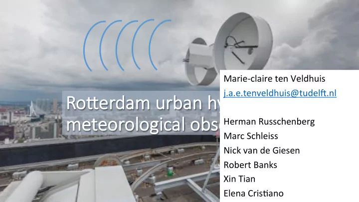
Marie-claire ten Veldhuis j.a.e.tenveldhuis@tudel5.nl Ro#erdam m urban hydro- Herman Russchenberg me meteorological observatory Marc Schleiss Nick van de Giesen Robert Banks Xin Tian Elena CrisEano Andreas Krietemeyer
2
Hydro-Meteo-observatory Rotterdam
Objec&ves:
- Measuring small-scale rainfall variability
- Short-term high resoluEon rainfall forecasEng
(nowcasEng)
- Numerical weather predicEon and rainfall forecasEng
- Hydrological response analysis and early-warning
Partners: TU Del5: Deps Watermanagement ; Geosciences&Remote Sensing ; Microelectronics RoTerdam City: Watermanagement ; Climate Resilience Program Industrial partners: SkyEcho, RHDHV
3
Hydro-Meteo-observatory Rotterdam
EU-funding support and interna&onal collabora&on:
- MUFFIN (MulE-scale Urban Flood ForecastINg)
- FLoodCiESense (Early warning service for urban pluvial
floods for and by ciEzens and city authoriEes)
- BRIGAID (Bridging the Gap for InnovaEons in Disaster
Resilience)
4
Hydro-meteorological
- bservaEon network
RoTerdam region 40km – 30 km – 20 km – 10 km – 5km range from radar posiEon (RoTerdam city centre)
5
Hydro-meteorological
- bservaEon network
RoTerdam region 40km – 30 km – 20 km – 10 km – 5km range from radar posiEon (RoTerdam city centre)
6
Hydro-meteorological
- bservaEon network
RoTerdam region 40km – 30 km – 20 km – 10 km – 5km range from radar posiEon (RoTerdam city centre)
7
Hydro-meteorological
- bservaEon network
RoTerdam region 40km – 30 km – 20 km – 10 km – 5km range from radar posiEon (RoTerdam city centre)
8
Hydro-meteorological
- bservaEon network
RoTerdam region 40km – 30 km – 20 km – 10 km – 5km range from radar posiEon (RoTerdam city centre)
9
Available instrumentation
- Polarimetric Xband radar
- MRR: verEcal profiling radar
- Weather staEons: 8 operaEonal (Campbell) + 5 addiEonal to be
installed (Davis)
- GNSS receivers for water vapour esEmaEon: 4 single frequency,
14 dual frequency (from Nov. 2017)
- 50-60 Amateur weather staEons (Netatmo, Wunderground)
- 6 Disdrometers (installed on pumping staEons, status under
invesEgaEon)
- 20 Water level sensors at overflow weirs
- 100+ water level/flow sensors at pumping staEons
10
Polarimetric X-band radar
Some numbers:
- AlEtude radar: 156 m
- Blind zone near radar
(min range): 200m
- 1 full PPI/min
(6 degrees per second)
- constant elevaEon angle (1.4°)
- beam width 2.5 degrees
- FMCW radar: frequency excursions 5-50MHz
- 20 m range resoluEon ((range 3 - 30m for 50-5MHz)
- max range: 30 km
- Data formats: 1 min NetCDF
11
Pixel surface area: 100 m2 Radar alEtude = 156 m
12
Polarimetric X-band radar
Rainfall es&ma&on:
- via specific differenEal phase (KDP)
- via radar reflecEvity (R)
- interpolated
13
Radar PPI ReflecEon HH 18 Aug 2017, 9.39-9.48h
14
MRR: vertical profiling radar
ObjecEves:
- Precisely measure
hydrometeors from urban rainfall events with high ver&cal and spa&al resolu&on
- learn more about the drop size
distribuEon, liquid water content and rain rate for high- impact events
15
Liquid Water Content (g/m3) VerEcal range (m asl) Ver&cal profile of Liquid Water Content: Product of total volume
- f all droplets with
density of water, divided by the scaTering volume
- 0 - 4000 m verEcal
range
- Over 60 min Eme
Rain rate (mm/h) Rain rate: derived from liquid water content and fall velocity (Doppler spectra)
16
Network of weather stations
Campbell (HQ) Davis (MQ) Netatmo (LQ) Disdrometers (?)
17
Network of weather stations
www.weather.tudel5.nl Rainfall: retrieval of Epping Emes Data communica&on: LoRa (Long Range, wireless data communicaEon)
18
Network of personal weather stations
#Insert 1 or 2 quicklooks from MRR Brief descripEon of parameters measured ObjecEve of instrument?
Ongoing work 2017-2018: Development of data quality algorithm for PWS rainfall data In collaboraEon with:
- KNMI
- Wageningen University
Weather amateur networks: personal weather staEon data (PWS)
19
Hydrological response analysis
- Water level sensors at CSOs: 21 locaEons,
in 13 sewer districts
- Flood observaEons by ciEzens
(call centre data)
- Impact of green-blue soluEons: green roofs,
permeable pavements, bio-retenEon/rain gardens
20
Water levels at cso-weirs - Response Eme analysis, preliminary conclusions:
- RT varies between < 1 to > 4 h (25-75%
range)
- No significant correlaEons with area
size, imp. degree
Figures: Response Eme analysis; water level (blue), rainfall (red) (Example for District 5, 3 events) Courtesy: Mar-jn Mulder, MSc student TU Del8
21
Crowdsourcing: citizens’ flood
- bservations
ObjecEve: to idenEfy criEcal thresholds for early warning
Courtesy: Chris-an Bouwens, MSc student TU Del8 Density of flood reports, 2010-2016
22
Hydrological response analysis : Overflow pumping
ObjecEve: to idenEfy criEcal thresholds for early warning
23
Rain gauge ater level sensor umping staEon Study area: 1.32 km2
Impact of green-blue solutions
3-month study period: 10 Oct-10 Dec 2016, mild rainfall events (no CSO overflows) Courtesy: Jack Hill, visi-ng student Univ of Melbourne
24
Impact of green-blue solutions
3-month study period: 10 Oct-10 Dec 2016 % Total implementaEon: area implemented/total area
25
Impact of green-blue solutions
% Total implementaEon: area implemented/total area Flow variability (expressed as STD) % Peak runoff reducEon: Q_99%-ile (x% impl)/ Q_99%-ile (0% impl)
26
Impact of green-blue solutions
Some preliminary conclusions:
- green roofs and permeable pavements more
effecEve than bioretenEon (larger storage capacity)
- locaEon of implementaEon is important:
larger impact close to system outlet than far from system outlet
1-2-3 June 2018
27
Hydro-Meteo-observatory Rotterdam
Future work
- Analysing small-scale rainfall variability, space-Eme
characterisEcs
- Obtain high accuracy rainfall esEmates
- Develop early-warning tool to support urban flood
response (low-cost rainfall sensors, ciEzen science project)
- Hydrological response analysis: predictors for peak flow
variability, runoff raEos, impact of imperviousness and green blue soluEons
- Short-term high resoluEon rainfall forecasEng (nowcasEng)
- Numerical weather predicEon: WRF for urban environment
28
Merci de votre aJen&on Thank you!
Marie-claire ten Veldhuis j.a.e.tenveldhuis@tudel5.nl
Herman Russchenberg, Marc Schleiss, Nick van de Giesen, Robert Banks, Xin Tian, Elena CrisEano, Andreas Krietemeyer
29
Backup slides
30
31
NaEonal Weather Radar Polarimetric X-band radar 1x1 km2, 5-15 min 100x100 km2, 1 min
Courtesy: KNMI Courtesy: H.W.J. Russchenberg
32
33
34
35
36
37