
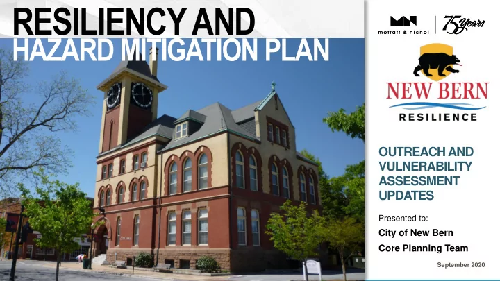
SLIDE 1
RESILIENCY AND
HAZARD MITIGATION PLAN
OUTREACH AND VULNERABILITY ASSESSMENT UPDATES
September 2020
Presented to:
City of New Bern Core Planning Team
RESILIENCY AND HAZARD MITIGATION PLAN OUTREACH AND VULNERABILITY - - PowerPoint PPT Presentation
RESILIENCY AND HAZARD MITIGATION PLAN OUTREACH AND VULNERABILITY ASSESSMENT UPDATES Presented to: City of New Bern Core Planning Team September 2020 Agenda Flexible agenda Post questions to the Welcome and Roll Call chat
OUTREACH AND VULNERABILITY ASSESSMENT UPDATES
September 2020
Presented to:
City of New Bern Core Planning Team
moffattnichol.com
〉Welcome and Roll Call 〉Activity from Past Month 〉Public Outreach Update 〉Vulnerability Assessment Update 〉Group Discussion 〉Next Steps
2 〉 Flexible agenda 〉 Post questions to the
chat function to help facilitate discussion at the end
moffattnichol.com
〉45 participants on Zoom 〉3 attendees at City Hall 〉0 attendees at Development Services 〉634 views on Facebook
3 〉 September 10, 6-7 p.m. 〉 Hybrid meeting: online
and in-person venues, including social media
moffattnichol.com
〉What examples of other cities or regions that have
successfully mitigated are we turning to for guidance?
〉How will this planning be integrated into the New Bern
Urban Design Plan and the Redevelopment Plan that has been developed?
〉Is Stanley White included in this process on Chapman
Street?
〉Can the group describe in more detail what stakeholder
involvement looks like when developing a resiliency plan?
4 〉 There was a request for
the planning team to contact the organization CARE
〉 There was a request for
more information on the background and credentials of the speaking team
moffattnichol.com
5 〉 Intent of the logo is to
provide an identity to the project’s materials
〉 The project logo is
reflective of New Bern’s
standards
moffattnichol.com
〉220 responses 〉81% completion rate 〉14 m is the average time spent on each survey
6 〉 Survey 1 was open to
the public from August 28 to September 24
〉 Do we want to keep the
survey open longer??
〉 Recommendation is to
extend the survey by at least one week
moffattnichol.com
〉Q1: What is your relationship to New Bern?
80% live in New Bern Q2: Is your home located in a floodplain? 59% of people’s homes are not located in a floodplain 7% don't know Q3: Do you have flood insurance? 54% of survey participants do not
7
moffattnichol.com
〉Q4: Who is your flood coverage provider?
71% have National Flood Insurance Program - FEMA Q5: If you do not have flood insurance, why not? 69% of survey participants are not located in a floodplain Q6: Have you ever experienced or been impacted by a flood-related disaster? 67% of survey participants said yes
8
moffattnichol.com
〉Q7: If “yes”, which flood hazard have you
experienced or been impacted by? 90% stated flooding caused by hurricanes and tropical storms, including storm surge Q8: How concerned are you about the possibility of all of New Bern community being impacted by these flood hazards? 83% of survey participants are very concerned about flooding caused by hurricanes and tropical storms, including storm surge
9
moffattnichol.com
〉Q9: Which of the following types of assets are most
susceptible to flood hazards in your community?
1. Economic 2. People 3. Cultural/Historic 4. Infrastructure 5. Community 6. Governance 7. Environmental 8. Experience
10 〉 Rating Score: 1.
People: 5.49
2.
Infrastructure: 5
3.
Governance: 4.19
4.
Economic: 5.88
5.
Experiences: 2.76
6.
Cultural/Historic: 5.02
7.
Community: 4.27
8.
Environmental: 3.93
moffattnichol.com
〉Q10: How important is each of the following
specific community assets to you?
11
1. Hospitals & Medical Facilties 2. Emergency Medical Facilities 3. Fire Stations 4. City/County Emergency Operations Centers 5. Police Stations 6. Major Bridges 7. Small Businesses 8. Major Employers 9. Schools (K-12) 10. Emergency Shelters 11. Historic Buildings/Districts
13. City Hall/Courthouse 14. Eldercare Facilities
16. Parks 17. Daycare Facilities
〉 Extremely Important to
Very Important
moffattnichol.com
〉Q11: Please indicate how important each statement is to
you?
1. Protecting critical facilities 2. Protecting and reducing damage to utilities 3. Protecting private property 4. Strengthening emergency services 5. Preventing development in flood hazard areas 6. Promoting cooperation among public agencies, non-profit organizations, and businesses 7. Addressing socio-economic disparity in economically distressed neighborhoods and business districts 8. Protecting historic and cultural landmarks and districts 9. Enhancing function of natural features 10. Protecting transportation networks
12 〉 Very Important to
Somewhat Important
moffattnichol.com
〉Q12: What are some steps your local government
could take to reduce or eliminate the risk of future flood hazard damages to your neighborhood?
protection measures
5. Create an economic incentive to assist property owners with mitigating or adapting their property to reduce flood risk 6. Educate property owners on wet/dry floodproofing/elevation strategies 7. Publicize the importance of property owners acquiring flood insurance 8. Fund temporary storm protection systems
13 〉 Other Comments:
〉 Focus on areas heavilyflooded first
〉 Maintain clearance of debrisfor all storm ditches and creek beds
〉 Consider a coastal hazardsstatement
〉 Retrofit stormwater practices,and living shorelines, to reduce flooding potential
〉 Nature-based solutions 〉 Educate homeowners onmethods to maintain SMS
〉 Dredge major rivers toincrease flow out of low areas
〉 Adopt the Netherlands’flooding policy
〉 Install underground utilities 〉 Use the RR tracks as a levee moffattnichol.com
〉Q13: How important is each for your community to
pursue?
1. Prevention 2. Emergency Services 3. Property Protection 4. Public Education & Awareness 5. Natural Resource Protection 6. Structural Projects 7. Historic Preservation
14 〉 Very Important
moffattnichol.com
〉Q14: Rank the places you are most interested in
protecting in order of importance.
15 〉 Home/Neighborhood - 8.29 〉 Business/Work - 6.42 〉 Downtown - 5.99 〉 School - 5.21 〉 Neighborhood Business
Districts - 4.62
〉 Cultural & Historic
Properties - 4.38
〉 Government Offices - 4.29 〉 Places of Worship - 3.60 〉 Public Parks &
Playgrounds - 2.80
moffattnichol.com
〉Q15: What are the most effective ways for you to
receive information about how to make your home and neighborhood more resistant to flood hazards?
16 〉 Other ways: 〉 Email 〉 All 〉 Watershed-scaled
educational campaigns
〉 Scheduled weekend
workshops
〉 Workplace
announcements and training
1. Internet (Web Pages) 2. Internet (Social Media) 3. Mail 4. Television news 5. Public Meetings/Workshops 6. Mobile messages/alerts 7. Newspaper 8. Radio news 9. Television ads 10. Television programs 11. Brochures/flyers in public buildings 12. Automated phone calls 13. Radio programs 14. Church bulletins 15. Door hangers 16. Word of mouth 17. Radio ads
moffattnichol.com
17 〉 Have Done
〉Q16: Check the disaster preparedness activities
you’ve done in your household, plan to do in the near future, have not done, or are unable to do.
1. Prepared my home by installing smoke detectors 2. Talked with household members about what to do in case of a natural disaster or emergency 3. Developed a "Household Family Emergency Plan" 4. Implemented mitigation measures to protect my property 5. Attended meetings or received written information on natural disasters or emergency preparedness 6. Established a financial plan and/or have a reserve fund set aside for post event recovery 7. Discussed or created a utility shut-off procedure in case of emergency 8. Within the last year, a member of my household was trained in CPR 9. Created a business continuity plan that addresses future disasters
moffattnichol.com
18
〉Q17: What is your age range?
41% 65+ 31% 55-64 12% 35-44 11% 45-54 3% 25-34 1% 18-24 0% Under 18
〉Q18: How many people live in your household?
75% 1 to 2 19% 3 to 4 5% 5 to 6 1% 7 or more
moffattnichol.com
19
〉Q19: Where do you live?
75% I live inside the city limits of New Bern 13% I live outside the city limits of New Bern 4% I live in Craven County 3% I am not a Craven County resident 2% I live outside Craven County 1% Not applicable, I don’t live in the vicinity
〉Q20: How long have you lived in New Bern?
34% 1-5 years 29% 20 years or more 20% 10-19 years 13% 6-9 years 5% Less than one year
moffattnichol.com
20 〉 Q22. Other relations to
New Bern:
〉 Trent Woods resident 〉 Relatives live in New
Bern
〉Q21: If you live in New Bern, which zip code?
50% 28562 50% 28560 0% 28561, 28563, 28564
〉Q22: If you don’t live in New Bern full time, which
describes your relation to New Bern?
62% Other (see sidebar) 21% I visit New Bern 17% I own a second home in New Bern
moffattnichol.com
21 〉 Q24. Other dwelling
type:
〉 Townhome 〉 2-story building
〉Q23: What is your living situation?
94% I own my home 6% I rent my home 0% I live with family or friends
〉Q24: What type of building do you live in?
92% Single-family home 2% Manufactured home 2% Other (see sidebar) 1% Apartment (5 or more units in structure) 1% Duplex 1% Apartment (3-4 units in structure) 1% Condominium
moffattnichol.com
22 〉 Tags:
〉Climate change
〉Destroy business
〉Disadvantaged residents
〉Downtown destruction
〉Economic infrastructure
〉Economic social impacts
〉Education
〉Failed city planning
〉Flooding
〉Frequency of storms
〉Historic district
〉Historic home
〉Home
〉Infrastructure
〉Lack of innovation
〉Lack of planning
〉Long recovery
〉Mental health consequences
〉Nature based solutions
〉No flood zone development
〉No solution
〉Our environment
〉Power loss in home
〉Preservation
〉Property damage
〉Protect home
〉Rescuers
〉Resiliency
〉Resiliency planning
〉Storm surge
〉Stormwater infrastructure
〉Sustainability
〉Q25: “My greatest concerns about how future
flooding and storms will impact New Bern/Craven County are…”
moffattnichol.com
Assessment Approach:
make informed decisions
available data
influence vulnerability and risk
resilience and hazard mitigation strategies
23
moffattnichol.com
Threat Data Source Flooding types
Floodplain Inundation (Riverine and Coastal) FEMA FIRM (100-yr, 500-yr,
Riverine, Coastal/Storm Surge Storm Surge NOAA SLOSH (Cat 1-5) Storm Surge Tidal Flooding (Current) NOAA High Tide (NOAA Impact Threshold) King Tides, Sunny Day Flooding Sea Level Rise and Future Tidal Flooding NOAA Sea Level Rise (Thresholds based on planning horizon) Future Tidal, Coastal, SLR Inundation
24 〉 FEMA and NOAA as
trusted sources of information
〉 No existing data
sources for:
〉 Levee/Dam Failure 〉 Stormwater/Rainfall
moffattnichol.com
25
Riverine & Coastal Floodplain Inundation (FEMA) Storm Surge (NOAA) Current Tidal Flooding (NOAA)
Wave action (VE) 100-yr 500-yr Cat 1-2 Cat 3-5 (Major) NOAA Impact Threshold
moffattnichol.com
26 〉 SLR is a stressor to all
types of flooding
〉 How can the
assessment help inform the City's planning horizons?
〉 Two planning thresholds
(Mid and Long-term) can be helpful for handling future uncertainty
Note: Beaufort is one of the nearest official NOAA tidal stations Source: NOAA Sea Level Rise Curves https://tidesandcurrents.noaa.gov/sltrends/sltrends_station.shtml?id=8656483
High Int-High Int Int-Low Low Extreme Local Relative Sea Level Rise (Feet)
moffattnichol.com
27 〉 Potential future water
levels can be used to understand future change
〉 Water levels can be used
to understand both frequency and severity
〉 Currently working to
understand tidal flooding thresholds more specific to New Bern
Extent and Severity of Potential Tidal Flooding and Persistent Inundation (NOAA SLR Viewer) 3 ft + MHHW 5 ft + MHHW
Note: these example images are not representative of the entire City
Frequency of High Tide Flooding Days for Beaufort, SC (NOAA)
Note: High tide flooding threshold for Beaufort, NC is 1.77 ft + MHHW
moffattnichol.com
Asset Category Specific Asset Types (from data received) Sources Status
Residential Multi-residence, Single-residence, Manufactured, Retirement, Group Homes, Assisted Housing Craven County, New Bern GIS (Parcels) Commercial and Industrial Retail, Restaurant, Hotel, Office, Industrial/Manufacturing Craven County GIS (Parcels) Critical Facilities Medical, Utilities, Food Infrastructure, Public Safety (Fire, Police) Craven County GIS (Parcels) Government- Owned Federal, State, Municipal/City-Owned Craven County, New Bern GIS (Parcels) Parks and Cultural Parks, Recreation, Cultural, Religious Craven County GIS (Parcels) Historic National Register Properties, and Locally Designated NRHP, NCHPO Socioeconomic Social Vulnerability, SNAP Retailers, Assisted Housing US Census, CDC,USDA FNS Annual Sales Volume Total sales Esri Business Analyst Jobs/Employees Total employees Esri Business Analyst Roads Major, Minor OSM
28 〉 Coordinated on asset
data needs
〉 Thanks again to Alice
Wilson (GIS)!
moffattnichol.com
29
Vulnerability
〉 Asset within extent of potential
inundation
〉 Criticality or use of assets 〉 First floor elevation and pre vs
post FIRM
Example extent of potential inundation Example buildings with finished floor
BFE, below BFE
Risk
〉 Probability or likelihood of
flooding
〉 Depth of flooding
〉 Vulnerability and risk
factors are combined to create a single output of "combined vulnerability and risk"
moffattnichol.com
Asset Categories
〉 Residential 〉 Commercial and Industrial 〉 Historic
Example Insights
〉 Vulnerable homes,
neighborhoods, and commercial corridors
〉 Where physical vulnerabilities
intersect with high social vulnerability
30
Example residential area showing a vulnerable retirement community
moffattnichol.com
Asset Categories
〉 Critical Facilities 〉 Government-Owned 〉 Parks and Cultural
Example Insights
〉 Specific lifelines that are
vulnerable and at-risk
〉 Potential for loss or disruption to
key services in socially vulnerable areas
31 〉 What are the critical
facilities and services that community members rely on the most?
Example government-owned properties, showing
adaptive capacity (green)
moffattnichol.com
Asset Categories
〉 Annual Sales Volume 〉 Jobs/Employees
Example Insights
〉 Areas where high proportions
impacted
〉 Potential business
interruption as it relates to jobs and sales
32
Example of two locations with high sale volume and jobs with different levels of vulnerability associated with each location
〉 Are there particular
types of businesses or areas in the City that have been most affected by business interruption in past flooding events?
moffattnichol.com
Asset Categories
〉 Major roads 〉 Minor roads
Example Insights
〉 Inundated roads 〉 Inaccessible roads 〉 Isolated properties
(including critical facilities)
33 〉 Are there any known
areas of concern related to road access during flood events (especially for emergency response services)?
Example neighborhood potentially inaccessible due to flooding
moffattnichol.com
Asset Categories
〉 Social Vulnerability 〉 Food SNAP Retailers 〉 Public Housing
Example Insights
〉 Types of
social vulnerability (CDC’s SVI)
〉 Disproportionately
vulnerable populations
〉 Overall Social Vulnerability 〉 Minority Status & Language〉 Vulnerability of critical
assets and services
34 〉 Are there any
ACS/Census or other metrics the City uses for planning purposes?
moffattnichol.com
35
Map summaries Table summaries (Citywide, Neighborhood Areas)
〉 We will be coordinating
represent neighborhood areas in assessment summaries
moffattnichol.com
36 〉 Geared toward use by
city staff and departments
〉 We will be coordinating
with the City on providing access to staff with delivery of the preliminary assessment
moffattnichol.com
〉Questions about the material presented
today?
〉Thoughts and input moving forward?
37 〉 We will start with any
questions that came in via the Chat box
〉 Any feedback is
welcome
〉 Feedback can also be
emailed to Mike or Amanda following the meeting
moffattnichol.com
〉Next Planning Team Meeting
▪ Thursday, October 22 at 1 p.m. ▪ Next month’s focus topic will be historic preservation
〉Ongoing Work
▪ Site visits ▪ Public involvement ▪ Stakeholder engagement ▪ Preliminary vulnerability assessment results
38 〉 Monthly calls will be a
combination of status updates and focused discussion on specific topics
Moffatt & Nichol 4700 Falls of Neuse Road Suite 300 Raleigh, NC 27609 Tel: 919.781.4626 moffattnichol.com
39