
SLIDE 1
Ohio Planning Conference
Greater Cleveland Regional Transit Authority
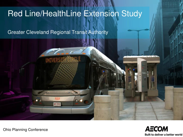
Red Line/HealthLine Extension Study
Red Line/HealthLine Extension Study Greater Cleveland Regional - - PowerPoint PPT Presentation
Red Line/HealthLine Extension Study Greater Cleveland Regional Transit Authority Ohio Planning Conference Agenda Background information Transit-Oriented Development in urban settings Alternatives examined Alternatives evaluation
Ohio Planning Conference
Greater Cleveland Regional Transit Authority
Red Line/HealthLine Extension Study
Agenda
RTA Strategic Plan 2010-2020
HealthLine Red Line
Euclid Ave
Regional Transit Map
Laketran service area
Economic Benefits of Transit Investments
Direct Benefits
Indirect Benefits
Transit Drives Community Revitalization
Transit and Economic Opportunity
Transit Economic Development Multipliers
Public transit spurs economic growth and development
Transit Oriented Development
What Do We Mean?
Patterns of land use and development that feature:
Transit Oriented Development (TOD):
Characteristics TOD US Average Cars per household (HH) 0.9 1.6 Percent no cars per HH 18.5% 10.7% Percent 2 cars per HH 40% 60% Percent < 2 cars per HH 63% 45%
– Builds neighborhood and community – Provides diversity and mixed-use, creates place – Respects the human scale – Creates quality pedestrian realm – Lowers automobile use – Improves sustainability
Red Line Extension
Heavy Rail Transit (HRT)
Red Line railcars were originally delivered with signs for Euclid and Mentor!
Alternative B (Heavy Rail Transit)
Euclid Park-N-Ride Euclid Park-N-Ride
HealthLine Extension
Bus Rapid Transit (BRT)
Alternative E (Bus Rapid Transit)
East 300th Street / Shoregate Shopping Center
Alternative G (Bus Rapid Transit)
East 300th Street / Shoregate Shopping Center
FTA New Starts Project Evaluation Rating
Economic Development (16.66%) Mobility Improvements (16.66%) Environmental Benefits (16.66%) Congestion Relief (16.66%) Land Use (16.66%)
Project Justification Rating (50%)
Reliability/ Capacity (50%) Commitment of Funds (25%) Current Conditions (25%)
Financial Rating (50%)
Summary Rating
Cost Effectiveness (16.66%)
FTA New Starts Project Evaluation Rating
Economic Development (16.66%) Land Use (16.66%)
Project Justification Rating (50%)
Reliability/ Capacity (50%) Commitment of Funds (25%) Current Conditions (25%)
Financial Rating (50%)
Summary Rating
Examination of the existing corridor and station area development, character, and affordability housing.
Question Answer What are we measuring? Number of legally binding affordable housing units. Density of population and employment within ½-mile of stations. What are the sources? Census data; affordable housing policies Reporting methods
the template.
Environmental Benefits Congestion Relief Cost Effectiveness Economic Development Mobility Improvements
Land Use
The land use measure includes an examination of existing corridor and station area development and character; existing station area pedestrian facilities, existing corridor and station area parking supply and population and Employment living or working within a one-seat ride of the project station.
Land Use Rating Breakpoints
Rating Employment Served by System Average Population Density (persons/square mile) High ≥ 220,000 ≥ 15,000 Medium-High 140,000-219,999 9,600 - 15,000 Medium 70,000-139,999 5,760 – 9,599 Medium-Low 40,000-69,999 2,561 – 5,759 Low ≤ 40,000 ≤ 2,560
Urban Fabric Analysis
Urban Fabric: Heavy Rail Extension
– station design concept – horizontal and vertical connections – Is there something to connect to?
– Land redevelopment opportunities vs. active employment centers
Urban Fabric: BRT, Rapid+
Boulevard, St. Clair Avenue, and the north-south connecting streets work as transit corridors?
– Distinctive stations in strategic spots? – BRT or streetcar running ways? – BRT or streetcar on “complete streets”?
Station Area Population and Employment
Alternative B Alternative E Alternative G Hybrid Technology HRT BRT BRT BRT/HRT Stations 7 23 23 31 Square miles 5.53 18.17 18.17 24.49 Population and Population Density (persons per square mile of station area) Population (½-mile radius) 24,752 54,470 53,012 61,907 Population density 4,475.9 2,997.8 2,917.6 2,527.8 FTA Rating Medium-low Medium-low Medium-low Low Employment CBD + University Circle 130,000 130,000 130,000 130,000 Study area employment 10,050 8,744 10,117 26,755 Total employment 140,050 138,744 140,117 156,755 FTA Rating Medium-high Medium Medium-high Medium-high
Examination of the extent the project is likely to induce additional transit-supportive and oriented development.
Question Answer What are we measuring? Qualitative examination of existing local plans and policies to support economic development. What are the sources? Local development plans and policies; zoning ordinances; underlying economic conditions ; availability of land in station areas. Reporting methods Deferred to project development and preliminary engineering.
Environmental Benefits Congestion Relief Cost Effectiveness Mobility Improvements
Economic Development
Land Use
Transit Supportive & Oriented Development
Patterns of land use and development that feature:
Economic Development Market Perspective
TOD Choices: Distinctly Different
Alternative B: Heavy Rail Extension
destinations and redevelopment potential, but poor connectivity
Alternatives D, E, G: BRT or Rapid+
Collinwood, downtown Euclid, lake shore, neighborhoods, industry
Collinwood Five Points
Circa 1942
Collinwood Five Points Land-Use
Red Line/Healthline Extension Major Transportation Improvement Analysis Page 31
East Cleveland Land-Use (Euclid Avenue)
Red Line/Healthline Extension Major Transportation Improvement Analysis Page 32
Reimagining Euclid – Noble Road
Economic Development Criteria
Alternative B Alternative E Alternative G Hybrid Growth management Medium-low Medium-low Medium-low Medium-low Transit supportive policies Medium-low Medium-low Medium-low Medium-low Supportive zoning near transit Medium Medium Medium Medium TOD implementation tools Medium Medium Medium Medium Performance of TOD policies Medium-High High High High Potential TOD impact Medium Medium Medium Medium Affordable housing policies Medium Medium Medium Medium Economic Development Rating Medium-low Medium Medium Medium
Summary Project Justification Evaluation
Alternative B Alternative E Alternative G Hybrid Technology HRT BRT BRT BRT/HRT Route Miles 6.5 10.4 10.3 15.3 New Start Project Justification Ratings Cost effectiveness Medium Medium Medium Medium Mobility Medium Medium-low Medium-low Medium Congestion relief Medium Medium-low Medium-low Medium Environmental benefits High High High Medium-high Land use Medium Medium-low Medium Medium-low Economic development Medium-low Medium Medium Medium Project Justification Rating Medium 3.16 Medium-low 2.8 Medium 3.0 Medium 3.0
Red Line/HealthLine Extension Major Transportation Improvement Analysis
Funding Gap for Capital Improvements
State of Good Repair $210.9 million Bus fleet replacement $53.1 million
Rail fleet replacement
$280 million
State Investment in Transit
$0.0 $5.0 $10.0 $15.0 $20.0 $25.0 $30.0 $35.0 $40.0 $45.0 $50.0 2000 2001 2002 2003 2004 2005 2006 2007 2008 2009 2010 2011 2012 2013 2014 2015
Transit Funding (Million $)
Ohio General Revenue Funding For Public Transit
State Funding for Public Transit
(2000 – 2014)
Source: ODOT; Transit Needs Study, January 2015.
Summary of Financial Rating
Current conditions
Local financial commitment
Reliability and capacity
Summary Rating – Not Eligible for New Starts
Financial rating = Low Project justification rating = Medium
Alternative B Alternative E Alternative G Hybrid Technology HRT BRT BRT BRT/HRT Route Miles 6.5 10.4 10.3 15.3 New Start Project Justification Ratings Cost effectiveness Medium Medium Medium Medium Mobility Medium Medium-low Medium-low Medium Congestion relief Medium Medium-low Medium-low Medium Environmental benefits High High High Medium-high Land use Medium Medium-low Medium Medium-low Economic development Medium-low Medium Medium Medium Project Justification Rating Medium 3.16 Medium-low 2.8 Medium 3.0 Medium 3.0 New Start Financial Rating Current Condition Low Low Low Low Local financial commitment Low Low Low Low Reliability and capacity Low Low Low Low Financial Rating Low Low Low Low Summary Rating New Starts Summary Rating Medium-low Medium-low Medium-low Medium-low
Conclusions
– Red Line & HealthLine options satisfy FTA project justification criteria, but... – Inadequate local/state financial support for New Starts project.
Next Steps
– Study the alternatives in segments – Work with local communities to plan for transit improvements – Continue to develop transit-supportive land use policies with partners – Develop support from other partners for a major capital investment
Red Line/HealthLine Extension Major Transportation Improvement Analysis