
SLIDE 1
Photo Credit: Bike Walk Wichita
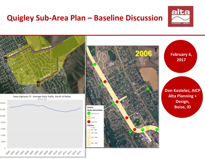
Quigley Sub-Area Plan Baseline Discussion February 6, 2017 Don - - PowerPoint PPT Presentation
Quigley Sub-Area Plan Baseline Discussion February 6, 2017 Don Kostelec, AICP Alta Planning + Design, Boise, ID Photo Credit: Bike Walk Wichita Purpose A more focused evaluation of transportation network connectivity in the area
Photo Credit: Bike Walk Wichita
Photo Credit: Bike Walk Wichita