Public Meeting 2 Dr. Martin Luther King, Jr School Cafeteria 102 - - PowerPoint PPT Presentation

public meeting 2
SMART_READER_LITE
LIVE PREVIEW

Public Meeting 2 Dr. Martin Luther King, Jr School Cafeteria 102 - - PowerPoint PPT Presentation

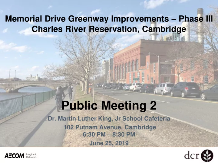
Memorial Drive Greenway Improvements Phase III Charles River Reservation, Cambridge Public Meeting 2 Dr. Martin Luther King, Jr School Cafeteria 102 Putnam Avenue, Cambridge 6:30 PM 8:30 PM June 25, 2019 Commonwealth of Massachusetts


slide-1
SLIDE 1
  • Dr. Martin Luther King, Jr School Cafeteria

102 Putnam Avenue, Cambridge 6:30 PM – 8:30 PM June 25, 2019

Memorial Drive Greenway Improvements – Phase III Charles River Reservation, Cambridge

Public Meeting 2

slide-2
SLIDE 2

Commonwealth of Massachusetts

Governor Charles D. Baker Lieutenant Governor Karyn E. Polito Energy and Environmental Secretary Kathleen Theoharides Department of Conservation and Recreation Commissioner Leo P. Roy

2

slide-3
SLIDE 3

DCR Mission Statement

To protect, promote, and enhance our commonwealth of natural, cultural, and recreational resources for the well-being of all.

3

slide-4
SLIDE 4

Tonight’s Meeting: Existing Conditions, Concepts

Welcome and Opening Remarks Presentation

➢ What We Heard Last Time ➢ Shared Goals ➢ Existing Conditions ➢ Traffic Study ➢ Preliminary Concepts Overview

Breakout Groups

➢ Reid Overpass/ B.U. Rotary ➢ Western Avenue and River Street Intersections ➢ Traffic Study ➢ Preliminary Concepts

slide-5
SLIDE 5

Phase III

  • Reid Overpass and Rotary at Boston

University Bridge

  • Major Intersections at Western Avenue,

River Street, JFK Street

  • Dr. Paul Dudley White Bike Path
  • John W. Weeks Footbridge (over the

Charles River)

  • Magazine Beach Pedestrian Bridge

5

slide-6
SLIDE 6

Public Process

Hear Community Priorities Assess Existing Conditions Conceptual Alternatives Design Development

Implementation

6

Tonight

slide-7
SLIDE 7

What We Heard

  • Over 800 comments received

7

Wicked Local/ Diane McLaughlin

slide-8
SLIDE 8

What We Heard: Listening Session

8

Desire for wider path for pedestrians and cyclists and a healthy tree canopy

17% 27% 56%

LISTENING SESSION COMMENTS

Public realm Recreation Transportation

slide-9
SLIDE 9

What We Heard: Public Input Map

9

* Option to check multiple options

234 transportation comments*:

Bicycling – 67% Walking/Jogging – 63% Driving – 32% Street Crossings – 31% Traffic Signals – 24%

74% 8% 18%

PUBLIC INPUT MAP

Transportation Public Realm Recreation

slide-10
SLIDE 10

Public Input Map – Pin Clusters: Transportation

10

Memorial Drive at BU Rotary “Need continuous protected bike lane

in entirety of rotary. At minimum, where a bike lane starts should not be in the middle of the rotary where there is no ramp to get onto it safely. The current ramp on this side nearest the BU bridge is often crowded by pedestrians and not cut wide enough to make an smooth turn onto the bridge from the ped/bike path without feeling like you will end up in the vehicular lane.”

slide-11
SLIDE 11

Public Input Map – Pin Clusters: Transportation

11

Memorial Drive at Western Ave “I live just down the street from this

intersection and have witnessed multiple

  • collisions. Fortunately all involved have

been safe each time because only cars were involved, but it terrifies me to bike through this intersection (as I must do each day to get to work). The intersection should be redone in order to encourage cars to slow down significantly to make it safer for all involved, with specific care taken for infrastructure for bikers and

  • pedestrians. Cross walks are needed in all

directions at this intersection.”

slide-12
SLIDE 12

Public Input Map – Pin Clusters: Public Realm

12

Memorial Drive at North Harvard Street “I think most places along the path could

benefit from more plantings of native species, especially here where beds of daffodils add visual appeal but do little for birds, bees, or the river ecosystem. The example of the wetlands areas further west provide a good model to follow.”

slide-13
SLIDE 13

Public Input Map – Pin Clusters: Recreation

13

Memorial Drive at Weeks Footbridge “More water fountains should be added.

The water fountains are few and far between on this side of the Charles.”

slide-14
SLIDE 14

What We Heard: Written Feedback

  • Cambridge
  • Boston
  • Allston
  • Brighton
  • Charlestown
  • Dorchester
  • Jamaica

Plain

  • Roslindale
  • Somerville
  • Arlington
  • Belmont
  • Brookline
  • Malden
  • Medford
  • Melrose
  • Needham
  • Newton
  • Wakefield
  • Wellesley
  • Winchester

➢ Magazine Beach Partners ➢ WalkBoston ➢ Cambridge Bicycle Safety ➢ The Charles River

Conservancy

➢ Buckingham, Browne &

Nichols School

➢ City of Cambridge

14

Residents of:

slide-15
SLIDE 15

Shared Goals: Public Realm

  • Improve drainage through the use of green stormwater

management

  • Design for habitat enhancement using native plant species
  • Seize opportunities for place-making where space allows

such as the river’s edge west of JFK Street

  • Enhance the tree canopy through the application of

species most likely to thrive in the riverside environment

15

slide-16
SLIDE 16

Shared Goals: Recreation

16

  • Improve the pedestrian and cyclist’s user experience:

➢ Provide separate treadways, wherever possible ➢ Improve pathway surface conditions ➢ Improve pathway/roadway crossings

  • Improve drainage to minimize roadway impacts on

water quality

  • Improve accessibility to parklands for people of all

abilities

slide-17
SLIDE 17

Shared Goals: Recreation

17

  • Investigate expansion of car-free Memorial Drive to

include both Saturdays and Sundays during the summer

  • Investigate options to shorten the distance between

access points from the adjoining neighborhoods to the parks.

  • Provide lighting to increase level of comfort in the

parkland

slide-18
SLIDE 18

Shared Goals: Transportation

18

  • Improve timing and phasing at intersections to reduce

modal conflicts

  • Target project area for a road diet wherever applicable
  • Improve operation for all modes at the BU Rotary/Reid
  • verpass. Consider designs to eliminate barriers for

pedestrians and cyclists while improving transit.

slide-19
SLIDE 19

Existing Conditions

Tree Health Stormwater Management Typical Road Conditions Traffic Study

19

slide-20
SLIDE 20

Evaluating Tree Conditions

20

slide-21
SLIDE 21

Stormwater Management

Concerns and Areas for Improvement

21

slide-22
SLIDE 22

Typical Road Conditions: Memorial Drive

Horizontal photo placeholder

22

slide-23
SLIDE 23

Bicyclist and Pedestrian Volumes

Horizontal photo placeholder

23

slide-24
SLIDE 24

Traffic Volumes

Horizontal photo placeholder

24

slide-25
SLIDE 25

Critical Approaches and Turning Movements

25

slide-26
SLIDE 26

Key Pedestrian/Cyclist Connections

Horizontal photo placeholder

26

slide-27
SLIDE 27

Travel Times (a.m. peak)

Horizontal photo placeholder

27

slide-28
SLIDE 28

Travel Times (p.m. peak)

Horizontal photo placeholder

28

slide-29
SLIDE 29

Intersection Operations

Horizontal photo placeholder

29

slide-30
SLIDE 30

Intersection Operations – Turning Movements

Horizontal photo placeholder

30

slide-31
SLIDE 31

Regional Coordination

slide-32
SLIDE 32

Crash Data Summary

  • 2 Intersections in state-wide top 200 crash locations:

➢ Memorial Drive/River Street (#86) ➢ Memorial Drive/Western Avenue (#135)

  • Bicycle Crash Clusters identified at 2 locations:

➢ Memorial Drive/JFK Street ➢ Memorial Drive/Boston University Rotary

  • Crash Data Summary

➢ 225 crashes on Memorial Drive (2014 – 2016) ➢ 8.5% of total crashes involved peds and cyclists ➢ Memorial Drive/JFK Street: highest number of crashes

involving pedestrians and cyclists

➢ Most prevalent collision type: angle collision

slide-33
SLIDE 33

Traffic Study

Horizontal photo placeholder

33

Evaluation Criteria

  • Existing peak hour demand
  • Travel times

➢ Individual segments and overall corridor

  • Intersection operations

➢ Current and reduced capacity ➢ Current and modified phasing & timings

  • Critical turning movements along corridor
slide-34
SLIDE 34

Preliminary Concepts Overview

slide-35
SLIDE 35

Reclaiming Space on the Corridor

slide-36
SLIDE 36

Eliot Bridge to JFK Park Concept

  • Road diet
  • Additional park

space

  • Separated paths
  • Evaluation of existing

street trees

slide-37
SLIDE 37

18

JFK Park to Flagg Street Concept

  • Existing parkland

allows path widening and separation

  • Improvements to
  • pen space
  • Widening crossings
  • Turning movements

require lane allocation

  • Preservation of

existing street trees

slide-38
SLIDE 38

8

Flagg Street to Pleasant Street Concept

  • Opportunity for

signal timing improvements

  • Boardwalk being

considered in specific locations

  • Turning Movements

Require Lane Allocation

  • Narrow right-of-way
  • Environmental

Impact Considerations

slide-39
SLIDE 39

8

Pleasant Street to B.U. Rotary Area Concept

  • Increased path

width and separation

  • Drainage

improvements

  • High traffic

volumes

  • Narrow right-of-

way in places

slide-40
SLIDE 40

Boston University Rotary/ Reid Overpass

  • Goals
  • Considerations
  • Concepts
slide-41
SLIDE 41

8

B.U. Rotary/ Reid Overpass: Goals

  • Remove Ped/ Bike

Connectivity barriers

  • Calm Traffic
  • Remove Conflict Points,

improve Safety

  • Do Not Preclude Grand

Junction Rail/Trail Connection

slide-42
SLIDE 42

8

  • Park Space and

Connectivity

  • Topography
  • Capacity Limits on the B.U.

Bridge

  • Structure Ownership
  • Historic Designation

B.U. Rotary/ Reid Overpass: Considerations

slide-43
SLIDE 43

Where is Traffic Heading Today

43

From Eastbound Memorial Drive From Northbound BU Bridge

slide-44
SLIDE 44

Where is Traffic Heading Today

Horizontal photo placeholder

44

From Westbound Memorial Drive From Southbound Brookline Street

slide-45
SLIDE 45

8

Alternative 1: Formalize Existing Configuration

B.U. Rotary/ Reid Overpass Concept

  • Gains to parkland greenspace

limited

  • Improvements to conflict

points limited to south side

  • Limited improvements for

ped/bike crossing (north- south)

  • Some improvements to lane

delineation (geometry, curb lines, and striping)

  • Signal opportunities
  • Improvements to ped/bike

crossing (east-west)

slide-46
SLIDE 46

8

Alternative 2: Keep Overpass, Reconfigure At-grade Geometry

B.U. Rotary/ Reid Overpass Concept

  • Eliminates rotary aspect and

controls all vehicle thru and turning movements with signals

  • Flexibility for left-turn options
  • Improvements to ped-bike

crossings (north-south)

  • Gains to parkland greenspace

in all four quadrants

  • Conflict points managed by

signalized crossings

  • Improvements to ped-bike

crossing (east-west)

slide-47
SLIDE 47

8

Alternative 3: Remove Overpass and Accommodate Volumes At-grade

B.U. Rotary/ Reid Overpass Concept

  • Results in long vehicle queue

lengths at signalized crossing

  • Reduces number of conflict points
  • Improvements to ped-bike crossing

(east-west)

  • Improvements to ped-bike

crossings (north-south)

  • Substantial gains to parkland

greenspace in all four quadrants

  • Vehicle travel times increased
slide-48
SLIDE 48

Breakout Groups 7:40 – 8:15 p.m.

Report back: 8:15 p.m.

Western and River Box BU Rotary/ Reid Overpass Alternatives Traffic Questions? Concept Development

slide-49
SLIDE 49

Next Steps

  • Next Anticipated Meeting: Fall 2019

➢ Design Development ➢ Path at Intersections ➢ BU Rotary/Reid Overpass ➢ Landscape/Programming

49

Hear Community Priorities Assess Existing Conditions Conceptual Alternatives Design Development

slide-50
SLIDE 50

Comment Deadline Associated with this Meeting: July 25, 2019 For more information: www.mass.gov/dcr/past-public-meetings

  • https://www.mass.gov/service-details/memorial-drive-greenway-

improvements-phase-iii

  • If you have comments or suggestions on this project:

Submit online: www.mass.gov/dcr/public-comment Write: Department of Conservation and Recreation Office of Public Outreach 251 Causeway Street, Suite 600 Boston, MA 02114 Note: Public comments submitted to DCR may be posted on the DCR website in their entirety, and no information, including contact information, will be redacted. If you wish to subscribe to a DCR general information or project-related listserv: contact DCR’s Office of Community Relations at 617-626-4973 or Mass.Parks@state.ma.us.

Connect: Stay Involved

50

slide-51
SLIDE 51
slide-52
SLIDE 52

Weekday Travel Speeds – 24 hours

30-34 35-39 30-34 35-39 25-29 30-34 30-34 35-39 30-34 35-39 30-34 35-39 25-29 30-34 35-39 40-44 XX-XX (mph) XX-XX (mph) EASTBOUND WESTBOUND AVG 85th AVG 85th XX-XX (mph) XX-XX (mph)

slide-53
SLIDE 53

Weekday Travel Speeds – Off Peak

30-34 35-39 30-34 35-39 20-24 30-34 30-34 35-39 25-29 30-34 30-34 35-39 20-24 30-34 35-39 40-44 XX-XX (mph) XX-XX (mph) EASTBOUND WESTBOUND AVG 85th AVG 85th XX-XX (mph) XX-XX (mph)

slide-54
SLIDE 54

AM Peak Hour Travel Speeds (mph)

29 8 17 5 8 14 31 25 24 15 7 26 20 24 31 21

slide-55
SLIDE 55

PM Peak Hour Travel Speeds (mph)

30 11 20 27 11 24 32 8 9 14 20 4 5 5 3 18

slide-56
SLIDE 56
  • Takes 5 min 14 sec to traverse corridor at 25 mph.