
SLIDE 1
PRIMARY STUDY AREA CITY & FEDERAL PLANNING INITIATIVES National - - PDF document
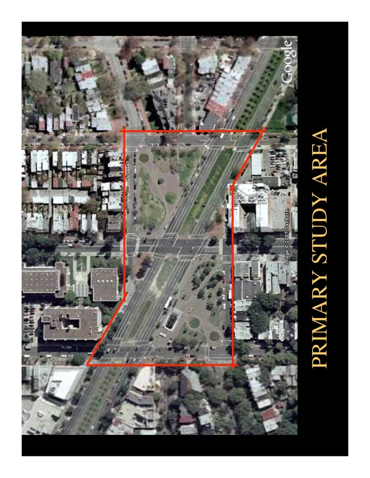
PRIMARY STUDY AREA CITY & FEDERAL PLANNING INITIATIVES National Capital Framework Plan Tonights Presentation Site History & Existing Conditions Amy Weinstein Weinstein Studio Traffic and Transportation Issues Louis J. Slade,
National Capital Framework Plan
Amy Weinstein Weinstein Studio
Louis J. Slade, Principal Steve Pinkus, Planner Gorove/Slade Associates
Marisa Scalera, Associate Oehme, van Sweden & Associates
The Ellicott “Ten-Mile Square” map 1794 (based on 1793 manuscript)– Andrew Ellicott
1791 L’Enfant Plan
(as redrafted in 1887 by Colonna & Thorn)
1792 Ellicott Plan 1804 King Plat
1795
Tunnicliffe’s Tavern (Eastern Branch Hotel) c 1875 photograph
1795
The Maples
Mid 19th Century
2 residences at NE corner of 8th & D Streets
Compiled from:
1857 Boschke map
Wallach School (photo taken in the 1870’s)
Old Naval Hospital (photo c. 1900 from National Archives)
View east along Pennsylvania Avenue
Compiled from:
1876 Reservation Plats, 1882 Hilgard Engineering Map 1887 Hopkins Real Estate Atlas
1892
Charles Gessford Row (824 – 832 D Street, SE)
1891
Henry Rabe Residence (820 D Street, SE)
1891-95
Grace Church built
Newspaper ad for Haines Store showing 8th St. Trolley
1894 Cast iron balustrade fence installed
Compiled from:
1903 Baist Real Estate Atlas
1922
SE Branch Carnegie Library built (1927 photograph looking across Res. 44)
NEOCLASSICAL PARK DESIGN
VICTORIAN PARK DESIGN
Looking east from 7th & Carolina
People’s Drug Store
Kresge’s 5 & 10
Compiled from:
1938 Baist Real Estate Atlas 1957 Baist Real Estate Atlas
Wallach School a year before it was demolished
Looking Southeast at 8th Street shortly before tracks are removed
1966
Hine Junior High School
1967
Bill introduced to the House of Representatives to name the space “Eleanor Roosevelt Square”
1969 - South Carolina Ave. closed 1970 - Metro Station Construction 1975/1982 - WMATA / NPS
Landscape Restoration
1990
660 Pa Ave addition to Kresge
D Street South new construction (FedEx, Kinko’s)
Mount Vernon Square Stanton Park Eastern Market Metro Park & Plaza Marion Park
Streetcar Lines
1880’S Compiled Map
1872
Petersen & Enthoffer
1872
Office of Public Buildings & Grounds
1901 McMillan Plan No. D - 99
1914 Permanent System of Highway
1914 System of highways
1792 1800 2 Horse Stage Coach 1830 Omnibus 1862 Horse drawn Streetcar 1892 Streetcar goes electric 1903 Streetcar extend along Penn. Avenue 1908 Streetcar extends north on 8th Permanent System of Highways map showing roads diverted around a single central space McMillan Report map showing a single green space Federal map showing a single space L’Enfant concept of focal civic spaces linked by avenues
1970 Construction of Metrorail Station 1872 1901 1914
1930’s – 60’s Growth in personal car use 2008 Multi Modal Transportation Network 2008 Eastern Market Metro Park/ Plaza
Sq uar e V tran spo rt 1921 1970 2008
DDOT Proposed
EXISTING
Low-Medium Density Housing Commercial Public Medium Density Housing
Compiled from: DC Government, Office of Planning
East-West Section North-South Section
Compiled from: AMT Survey
x
indicates number of feet above sea level
Compiled from: AMT Survey
Compiled from: AMT Survey
Water line Water Manhole Sewer Line Sewer Manhole Fire Hydrant
Compiled from: AMT Survey and WMATA Rail Alignment Drawings
Compiled from: AMT Survey and WMATA Rail Alignment Drawings
Aerial View
Compiled from: Gorove / Slade Traffic Analysis
Compiled from: Gorove/Slade Traffic Analysis
No Parking Metered Parking 2 Hour Parking, Zone 6 RPP # hr Meter Time Allowance # Number of Spaces
Compiled from: Gorove / Slade Traffic Analysis Source: DDOT
Signs Indicating a Shared Roadway (Existing) Bicycle Lane (Planned)
Compiled from: Gorove / Slade Traffic Analysis
Compiled from: Gorove / Slade Traffic Analysis
Compiled from: Gorove / Slade Traffic Analysis Source: DDOT
One-way stop sign causes excessive delay during peak periods
Compiled from: Gorove / Slade Traffic Analysis
Compiled from: Gorove / Slade Traffic Analysis
Dominant Pedestrian Flow Secondary Pedestrian Flow
Compiled from: Gorove / Slade Traffic Analysis Source: WMATA
METRORAIL Average Daily Boardings METROBUS Average Daily Boardings 5,600 2,500
Average Weekly Mode Split – Eastern Market Metrorail
Compiled from: Gorove / Slade Traffic Analysis Source: WMATA
Drop-offs Bus & Connecting Rail Walk Drove & Parked
Compiled from: Gorove / Slade Traffic Analysis Source: DDOT and WMATA
Compiled from: Gorove / Slade Traffic Analysis Source: DDOT and WMATA
Compiled from: Gorove / Slade Traffic Analysis
INCLUDING EXCESSIVE SPEEDS
STREETS
TRANSFER DISTANCES
Lincoln Park
Stanton Park
Eastern Market Metro Park & Plaza
Marion Park
Dupont Circle
Folger Park/ Providence Park
Silva Cell Developed by James Urban and DeepRoot
Precedent at SW 12th Avenue Green Street Project Portland, Oregon Designer: Kevin Robert Perry, ASLA
Precedent from City of Portland Stormwater Solutions Handbook Portland, Oregon
Precedent at Washington Canal Park Washington, DC Designer: Gustafson Guthrie Nichol and Magnusson Klemencic Associates (civil engineers)
COMMERCE
EXTEND THE CITY’S HISTORIC PLANNING VISION FOR COMMUNITY CENTERED URBAN OPEN SPACES