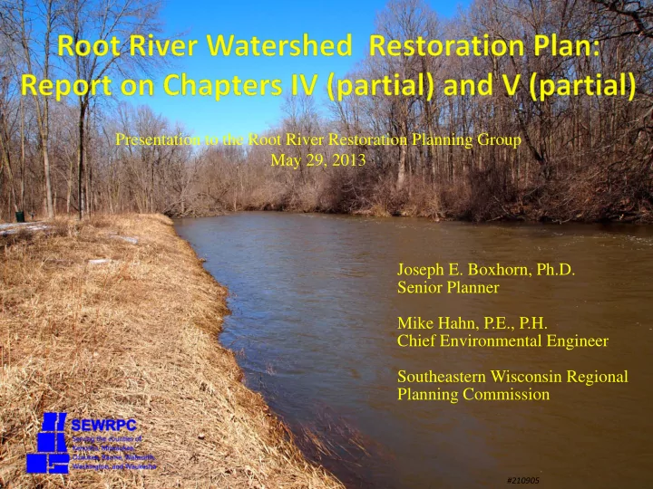
SLIDE 1 Joseph E. Boxhorn, Ph.D. Senior Planner Mike Hahn, P.E., P.H. Chief Environmental Engineer Southeastern Wisconsin Regional Planning Commission
#210905
Presentation to the Root River Restoration Planning Group May 29, 2013
SLIDE 2
Partners and Funding Agencies
Municipalities and Counties of the Root River Watershed
SLIDE 3
Plan Approach
1. Summarize Recommendations of the Regional Water Quality Management Plan Update (RWQMPU) 2. Evaluate Implementation of the RWQMPU 3. Inventory Recent and Ongoing Projects, Programs, and Initiatives and Integrate these Into Recommendations 4. Review and Refine Initially Identified Focus Issues 5. Characterize the Watershed Concentrating on Features Related to the Focus Issues
SLIDE 4 Plan Approach
6. Identify Targets to be Achieved by the End of the Plan Period 7. For Each Target, Identify Actions to be Taken 8. Identify Foundation Actions 9. Present Actions in Addition to those Recommended in the RWQMPU
- 10. Develop an Implementation Strategy
SLIDE 5 The plan is being documented in: SEWRPC Community Assistance Planning Report
- No. 316, A Restoration Plan for the Root River
Watershed
SLIDE 6 Report Chapters
I. Introduction II. Summary of recommendations of the RWQMPU for the Root River and evaluation of implementation to date
- III. Inventory of relevant plans, programs, and initiatives
- IV. Characterization of the watershed
V. Description of targets to be achieved and alternative management measures
- VI. Recommended watershed restoration plan
- VII. Implementation strategies
SLIDE 7
Chapter IV—Characterization of the Root River Watershed
SLIDE 8
Exotic and Invasive Species
SLIDE 9 Aquatic Invasive Species ‐ Animals
Common Carp
Source: Minnesota DNR
Rusty Crayfish
Source: Wisconsin DNR
Goldfish
Source: B. Albert, USGS
Zebra Mussel
Source: Wisconsin Lakes Partnership
SLIDE 10 Aquatic Invasive Species ‐ Plants
Curly-leaf Pondweed
Source: Elizabeth Czarapata, WDNR
Eurasian Water Milfoil
Source: Elizabeth Czarapata, WDNR
Flowering Rush
Source: W.A. Smith, WDNR
SLIDE 11 Riparian Invasive Species ‐ Plants
Japanese Knotweed
Source: Elizabeth Czarapata, WDNR
Purple Loosestrife
Source: S. Kelly Kearns, WDNR
Common Reed Grass
Source: Elizabeth Czarapata, WDNR
Common Buckthorn
Source: Wisconsin DNR
Glossy Buckthorn
Source: Wisconsin DNR
Wild Parsnip
Source: Wisconsin DNR
SLIDE 12 Riparian Invasive Species ‐ Plants
Common Teasel
Source: Stephen Solheim, UW-Whitewater
Cut-Leaf Teasel
Source: Wisconsin DNR
Reed Canary Grass
Source: Wisconsin DNR
Garlic Mustard
Source: Wisconsin DNR
SLIDE 13 Infestations of Aquatic Invasive Species
Waterbody Species Reported Hoods Creek Rusty Crayfish Lower Kelly Lake Eurasian Water Milfoil Quarry Lake Zebra Mussel Root River Common Carp, Goldfish, Rusty Crayfish Root River Canal Common Carp, Rusty Crayfish Ryan Creek Rusty Crayfish Scout Lake Curly‐leaf Pondweed, Eurasian Water Milfoil Upper Kelly Lake Curly‐leaf Pondweed, Eurasian Water Milfoil West Branch Root River Canal Rusty Crayfish
SLIDE 14 SEWISC Roadside Surveys: 2011‐2012
Conducted from cars
driving along highways
Common Reed Grass at
115 sites
Teasel at 113 sites Japanese Knotweed at
3 sites
Wild Parsnip at 81 sites
Infestations were
quantified as small, moderate, or large
SLIDE 15 WDNR Reed Canary Grass Assessment
Used satellite imagery
to assess wetlands dominated by reed canary grass
5,230 acres of wetland
with less than 50 percent reed canary grass coverage
619 acres of wetland
with more than 50 percent reed canary grass coverage
SLIDE 16
Recreational Use and Access
SLIDE 17
Park and Open Space Sites
State
8 sites 220 acres
Milwaukee County
18 sites 5,582 acres
Racine County
10 sites 1,244 acres
SLIDE 18
Park and Open Space Sites
Municipal
124 sites 2,056 acres
Milwaukee Metropolitan
Sewerage District
8 sites 202 acres
SLIDE 19
Trails
44 miles of off street
trails
31 miles of on street
bicycle trails
Also equestrian trails Also “small trails” in
several parks
SLIDE 20 Boat Access
Below Horlick Dam
1 developed boat launch 4 developed canoe/kayak
launches
8 marinas/yacht clubs
Above Horlick Dam
1 developed boat launch 1 developed canoe/kayak
launch
“Informal” launches
Lakes
Upper and Lower Kelly
Lakes
SLIDE 21
Fishing Access
From banks at parks Urban fishing waters
SLIDE 22 Urban Fishing Waters
Stocked ponds with
special fishing rules
Franklin High School Gorney Park Lockwood Park Johnson Park Quarry Lake Park Scout Lake Park Schoetz Park
SLIDE 23
Chapter V—Development of Targets and Alternative Measures
SLIDE 24
Developing Targets
Begin with a definition of the main problems or issues
related to each focus area
As revealed by the inventories in Chapter IV Constitutes a refining of the focus area
Points to overall strategies for addressing the
problems
SLIDE 25
Sources of Targets
Starting point is the recommendations and analyses in
the Regional Water Quality Management Plan Update
Draw from relevant State and Federal standards Draw from the goals and objectives of related plans
and efforts that address the overall strategy
SLIDE 26 Water Quality Targets
Water quality problems are related to concentrations
- f dissolved oxygen, nutrients, and chloride
Chloride concentrations
Long‐term increase (since 1964) Exceedences of water quality criteria Accumulation of chloride in groundwater Information gaps
Few winter data Compared upper Root River to Menomonee River
where there are more data available Appendix E
SLIDE 27 Water Quality Targets
Drivers of chloride problems:
Salt use for snow and ice control is probably the biggest
source
Atmospheric deposition is probably only responsible for
0.25 – 0.50 milligram per liter
Average concentration is about 200 milligrams per liter
Nationally, salt for deicing accounted for 41 percent
Salt for water treatment accounted for 1 percent
Salt for agricultural uses accounted for 3 percent
SLIDE 28 Water Quality Targets
Overall strategies
Fill data gaps Reduce applications of chlorides for snow and ice control
Targets
1.
Fill data gaps
a.
Sample during winter
b.
Sample the mainstem in Racine County and tributaries throughout the watershed
c.
Sample for both chloride and specific conductance
SLIDE 29
Water Quality Targets
Targets
2.
Continue ongoing evaluations of existing county and municipal deicing and anti‐icing programs with an emphasis on achieving additional salt reductions without compromising public safety
3.
Promote evaluations of private deicing operations on commercial, industrial, institutional, and residential properties with an emphasis on achieving voluntary salt reductions without compromising public safety
SLIDE 30 Recreational Use and Access Targets
Problem related to high concentrations of bacteria
indicative of fecal contamination
Water may be unsafe for human contact because it contains
disease‐causing agents
Two overall strategies for targets
Locate sources contributing sanitary wastewater to surface
waters and end these contributions
Locate sources contributing fecal pollution of nonhuman
- rigin and end these contributions.
SLIDE 31 Targets: Load Reductions
Source Fecal coliform bacteria (trillion cells) Urban NR 151‐related 963.29 Other measures 3,019.28 Subtotal 3,982.57 Rural NR 151‐related 204.67 Other measures 624.31 Subtotal 828.98 Total 4,725.42
SLIDE 32 Associated Water Quality
Condition Mean Fecal Coliform Bacteria (cells per 100 ml) during year Mean Fecal Coliform Bacteria (cells per 100 ml) during May to September swimming season Mean Range of Assessment Area Means Mean Range of Assessment Area Means Existing (2000) 5,009 2,401‐8,198 3,240 1,995‐5,142 Recommended Plan (2020) 2,987 1,975‐4,213 1,707 1,393‐2,141
SLIDE 33 Compliance with Fecal Coliform Bacteria Single Sample Standard
Condition Full year 400 cells per 100 ml (percent) Swimming Season 400 cells per 100 ml (percent) Mean Range of Assessment Area Means Mean Range of Assessment Area Means Existing (2000) 57 43 – 72 69 55 – 81 Recommended Plan (2020) 61 51 – 72 72 63 – 80
SLIDE 34 Compliance with Fecal Coliform Bacteria Geometric Mean Standard
Condition Full year 200 cells per 100 ml (days in compliance) Swimming Season 200 cells per 100 ml (days in compliance)a Mean Range of Assessment Area Means Mean Range of Assessment Area Means Existing (2000) 46 6 – 148 27 4 – 84 Recommended Plan (2020) 94 28 – 248 54 12 – 138
aOut of 153 days in the months May through September.
SLIDE 35 Recreational Use and Access Targets
Issue related to adequacy of the number of public
access points to the Root River
State Standard Major streams should have one access
site with parking every 10 miles of stream.
Currently one developed site with parking above Horlick Park
Additional access points recommended in Milwaukee
County and Racine County park and open space plans
Back to the Root plan recommends adding a launch at
Lincoln Park for portaging around the weir
SLIDE 36
Recreational Use and Access Targets
Issue related to adequacy parking at public access
points to Upper Kelly Lake and Lower Kelly Lake
State Standard Small lakes of less than 10 acres should
have one carry‐in access site with parking for five vehicles
Both lakes have adequate numbers of access points Both lakes have limited parking in the vicinity of the access
points
SLIDE 37
Recreational Use and Access Targets
Targets for public points to waterbodies
1.
Creation of 1‐2 carry in access sites along the Root River upstream from Horlick dam
2.
Develop additional parking at existing access sites on Lower Kelly Lake and Upper Kelly Lake
SLIDE 38 Next Steps
Continue and complete characterization of the
watershed
Biological conditions
Fish, macroinvertebrates, mussels
Buffer analyses Stream Characteristics Flooding (Racine County) Recreational access
SLIDE 39 Next Steps
Continue identifying targets to be achieved by the end
- f the plan implementation period
Continue Identifying and developing alternative
measures for achieving targets
SLIDE 40 Project Web Site
http://www.sewrpc.org/SEWRPC/Environment/Root‐River‐
Watershed‐Restoration‐Plan.htm
RRRPG meetings
- Summary notes from Advisory
Group meetings
- Draft chapters as they are
completed