
SLIDE 1
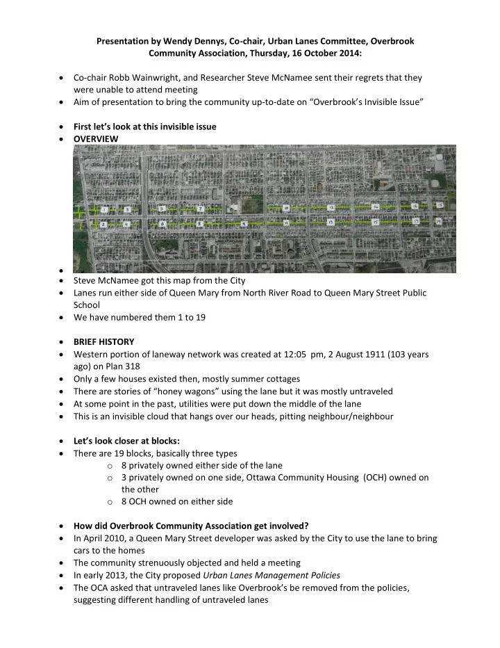
Presentation by Wendy Dennys, Co-chair, Urban Lanes Committee, Overbrook Community Association, Thursday, 16 October 2014: Co-chair Robb Wainwright, and Researcher Steve McNamee sent their regrets that they were unable to attend meeting Aim of presentation to bring the community up-to-date on “Overbrook’s Invisible Issue” First let’s look at this invisible issue OVERVIEW Steve McNamee got this map from the City Lanes run either side of Queen Mary from North River Road to Queen Mary Street Public School We have numbered them 1 to 19 BRIEF HISTORY Western portion of laneway network was created at 12:05 pm, 2 August 1911 (103 years ago) on Plan 318 Only a few houses existed then, mostly summer cottages There are stories of “honey wagons” using the lane but it was mostly untraveled At some point in the past, utilities were put down the middle of the lane This is an invisible cloud that hangs over our heads, pitting neighbour/neighbour Let’s look closer at blocks: There are 19 blocks, basically three types
- 8 privately owned either side of the lane
- 3 privately owned on one side, Ottawa Community Housing (OCH) owned on
the other
- 8 OCH owned on either side