planning for the future of burrill lake bridge
play

PLANNING FOR THE FUTURE OF BURRILL LAKE BRIDGE Community workshop - PowerPoint PPT Presentation

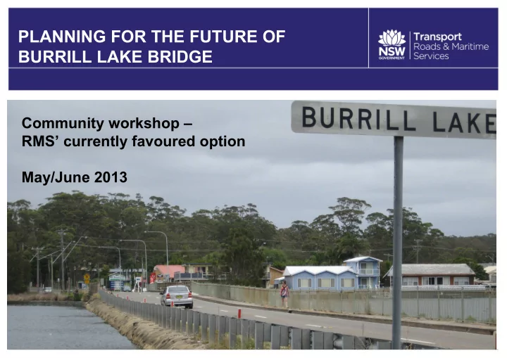
PLANNING FOR THE FUTURE OF BURRILL LAKE BRIDGE Community workshop RMS currently favoured option May/June 2013 Welcome 1. Housekeeping 2. Agenda and timing 3. Introductions 4. Objectives of the workshop 5. Overview and investigations


  1. PLANNING FOR THE FUTURE OF BURRILL LAKE BRIDGE Community workshop – RMS’ currently favoured option May/June 2013

  2. Welcome 1. Housekeeping 2. Agenda and timing 3. Introductions 4. Objectives of the workshop 5. Overview and investigations 6. RMS currently favoured option 7. Workshop – table discussions 8. Next steps 9. Light refreshments and further discussions RR

  3. Housekeeping and ground rules Housekeeping • Fire exits • Toilets • Refreshments • Room set-up: displays and materials Ground rules • Phones on silent • One person talking at a time • Table facilitators’ role RR

  4. Agenda and timing Overview and investigations: 6:35 pm (30 mins) • The existing bridge • Technical and field studies • Community consultation • Options considered • RMS’ currently favoured option Questions 7:05pm (25 mins) Workshop 7:30pm (45 mins) Report back 8:15pm (10 mins) Next steps and close 8:25pm (5 mins)

  5. Introductions – RMS staff • Renee Ridley – Senior Communications Officer – facilitator • Adam Berry – Project Manager – for this project • Scott Fayers – Bridge Maintenance Planner • Wade Higgins – Lead Road Designer • Peter Townsend – Project Manager (construction) • Angela Riepsamen – Environment Officer • Bill Healy – Property Acquisition Manager • James Page – Communications Officer RR

  6. Objectives of the workshop • Explain and discuss the RMS currently favoured option. • Explain and discuss how we got here. • Obtain your feedback. • Talk about the next steps. RR

  7. Key problem – the bridge is failing • The bridge is failing - 24 of 35 piles have full length vertical cracking. • Temporary brackets put in in 2003 have an effective life of 10 to 15 years. AB

  8. Other problems – low and flood prone The crossing floods too frequently for a major highway. This impacts on highway traffic and on residents by denying you a flood evacuation route. The frequency of flooding is predicted to increase in the future… AB

  9. Low and flood prone Climate Change 1 in 100 flood by 2100 3m AHD with sea level rise 1in100 flood now 2.4m AHD Bridge road level 2.1m AHD Causeway road level 1.5m AHD Typical water 0.4 - 1.2m AHD level now. AHD is “Australian Height Datum” which is sea level. So 3 metres AHD means 3 metres above sea level AB

  10. Other problems – low and flood prone AB

  11. Other problems – poor pedestrian facilities AB

  12. Other problems – narrow lanes and shoulders AB

  13. What have we done so far? • Flood and hydraulic modelling. • Flora, fauna, archaeology, noise, vibration, contamination, traffic and road safety issues. • Built a picture of the local community that includes business, tourism, social, pedestrian and other community considerations. • Surveyed the existing bridge, causeway, highway approaches, landforms and local road connections. • Road design and engineering investigations. • Geotechnical drilling to understand ground conditions. • Consulted with the community. AB

  14. Community consultation in mid 2012 • 5,000 brochures to Burrill Lake, Dolphin Point, Kings Point, Ulladulla and Mollymook. • Community information sessions at Ulladulla on May 22 and June 2. • 30 people attended the information sessions and 49 written submissions were received. AB

  15. Community consultation – shopper survey in late 2012 Between 11:00am and 3:00pm on a Saturday in November. 42 people using the shops were surveyed, 70 per cent of whom lived in Burrill Lake or surrounding areas. AB

  16. Community consultation – business surveys • Not exhaustive, snapshot of 9 businesses. • Many depend on trade from tourists to the lake, as well as passing motorists. • Some businesses more reliant on passing trade than others. i.e. some serve the local community more. • Access arrangements - both during and after any construction activity will be important for business. • Highway visibility and convenience of parking are key to the access arrangements. AB

  17. Summary - what you told us in 2012 • Residents value Burrill Lake for its environmental amenity, scenic attributes and quality of life. • The key local issues raised by the community included: � Improving the ecology of the lake (the causeway) � Improving traffic congestion (holiday traffic) � Improving pedestrian safety and access � Avoiding affecting the tourism industry � Maintaining business access due to their reliance on passing motorists � Opportunity to mitigate flood risks � Improving road safety � Considering local character and amenity AB

  18. Options for solving the problems… Options have been considered in light of: • Technical investigations. • Environmental and other field studies. • Feedback from the community. • Affordability and value for money. AB

  19. Maintenance Continued maintenance of the existing bridge (only the bridge) would: √ Address the immediate problem of the bridge piles. × Mean that maintaining the 50 year old bridge already failing will become increasingly expensive, inefficient and disruptive. × Retain the low bridge and road level and do nothing to improve flood immunity of the highway or to provide a ‘flood evacuation route’. × Mean retaining the causeway. × Mean retaining the existing road facilities – the poor pedestrian path, the narrow lanes for cars and trucks and the narrow road shoulders. AB

  20. New bridge and keep the causeway Replacing the existing bridge (only the bridge) would: √ Address the immediate problem of the bridge piles. × Retain the low bridge and road level and do nothing to improve flood immunity of the highway or to provide a ‘flood evacuation route’. × Mean retaining the causeway. × Mean retaining the existing road facilities on the causeway – the poor pedestrian path, the narrow lanes for cars and trucks and the narrow road shoulders. AB

  21. New bridge and remove the causeway Replacing the existing bridge and the existing causeway would: √ Address the immediate problem of the bridge piles. √ Allow the bridge and road level to be made higher - above the predicted 1 in 100 year flood level and would provide a ‘flood evacuation route’. √ Allow for the causeway to be removed. √ Allow for the existing road facilities to be replaced with a modern standard, wide pedestrian paths, lanes for cars and trucks and road shoulders. AB

  22. New bridge and remove the causeway • This is RMS currently favoured option. • This would be more expensive but would provide better value for money long-term solution. AB

  23. How will decisions be made? • No final decision has been made. • RMS and the NSW Government need to make a decision on the ‘preferred option’ before funding is committed. • The decision will be evidence based and take into account: • Technical investigations • Environmental and other field studies • Feedback from the community. • Affordability and value for money. • It is beyond the scope of this project and this project team to re- examine the Milton-Ulladulla bypass corridor. AB

  24. RMS’ currently favoured option: new higher bridge on a new alignment and remove the causeway AB

  25. Potential benefits of RMS’ currently favoured option If selected as the RMS preferred option, a new, higher bridge to the east of the existing crossing would: • Improve the overall reliability of the Princes Highway on the south coast by reducing future maintenance issues. • Provide a lake crossing and road approaches designed above the predicted 1 in 100 year flood level. • Improve road safety by providing new intersections to modern safety standards connecting the Princes Highway to local roads. • Provide the opportunity to improve pedestrian and cyclist access and safety. AB

  26. North and south sides... North side South side *Cross sections are indicative only AB

  27. RR Questions?

  28. Workshop – table discussions At your tables please discuss RMS’ currently favoured option. In particular RMS would like feedback on: • Parking and access arrangements for businesses on either side of the bridge. • Local amenity issues around the businesses on both sides. • Connections between existing pathways and new pathways on the proposed bridge. • Urban design and landscaping. • Potential noise impacts and mitigation measures. • Other comments? RR

  29. Next steps • Workshop and community issues report will be published - late 2013. • Concept design will be developed – late 2013. • Environmental assessment will be displayed for further community comments – late 2013 to early 2014. AB

  30. We want your feedback • Feedback forms are available for your individual feedback. • Submissions close Monday 10 June 2013. • Email: burrilllakecrossing@rms.nsw.gov.au •Post: RMS Southern Regional Office, PO Box 477, Wollongong, NSW 2520 •Telephone: 02 4221 2586 (during business hours) RR

  31. Thank you Thank you for participating Keep an eye on the project web page for updates: http://www.rta.nsw.gov.au/roadprojects/projects/princes_hway/burill_lake /index.html RR

Download Presentation
Download Policy: The content available on the website is offered to you 'AS IS' for your personal information and use only. It cannot be commercialized, licensed, or distributed on other websites without prior consent from the author. To download a presentation, simply click this link. If you encounter any difficulties during the download process, it's possible that the publisher has removed the file from their server.

Recommend


More recommend