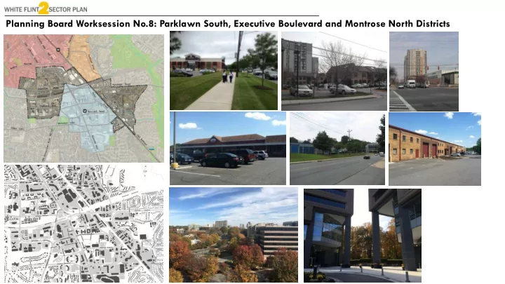
SLIDE 1
Planning Board Worksession No.8: Parklawn South, Executive Boulevard and Montrose North Districts
SLIDE 2 2
Prior Worksessions
▪ January 27: Focused on transportation analysis and staging recommendations in the Draft Plan. ▪ February 9: Reviewed the Executive Boulevard District and associated economic feasibility analysis for some properties. ▪ February 16: A joint meeting with the Rock Spring Master Plan
- n school issues within the Walter Johnson Cluster.
▪ February 23: Reviewed the Rockville-Pike Montrose North District and revisited five properties in the Executive Boulevard district. ▪ March 9: Reviewed the Randolph Hills district and Parklawn South district, and addressed industrial issues and multifamily residential issues. ▪ April 20: Reviewed the updated Highway Capacity Manual (HCM) analysis and revised staging recommendations. ▪ May 4: Reviewed the Urban Design Guidelines.
SLIDE 3 3
Worksession Overview
Today’s worksession is focused on revisiting a segment of Parklawn South, Executive Boulevard, and a segment of Rockville Pike- Montrose North.
SLIDE 4 4
Draft Plan Recommendations
Residential: 6,000 dwelling units Non-Residential: 3 million sq.ft. Approximately 60% of the new residential development and more than 50% of new non-residential development recommended in the 2010 White Flint Plan. Does not reflect all of the floating zones possibilities.
SLIDE 5
Height and Density Framework
5
▪ Tallest heights in the area remain around White Flint Metro Station. ▪ Focus development around the Western Workaround and along Rockville Pike. ▪ Recommend heights and density compatible with adjacent developing properties, and transitioning down to neighboring residential communities.
SLIDE 6
6
Parklawn South
Randolph Hills Shopping Center Parklawn Drive Nicholson Court
SLIDE 7 7
Industrial Analysis
WFII Industrial District County (Industrial) Occupancy Rate 90.50% 89.50% 5-Year Occupancy Rate Change 4.70% 1.50% Rent per SF $13.12 $12.34 5-Year Rent PSF Change 2.00% 2.10% Annual Net Absorption Rate 2.20% 1.00% Proportion of Underutilized Land2 7.20% 33.7
White Flint II Industrial District: Market Performance Indicators1
Source: CoStar Group, Inc.
1 Industrial space measured in the County include only buildings classified as industrial and flex space. 2 Planning professionals often consider properties with an improvement-to-land ratio below one to be
underutilized and more likely to redeveloped or improved over time
Occupancy Rent Absorption Utilization
Market Analysis
March 9 Worksession Conclusions ▪ Strong market; vacant space accommodates future demand ▪ Diverse businesses; many provide valuable down- county services ▪ Facilities match the needs of industrial tenants ▪ Older facilities keep rents low, although could benefit from reinvestment Land Use Recommendations ▪ Maintain IL zoning for majority of industrial district ▪ Providing additional density (within existing uses) could encourage reinvestment for some properties ▪ Retail zoning classifications possible for properties with established retail presence ▪ Limit new residential uses in the district
SLIDE 8
8
Parklawn South
Draft Plan Zoning Recommendations Existing Zoning
Existing Land Area ▪ 90 acres of IL zoned properties Draft Plan Recommendation ▪ 79.4 acres of IL zoned properties
SLIDE 9
9
Parklawn South
CRT CRT
Planning Board Recommendations Draft Plan Zoning Recommendations
Planning Board Recommendations Randolph Hills and Nicholson Court areas ▪ Approximately 46.03 acres Floating Commercial Residential Town (CRT) ▪ 1.5 FAR-Pedestrian/bike bridge ▪ 2.0 FAR-MARC station Retain industrial base zone
SLIDE 10
10
Parklawn South
Property: Pickford Enterprises Land Area: 4.88 acres Existing FAR: 0.65 Pickford proposal ▪ IL zone at 1.5 FAR ▪ Height: 75 feet ▪ Zoning text amendment for residential uses Recommendations ▪ Retain industrial base with floating zone options. ▪ Include mixed-use industrial features in the Urban Design guidelines. ▪ Provide additional guidance in the Sector Plan, including public benefits such as support for small businesses.
Pickford Concept
Draft Plan Recommendation ▪ IL 1.0 H-50 zone Planning Board Recommendations ▪ IL 1.0 H-50 zone (Base) ▪ CRT 1.5 zone- H-75 (Floating) ▪ CRT 2.0 zone-H-75(Floating)
SLIDE 11 Executive Boulevard District – Existing Properties
11
Prior Planning Board Worksessions February 9 ▪ Highlights of prior office studies (ULI and adaptive reuse) ▪ Overview of Executive Boulevard and financial
- analysis. Discussions regarding
height and density for
- properties. The Board made no
decisions. February 23 ▪ Revisit for a portion of Executive Boulevard (6100, 6110, 6116, 6120-6120 Executive Boulevard and 2115 East Jefferson). ▪ Recommended the floating CRT zone, while adjusting the base EOF. Montrose Parkway Willco Guardian Realty Peel Properties Eagle Bank Jewish Federation Kaiser Lab Executive Office Condos East Jefferson 6100 6110 6116 2115
SLIDE 12
Executive Boulevard District – Building Heights
200 ft 150 ft 100 ft 100 ft 200 ft 300 ft 250 ft 100 ft 70 ft 50 ft 300 ft 12
SLIDE 13
13
Economic Analysis
* Initial analysis was conducted prior to amended FAR and height recommendations
Development Programs – Willco and Eagle Bank
Zoning Development Program (SF) Residential (DU) Retail (SF) Office (SF) Hotel (Rooms) Total Willco Property Owner Preferred Development Concept CR-3.0, H- 200' 1,750 157,500 442,000 150 2,424,500 1,875 171,000 302,000 150 2,423,000 Planning Team Preferred Zoning CR-2.0*, H-200' 1,426 129,245 292,704 118 1,907,108 Eagle Bank Property Owner Preferred Development Concept CR-2.0, H-150' 117 25,213 327,039 N/A 469,646 Planning Team Preferred Zoning CR-2.0, H-120‘* 117 25,213 327,039 N/A 469,646
SLIDE 14 14
Economic Feasibility
Initial Findings
▪ Densities contemplated by Planning Team would likely be feasible for
- wners’ preferred vision of
significant infill development while keeping existing buildings intact
- Relatively large positive residual
value at build-out ▪ Initial miscalculation in construction cost (brought to our attention by Willco in March) results in lower amended residual value
- However, overall conclusions
remain unchanged Residual Value Proforma Analysis: Willco and Eagle Bank (in millions)
Estimates Willco Eagle Bank Eagle Bank (w/o new
Total Value of Project $927 $193 $114 Cost of Development $(610) $(191) $(95) Cost of Public Benefits $(78) $(9) $(7) Residual Value $257 $(4) $(16) (Amended) Cost of Development $(742) $(191) $(95) (Amended) Residual Value $125 $(4) $16
SLIDE 15 15
Economic Feasibility
Willco Response
Difference in Market Assumptions - Willco/Staff
Market Factors Product Type Staff Assumption Willco Assumption Staff Comments Rents Office, Retail $35 PSF (O) $41 PSF (R) $30 PSF (O) $30 PSF (R)
New office can achieve higher rents than current. Retail rents conservative but in range.
Vacancy Rate Office, Retail 5% (O) 5% (R) 10% (O) 10% (R)
5% typically represents stabilized
- ccupancy, especially Metro-
proximate
Market "Cap" Rate Multifamily 4.75% 5.50%
Fed interest rate increases & slowdown in market sector
Rate of Return Multifamily 6.25% 7.25%
Commensurate with cap rate (1.5%- 2.5% higher)
Construction Cost Multifamily $170 PSF $200 PSF
$200 PSF on high end of range
SLIDE 16 16
Executive Boulevard-North
Property Land Area Draft Plan Recommendation Property owner recommendation Willco (6001, 6003, 6011 Executive Blvd 21.9 acres CR 2.5 C1.0 R2.0 H200 CR 3.0 C1.5 R2.5 H200 Kaiser Lab-6111 Executive Blvd 4 acres EOF 0.75 H75 EOF 0.75 H75 Greater Washington Jewish Federation-6101 Executive Blvd 3.02 acres CR 2.5 C1.0 R2.0 H200 _ The Executive Office Condos 6.66 acres EOF 0.75 H75 _
February 9 and 23 Recommendation
Willco Kaiser Lab Office Condos Federation
Existing Zoning
Kaiser Lab Office Condos Willco
SLIDE 17
Executive Boulevard-South
17
Luxmanor Park and School Guardian Peel Properties Eagle Bank Luxmanor Elementary and Park 6120-6130 6100 6110 6116 2115 East Jefferson
SLIDE 18 18
Executive Boulevard-South
Recommended Zone
CRT 2.0 C1.0 R1.5 H150 1.5 H100 1.25 H100
Planning Board Review (February 9 and 23) Properties ▪ 6000, 6006 and 6010 Executive Boulevard Existing Zone ▪ EOF 0.75 H100 T Recommended Zone ▪ CRT 2.0 C1.0 R1.5 H150
Key Properties
Property Land Area Plan Recommendation Property owner recommendation
Guardian Realty- 6000 Executive Blvd 6.7 acres CRT 2.0 C1.0 R1.5 H150 CR 2.5 C2.25 R2.25 H200 Peel Properties- 6006 Executive Blvd 5.15 acres CRT 2.0 C1.0 R1.5 H150 CRT 2.5 C2.0 R2.25 H150 Eagle Bank-6010 Executive Blvd 5.38 acres CRT 2.0 C1.0 R1.5 H150 CRT 2.0 C1.0 R1.5 H150
SLIDE 19 19
Executive Boulevard-South
Properties ▪ 6100, 6110, 6116, 6120-6130 Executive Boulevard and 2115 East Jefferson Revised Zoning Recommendation ▪ EOF 1.25 H-100 Revised Floating Zone Option ▪ CRT 1.5 R1.0 C1.25 H-100 Property Land Area Existing Square Feet Existing FAR Existing Zone
6100 Executive Blvd 4.42 acres 150,934 sq.ft. 0.78 EOF 0.75 H100 T 6110 Executive Blvd 6.23 acres 215, 552 sq.ft. 0.79 EOF 0.75 H100 T 6116 Executive Blvd 4.83 acres 217,109 sq.ft. 1.03 EOF 0.75 H100 T Monument Realty-6120- 6130 Executive 12.91 acres 354,840 sq.ft. 0.63 EOF 0.75 H100 T GPT properties- 2115 East Jefferson 5.48 acres 139,006 sq.ft. 0.58 EOF 0.75 H100 T
Revised Recommendations
CRT 2.0 C1.0 R1.5 H150 1.5 H100 1.25 H100
Key Properties
SLIDE 20 20
6120-6130 Executive Boulevard
6120-6130 Executive Boulevard Concepts ▪ Two vacant office buildings ▪ New tenant (ABT) moving into a building in 2018 ▪ Recommendation: CRT 1.5 R1.0 C1.25 H-100 (Floating)
SLIDE 21 21
School Impacts and Residential Development
Public Hearing Draft Recommendation Dwelling Units Residential Development 5, 938 Additional Executive Boulevard 1,231 Total 7,169 Elementary Middle High White Flint 2 Sector Plan in the Walter Johnson Cluster* 329 139 189 Additional Executive Boulevard 79 33 45 Revised Walter Johnson Total 408 172 234 White Flint 2 Sector Plan in the Downcounty Consortium* 91 38 48 Total White Flint 2 Sector Plan Schools 499 210 282
*Assumption: 90% of the residential development are multifamily; 10% are townhouses and latest generation rates for the Southwest area (June 2016)
SLIDE 22 Executive Boulevard District – Easement and Setbacks
Existing and prior requirements ▪ Stormwater and Sanitary Easement ▪ Setback requirements from the I-3 Zone
22
Record Plat No. 9672
SLIDE 23 Executive Blvd South Buffer
I3 Zone Setbacks 100 ft Surface Parking 200 ft Building/Structures 100 ft platted Storm and Sanitary Sewer Easement 40 ft platted Storm Drain easement easement Block outline per Western Workaround Re-alignment
6000 Executive Blvd
Recommended 75 ft buffer
200 ft 150 ft 100 ft 70 ft 50 ft 200 ft Staff Recommendation
- Retain the 100 ft setback associated with the
platted easement to provide a buffer to single family community to the south for properties west of 6000 Executive Blvd.
- Provide space for the recommended WF2 Ped-Bike
Path outside the 100 ft buffer
- Encourage retaining as much tree coverage as
possible
- Provide a 75 ft buffer along the southern edge of
6000 Executive Blvd
- Recommended ped-bike path can be located within
the buffer at this property only.
SLIDE 24 Green Acres School Access Road
Green Acres School
Montrose Parkway 2101 E Jefferson St 2115 E Jefferson St 6120 - 6130 Executive Blvd AG-Monument Proposal (6120-6130 Executive Boulevard) Shared entrance with 6120 from Executive Blvd and driveway access to school through shared property line
- If rezoned as requested, access driveway would be
provided as part of future redevelopment
- Most driveway needed for this alternative exists, so
connection could be provided independent of redevelopment
- Ped-Bike connection adjacent to the existing tree buffer
could be provided also as part of future redevelopment PB Recommendation Provide street connection from Montrose Parkway via 2101 E Jefferson entrance
- Location would utilize existing Montrose Parkway access
point to 2101 E Jefferson St
- Potential disruption to existing 2101 E Jefferson St SWM
facilities and dedicated access from Montrose Parkway
- If public street, would require dedication from 2101 and
2115 E Jefferson St Existing School Access Drive
- Both existing entrance and exit are from Danville Drive
Staff Recommendation
- AG proposal would be sufficient to provide additional
access to the school
WF2 Ped-Bike Path
SLIDE 25 Executive Boulevard District – Building Heights
150 ft 110 ft 200 ft 50 ft
Neilwood Drive Executive Blvd.
Stream Buffer CRT R-200 200 ft Sight Line Study – Executive Blvd. South 200 ft
25
SLIDE 26 Wilgus Property – Existing Conditions
Cherington Community Jewish Community Center Morgan Apts. Monterrey Apts. 6003 Executive Blvd.
Gas Station
26
SLIDE 27 Rockville Pike-Montrose North
Wilgus Property Draft Plan Recommended Zoning Existing Zoning Land: 13.34 acres ▪ Area A: 6.35 acres ▪ Area B: 3.77 acres ▪ Area C: 3.2 acres
A B C
27
Zoning by Areas ▪ Area A: EOF 1.5 H-75 and EOF 3.0 H-100 ▪ Area B: CRT C0.25 R0.25 H-35 and R-200 ▪ Area C: R-200
SLIDE 28 Wilgus Property – Draft Plan Recommended Building Heights
50 ft 200 ft 75 ft Cherington Community Jewish Community Center Morgan Apts. Monterrey Apts. 6003 Executive Blvd.
28
SLIDE 29 Rockville Pike-Montrose North
Wilgus Property Public Hearing Testimony and New Emails Cherington Homeowners Association and residents ▪ Supportive of retaining the as a linear park.
- Development south of the Cherington would fundamental change the area.
- Significant benefits of nature, including wooded area.
▪ Supportive of the step down in building heights. ▪ Supportive of mixed-use development east of Stonehenge Place. ▪ Against commercial development west of Stonehenge Place ▪ Concern about cut-through traffic from the extension of Stonehenge Place to Montrose Road.
29
SLIDE 30 Rockville Pike-Montrose North
Wilgus Property Property Owner ▪ Additional FAR and height above the Draft Plan recommendations. ▪ Property has extensive frontages and is surrounded by commercial and mixed-uses. ▪ Relocate the proposed linear park since the linear area is a poor choice for a park. ▪ No school site. ▪ Townhouses would be compatible with the Cherington.
February 2017 Concept Plan
A B C
30
SLIDE 31 Value of Ecosystem Services ▪ Water Supply ▪ Water Quality ▪ Air Quality ▪ Carbon Sequestration ▪ Wildlife Habitat ▪ Erosion Reduction ▪ Urban Heat Island Amelioration ▪ Mental Health Benefits ▪ Visual Buffer
Rockville Pike-Montrose North
31
SLIDE 32 Rockville Pike-Montrose North
Existing Environmental Resources Montrose Parkway East Wilgus Redevelopment Kaiser Lab Executive Boulevard
32
SLIDE 33 PARK PLANNING & STEWARDSHIP DIVISION
White Flint 2 Forest Area
Concerns from Arborist’s Report – Wilgus Property Concern ▪ “To maximize the natural benefits of a forest, recreational opportunities need to be limited” and vice-versa Response ▪ We agree. Our primary goal is to preserve forest areas where feasible, but enhance the forest’s value to the community by introducing limited, and compatible, recreation in a park setting. We seek to balance forest preservation and provision of appropriate recreational opportunities. Concern ▪ Fill areas Response ▪ We are only looking to preserve part of Area C. Apparent fill areas are minimal.
SLIDE 34 PARK PLANNING & STEWARDSHIP DIVISION
White Flint 2 Forest Area
Concern ▪ Health and sensitivity of tuliptrees Response ▪ Tuliptrees are the most common tree in Montgomery County, including throughout Montgomery County Parks. We have many recreational facilities near tuliptrees. There is a danger associated with any large tree, of any species, any where they
▪ Tuliptrees can be sensitive to root compaction. The park should be planned to limit root compaction to trees. ▪ The trees were assessed by a Parks Department arborist on 5/17. Most trees appear to be in good health. Many have invasive vines that should be removed. All trees on the site should be assessed for health. It is possible that a few may need to be removed.
SLIDE 35 PARK PLANNING & STEWARDSHIP DIVISION
White Flint Forest Area
- White Flint has some of the lowest forest canopy cover in Montgomery
County
- Benefits unlikely to be recaptured in White Flint if existing forest is lost
Site Selection: D Site Selection: Dogs,
Gardens, Skate, C , Skate, Community
Open Space
SLIDE 36 PARK PLANNING & STEWARDSHIP DIVISION
White Flint Woods at Montrose Pkwy and E. Jefferson, 1951
SLIDE 37 PARK PLANNING & STEWARDSHIP DIVISION
White Flint 2 Forest Area
Concern ▪ Use of forest as homeless encampment Response ▪ The forest in Area C is not the portion favored by use by the homeless, because most of the area is visible from the road on one side and the townhouses on the other. Management to remove invasive species will make the understory area more visible. The Department of Parks management approaches for this kind of park include incorporating CPTED principles for safety. Concern ▪ The forest is not sustainable Response ▪ Any urban forest requires management; but, with proper management, this forest should be sustainable. Concern ▪ The energy expended to create the forest preserve will outweigh the environmental benefits. Response ▪ Staff disagrees.
SLIDE 38 PARK PLANNING & STEWARDSHIP DIVISION
White Flint 2 Forest Area
Concern ▪ This area is not suitable as a park Response ▪ This area fits a new park paradigm highlighted in the recent PROS Plan. The designation would be an Urban Wooded Park. This kind of park recognizes the need to provide natural areas near people in more urban settings. It anticipates the kind of maintenance that we acknowledge will be needed. This kind of park responds to an identified and growing need. Creating this kind of park here will allow us to implement this new design.
SLIDE 39 Cherington Community Jewish Community Center Morgan Apts. Monterrey Apts. 6003 Executive Blvd.
Wilgus Property – Public Hearing Draft Density (2.0)
39
SLIDE 40 Rockville Pike-Montrose North
Wilgus Property
A B C February 21, 2017
40
Land Area Property Owner Area A: 6.35 acres CRT-3.0 C1.5 R3.0 H-200 Area B: 3.77 acres CRT 2.5 C1.5 R2.0 H-150 Area C: 3.2 acres CRT 1.25 C0.0 R1.25 H-50 Land Area Revised Recommendations Area A: 6.35 acres CR 2.0 C1.0 R1.5 H200 Area B: 3.77 acres CR 2.0 C0.25 R1.5 H-75 Area C: 3.2 acres CRN 0.75 C0.0 R0.75 H-50
SLIDE 41 Future Worksession
41
June 8, 2017