
SLIDE 1
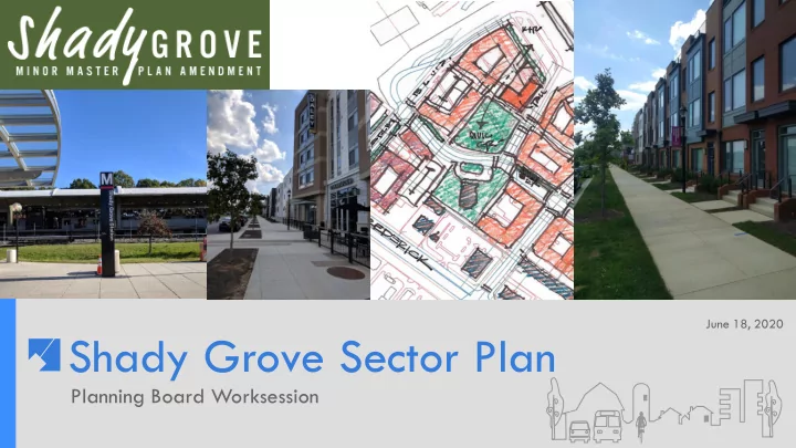
Shady Grove Sector Plan
Planning Board Worksession
June 18, 2020
Shady Grove Sector Plan Planning Board Worksession Worksession - - PowerPoint PPT Presentation
June 18, 2020 Shady Grove Sector Plan Planning Board Worksession Worksession Overview Shady Grove Context Comparison to others transit areas in the County and Regional end of the line stations. Metro Neighborhoods: o Metro West o
Planning Board Worksession
June 18, 2020
Planning Board Worksession
2 ▪ Shady Grove Context ▪ Comparison to others transit areas in the County and Regional end of the line stations. ▪ Metro Neighborhoods:
Planning Board Worksession
3 ▪ Public Hearing Highlights
removal of the MCPS Bus Depot on Crabbs Branch Way.
Grove.
Planning Board Worksession
Key overview highlights: ▪Mixed-use areas surrounding the Metro Station (Metro Neighborhoods) and other key locations. ▪Increased height, density and development flexibility from 2006 Sector Plan. ▪Retention of industrial/office areas. ▪Maintain existing residential communities. ▪New bikeways and street network, especially within the Metro Neighborhoods. 4
Planning Board Worksession
5 Sector Plan Area Surrounding areas of Rockville and Gaithersburg
Planning Board Worksession
6 Bethesda CBD
156 Acres FAR 0.5-8.0 Heights 35’-300’
Wheaton CBD
83 Acres FAR 2.0-6.0 Heights 75’-250’
Silver Spring CBD
265 Acres FAR 1.0-8.0 Heights 50’-200’
Urban/Downcounty areas: ▪ Bethesda ▪ Silver Spring ▪ Wheaton ▪ Glenmont ▪ Forest Glen ▪ Friendship Heights
Planning Board Worksession
7
Outside of the Beltway: Emerging Corridors ▪ Twinbrook ▪ White Flint ▪ Grosvenor Strathmore
Twinbrook
154 Acres FAR 1.0-2.0 Heights 60’-145’
White Flint
430 Acres FAR 0.5 – 4.0 Heights 50’-300’
Planning Board Worksession
8
Glenmont WMATA property: 11.91 acres (east) Metro Parking: 2,998 spaces ▪ Metro Property: CR 2.0 C0.5 R1.75 H-120 ▪ Shopping Center: CR 3.0 C2.5 R2.5 H-120 Greenbelt General Plan: Metropolitan Center Metro Parking: 3, 667 spaces Transit: 12 Metro routes as well as local and regional routes WMATA property: 78 acres ▪ North Core: Proposed GSA/FBI area: 61 acres GSA/FBI Development: 2.1M sq.ft. ▪ FAR: 1.26
Planning Board Worksession
Vienna-Fairfax Existing Transit: Metro and Fairfax Connector Existing Metro parking: 5,169 space Fairlee West Partially implemented development ▪ Land Area: 56 acres (3.8 Metro)
development
New Carrollton Existing Transit: Amtrak/MARC/Purple Line/Greyhound/Metro Bus and Rail/The Bus Existing Metro Parking: 3,519 spaces Urban Atlantic Land Area: 39 acres ▪ 2.74M mixed-use development
Regional Transit Oriented Development: End of the Line
Urban Atlantic/WMATA concept 9 Overall Fairlee West
Planning Board Worksession
Shady Grove: Metro West, South and North
▪ Recommended FAR: 1.5 to 2.0 ▪ Recommended Heights: 120-200 feet 10
Planning Board Worksession
11
Planning Board Worksession
12
WMATA Property Teachers Credit Union Roberts Oxygen Key Properties
Planning Board Worksession
City of Rockville Annexations
Bainbridge at Shady Grove City of Rockville Maximum Expansion Limits City of Gaithersburg Maximum Expansion Limits Bainbridge
City of Rockville Maximum Expansion Limits Bainbridge Shady Grove Metro
Two annexations by the City of Rockville ▪ Bainbridge at Shady Grove Metro ▪ 15931 Frederick Road (MD355)-Former Carmax 13
Planning Board Worksession
Metro West
14
Key Properties Property Land Area Existing Square Feet Existing FAR Recommended FAR Somerville 3.92 acres 33,900 sq.ft. 0.20 2.0 Roberts Oxygen 1.23 acres 7,869 sq.ft. 0.15 2.0 Teachers Credit Union 2.29 acres 43,500 sq.ft. 0.44 2.0 WMATA property 14.25 acres 10,340 sq.ft 0.02 2.0 Public Storage 3.25 acres 171,435 sq.ft. 1.21 2.0 Midway Center 1.43 acres 18,000 sq.ft. 0.29 2.0
WMATA
Planning Board Worksession
Metro West
15 Draft Plan Recommendations ▪ Rezone properties to Commercial Residential (CR) with highest densities and heights for the WMATA and adjacent Somerville properties.
▪ Public open space on the WMATA property. ▪ Streets to accommodate BRT/CCT. Existing zoning Draft Plan proposed zoning
Planning Board Worksession
Metro South
16 Area: 18.74 acres ▪ 15 properties Existing Development: 123,840 sq.ft. Average Existing FAR: 0.15
Planning Board Worksession
Metro South
17 Draft Plan Recommendations ▪ Rezone properties to Commercial Residential with increased density and height. ▪ Modified street network that provides greater flexibility. ▪ New public open space and linear promenade. Existing zoning Draft Plan proposed zoning
Planning Board Worksession
18
Bainbridge Apartments CarMax Redevelopment WMATA 2.0 FAR ±1,439,782 gsf ±859 DU’s Somerville Properties 2.0 FAR (Overall) ±1,486,333 gsf ±891 DU’s (Combined) Frederick Rd. Properties 2.0 FAR (Overall) ±882,446 gsf ±529 DU’s (Combined) Built/Approved Since 2006 WMATA at Metro West Somerville Drive Properties Frederick Road Properties
and exist. uses may limit near-term potential
Planning Board Worksession
19
AVA Wheaton – 2.3 FAR Solaire Wheaton – 2.3 FAR NoBe Market – 2.0+ FAR Twinbrook Commons – 2.0 FAR The Galvan – 2.0 FAR Bainbridge Apts. – 2.5 FAR
Planning Board Worksession
20
An Alternative If the Planning Board supports more development than the Public Hearing Draft Plan recommendations for the Metro Neighborhoods, staff recommends up to an additional 0.5 FAR for the Metro West and Metro South neighborhoods. ▪ The transportation and public facilities impacts associated with additional development, if supported by the Board, would be addressed at a future worksession. Metro West Metro South
Planning Board Worksession
21
Townes at Shady Grove VEIP Derwood Store and Post Office Key Properties
Planning Board Worksession
22 Draft Plan Recommendations ▪ New zones to further the introduction of new residential development and to make zoning adjustments, especially for the Planned Development (PD) zoned.
35), Shady Grove Apartments (PD 2) and Derwood Station (PD-2) townhouses to the Commercial Residential Neighborhood (CRN) zone and Townhouse Low Density (TLD) zone, respectively. ▪ Rezone the Derwood Store and Post Office property to CRN. ▪ Rezone single-family zoned properties that do not meet the minimum 20,000 square feet for R-200 zone to the R-90 and R-60 zones. ▪ Rezone the VEIP and provide a floating zone for the Derwood Business Center. Existing Zoning Draft Plan Proposed Zoning
Planning Board Worksession
23 The Derwood Store and Post Office On July 9, Historic Preservation Staff will provide the Board with its historic review and recommendations for this property.
Planning Board Worksession
24
WMATA Surface Parking WMATA Structured and Surface Parking Ride On , MTA , Kiss N Ride and Parking Garage
Land Area: 24.52 acres Existing Use: Surface and structured parking as well as Ride On and MTA pick and drop off.
Planning Board Worksession
25 Draft Plan Recommendations ▪ Rezone properties to Commercial Residential with increased building height and more FAR than current plan. ▪ Transitional building elements towards the existing south of Redland Road. ▪ New streets to promote enhanced mobility. ▪ Retention of the existing stream as a linear park. Draft Plan Proposed Zone Existing zone
Extent of Zoning Boundary Potential Buildable Areas
Planning Board Worksession
26
Shady Grove Westside Existing WMATA Garage WMATA North 1.5 FAR ±2,718,076 gsf ±1449 DU’s Neighborhood Green ±.75 acre Old Derwood Enhanced Stream Potential WMATA Garage Existing WMATA Garage w/ Potential Expansion Built/Approved since 2006 WMATA at Metro North Existing Structures
Potential WMATA Garage
Planning Board Worksession
27
Metro North - WMATA Metro West Metro South
Potential Development
Planning Board Worksession
28 Planning Board Review ▪ July 9: Historic Preservation ▪ July 23: Shady Grove Station, Westside and Jeremiah Park and other key properties