
SLIDE 1
A Teton Wildlands Conservation Plan
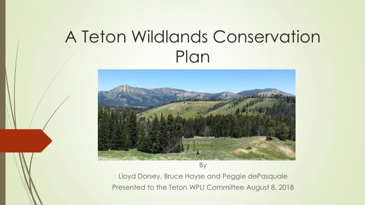
By Lloyd Dorsey, Bruce Hayse and Peggie dePasquale Presented to the Teton WPLI Committee August 8, 2018
Plan By Lloyd Dorsey, Bruce Hayse and Peggie dePasquale Presented - - PowerPoint PPT Presentation
A Teton Wildlands Conservation Plan By Lloyd Dorsey, Bruce Hayse and Peggie dePasquale Presented to the Teton WPLI Committee August 8, 2018 Striving for a Balanced & Practical Approach Towards Long-term Conservation in Teton County
By Lloyd Dorsey, Bruce Hayse and Peggie dePasquale Presented to the Teton WPLI Committee August 8, 2018
This Plan includes the following recommendations being applied county wide on US Forest Service lands:
Photo provided by EcoFlight
Table 1: Proposed Wilderness Acreage Comments Palisades WSA 54,380 acres New Palisades Wilderness Area within Teton County, WY; minus a carve out for motorized/mechanized recreation area from Mosquito Creek Rd 30980 & Trails 3005 & 049 north to near Hwy 22 Shoal Creek WSA 11,619 acres Addition to existing Gros Ventre Wilderness Area, only that part of the WSA within Teton County Grizzly Lake 3,955 acres Addition to existing Gros Ventre Wilderness Area Spread Creek-GV River-Mt. Leidy 132,152 acres New Mt. Leidy Wilderness Area within Teton County; minus a carve out not to exceed 2,500 acres for Horsetail motorized trail 4090 Willow Creek and Beaver Mtn portions of Grayback Ridge IRA 25,820 acres New Grayback Wilderness Area within Teton County Pacific Creek-Blackrock 23,761 acres Addition to existing Teton Wilderness Area Granite-Boulder-Little Granite 4,752 acres; Addition to existing Gros Ventre Wilderness Area Total 254,280 acres
Table 2: Teton Conservation Areas Acreage Comments Curtis Canyon 9,581 acres Unroaded area only Cache Creek-Game Creek 14,867 acres Unroaded area only Phillips Ridge 9,786 acres Unroaded area only Munger Mountain 10,063 acres Unroaded area only Palisades WSA carve out near Hwy22 17,462 acres From Mosquito Creek Road 30980 north to near Hwy22 West Slope of the Tetons on CTNF 39,189 acres Spread Creek-GV River-Mt. Leidy carve out for Horsetail Creek route 2,439 acres Not to exceed 2,500 acres to allow continued use of motorcycle route 4090 Northern carve out from Mt Leidy-Spread Creek IRA 21,066 acres From Continental Divide Snowmobile Trail to “K” Trail northward to allow continued motorized/mechanized use according to Forest and Travel Plans Total 124,453 acres
Table 3: Roaded Areas- No change via the Teton Wildlands Conservation Plan (except minerals & timber withdrawals apply) Acreage Comments Gros Ventre Valley (Lower Slide Lake, Slate Creek, Crystal Creek, Upper Slide Lake, Gunsight Pass, Breakneck, Soda Lake, Cottonwood Creek, Big Cow Creek, Darwin Ranch, etc.) Approximately 44,000 acres The roaded and motorized lower elevations Buffalo Valley-Blackrock-Togwotee Pass-North Fork of Fish Creek roaded areas Approximately 60,800 acres Not in proposed Wilderness nor in Conservation Areas Toppings Lakes Approximately 6,000 acres Shadow Mountain Approximately 8,000 acres Snow King-Leeks Cyn-Hwy 191 faces Approximately 4,000 acres “Dino” footprint & Fall Creek roaded areas within Palisades WSA Approximately 6,000 acres South Fork of Fish Creek, Buffalo Meadow, Wagon Creek, Mosquito Lake Approximately 18,000 acres Not in proposed Wilderness nor in Conservation Areas West Slope of the Tetons on Caribou-Targhee National Forest Approximately 87,680 acres Not in proposed Conservation Areas Wind River Lake, Sheridan Creek on the Shoshone National Forest near Togwotee Pass Approx 2,560 acres Total Approximately 237,040 acres
Adds 254,280 acres of Wilderness (Table 1). Designates 124,453 acres of USFS land as unroaded Teton Conservation Areas. (Table 2) Still allows motorized and mechanized recreation. Estimated 237,040 acres of Roaded USFS land (Table 3) maintains motorized and mechanized. Total mineral/timber withdrawal: approximately 614,773 acres. (Tables 1, 2, & 3). Allows motorized and mechanized uses to continue on approximately 361,493 acres of USFS land in Teton County. (Tables 2 & 3).
Does not: Affect WUI issues nor change USFS Wildfire Management Policies for Wilderness or non-Wilderness lands. Does not: Remove motorized or mechanized uses in approximately 124,453 acres of Teton Conservation Areas. (see Table 2) Does not: Remove motorized or mechanized uses in approx. 237,040 acres of already roaded USFS lands in Teton County, Wyoming. (see Table 3) Does not: Affect the three motorcycle-only backcountry trails at issue (Mosquito Creek, Munger Mountain, and Horsetail Creek) Does not: Significantly affect Heli-skiing user days; most of 5-year average user days maintained by this Plan. Does not: Affect livestock grazing. Does not: Affect collaborative wildlife management among the WGFD, USFS, and the US Fish and Wildlife Service. Does not: Affect hunting or fishing as collaboratively managed by the 3
big game hunting in Wilderness Areas. And, travel by stock or on foot only.)
7 14 21 28 Miles
Inventory Roadless Areas In Wyoming
Legend
LandCT_Districts
RoadlessAreaName
Palisades Stump Creek West Slope Tetons Winegar Hole