
SLIDE 1
Plan completion and implementation
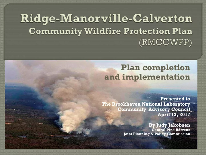
Presented to The Brookhaven National Laboratory Community Advisory Council April 13, 2017 By Judy Jakobsen
Central Pine Barrens Joint Planning & Policy Commission
Plan completion and implementation Presented to The Brookhaven - - PowerPoint PPT Presentation
Plan completion and implementation Presented to The Brookhaven National Laboratory Community Advisory Council April 13, 2017 By Judy Jakobsen Central Pine Barrens Joint Planning & Policy Commission What is a Community Wildfire
Presented to The Brookhaven National Laboratory Community Advisory Council April 13, 2017 By Judy Jakobsen
Central Pine Barrens Joint Planning & Policy Commission
What is a Community Wildfire Protection Plan
developing a plan with recommendations and strategies
Healthy Forests Restoration Act 2003
forest planning and prioritization of hazardous fuel reduction projects on public lands.
communities as they develop and implement forest management and hazardous fuel reduction projects.
1)Collaboration: A CWPP must be collaboratively
developed by local and state government representatives, in consultation with federal agencies and other interested parties.
(2) Prioritized Fuel Reduction: A CWPP must identify and
prioritize areas for hazardous fuel reduction treatments and recommend the types and methods of treatment that will protect one or more at-risk communities and essential infrastructure.
(3) Treatment of Structural Ignitability: A CWPP must
recommend measures that homeowners and communities can take to reduce the ignitability of structures throughout the area addressed by the plan.
Protection
Natural Resources
Held 3 Core Team Member meetings at key document
preparation points
Held 2 public information meetings to obtain input on local
community concerns on wildfire risk
April 21, 2016
RMCCWPP Facebook page – over 350 likes Community survey – 101 responses (online & direct mail) Press releases –promote CWPP, announce public meetings,
project status
Updates and presentations made at Central Pine Barrens
Commission meetings by staff and SWCA Environmental Consultants
GIS risk assessment based on fuels (vegetation), weather, topography, and historic fire occurrence Community assessment tour of area with fire personal &
identify potential hazards at the neighborhood level (i.e. insufficient defensible space, no public water, emergency vehicle access, etc.)
Community Values at Risk (natural, social and cultural resources)
Available on the Central Pine Barrens Commission’s website www.pb.state.ny.us For a hardcopy call the Commission office at 631-288-1079
Purchase Smokey Bear Fire
Public information brochure
Individual wildfire prevention
Thanks to USFS grant funding provided by the Northeast Forest Fire Protection Compact and the NYS DEC Division of Forest Protection
Funding available for implementation Direct mail Facebook 16 homeowners signed up FREE - PARTICIPATION IS VOLUNTARY
Firewise Concepts: What the homeowner can do to protect their
1. Home Ignition Zone 2. Lean, Clean & Green Landscaping 3. Fire-resistant roof construction 4. Fire-resistant attachments 5. Fire-resistant construction 6. A disaster plan 7. Emergency access
Think like an ember
How is the structure positioned in relationship to severe fire behavior? (e.g. slope, proximity to vegetated public lands) Type of construction. When was home built? Describe the surrounding fuel type and density. Is home on private well or public water? Distance to nearest fire hydrant. Distance to nearest fire station. Is there a house number present? Location (e.g. house, mailbox, curb) Size of letters?
Overview of Surroundings and Site
Firewise Construction
Evaluate Chimney to Eaves: (Possible entry points for embers)
combustible or not (material composition i.e., vinyl, metal)
the roof.
whether they are dome shaped acrylic or flat tempered glass.
Note condition of eaves, attic vents, fascias, soffits, and whether any vents are enclosed or covered with 1/8” wire mesh? Note siding materials and whether they are combustible or not (i.e., wood shingle, vinyl, cedar shake, stucco, etc.), condition and whether there are any gaps.
tempered glass, multi-paned window?
windows?
wood, metal or vinyl)
vegetation.
section)
composition (i.e., nylon, fiberglass, metal, aluminum, other) Note if there are any indoor pets present (i.e., cat, dog) and whether there are any pet doors? Are there outdoor water spigots present?
porches, decks, fences, their composition and condition
combustible materials? Are there any combustible materials next to or under structures (i.e., debris, propane tanks, lawn furniture, wood piles, etc.)? Review condition of garage including doors and windows if any. Note if it is detached or attached and if there are any gaps in the door.
Firewise Landscaping: (Be Lean, Clean and Green!)
Home Ignition Zone 1: 0-5 feet around the perimeter of the home. The objective
landing near the home, igniting combustible debris or materials and exposing the home to flames. This zone is closest to the house, so it requires the most careful selection and management of vegetation and other materials. Is there an outside water spigot present? Property management – Is there an accumulation of leaves/debris
Landscaped vegetation – review. Are there trees overhanging the house? Any vines on the house? Is there firewood/fuel storage or a propane tank present?
Home Ignition Zone 2: 5 ft. – 30 ft. around the perimeter (or to the property line)
The objective of this zone is to create and maintain a landscape that if ignited, will not readily transmit fire to the home. Tree and shrubs in this zone should be well spaced groupings and well maintained. Ladder fuels (i.e., shorter vegetation or shrubs under taller trees) should be avoided to prevent the fire from climbing into the crown or upper portions of trees. If these groupings were to be ignited by wind-blown embers, the resulting fire should not be able to threaten the home by a radiant heat exposure of by flames being able to touch the exterior surfaces of your home. It also examines whether there are any structures or fencing present within 30 ft. of the home that could potentially help transmit fire toward the home. Outside water spigot present? Any structures present? Identify if fencing present and type of material (wood, metal or vinyl). Indicate whether or not there is a pool or pond present. Is there firewood/fuel storage or a propane tank present? Are there any horses or other livestock present
Property management – Is there an accumulation of leaves/debris on or near home? Landscaped vegetation - review separation distances, maintenance, and plant selection. Natural vegetation - density, Are ladder fuels present?
Home Ignition Zone 3: 30 to 100 ft from the home (or to property line) The objective of vegetation management in this zone is to reduce the energy and speed of the wildfire. Tree and brush spacing should force the fire in the tops of the tree, brush or shrub crowns to drop to the ground. Flame length should decrease. It also examines whether there are any structures, fencing or livestock in this area that may be a concern.
Report contains information collected from site visit , photos, and aerials and provides recommendations to consider for implementation. Example recommendations
and debris
consider installing gutter guards to reduce maintenance
prevent ember entry
from home during fire season
Implementation is voluntary. The more a homeowner implements the greater the ability for their home to survive a wildfire.
Limited funding is available to assist homeowners to implement mitigation projects thanks to a USFS Grant received by the Northeast Forest Fire Protection Compact and the NYSDEC Forest Protection Division
USDA Forest Service - Northeastern Area State and Private Forestry Cohesive Fire Strategy
homeowners association representatives and fire department members Livestock evacuation plan Public lands mitigation
Judy Jakobsen jjakobsen@pb.state.ny.us 631-563-0306
Thank you.