phase ii laramie monitor well project report
play

PHASE II LARAMIE MONITOR WELL PROJECT REPORT June 18, 2015 - PowerPoint PPT Presentation

PHASE II LARAMIE MONITOR WELL PROJECT REPORT June 18, 2015 Submitted to: City of Laramie P O Box C P.O. Box C Laramie, Wyoming 82073 Prepared by: Bern Hinckley, P.G. Chris Moody, P.G. Hinckley Consulting Wyoming Groundwater, LLC


  1. PHASE II – LARAMIE MONITOR WELL PROJECT REPORT June 18, 2015 Submitted to: City of Laramie P O Box C P.O. Box C Laramie, Wyoming 82073 Prepared by: Bern Hinckley, P.G. Chris Moody, P.G. Hinckley Consulting Wyoming Groundwater, LLC P.O. Box 452 710 Garfield Street, Suite 211 Laramie, Wyoming 82073 Laramie, Wyoming 82070 
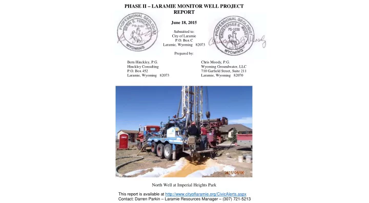
North Well at Imperial Heights Park This report is available at http://www.cityoflaramie.org/CivicAlerts.aspx Contact: Darren Parkin – Laramie Resources Manager – (307) 721-5213

  2. t l u a F s g n i r p S y t i C Quarry Anticline City Springs Turner No. 2 _ ^ _ ^ Quarry Fault y Fault LCCC MW #1 LCCC MW #1 Turner No. 1 Imperial Heights Subdivision Triangle Well Middle Borehole North S h e r m a n H i l l s Sherman Hills F a u Well l t Z o n e Subdivision Honken Honken South S th Huntoon #1 Well Laramie Plains City of Laramie Subdivision Septic Systems (2008 CAPP) Potential Contamination Sources (2008 CAPP) Location Map Laramie Monitor Well Project

  3. Turner Wellfield _ ^ _ ^ East Grand Ave. I-80 Pope Wellfield p Groundwater Flow Schematic Laramie Monitor Well Project

  4. Casper Aquifer Protection Timeline Late 1970s: U. Wyo. Geology Dept. Research Huntoon, Lundy, Thompson 1993: Wellhead Protection Plan (WWC) 2002: First Casper Aquifer Protection Plan (City/County EAC) 2008: Most recent CAPP update – City and County versions p y y 2009/2010: Well sampling 2013: East Laramie Wastewater Study 2008 ‐ 2014: 53 Site Specific Investigations (SSI)

  5. FINAL REPORT ISSUED APRIL 1, 2013

  6. No Impact Impacted Significant Impact Unsafe WWC Engineering, 2013

  7. Data collected from domestic wells by City of Laramie 2009, 2010 WWC Engineering, 2013

  8. Conclusion: “Risk to City Wells ‐ Low” L ” Modified from WWC Engineering, 2013

  9. 41T3 Turner No. 2 _ ^ 41T2 41T1 ^ _ Turner No 1 Turner No. 1 LCCC MW #1 LCCC MW #1 LAPCA-1 Triangle Well North Well SHFCA-1 Sherman Hills Fault Laprele #1 Huntoon #1 Middle Borehole Middle Borehole South Well Huntoon #2 Monitoring Sites Laramie Monitor Well Project

  10. 41T3 Turner No. 2 _ ^ 41T2 41T1 ^ _ Turner No 1 Turner No. 1 LCCC MW #1 LCCC MW #1 LAPCA-1 Triangle Well North Well SHFCA-1 Sherman Hills Fault Laprele #1 Huntoon #1 Middle Borehole Middle Borehole South Well Huntoon #2 Monitoring Sites Laramie Monitor Well Project

  11. Casper Aquifer Schematic Cross-Section W E Sherman Hills Laramie Imperial Subdivision Plains Heights Subdivision Subdivision North Well Triangle ? ? Well LCCC MW #1 City Springs/ Well Turner No. 2 v e l L e Forelle Fm. r a t e W Well ? n o i t a n m o r l o i s F p E a k n a a a m t l t e a a m m D D S S a a G G a Casper Aquife t e B a h p l A ? ? Casper Aquifer fer 100 ft Sandstone Limestone 0 mi 0.3 mi 0.6 mi 0.9 mi 1.2 mi 1.5 mi 1.8 mi 2.1 mi

  12. Turner No. 2 _ ^ ^ _ Turner No 1 Turner No. 1 Triangle Well North Well Sherman Hills Fault Middle Borehole Middle Borehole South Well Monitoring Sites Laramie Monitor Well Project

  13. Triangle Well s

  14. Bedding-plane openings in Triangle Well Down-hole images from Laramie Monitor Well Project - June, 2015 (vertical scale in feet)

  15. North Well

  16. Bedding-plane opening in North Well Down-hole image from Laramie Monitor Well Project - June, 2015 (vertical scale in feet)

  17. Middle Borehole

  18. Thin shale layer in Middle Borehole Down-hole image from Laramie Monitor Well Project - June, 2015 (vertical scale in feet)

  19. South Well th W ll S

  20. Bedding-plane opening in South Well Down-hole image from Laramie Monitor Well Project - June, 2015 (vertical scale in feet)

  21. North Well 400 gpm SWL = 7322 ft. Middle Borehole (observation) SWL = 7323 ft. South Well (observation) SWL SWL = 7324 ft. 7324 ft

  22. North Well South Well Middle Borehole 400 gpm (2 days) static water level 6 ft. 2 ft. 19 ft. 7.0 8.3 fault zone fault zone 1 1 1.1 2.3 Laramie Monitor Well Project - North Well Pump Test

  23. ^ _ Turner No. 2 Quarry Anticline Elevation 7270 ft Elevation 7276 ft Elevation 7279 ft _ _ ^ ^ Quarry Fault Elevation 7267 ft Elevation 7287 ft Elevation 7304 ft Elevation 7304 ft Sherman Hills Fault Zone Fault Zone Ele ation 7322 ft Elevation 7322 ft Elevation 7329 ft Elevation Elevation 7323 ft 7324 ft Groundwater Elevation Laramie Monitor Well Project

  24. ^ _ Turner No. 2 Quarry Anticline _ _ ^ ^ Quarry Fault Nitrate = 2.0 mg/l Nitrate = 3.1 mg/l Nitrate = 4 8 mg/l Nitrate = 4.8 mg/l Sherman Hills Fault Zone Fault Zone Nitrate Nitrate = 1.6 mg/l 1 6 mg/l Nitrate = 9.4 mg/l Nitrate = 8.3 mg/l Nitrate = 7.0 mg/l Nitrate Concentrations Laramie Monitor Well Project

  25. Conclusions • Residential activity in the East Grand subdivisions has impacted groundwater quality at Imperial Heights Park. • The Sherman Hills Fault zone is not a barrier to groundwater flow. • A portion of the discharge of City Springs and the Turner Wellfield is impacted by the East Grand subdivisions. • Within this general picture, the details of groundwater flow and quality are complex. • Groundwater level and quality monitoring should continue at available locations.

  26. Spur Formations Wellfield atanka/Forelle F Casper Formation on ater Formation S Turner State of Wellfield Wyoming Ca Chugwa ¨ ¦ § Pope 80 Wellfield Wellfield Soldier #1 Laramie Municipal Wells Casper Aquifer Laramie Monitor Wells Monitor Well Network Proposed Monitor Wells

Download Presentation
Download Policy: The content available on the website is offered to you 'AS IS' for your personal information and use only. It cannot be commercialized, licensed, or distributed on other websites without prior consent from the author. To download a presentation, simply click this link. If you encounter any difficulties during the download process, it's possible that the publisher has removed the file from their server.

Recommend


More recommend