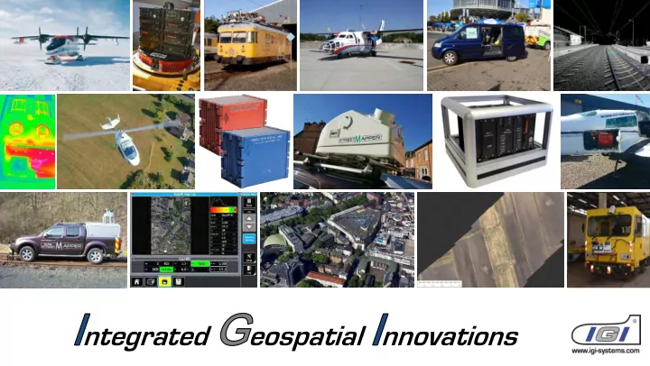
SLIDE 1
ntegrated eospatial nnovations
SLIDE 2
Founded 1978 More than 500 customers in 84 different countries World-wide technical support
IGI office in Kreuztal, Germany
IGI mbH - 40 years celebration
SLIDE 4
SLIDE 5
Open Skies – Area of Operation
SLIDE 6
IGI Sensor Management: SMS-1, Sensor Management System 11 different Sensors BD/Z-84, Operator Interface for Zenit Z-84 PAN-Camera German Open Skies Aircraft until 1997: Tupolev 154-M
SLIDE 7
IGI Sensor Management: SMS-1, Sensor Management System 11 different Sensors BD/Z-84, Operator Interface for Zenit Z-84 PAN-Camera Source: http://de.wikipedia.org/wiki/Tupolew_Tu-154M,_Deutsches_Open_Skies
SLIDE 8 Open Skies 2017 Airbus A-319
http://www.pivotarea.eu/2015/12/23/neuer-open-skies-flieger-fuer-die-bundeswehr/
SLIDE 9 1550 m 96° 63° 3400 m 85° 5870 m 81° 1900 m
Open Skies – Flying Altitudes
HIGH MEDIUM LOW
DigiCAM-OS-l DigiTHERM-OS-l DigiCAM-OS-m DigiCAM-OS-h
3500 m 6100 m 10000 m
SLIDE 10
- Mission Planning & Flight Guidance
- Sensor Management
- GNSS/IMU Navigation
- Aerial Sensor Systems
- Mobile Mapping Solutions
- Turn-key Solutions
SLIDE 11
IGI AEROcontrol Compact – supporting all flight levels
SLIDE 12
IGI TERRAcontrol Compact – supporting all platforms
SLIDE 13
- Mission Planning & Flight Guidance
- Sensor Management
- GNSS/IMU Navigation
- Aerial Sensor Systems
- Mobile Mapping Solutions
- Turn-key Solutions
SLIDE 14
IGIvisu – Integrated Sensor Management (DigiCAM)
SLIDE 15
IGIvisu – Integrated Sensor Management (DigiCAM)
SLIDE 16
IGIvisu – Integrated Sensor Management (DigiCAM)
SLIDE 17
IGIvisu – Integrated Sensor Management (DigiCAM)
SLIDE 18
IGIvisu – Integrated Sensor Management (DigiCAM)
SLIDE 19
IGIvisu – Integrated Sensor Management (DigiCAM)
SLIDE 20
IGIvisu – Integrated Sensor Management (LiteMapper)
SLIDE 21
IGI real-time Software for “Clockwork-Ocean”
SLIDE 22
SLIDE 23 IGI UrbanMapper
2-IN-1 Aerial Camera System
- Large format camera with NIR module
- Oblique camera (4 x 100Mpixel)
Modular Design:
- Upgradeable NIR & Oblique Camera Modules
RGB 28,200 x 11,600 pixels RGBI 24,900 x 11,600 pixels (option) 84db Dynamic range, CMOS Technology 0.6 sec Image Repetition Rate
SLIDE 24 IGI UrbanMapper
2-IN-1 Aerial Camera System
- Large format camera with NIR module
- Oblique camera (4 x 100Mpixel)
Modular Design:
- Upgradeable NIR & Oblique Camera Modules
RGB 28,200 x 11,600 pixels RGBI 24,900 x 11,600 pixels (option) 84db Dynamic range, CMOS Technology 0.6 sec Image Repetition Rate
SLIDE 25 IGI UrbanMapper
2-IN-1 Aerial Camera System
- Large format camera with NIR module
- Oblique camera (4 x 100Mpixel)
Modular Design:
- Upgradeable NIR & Oblique Camera Modules
RGB 28,200 x 11,600 pixels RGBI 24,900 x 11,600 pixels (option) 84db Dynamic range, CMOS Technology 0.6 sec Image Repetition Rate
SLIDE 26
- 20” / 4K touch screen
- Control of camera groups
& single modules
- Tools and indicators for optimal
illumination
IGI UrbanMapper – IGIvisu, the operator’s view
SLIDE 27
IGI UM – Image Processing Workflow
SLIDE 28
IGI UrbanMapper – @ AEROWEST
SLIDE 29
SLIDE 30
94 GHz
10 GHz
1.5 cm
800 mW
AEROcontrol
- Automatically readjust the gimbal to a position
SLIDE 31
94 GHz
10 GHz
1.5 cm
800 mW
AEROcontrol
- Automatically readjust the gimbal to a position
SLIDE 32
What is the CTBT? The Comprehensive Nuclear-Test-Ban Treaty (CTBT) bans nuclear explosions by everyone, everywhere: on the Earth's surface, in the atmosphere, underwater and underground. 183 countries have signed the treaty, of which 166 have also ratified it, including three of the nuclear weapon states. The treaty is not yet in force. The Multi Sensor System is mounted in an external helicopter pod. It can be attached flexibly to different Helicopter platforms.
Multi Sensor System for CTBTO
SLIDE 33 The Multi Sensor System includes
- Hyperspectral sensor
- Optical camera
- Thermal camera
- LiDAR system
- AEROcontrol
- CCNS-5
Multi Sensor System for CTBTO
SLIDE 34 The Multi Sensor System includes
- VQ-1560 Dual LiDAR sensors
- DigiCAM-100
- AEROcontrol
- CCNS-5
LM-1560 for Ministry of Mining in Kenya
SLIDE 35 LM-1560 for Ministry of Mining in Kenya
The Multi Sensor System includes
- VQ-1560 Dual LiDAR sensors
- DigiCAM-100
- AEROcontrol
- CCNS-5
SLIDE 36
Thank you! Please visit IGI Demo D, 2nd Floor, Room 17.21