
SLIDE 1
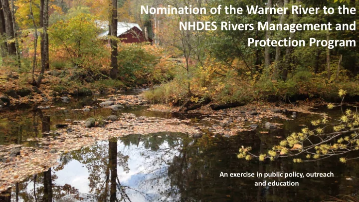
Nomination of the Warner River to the NHDES Rivers Management and Protection Program
An exercise in public policy, outreach and education
Nomination of the Warner River to the NHDES Rivers Management and - - PowerPoint PPT Presentation
Nomination of the Warner River to the NHDES Rivers Management and Protection Program An exercise in public policy, outreach and education NH R H River ers M Managem emen ent and Protec ection on P Progr gram am LAC RMAC Towns
An exercise in public policy, outreach and education
places & State Parks.
management Advisory Committee (LAC) is establish and tasked with creating a River Management Plan.
zoning ordinances or regulations.
added with a designation are those for solid waste facilities. Additional dam restrictions do apply to some river classifications.
Four Classifications:
new hazardous waste facilities must be 250’ from high water mark.
use development, new landfills
new dams allowed
No new dams on Natural, Rural or Rural Community designated rivers. No motor boats on Natural rivers. Instream Flow protections on all designated rivers. Restrictions on new and expanded waste facilities near designated rivers. Inter-basin water transfers prohibited.
Woods Trout Unlimited conducted an assessment that found that 2/3rds of streams within the Warner River watershed support wild brook trout, the Warner Conservation Commission approached the Central NH Regional Planning Commission (CNHRPC) for assistance in nominating the Warner River to NHDES’s River Management and Protection Program.
nomination document and is in the process of holding public information meetings in the five river communities of Bradford, Warner, Sutton, Webster, and Hopkinton.
The Fish Species Captured at Four Locations within the Mainstem Warner River in 2014 Species Survey Location Above Melvin Mills (Bradford) Sutton/Warner Town Line Chemical Ave (Warner) West Joppa Rd (Warner)
Blacknose Dace 13 NE* 16 Brown Trout (Hatchery) 2 Burbot 6 NE 6 Chain Pickerel 2 Common Shiner 5 3 2 Fallfish 11 5 21 Golden Shiner 3 Largemouth Bass 5 NE Longnose Dace 2 25 NE 14 Margined Madtom 4 10 NE 5 Redbreast Sunfish 1 Smallmouth Bass 1 NE 1 Tessellated Darter NE 8 White Sucker 4 3 NE 1 Yellow Perch 1
Select Boards tasked with collecting and organizing information on river history and resources, building local support and identifying appropriate river classifications according to RSA 483:7-a.
to NHDES for review. Following submission, the nomination document must be approved/supported by the Rivers Management Advisory Committee, a public hearing held by NHDES, the legislature, and will finally be submitted to the Governor to sign the designation into law, amending RSA 483 to include the river.
awareness of the river and its resources and creates a Local Advisory Committee with representatives from each community with various interests.
(local, state, and federal) within the river corridor. As a result, development is more apt to occur in a manner which assures river resources are maintained.
the public about water quality, invasive species, and other river issues.
Perceived water quality decline could mean economic losses
What’s Our Water Worth? Anne Nordstrom, Ph.D. The Economic Impact of Potential Decline in NH Water Quality: The Link Between Visitor Perceptions, Usage & Spending.
representing various river interests.
Shoreland and various other applications approved.
applications within the river corridor for local, state, and federal projects.
resulting in faster reporting and potentially faster response to issues concerning the river.
funds for watershed improvements.
some collect town dues, often it is a combination of both. Regional Planning Commissions often assist with grant applications.
developers and realtors in proper system installation and maintenance and the associated permits and processes.
regarding impacts of land use and impervious surface on water quality & riparian habitat.
hydropower in the mill-era. Potential for hydro electric generation still possible today.
water quality and many of its tributaries are home to native brook trout populations.
recreation in the state.
river corridor.
Photo courtesy of American Whitewater. Kayaking the Swain Lowell Dam.
Timeline of the Warner River Nomination Committee
Session, Warner
riparian interests
RMPP program and its impacts
Regulation Shoreland Water Quality Protection Act (SWQPA) Local Zoning Ordinance Establishment of salt storage yards, automobile junkyards, and solid or hazardous waste facilities Prohibited within 250 feet of the reference line*. No solid waste facility may place solid waste or construction and demolition debris within 300 feet of the reference line. Development
a permit.
extent practical.
navigable river.
than 75 feet from a well or waterbody. Construction of water dependent structures** NHDES permit needed Not Addressed Application of fertilizer & pesticides/herbicides
within 25 feet of the reference line of any public water other than slow or controlled release fertilizers. All other fertilizers may be applied outside of 50 feet of the highwater mark.
Not Addressed Maintenance of a Waterfront Buffer
improve runoff control or planting in the Waterfront Buffer.
for a 6-foot-wide foot path. See SWQPA Maintenance of a Natural Woodland Buffer
feet of the reference line.
maintained in an unaltered state or improved with additional vegetation. See SWQPA Impervious surfaces
protected shoreland shall be composed of impervious surfaces unless a stormwater management plan is designed by an engineer.
stormwater management system shall be implemented. The edge of any impervious surface upon which solid waste is stored shall not be within 300 feet of the reference line.
Comparative Analysis
Quality Protection Act (SWQPA) regulations & the Town of Hopkinton’s existing Zoning Ordinances
*For rivers, the ordinary highwater mark. **Dock, wharf, pier, breakwater, beach, boathouse, retaining wall,
structure, or any part thereof built
facilities and all associated structures. ***All agricultural activities and
RSA 21:34-a shall be exempt from the SWQPA provided such activities are in conformance with the most recent best management practices of USDA Natural Resources Conservation Service.
Learn more on our web site: www.warnerrivernomination.wordpress.com wrnomination@gmail.com